 Block
BlockDumas, Texas
6 topographic sheets cover this place, the earliest surveyed in 1954 and the latest in 1986. It stands in the Dumas census division. It lies in ZIP code area 79029. The Survey maps it on the Dumas South quadrangle. 14,501 people lived here at the 2020 count. It stands 3,661 feet above sea level.
Population over time
2 figuresDumas fell from 14,691 to 14,501 between 2010 and 2020. These are the recorded population figures Wikidata holds for this place, reached through the Geographic Names Information System number this page is keyed on rather than by name, so they belong to this place and not to another of the same name. Most are census counts, but not all are: an early figure may be a founding or settlement estimate, and an estimate published within five years of a census is left out. The change column is computed, and is left blank where more than 20 years separate a figure from the one before it, because a gap that long is not a change between two counts.
| Year | People | Change |
|---|---|---|
| 2010 | 14,691 | |
| 2020 | 14,501 | -190 (-1%) |
Topographic sheets covering this place
4 surveys from 6 printed sheetsMatched by testing this settlement's coordinate against the published boundary of every sheet in the United States Geological Survey's historical collection. Each opens the scanned sheet at the Survey.
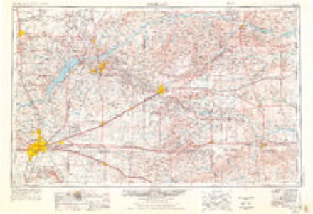
- 1954 USGS Amarillo quadrangle1:250000, 2 printings
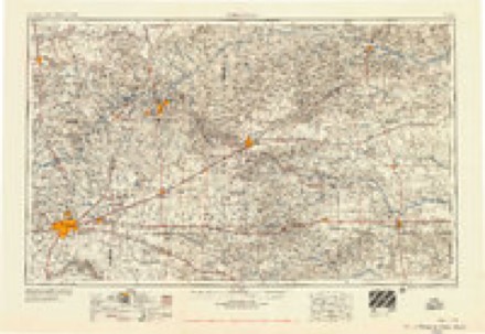
- 1958 USGS Amarillo quadrangle1:250000
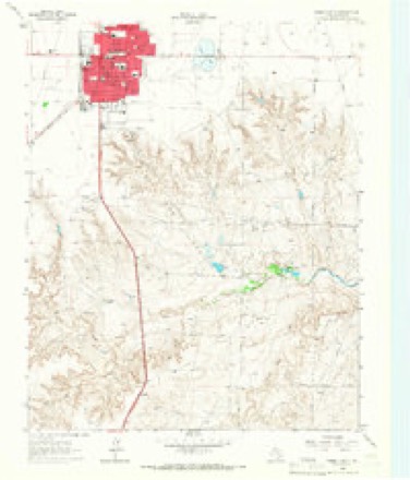
- 1965 USGS Dumas South quadrangle1:24000
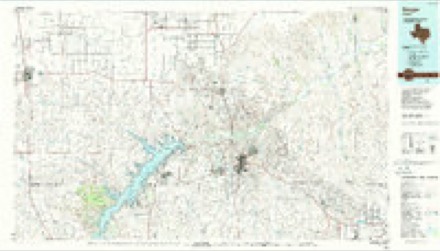
- 1986 USGS Borger quadrangle1:100000, 2 printings
Fires near this place
45 since 2006Regional context, not property-specific evidence. The federal wildfire occurrence database lists 45 fires within 5 miles of Dumas between 2006 and 2019, burning about 2,280 acres in total. 1 started naturally. None was recorded as arson. Distance is straight-line from the map coordinates, so a fire counted here may appear on a neighbouring settlement's page as well.
| Reported cause | Fires |
|---|---|
| Missing data/not specified/undetermined | 24 |
| Equipment and vehicle use | 8 |
| Debris and open burning | 6 |
| Recreation and ceremony | 3 |
| Natural | 1 |
| Other causes | 1 |
| Misuse of fire by a minor | 1 |
| Power generation/transmission/distribution | 1 |
The most recent of them, most recent first, with the day each was reported and the service that recorded it.
| Date | Cause | Size | Reported by | Name on the report |
|---|---|---|---|---|
| 8 August 2019 | Missing data/not specified/undetermined | under an acre | Texas A & M Forest Service | BEAUCHAMP RESIDENT FIRE 645 |
| 2 August 2014 | Missing data/not specified/undetermined | 1.0 acres | Texas A & M Forest Service | DUTCHER539 |
| 21 July 2011 | Missing data/not specified/undetermined | 5.0 acres | Texas A & M Forest Service | DEPECHE MODE 614 |
| 28 June 2011 | Missing data/not specified/undetermined | 1.0 acres | Texas A & M Forest Service | BOREN561 |
| 23 June 2008 | Missing data/not specified/undetermined | 10 acres | Texas A & M Forest Service | not named |
| 15 June 2008 | Missing data/not specified/undetermined | 120 acres | Texas A & M Forest Service | not named |
| 12 June 2008 | Missing data/not specified/undetermined | under an acre | Texas A & M Forest Service | not named |
| 7 May 2014 | Missing data/not specified/undetermined | 1.0 acres | Texas A & M Forest Service | DUTCHER300 |
Settlements close enough to share some of these fires:
Storms near this place
60 of 240 shownRegional context, not property-specific evidence. The National Weather Service names Dumas in 240 storm reports between 1993 and 2026: 164 hail, 52 thunderstorm wind, 11 flash flood, 10 tornado. The reports record 16 injuries. Each account below is quoted exactly as the forecast office filed it, from the NOAA Storm Events Database, and each date opens the federal record of that event.
| When | Event | Place named | Harm | What the report says |
|---|---|---|---|---|
| April 2007 | Tornado (EF2) | Dumas | 14 hurt, $1,300,000 | This tornado formed ten miles west southwest of Dumas at 1816 CST and tracked northeast for about twenty miles before exiting Moore county one half of a mile north of Cactus at 1840 CST. The tornado continued in Sherman county for about another four miles...before dissipating at 1852 CST. In Moore county...evidence suggested that the tornado was about three quarters of a mile wide as it passed through the town of Cactus. The most significant damage occurred across the northwest half of Cactus...but most homes and businesses received some damage as a result of this tornado. It is estimated that at least ten mobile homes were demolished and many more left uninhabitable. Fourteen people were injured in Cactus...however there were no fatalities. On April 25...Governor Rick Perry declared a State of Emergency in two proclamations for Moore county as a result of the Cactus tornado. The Governor also requested President Bush to declare a Presidential Disaster Declaration for the county. |
| May 1998 | Flash Flood | Dumas | 1 hurt | One car accident from water over State Highway 152 on the east side of Dumas, caused one injury. |
| June 2010 | Hail | Dumas | 1 hurt | no account filed |
| June 1994 | Thunderstorm Wind | Dumas | $500,000 | no account filed |
| August 2002 | Thunderstorm Wind | Dumas | $200,000 | Widespread wind damage across western sections of Dumas including roofs which were torn off of two homes and another home had an attached garage totally destroyed leaving debris for one quarter of a mile. Another home had a cement brick fence destroyed. A storm damage survey was done on this event. |
| June 2010 | Thunderstorm Wind | Dumas | $100,000 | The Moore County Emergency Manager reported that three mobile homes had blown off of their foundations and into the road at the sixteen hundred block of Binkley Avenue in Dumas Texas. |
| August 2002 | Flash Flood | Dumas | $70,000 | About twelve downtown businesses received flood damage and around eight homes also received flood damage. Numerous cars were stalled with two feet of water covering roads. Water also entered the Moore County Jail. |
| May 2001 | Thunderstorm Wind | Dumas | $40,000 | Numerous trees and power lines and Telco poles reported down. A commercial sign was also reported blown down. |
| May 1995 | Hail | Dumas | $25,000 | no account filed |
| August 2006 | Thunderstorm Wind | Dumas | $17,000 | Numerous two to twelve inch tree branches blown down...two willow trees uprooted...and two irrigation pivots overturned and damaged by the high winds at the Pheasant Trails Golf Course. Also...two aluminum garage doors were blown in and badly damaged. One house lost many shingles on the north facing side...a fence with metal posts was partially blown down...and an aluminum roof on a storage shed was ripped up. |
| May 2010 | Hail | Dumas | $12,000 | The Emergency Manager for Moore County received numerous reports of cars receiving hail damage including broken windows. |
| April 2012 | Hail | Dumas | $10,000 | no account filed |
| April 2007 | Tornado (EF1) | Dumas | $6,000 | This tornado formed four miles east of Dumas at 1945 CST and moved northeast and likely dissipated about four miles south of Sunray at 2000 CST. Minor damage was reported at Texas Beef Feedyard. Damage included double wooden power poles which were snapped near their bases. No injuries were reported. |
| June 2012 | Thunderstorm Wind | Dumas | $5,000 | The Moore County Emergency Managers Office reported that tree branches around six to twelve inches in diameter were blown down. There was also a live tree around twelve to fourteen inches in diameter which was split in half with one half of the tree lying on the ground. All of the damage was confined to within a two block area. There were no reports of injuries or fatalities. |
| May 2008 | Thunderstorm Wind | Dumas | $2,000 | The high winds blew down two power poles. |
| May 2010 | Thunderstorm Wind | Dumas | $1,000 | The Moore County Emergency Manager reported one downed power pole in Dumas Texas. No injuries were reported. |
| May 2010 | Hail | Dumas | $1,000 | The Moore County Emergency Manager reported one window broken by the large hail at the Walmart in Dumas Texas. |
| July 2025 | Thunderstorm Wind | Dumas | - | The mesonet site located three miles southeast of Dumas measured two severe wind gusts in consecutive minutes. The first was 71mph at 2312 CDT and the second was 61mph at 2313CDT. |
| May 2024 | Thunderstorm Wind | Dumas | - | This gust was from decaying thunderstorms, not so much from a strong/severe storm that had a strong updraft. This gust is assumed to be from rain falling through a dry low level layer creating cooling and sinking air. |
| August 2024 | Thunderstorm Wind | Dumas | - | This wind gust was in association with the outflow boundary moving through the area. |
| April 2022 | Thunderstorm Wind | Dumas | - | The mesonet station located near Dumas measured a thunderstorm wind gust of 73 mph at 1851 CDT. |
| April 2022 | Thunderstorm Wind | Dumas | - | Two, one minute, wind gusts of 64 mph were reported by the Dumas West Texas mesonet station at 2334 and 2335 CDT. |
| August 2022 | Tornado (EF0) | Dumas | - | The landspout tornado damaged some out buildings and ripped half the roof off an older mobile home which was one of the main damage indicators for this event. Several empty semi tractor trailers at a trucking company were flipped and pushed several yards. Toward the end of the damage path, the tornado destroyed a poorly constructed and old cabin/storage building. Power lines along the path were not damaged and a mobile home directly adjacent to the poorly constructed destroyed building only showed very minor damage. These factors suggest a high end EF0 rating with maximum winds around 85 mph. This survey utilized pictures and information provided by Moore County Emergency management. The landspout was well documented on video by numerous witnesses. |
| June 2022 | Thunderstorm Wind | Dumas | - | Gas station canopy destroyed in Dumas. |
| May 2022 | Thunderstorm Wind | Dumas | - | Severe thunderstorm inflow measured at the West Texas station located 3 miles SE of Dumas. Severe gusts from 1840CDT through 1846CDT, with the peak gust occurring at 1846CDT. |
| June 2019 | Funnel Cloud | Dumas | - | Large funnel cloud observed half way down to the ground. |
| June 2019 | Thunderstorm Wind | Dumas | - | Late report of quarter size hail with 61 mph measured wind gust. |
| June 2019 | Hail | Dumas | - | Quarter size hail was observed and a 61 mph wind gust was measured. No damage was reported. |
| March 2017 | Hail | Dumas | - | Picture of quarter to half dollar size hail in Dumas. |
| March 2017 | Hail | Dumas | - | Quarter-sized hail falling at the Moore County airport at 912 pm. Visible via sky cam. |
| March 2017 | Hail | Dumas | - | Ping pong ball hail reported in Dumas and is breaking windows. |
| April 2017 | Hail | Dumas | - | Late report from Moore county Sheriffs office of quarter size hail in western and downtown Dumas. |
| June 2017 | Hail | Dumas | - | Late report of half dollar sized hail. |
| August 2017 | Hail | Dumas | - | Hail the size of quarters to half dollars falling with moderate to heavy rain and winds 20 to 40 mph. |
| August 2017 | Hail | Dumas | - | Picture of 2 inch hail submitted from social media 4 miles north of Dumas. |
| April 2016 | Hail | Dumas | - | Hail up to golf ball size fell and damaged some porch skylights southwest of Dumas. |
| April 2016 | Hail | Dumas | - | Golf ball size hail was reported just south of Dumas. |
| April 2016 | Thunderstorm Wind | Dumas | - | Power poles were snapped by the wind at FM 1060 and County Road I. |
| June 2015 | Thunderstorm Wind | Dumas | - | The KVII School Net at Dumas High School measured a wind gust of 58 mph. |
| April 2015 | Hail | Dumas | - | Nickel size hail was reported at Morningside Elementary School in Dumas. |
| November 2015 | Thunderstorm Wind | Dumas | - | An uprooted tree was reported in Dumas due to severe thunderstorm winds. |
| March 2013 | Thunderstorm Wind | Dumas | - | A member of the public estimated a 60 mph wind gust from an collapsing thunderstorm over the city of Dumas (Moore County). No damage or injuries were reported in relation to this storm. |
| July 2013 | Heavy Rain | Dumas | - | Scattered discrete thunderstorms slowly moved across Moore County during the late night hours of the 31st. These slow moving storms allowed heavy rain to accumulate across the city of Dumas (Moore County) that lead to minor flooding. A trained storm spotter in Dumas (Moore County) reported about a foot of water in their backyard and reported that near 4 inches of rain fell in 2 hours. No injuries or swift water rescues were reported in association to this flooding. The flood waters lasted for a few hours before receding by midnight of August 1st. |
| July 2013 | Heavy Rain | Dumas | - | Scattered discrete thunderstorms slowly moved across Moore County during the late night hours of the 31st. These slow moving storms allowed heavy rain to accumulate across the city of Dumas (Moore County) that lead to street flooding. A motor home lost control while driving through a flooded street and ended up in a ditch. No injuries or swift water rescues were reported with this accident. The flood waters lasted for a few hours before receding by midnight of August 1st. |
| May 2010 | Tornado (EF0) | Dumas | - | The tornado touched down two miles south southwest of Dumas at 1728 CST. The tornado remained over open country and was on the ground for about two miles with a maximum path width of twenty-five yards. The tornado dissipated at 1730 CST approximated two miles southeast of Dumas. |
| May 2010 | Tornado (EF0) | Dumas | - | The tornado touched down two miles east of Dumas at 1742 CST and was reported by both VORTEX2 and storm chasers. The tornado remained on the ground for about one mile with a maximum path width of two hundred yards. The tornado remained over open country and dissipated at 1745 CST. No damage or injuries were reported. |
| June 2010 | Thunderstorm Wind | Dumas | - | The public estimated the thunderstorm wind gust in Dumas Texas. |
| May 2010 | Tornado (EF0) | Dumas | - | The tornado touched down eleven miles west of Dumas at 1655 CST. The tornado was on the ground for one half mile with a maximum path width of twenty-five yards. The tornado dissipated at 1657 CST and remained over open country. No damage or injuries were reported. |
| June 2010 | Thunderstorm Wind | Dumas | - | The public estimated the thunderstorm wind gust in Dumas Texas. |
| July 2009 | Hail | Dumas | - | An amateur radio operator reported the hail west of Dumas on U.S. Highway 287. |
| August 2009 | Thunderstorm Wind | Dumas | - | An amateur radio operator reported that six inch diameter tree limbs had blown down. |
| May 2008 | Hail | Dumas | - | Golf ball size hail was reported along Farm to Market Road 722 southwest of Dumas. |
| May 2008 | Hail | Dumas | - | Quarter size hail was reported on and to the south of Farm to Market Road 722. |
| April 2007 | Tornado (EF0) | Dumas | - | This tornado formed eight miles east of Dumas at 1906 CST and then dissipated approximately eight miles east of Dumas at 1908 CST. The tornado remained over open country and the path length and path width were estimated. No damage or injuries were reported. |
| April 2007 | Hail | Dumas | - | Dime to nickel size hail was reported at Farm to Market Road 2202 and West County Road X. |
| September 2003 | Flash Flood | Dumas | - | Flash flooding reported in the town of Dumas on the east side. |
| August 2002 | Flash Flood | Dumas | - | One to two feet of water was reported on several city streets. |
| August 2002 | Flash Flood | Dumas | - | Six inches of water was reported over Farm to Market Road 722. |
| August 2002 | Flash Flood | Dumas | - | Five inches of water was reported over Farm to Market Road 119. |
| August 2002 | Thunderstorm Wind | Dumas | - | Tree limbs were reported blown down by the high winds. |
Nearest settlements
The eight closest, with where each one stands in the county. Distances are straight-line, computed from the Geographic Names Information System coordinates.
| Map | Place | Distance | Sheets |
|---|---|---|---|
| Stallwitz Lake | 4.4 miles | 6 | |
| Machovec | 5.5 miles | 6 | |
| Sheerin | 8.7 miles | 6 | |
| Bautista | 10.4 miles | 6 | |
| Middlewell | 10.6 miles | 6 | |
| Bryden | 10.9 miles | 6 | |
| Etter | 11.2 miles | 6 | |
| Sheerin Junction | 12.0 miles | 6 |
Elsewhere
Matched on this settlement's Geographic Names Information System number rather than its name, so it cannot be a different place of the same name in another state.
| Wikipedia article on Dumas | An encyclopaedic summary. Its text is share-alike, so it is linked here rather than copied. |
| Wikidata item Q975768 | The structured record the population and elevation above come from. Public domain (CC0). |
Provenance
This settlement is recorded in the Geographic Names Information System as feature 1356433. The sheet list is computed by point-in-boundary test against the United States Geological Survey's historical topographic inventory. Both are works of the United States government and carry no copyright under 17 U.S.C. 105.
Wildfire. Short, Karen C. 2022. Spatial wildfire occurrence data for the United States, 1992-2020 [FPA_FOD_20221014]. 6th Edition. Fort Collins, CO: Forest Service Research Data Archive. https://doi.org/10.2737/RDS-2013-0009.6 Collected with United States Government funding and usable without additional permissions or fees.
Storms. NOAA National Centers for Environmental Information, Storm Events Database https://www.ncei.noaa.gov/stormevents/ A work of the United States government, no copyright under 17 U.S.C. 105. Narratives are quoted verbatim from the National Weather Service report and are not edited or summarised.