 Block
BlockEl Paso, Texas
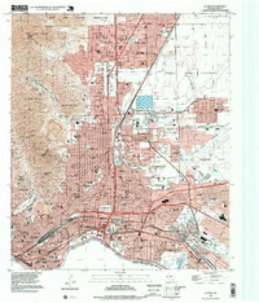
21 topographic sheets cover this place, the earliest surveyed in 1896 and the latest in 1997. It stands in the El Paso census division. It lies in ZIP code area 79901. It lies near Mesilla Valley. The Survey maps it on the El Paso quadrangle. 678,815 people lived here at the 2020 count. It stands 3,740 feet above sea level.
Research this city
On record in El Paso
Buildings and businesses the archive holds for this place. Each opens its own page, with the source record it came from.
On the National Register 12 of 48 shown
 Abdou Buildinglisted 1980
 O. T. Bassett Towerlisted 1980
 Richard Caples Buildinglisted 1980
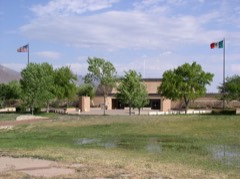 Chamizal National Memoriallisted 1974
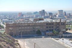 El Paso High Schoollisted 1980
 El Paso Natural Gas Company (Blue Flame) Buildinglisted 2018
 El Paso Union Passenger Stationlisted 1975
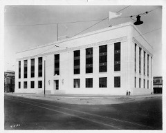 El Paso US Courthouselisted 2001
 First Mortage Company Buildinglisted 1978
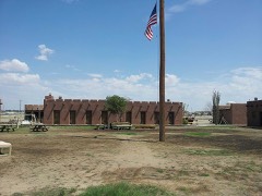 Fort Bliss Main Post Historic Districtlisted 1998
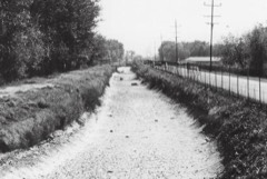 Franklin Canallisted 1992
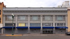 W. S. Hills Commercial Structurelisted 1980
Population over time
2 figuresEl Paso grew from 649,121 to 678,815 between 2010 and 2020. These are the recorded population figures Wikidata holds for this place, reached through the Geographic Names Information System number this page is keyed on rather than by name, so they belong to this place and not to another of the same name. Most are census counts, but not all are: an early figure may be a founding or settlement estimate, and an estimate published within five years of a census is left out. The change column is computed, and is left blank where more than 20 years separate a figure from the one before it, because a gap that long is not a change between two counts.
| Year | People | Change |
|---|---|---|
| 2010 | 649,121 | |
| 2020 | 678,815 | +29,694 (+5%) |
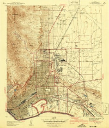
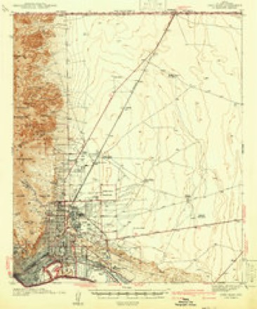
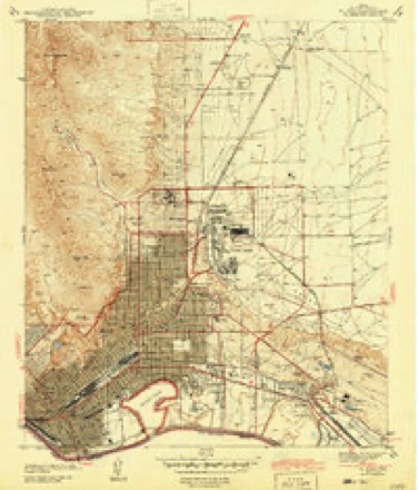
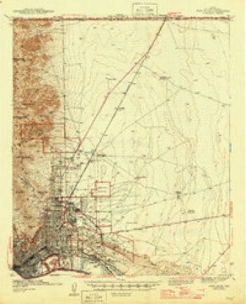
Topographic sheets covering this place
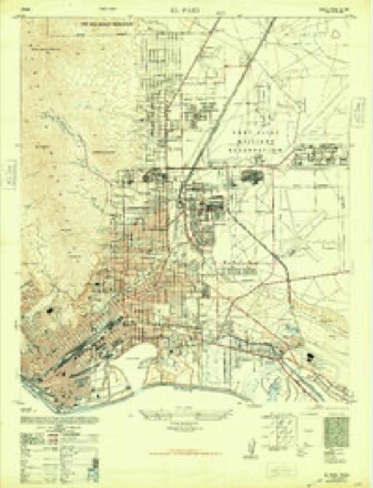
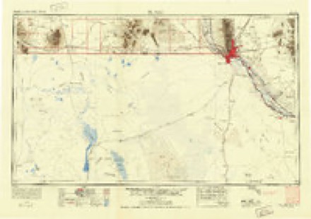
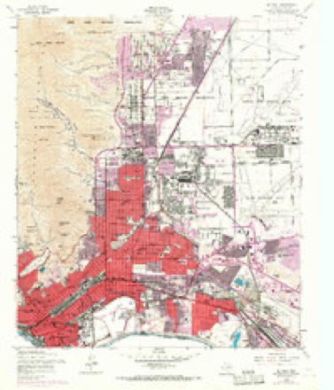
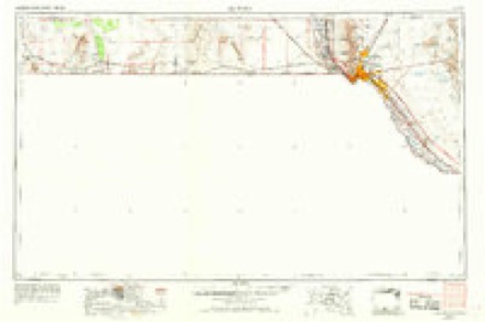
15 surveys from 21 printed sheetsMatched by testing this settlement's coordinate against the published boundary of every sheet in the United States Geological Survey's historical collection. Each opens the scanned sheet at the Survey.
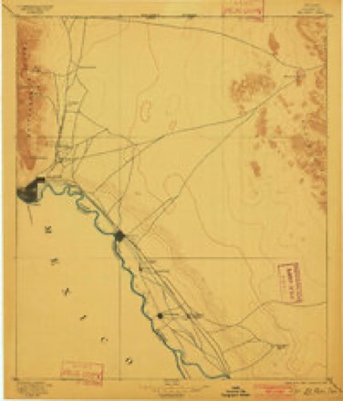
- 1896 USGS El Paso quadrangle1:125000, 2 printings
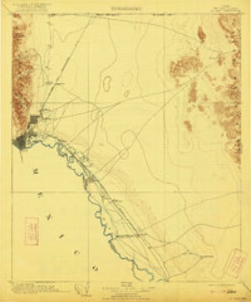
- 1908 USGS El Paso quadrangle1:125000, 2 printings
- 1941 USGS El Paso quadrangle1:31680
- 1942 USGS Fort Bliss quadrangle1:62500
- 1943 USGS El Paso quadrangle1:31680
- 1945 USGS Fort Bliss quadrangle1:62500
- 1948 USGS El Paso quadrangle1:24000
- 1953 USGS El Paso quadrangle1:250000
- 1955 USGS El Paso quadrangle1:24000, 3 printings
- 1959 USGS El Paso quadrangle1:250000, 2 printings
- 1964 USGS El Paso quadrangle1:250000
- 1965 USGS El Paso quadrangle1:250000
- 1983 USGS El Paso quadrangle1:100000, 2 printings
- 1994 USGS El Paso quadrangle1:24000
- 1997 USGS El Paso quadrangle1:24000
Fires near this place
1 since 2000Regional context, not property-specific evidence. The federal wildfire occurrence database lists 1 fire within 5 miles of El Paso in 2000, burning under an acre in total. None started naturally. None was recorded as arson. Distance is straight-line from the map coordinates, so a fire counted here may appear on a neighbouring settlement's page as well.
| Reported cause | Fires |
|---|---|
| Smoking | 1 |
The most recent of them, most recent first, with the day each was reported and the service that recorded it.
| Date | Cause | Size | Reported by | Name on the report |
|---|---|---|---|---|
| 13 January 2000 | Smoking | under an acre | Chamizal National Monument | BERMUDA |
Settlements close enough to share some of these fires:
Mines and quarries near this place
10 of 11 shownRegional context, not property-specific evidence. The federal mineral resources record lists 11 workings within 5 miles of El Paso: 9 producers, 2 plants. All of them still produce. What was taken out: Stone, Crushed/Broken, Sand and Gravel, Construction, Copper, Sulfur, Sulfuric Acid. Distance is straight-line from the map coordinates, so a quarry counted here may appear on a neighbouring settlement's page as well.
| Where | Site | Commodity | Status | Recorded |
|---|---|---|---|---|
| (Facility) El Paso Copper Smelter | Copper, Sulfur, Sulfuric Acid | Plant | ||
| (Facility) El Paso Lead Smelter | Lead, Smelter, Cadmium, Sulfur, Sulfuric Acid, Zinc | Plant | ||
| Ciudad Juarez Hf Plt | Fluorine-Fluorite | Producer | ||
| El Paso Quarry & Plant | Silica | Producer | ||
| El Paso Sulfur Plant | Sulfur | Producer | ||
| Edgar Park Pit | Sand and Gravel, Construction | Producer | Gravel, Sand | |
| Vowell Construction Company Pit | Sand and Gravel, Construction | Producer | ||
| Courchesne Quarry | Stone, Crushed/Broken | Producer | ||
| McKelligon Canyon Quarry | Stone, Crushed/Broken | Producer | ||
| Southwestern Cement Plant | Stone, Crushed/Broken | Producer |
Storms near this place
60 of 72 shownRegional context, not property-specific evidence. The National Weather Service names El Paso in 72 storm reports between 1993 and 2025: 38 flash flood, 18 thunderstorm wind, 12 hail, 3 flood. The reports record 4 deaths and 29 injuries. Each account below is quoted exactly as the forecast office filed it, from the NOAA Storm Events Database, and each date opens the federal record of that event.
| When | Event | Place named | Harm | What the report says |
|---|---|---|---|---|
| August 2021 | Flash Flood | El Paso | 2 killed | Flash flooding occurred across central El Paso with a torrent of water flowing down the mountainside near Fort Blvd and Louisiana St. There was also significant water flow down Nashville St where two deaths were reported as a wall collapsed in the basement of a house and trapped a 2 year old and her 65 year old grandmother. Atlas Avenue just north of Chapin High School also had the road buckle with slabs of pavement missing. A rainfall report at the Wyler Tramway reported 4.65 of rain in a couple of hours which caused the flash flooding. |
| August 2002 | Flash Flood | El Paso | 1 killed, $200,000 | no account filed |
| August 1993 | Thunderstorm Wind | El Paso | 1 killed, $50,000 | Strong thunderstorms developed over portions of eastern New Mexico and far west Texas ahead of an outflow boundary during the early afternoon. One of the storms moved south over southeastern portions of El Paso producing a downburst that struck Horizon City (12 miles southeast of El Paso) collapsing the frame of a house under construction. The damage was extremely localized and apparently enhanced by the orientation of a nearby house and mobile home. A construction worker suffered fatal injuries as the frame collapsed. |
| August 1995 | Thunderstorm Wind | El Paso | 27 hurt, $125,000 | A thunderstorm caused a microburst, which destroyed three mobile homes, damaged about 30 others, and overturned a tractor-semitrailer. Twenty-seven people were injured (seven were taken to the hospital, another 20 were just slightly injured). The high winds also damaged or destroyed several storage sheds. |
| June 1999 | Flash Flood | El Paso | 1 hurt, $50,000 | Thunderstorms produced heavy rains in the Sparks area just south of Horizon City. The resulting flash flooding severely damaged roads and washed mobile homes off their foundation. One car was overturned as it attempted to cross a flooded arroyo, leaving one man injured. |
| September 1997 | Flood | El Paso | 1 hurt | no account filed |
| September 2013 | Flash Flood | El Paso | $2,400,000 | Street flooding was reported on the west side of Trans-Mountain Road with debris. Autos were having a difficult time driving through with a rock slide blocking westbound portions of the road at the mountain top. Several homes and streets in the Vinton and Westway area were flooded with several inches of water. There were reports of cars overturned in arroyos near Executive Drive. Rainfall amounts of over 3 inches were reported on the west side of El Paso through the morning into the early afternoon. An electrical explosion and building fire in Downtown El Paso were also blamed on the heavy rain. Interstate 10 near the Piedras exit had to be closed due to water crossing the interstate. |
| August 2004 | Hail | El Paso | $250,000 | A large amount of quarter size hail caused damage to hundreds of vehicles at several auto dealers on the east side of El Paso. As a result, "hail sales" appeared in newspaper ads in the following weeks. |
| July 1997 | Thunderstorm Wind | El Paso | $150,000 | An apparent wet microburst partially removed the roofs on three buildings in an apartment complex located in southeastern El Paso. There were no injuries, partly due to rain preceding the wind, forcing most people inside where they were not subject to being struck by flying roofing material. |
| August 2006 | Flash Flood | El Paso | $100,000 | Central El paso experienced flash flooding for the second day in a row. Three feet of water on streets in that section entered some residences. A Skywarn Spotter measured 1.86 inches of rain within 35 minutes in east El Paso. Flooding and water rescues took place throughout the city, but hardest hit were the central and eastern sections. |
| July 2000 | Flash Flood | El Paso | $75,000 | Thunderstorms accompanied by an inch an a half of rain in a short time (including one report of an inch in 15 minutes) brought extensive street flooding to the downtown, central and eastern sections of the city. At least two lanes on Interstate 10 along with the access roads were closed, with water nearly 3 feet deep in some spots. |
| August 2007 | Flash Flood | El Paso | $50,000 | About 2 inches of rain fell in less than an hour over the western and downtown portions of El Paso. This caused major street flooding with numerous car rescues required. Rock slides occurred and and a few vehicles were submerged. |
| July 1998 | Lightning | El Paso | $50,000 | Lightning struck a communications tower used for regional emergency communications, resulting in considerable electrical damage and producing a shutdown of the facility lasting several days. |
| June 1994 | Thunderstorm Wind | El Paso | $50,000 | The NWS measured 60 knot (69 mph) winds from a severe thunderstorm in El Paso. The winds knocked down trees and utility poles. |
| September 2009 | Hail | El Paso | $50,000 | no account filed |
| June 2001 | Flood | El Paso | $30,000 | A series of thunderstorms dropped 2.5 inches of rain in an hour on west El Paso, and 3 inches on the northeast part of the city. This resulted in significant street flooding and numerous stalled vehicles. Numerous cloud-to-ground lightning strikes knocked out power to these same areas. |
| September 2005 | Flash Flood | El Paso | $20,000 | A cluster of thunderstorms dropped 1.5 to 3 inches of rain on mainly east El Paso, where numerous water rescues were performed due to major street flooding. |
| June 2000 | Thunderstorm Wind | El Paso | $20,000 | A severe thunderstorm produced winds which took off one roof and damaged others. A wind gust of 59 mph was measured in the vicinity. |
| July 2025 | Thunderstorm Wind | El Paso | $10,000 | Social Media post of downed powerlines at Ft. Bliss. |
| July 2024 | Thunderstorm Wind | El Paso | $10,000 | First responders reported power lines down on houses. |
| July 2007 | Flash Flood | El Paso | $10,000 | Rescue crews were busy due to high water levels at intersection of Robert E. Lee & Interstate 10, as well as with residential flooding on Ascarate Street where a canal overflowed. One man was swept away but then rescued with no serious injuries. |
| May 2007 | Flash Flood | El Paso | $10,000 | Torrential rains led to flooded roads in many sections of El Paso. A roof collapsed in the northeast part of the city from the weight of accumulated rain water. |
| August 2005 | Flash Flood | El Paso | $10,000 | Two to three inches of rain resulted in flooding from downtown El Paso to the eastern portion of the city.Several street closures were reported by law enforcement. |
| October 2002 | Hail | El Paso | $5,000 | A line of severe thunderstorms, including a low top supercell at the southern end of the line, moved rapidly eastward across northwestern El Paso. Quarter size hail from the supercell covered the ground to a depth of 3 inches in spots. There was also minor roof damage from gusty winds. |
| August 2005 | Hail | El Paso | $1,000 | no account filed |
| July 2025 | Flash Flood | El Paso | - | Social media post in the area showing multiple spots of standing and flowing water on roadways south of the airport. |
| July 2024 | Flash Flood | El Paso | - | Vehicle stalled due to high water with water rescue team on scene. |
| June 2023 | Thunderstorm Wind | El Paso | - | Tree down at the intersection of Dyer and Haines Dr from Emergency Manager. |
| June 2023 | Thunderstorm Wind | El Paso | - | Emergency Manager reported a tree had fallen on a power line near Fort Bliss. |
| September 2023 | Hail | El Paso | - | Social media report showed hail up to the size of quarters near Fort Bliss. |
| August 2021 | Flash Flood | El Paso | - | Flash flooding occurred at the intersection of East Missouri Ave and Poplar St around the Chevron Gas Station. Vehicles were reported underwater. |
| May 2018 | Flash Flood | El Paso | - | Flooding reported off of I-10 on Gateway West and Geronimo in central El Paso. |
| August 2016 | Flash Flood | El Paso | - | Video from Manhattan Heights showed cars barely making it through deep, fast-moving water. |
| July 2016 | Thunderstorm Wind | El Paso | - | Trees down at Copia and Alameda. |
| October 2015 | Flash Flood | El Paso | - | Flooding around US 54 and Montana in Central El Paso. |
| August 2015 | Flash Flood | El Paso | - | Fire department sent water rescue teams out for areas along Interstate 10 from around Bassett Center to Zaragoza. Gateway West was closed from Airway to Geronimo. |
| August 2014 | Flash Flood | El Paso | - | Numerous reports via Twitter and media showed Interstate 10 near Raynolds and the Spaghetti Bowl flooded with traffic at a standstill. A trained spotter reported 1.75 inches of rain near this area. |
| June 2013 | Thunderstorm Wind | El Paso | - | Local media affiliate reported a 70mph wind gust at Ascarate Park. |
| July 2011 | Flash Flood | El Paso | - | Flooding was reported at the intersection of Trowbridge and Chelsea in Central El Paso. |
| July 2010 | Thunderstorm Wind | El Paso | - | A wind gust of 60 mph was estimated at the El Paso Texas Department of Transportation building. |
| August 2007 | Flash Flood | El Paso | - | Street flooding occurred in the downtown and southwest portions of El Paso, with some intersections closed. |
| August 2007 | Thunderstorm Wind | El Paso | - | A gust of 61 mph was measured at a media mesonet. |
| July 2007 | Flash Flood | El Paso | - | A few cars were stranded in high water, mainly around UTEP and downtown. |
| July 2006 | Flash Flood | El Paso | - | Major street flooding occurred in central and northeast El Paso, and spread into west El Paso near UTEP. |
| July 2006 | Flash Flood | El Paso | - | The second in a wave of westward moving thunderstorms moved across El Paso, dropping heavy rain which resulted in a mudslide with debris blocking traffic on Mesa Street in west El Paso. |
| August 2006 | Flash Flood | El Paso | - | As much as 2.5 inches of rain within 50 minutes caused major street and arroyo flooding in central and west El Paso. Two feet of water covered streets in central El Paso. |
| August 2006 | Flash Flood | El Paso | - | Significant street flooding occurred at some intersections in the western and downtown portions of El Paso. |
| August 2006 | Flash Flood | El Paso | - | Significant street flooding took place in northeast and west El Paso, with a water rescue performed at Mesa and Glory Road (UTEP campus). |
| August 2006 | Flash Flood | El Paso | - | Significant street flooding was reported in northeast El Paso. |
| August 2006 | Flash Flood | El Paso | - | Major street flooding took place in the northeast and west portions of El Paso. A water rescue was performed at the intersection of Mesa and Glory Road. |
| September 2006 | Flash Flood | El Paso | - | Extensive street flooding occurred in portions of El Paso. TXDOT and weather spotters reported several roads under water and numerous stalled vehicles. |
| July 2006 | Flash Flood | El Paso | - | The third flood producing thunderstorm of the day for El Paso County caused flooding in central El Paso. |
| August 2005 | Thunderstorm Wind | El Paso | - | Power lines were blown down in northeast El Paso. |
| September 2005 | Flash Flood | El Paso | - | Local newscast showed video of flooded streets with police officers closing intersections. |
| July 2001 | Thunderstorm Wind | El Paso | - | An off-duty television meteorologist estimated winds gusting to 70 mph (wet microburst). A nearby mesonet site recorded a gust to 71 mph and 1.45 inches of rain in 40 minutes. |
| June 2000 | Flash Flood | El Paso | - | The southeast portion of the El Paso metro area experienced extensive street flooding from an intense downpour. A trucker had to be rescued from a stalled tractor-trailer, as all 4 lanes of Interstate 10 were flooded. Several streets in the area were washed out. |
| July 1999 | Flash Flood | El Paso | - | Heavy thunderstorm rains amounting to between one and two inches produced widespread urban and arroyo flooding on the east side of El Paso. There were numerous reports of stranded vehicles. Several vehicles were washed into a ravine in the lower valley. There were no injuries. |
| July 1999 | Hail | El Paso | - | A spotter reported dime size hail in the north hills area of El Paso. |
| August 1999 | Flash Flood | El Paso | - | Thunderstorms produced heavy rains which caused street flooding in the Lower Valley and Downtown areas of El Paso. Several traffic accidents were attributed to the blinding rain and street flooding. |
| August 1999 | Thunderstorm Wind | El Paso | - | A microburst knocked a mobile home off the foundation and blew off the roof in the Montana Vista area of far east El Paso. |
Nearest settlements
The eight closest, with where each one stands in the county. Distances are straight-line, computed from the Geographic Names Information System coordinates.
| Map | Place | Distance | Sheets |
|---|---|---|---|
| Mission Hills | 2.1 miles | 21 | |
| Smeltertown | 2.7 miles | 18 | |
| La Guna | 2.8 miles | 18 | |
| Courchesne | 3.4 miles | 18 | |
| Buena Vista | 4.4 miles | 18 | |
| Lakeside | 4.8 miles | 19 | |
| Coronado Hills | 5.3 miles | 18 | |
| Planeport | 5.4 miles | 21 |
Elsewhere
Matched on this settlement's Geographic Names Information System number rather than its name, so it cannot be a different place of the same name in another state.
| Wikipedia article on El Paso | An encyclopaedic summary. Its text is share-alike, so it is linked here rather than copied. |
| Wikidata item Q16562 | The structured record the population and elevation above come from. Public domain (CC0). |
Provenance
This settlement is recorded in the Geographic Names Information System as feature 1380946. The sheet list is computed by point-in-boundary test against the United States Geological Survey's historical topographic inventory. Both are works of the United States government and carry no copyright under 17 U.S.C. 105.
Wildfire. Short, Karen C. 2022. Spatial wildfire occurrence data for the United States, 1992-2020 [FPA_FOD_20221014]. 6th Edition. Fort Collins, CO: Forest Service Research Data Archive. https://doi.org/10.2737/RDS-2013-0009.6 Collected with United States Government funding and usable without additional permissions or fees.
Mines and quarries. USGS Mineral Resources Data System (MRDS) https://mrdata.usgs.gov/mrds/ A work of the United States government, no copyright under 17 U.S.C. 105.
Storms. NOAA National Centers for Environmental Information, Storm Events Database https://www.ncei.noaa.gov/stormevents/ A work of the United States government, no copyright under 17 U.S.C. 105. Narratives are quoted verbatim from the National Weather Service report and are not edited or summarised.