 Block
BlockFratt, Texas
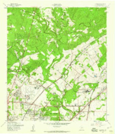
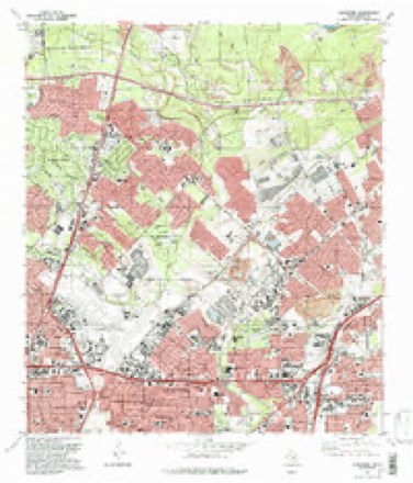
14 topographic sheets cover this place, the earliest surveyed in 1953 and the latest in 1992. It stands in the San Antonio Central census division. It lies in ZIP code area 78218. It stands on Beitel Creek. The Survey maps it on the Longhorn quadrangle.
Topographic sheets covering this place
7 surveys from 14 printed sheetsMatched by testing this settlement's coordinate against the published boundary of every sheet in the United States Geological Survey's historical collection. Each opens the scanned sheet at the Survey.
- 1953 USGS Longhorn quadrangle1:24000
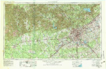
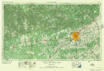
- 1954 USGS San Antonio quadrangle1:250000, 3 printings
- 1957 USGS San Antonio quadrangle1:250000
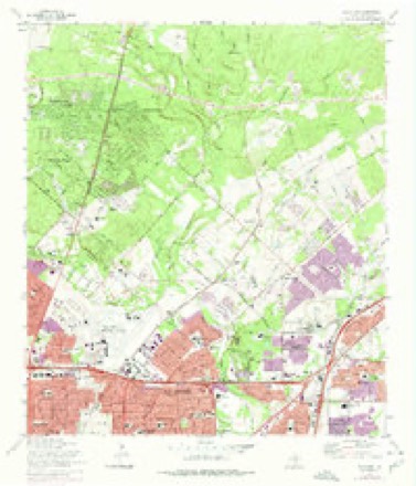
- 1967 USGS Longhorn quadrangle1:24000, 4 printings
- 1985 USGS New Braunfels quadrangle1:100000
- 1992 USGS Longhorn quadrangle1:24000, 2 printings
- 1992 USGS New Braunfels quadrangle1:100000, 2 printings
Fires near this place
139 since 2006Regional context, not property-specific evidence. The federal wildfire occurrence database lists 139 fires within 5 miles of Fratt between 2006 and 2011, burning about 357 acres in total. None started naturally. 2 were recorded as arson. Distance is straight-line from the map coordinates, so a fire counted here may appear on a neighbouring settlement's page as well.
| Reported cause | Fires |
|---|---|
| Missing data/not specified/undetermined | 90 |
| Debris and open burning | 22 |
| Misuse of fire by a minor | 12 |
| Recreation and ceremony | 5 |
| Equipment and vehicle use | 5 |
| Arson/incendiarism | 2 |
| Smoking | 2 |
| Railroad operations and maintenance | 1 |
The most recent of them, most recent first, with the day each was reported and the service that recorded it.
| Date | Cause | Size | Reported by | Name on the report |
|---|---|---|---|---|
| 7 September 2008 | Debris and open burning | 2.0 acres | Texas A & M Forest Service | not named |
| 6 September 2008 | Missing data/not specified/undetermined | under an acre | Texas A & M Forest Service | not named |
| 19 September 2008 | Debris and open burning | under an acre | Texas A & M Forest Service | not named |
| 18 September 2009 | Debris and open burning | under an acre | Texas A & M Forest Service | RUSTIC FOREST |
| 16 September 2009 | Debris and open burning | under an acre | Texas A & M Forest Service | NEW WORLD |
| 11 September 2011 | Missing data/not specified/undetermined | 100 acres | Texas A & M Forest Service | WETMORE FIRE |
| 11 September 2008 | Missing data/not specified/undetermined | under an acre | Texas A & M Forest Service | not named |
| 11 September 2008 | Missing data/not specified/undetermined | under an acre | Texas A & M Forest Service | not named |
Settlements close enough to share some of these fires:
Mines and quarries near this place
8 within 5 milesRegional context, not property-specific evidence. The federal mineral resources record lists 8 workings within 5 miles of Fratt: 6 producers, 2 past producers. 6 still produce. What was taken out: Limestone, General, Stone, Crushed/Broken, Limestone, General, Limestone, Ultra Pure, Cement Rock, Stone, Crushed/Broken. Distance is straight-line from the map coordinates, so a quarry counted here may appear on a neighbouring settlement's page as well.
| Where | Site | Commodity | Status | Recorded |
|---|---|---|---|---|
| Capital Cement Plant | Cement Rock, Stone, Crushed/Broken | Producer | ||
| Cementville Quarry | Limestone, General, Limestone, Ultra Pure | Past Producer | Limestone | |
| Judson Road Perlite Plant | Perlite | Producer | ||
| Cloud Quarry | Stone, Crushed/Broken, Limestone, General | Producer | Limestone | |
| Longhorn Quarry and Plant | Stone, Crushed/Broken, Limestone, General | Producer | ||
| Capitol Cement Quarry | Limestone, General | Producer | Limestone | |
| Kaiser Cement and Gypsum Corp | Limestone, General | Producer | ||
| Longhorn Quarry | Limestone, General | Past Producer | Limestone |
Storms near this place
43 since 2009Regional context, not property-specific evidence. The National Weather Service names Fratt in 43 storm reports between 2009 and 2025: 28 flash flood, 13 hail, 2 thunderstorm wind. No death or injury is recorded in these reports. Each account below is quoted exactly as the forecast office filed it, from the NOAA Storm Events Database, and each date opens the federal record of that event.
| When | Event | Place named | Harm | What the report says |
|---|---|---|---|---|
| November 2014 | Flash Flood | Fratt | $50,000 | Flash flooding on multiple roadways across north-central Bexar county was reported by the Highway Department. Road closures were reported at Cave Lane, Oak Glen Drive, Vance Jackson, McCullough Avenue, Rio Seco Drive, Sleepy Hollow Drive, and Bulverde Road. Other roadways were reported to have water on the roadway across the northern part of the city of San Antonio. |
| March 2023 | Thunderstorm Wind | Fratt | $1,000 | A thunderstorm produced wind gusts estimated at 60 mph that knocked down some three inch diameter tree limbs near Hollyhock Rd. and Whisper Point in northwestern San Antonio. |
| March 2023 | Thunderstorm Wind | Fratt | $1,000 | A thunderstorm produced wind gusts estimated at 60 mph that broke some three inch tree limbs off Vance Jackson Rd. in northwestern San Antonio. |
| March 2025 | Hail | Fratt | - | A thunderstorm produced penny size hail near the intersection of Fredericksburg Rd. and Gus Eckert Rd. in northwestern San Antonio. |
| March 2024 | Hail | Fratt | - | A thunderstorm produced golf ball size hail in northwestern San Antonio near Huebner Rd. and Eckhert Rd. |
| November 2024 | Flash Flood | Fratt | - | Thunderstorms produced heavy rain. San Antonio Fire Department rescued a person from a flooded drainage ditch near Tioga Dr. and I-10 in northwestern San Antonio. |
| May 2023 | Flash Flood | Fratt | - | Thunderstorms produced heavy rain that led to flash flooding. The low water crossing at Sleepy Hollow Dr. and Sunburst Ln. at Olmos Creek in northwestern San Antonio was flooded. |
| May 2023 | Flash Flood | Fratt | - | Thunderstorms produced heavy rain that led to flash flooding. Bexar Floods reported several low water crossings flooded in northwestern San Antonio. |
| October 2021 | Flash Flood | Fratt | - | Thunderstorms produced heavy rain that led to flash flooding. A pickup truck was carried a couple of hundred feet by rushing water on Southwell Rd near Verbena St. along Leon Creek. |
| October 2019 | Flash Flood | Fratt | - | Thunderstorms produced heavy rain that led to flash flooding. The San Antonio Fire Department made a water rescue at I-10 and Callaghan Rd. in northern San Antonio. Rainfall reports in the area were around three inches. |
| October 2019 | Flash Flood | Fratt | - | Thunderstorms produced heavy rain that led to flash flooding. The San Antonio Fire Department made a water rescue at 11920 Orsinger Ln. near Olmos Creek in northern San Antonio. Rainfall reports in the area were around three inches. |
| October 2019 | Flash Flood | Fratt | - | Thunderstorms produced heavy rain that led to flash flooding. The San Antonio Fire Department made a water rescue at Vance Jackson Rd. and Dreamland Dr. near Olmos Creek in northern San Antonio. Rainfall reports in the area were around three inches. |
| April 2016 | Hail | Fratt | - | A thunderstorm produced one inch hail at Methodist Hospital on Floyd Curl Dr. in northwestern San Antonio. |
| April 2016 | Hail | Fratt | - | A thunderstorm produced 2.75 inch hail near USAA at I-10 and Huebner Rd. |
| June 2016 | Flash Flood | Fratt | - | Thunderstorms produced heavy rain that caused flash flooding closing Dreamland Dr. at Westby Ln. near Olmos Creek in northern San Antonio. |
| June 2016 | Flash Flood | Fratt | - | Thunderstorms produced heavy rain that caused flash flooding closing Vance Jackson at Sunburst in northwestern San Antonio. |
| June 2016 | Flash Flood | Fratt | - | Thunderstorms produced heavy rain that caused flash flooding along the West Fork of Olmos Creek closing Orsinger Ln. at Sleepy Hollow St. in northwestern San Antonio. |
| April 2015 | Hail | Fratt | - | A thunderstorm produced one inch hail near I-10 and Fredericksburg Rd. in San Antonio. |
| June 2015 | Flash Flood | Fratt | - | Thunderstorms produced heavy rain that caused flash flooding in northwest San Antonio. There were water rescues at Verbena St. and Southwell Rd. and S. Hausman Rd. and Lake Run. Numerous roads were closed due to flooding including the I-10 access road near Fountainhead Dr., Evers Rd. at Poss Rd., Cave Ln. from Dundee Ave. to Kenilowrth Blvd., Lockhill Rd. at White Bonnet St., Danville Fr. at Overbrook, Orsinger Ln. at Vance Jackson Rd., and Sunburst St. at Sleepy Hollow St. |
| May 2015 | Flash Flood | Fratt | - | Thunderstorms produced heavy rain that caused flash flooding closing Orsinger St. at Vance Jackson Rd. in San Antonio. |
| June 2015 | Flash Flood | Fratt | - | Thunderstorms produced heavy rain that caused flash flooding along Olmos Creek in northwest San Antonio. Orsinger Ln. at Sleepy Hollow St. and at Vance Jackson Rd. were initially closed at 12:24 local time. At 14:11 local time there was a foot of water over Sleepy Hollow St. at Sunburst St. and at 14:30 local time nine inches of water was flowing over the road in the 11900 block of Orsinger Ln. |
| October 2015 | Flash Flood | Fratt | - | Thunderstorms produced heavy rain that caused flash flooding closing Sleepy Hollow St. at Sunburst St. in northwest San Antonio. |
| June 2015 | Flash Flood | Fratt | - | Heavy rain from Tropical storm Bill caused flash flooding closing Lockhill Rd. at Babcock Rd. in northwest San Antonio. |
| October 2015 | Flash Flood | Fratt | - | Thunderstorms produced heavy rain that caused flash flooding closing Southwell Rd. at Verbena St. in northwestern San Antonio. |
| October 2015 | Flash Flood | Fratt | - | Thunderstorms produced heavy rain that caused flash flooding closing Fredericksburg Rd. at the I-10 Access Rd. in northwestern San Antonio. |
| July 2014 | Flash Flood | Fratt | - | Thunderstorms produced heavy rain that caused flash flooding closing Vance Jackson at Orsinger. |
| June 2014 | Flash Flood | Fratt | - | Thunderstorms produced heavy rain that caused flash flooding closing Verbena Rd. at Southwell Rd. |
| June 2014 | Flash Flood | Fratt | - | Thunderstorms produced heavy rain that caused flash flooding closing Lockhill Rd. at White Bonnet St. |
| February 2012 | Flash Flood | Fratt | - | Thunderstorms produced heavy rain which caused flash flooding and closed Vance Jackson and Orsinger Roads in San Antonio. |
| February 2012 | Flash Flood | Fratt | - | Thunderstorms produced heavy rain which caused flash flooding and closed Vance Jackson Road and Sugar Hill Drive in San Antonio. |
| March 2012 | Flash Flood | Fratt | - | Thunderstorms produced heavy rain that caused flash flooding of numerous roads in San Antonio including Vance Jackson Road at Sunburst Lane, Orsinger Lane at Sandstone Drive, and Sleepy Hollow at Sunburst Lane. |
| September 2012 | Flash Flood | Fratt | - | Thunderstorms produced heavy rain that caused flash flooding closing Orsinger Ln at Sleepy Hollow St, Overbrook Dr at Danville, Sleepy Hollow St at Sunburst St, and Vance Jackson Rd at Orsinger Ln all in San Antonio. |
| October 2012 | Flash Flood | Fratt | - | Thunderstorms produced heavy rain that caused flash flooding closing Vance Jackson Rd. at Orsinger St. |
| February 2009 | Hail | Fratt | - | A spotter reported nickel size hail in the Medical Center area of San Antonio. |
| February 2009 | Hail | Fratt | - | A spotter reported quarter to ping pong ball size hail at the intersection of Vance Jackson and De Zavala Rds. in San Antonio. |
| September 2009 | Flash Flood | Fratt | - | Heavy rain caused flooding which closed Lockhill Road at White Bonnet Road. |
| October 2009 | Flash Flood | Fratt | - | Heavy rain caused flooding which closed several roads in San Antonio including Babcock Road at Hollyhock Road, Classen Road at Stahl Road, Encino Park Road at Southwell Road, Huebner Road at Southwell Road, and Lookout Road at Old O'Connor Road. |
| March 2023 | Hail | Fratt | - | no account filed |
| May 2017 | Hail | Fratt | - | no account filed |
| April 2016 | Hail | Fratt | - | no account filed |
| April 2013 | Hail | Fratt | - | no account filed |
| February 2012 | Hail | Fratt | - | no account filed |
| May 2012 | Hail | Fratt | - | no account filed |
Nearest settlements
The eight closest, with where each one stands in the county. Distances are straight-line, computed from the Geographic Names Information System coordinates.
| Map | Place | Distance | Sheets |
|---|---|---|---|
| Windcrest | 0.9 miles | 14 | |
| Longhorn | 1.0 miles | 14 | |
| Shorts Corner | 2.3 miles | 14 | |
| North Loop | 3.4 miles | 14 | |
| Wetmore | 3.4 miles | 14 | |
| Kirby | 3.8 miles | 12 | |
| Terrell Hills | 4.1 miles | 12 | |
| Converse | 4.3 miles | 11 |
Provenance
This settlement is recorded in the Geographic Names Information System as feature 1378324. The sheet list is computed by point-in-boundary test against the United States Geological Survey's historical topographic inventory. Both are works of the United States government and carry no copyright under 17 U.S.C. 105.
Wildfire. Short, Karen C. 2022. Spatial wildfire occurrence data for the United States, 1992-2020 [FPA_FOD_20221014]. 6th Edition. Fort Collins, CO: Forest Service Research Data Archive. https://doi.org/10.2737/RDS-2013-0009.6 Collected with United States Government funding and usable without additional permissions or fees.
Mines and quarries. USGS Mineral Resources Data System (MRDS) https://mrdata.usgs.gov/mrds/ A work of the United States government, no copyright under 17 U.S.C. 105.
Storms. NOAA National Centers for Environmental Information, Storm Events Database https://www.ncei.noaa.gov/stormevents/ A work of the United States government, no copyright under 17 U.S.C. 105. Narratives are quoted verbatim from the National Weather Service report and are not edited or summarised.