 Block
BlockGail, Texas
8 topographic sheets cover this place, the earliest surveyed in 1954 and the latest in 1986. It stands in the Gail South census division. It lies in ZIP code area 79738. It stands on Gail Mountain. The Survey maps it on the Gail quadrangle. 249 people lived here at the 2020 count. It stands 2,556 feet above sea level.
Research this city
Population over time
2 figuresGail grew from 231 to 249 between 2010 and 2020. These are the recorded population figures Wikidata holds for this place, reached through the Geographic Names Information System number this page is keyed on rather than by name, so they belong to this place and not to another of the same name. Most are census counts, but not all are: an early figure may be a founding or settlement estimate, and an estimate published within five years of a census is left out. The change column is computed, and is left blank where more than 20 years separate a figure from the one before it, because a gap that long is not a change between two counts.
| Year | People | Change |
|---|---|---|
| 2010 | 231 | |
| 2020 | 249 | +18 (+8%) |
Topographic sheets covering this place
4 surveys from 8 printed sheetsMatched by testing this settlement's coordinate against the published boundary of every sheet in the United States Geological Survey's historical collection. Each opens the scanned sheet at the Survey.
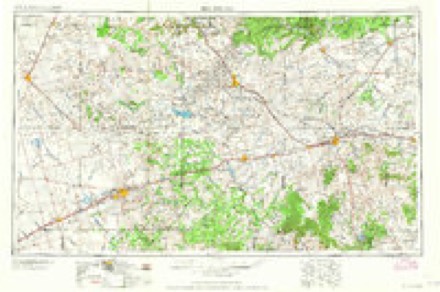
- 1954 USGS Big Spring quadrangle1:250000, 4 printings
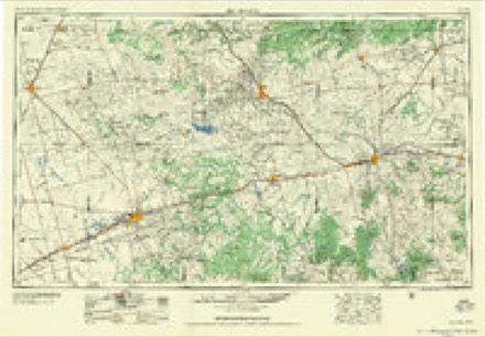
- 1958 USGS Big Spring quadrangle1:250000
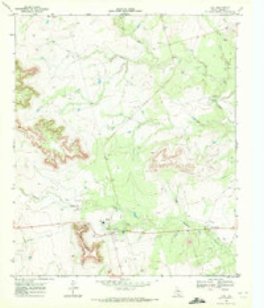
- 1969 USGS Gail quadrangle1:24000
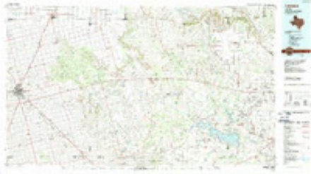
- 1986 USGS Lamesa quadrangle1:100000, 2 printings
Photographs
4 photographs, 2014Taken for the Office of War Information and the Farm Security Administration, who photographed the country between 1935 and 1944. Works of United States government photographers, with no known restriction on use. Each opens its catalogue record.
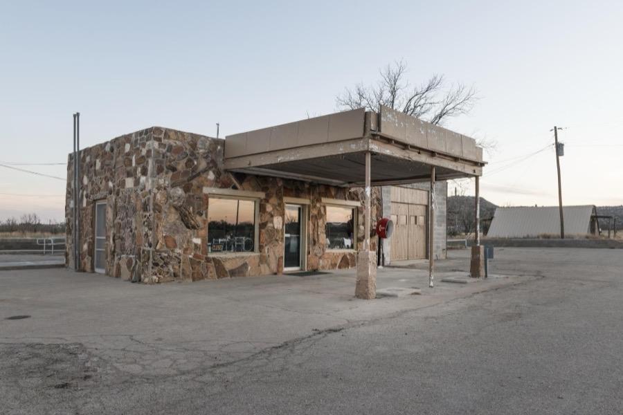
Highsmith, Carol M, 2014. Library of Congress
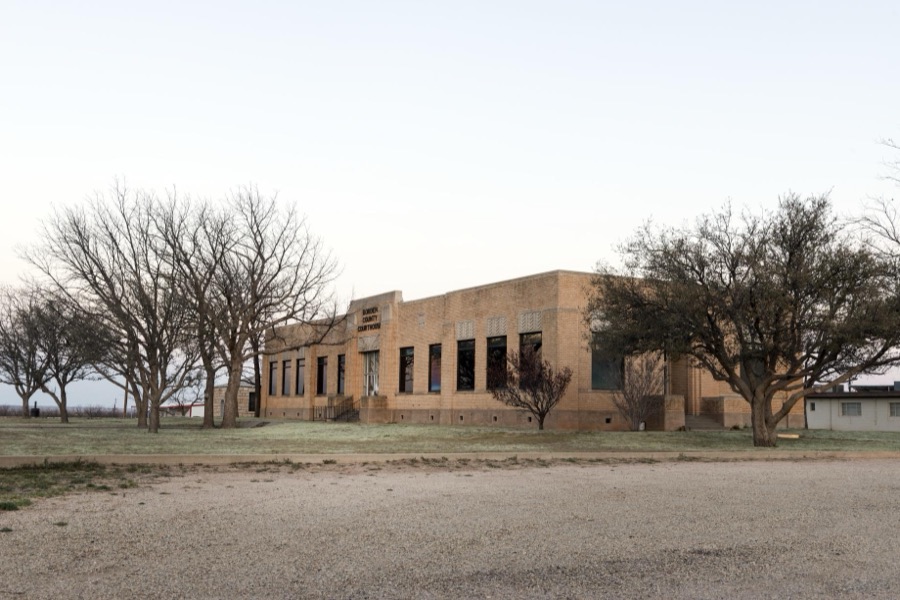
Highsmith, Carol M, 2014. Library of Congress

Highsmith, Carol M, 2014. Library of Congress
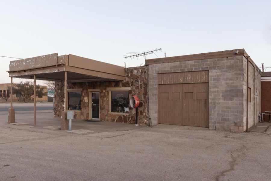
Highsmith, Carol M, 2014. Library of Congress
Fires near this place
3 since 2006Regional context, not property-specific evidence. The federal wildfire occurrence database lists 3 fires within 5 miles of Gail between 2006 and 2018, burning about 500 acres in total. 1 started naturally. None was recorded as arson. Distance is straight-line from the map coordinates, so a fire counted here may appear on a neighbouring settlement's page as well.
| Reported cause | Fires |
|---|---|
| Natural | 1 |
| Power generation/transmission/distribution | 1 |
| Equipment and vehicle use | 1 |
The most recent of them, most recent first, with the day each was reported and the service that recorded it.
| Date | Cause | Size | Reported by | Name on the report |
|---|---|---|---|---|
| 18 July 2011 | Natural | 200 acres | Texas A & M Forest Service | MULESHOE RANCH |
| 1 March 2006 | Equipment and vehicle use | 300 acres | Texas A & M Forest Service | not named |
| 27 January 2018 | Power generation/transmission/distribution | under an acre | Texas A & M Forest Service | CR 3 & CR 10 GRASS FIRE |
Storms near this place
60 of 168 shownRegional context, not property-specific evidence. The National Weather Service names Gail in 168 storm reports between 1993 and 2025: 78 hail, 67 thunderstorm wind, 17 flash flood, 5 tornado. No death or injury is recorded in these reports. Each account below is quoted exactly as the forecast office filed it, from the NOAA Storm Events Database, and each date opens the federal record of that event.
| When | Event | Place named | Harm | What the report says |
|---|---|---|---|---|
| June 2020 | Thunderstorm Wind | Gail | $100,000 | A thunderstorm moved across Borden County and produced wind gusts estimated to be 80 to 85 mph in Gail. Damages include roofs blown off, fences destroyed, trees blown over, sheds blown over, bent poles, and a damaged stop sign. The cost of damage is a very rough estimate. |
| June 2005 | Thunderstorm Wind | Gail | $100,000 | Severe thunderstorm winds caused extensive damage in Gail. At least two roofs were damaged with one being blown off of a permanent residence. In addition, a small outbuilding was overturned and several large trees downed. |
| September 2024 | Flash Flood | Gail | $75,000 | The emergency manager reports several high-water rescues were conducted near and around Lake J.B. Thomas during the afternoon and early evening. The property damage cost is an estimation. |
| May 1998 | Hail | Gail | $20,000 | Although sparsely populated, most of the people of north-central Borden County were pounded by this HP Supercell south of the mesocyclone. Numerous reports of broken windows in houses and vehicles were received. Animals including one coyote and one deer were killed by the hail as well as numerous rabbits, plus cattle had deep injuries and two horses had an eye put out by the wind-driven large hail. |
| June 2020 | Thunderstorm Wind | Gail | $8,000 | A thunderstorm moved across Borden County and produced winds estimated to be 100 to 120 mph five miles southeast of Gail. A localized microburst occurred according to a National Weather Service storm survey with three broken powerline poles. The cost of damage is a very rough estimate. |
| June 2018 | Thunderstorm Wind | Gail | $8,000 | A thunderstorm moved across Borden County and produced wind damage ten miles south of Gail. Power poles were blown down along Willow Valley Road. The cost of damage is a very rough estimate. |
| September 2014 | Flash Flood | Gail | $5,000 | Heavy rain fell across Borden County and produced flash flooding. Farm to Market Road 669 was closed due to high water. Portions of the road were swept away. The cost of damage is a very rough estimate. |
| April 2008 | Hail | Gail | $5,000 | Quarter to golfball sized hail covered the ground in Gail. |
| June 2005 | Tornado (F0) | Gail | $5,000 | Eye witnesses observed a brief tornado that developed along Farm to Market Road 669 just north of that highway's intersection with Farm to Market Road 1785. Local law enforcement officials and the Texas Department of Transportation reported that highway road signs were "missing" along the tornado's short track along Farm to Market Road 669. The signs were believed to be lofted by the tornadic winds and deposited in adjacent mesquite fields. This tornado developed along the flanking line of the cyclic tornadic supercell. The following tornado was associated with the storm's mesocylone, and formed east of this event. |
| September 2005 | Thunderstorm Wind | Gail | $5,000 | A severe thunderstorm produced nickel sized hail and damaging wind gusts in Gail on the evening of the 14th. The hail, accompanied by severe winds, broke windows in numerous structures. |
| September 2005 | Hail | Gail | $5,000 | A severe thunderstorm produced nickel sized hail and damaging wind gusts in Gail on the evening of the 14th. The hail, accompanied by severe winds, broke windows in numerous structures. |
| September 2014 | Flash Flood | Gail | $3,000 | Heavy rain fell across Borden County and produced flash flooding in Gail. Water was reported to have risen to residents' houses and some roads were impassable in Gail. The cost of damage is a very rough estimate. |
| April 2012 | Hail | Gail | $2,000 | A severe thunderstorm moved across Borden County and produced golfball, tennis ball, and softball sized hail fifteen miles northeast of Gail. This hail broke windshields on vehicles. The cost of the damage done to the windshields is an rough estimate. |
| March 2007 | Thunderstorm Wind | Gail | $1,500 | The West Texas Mesonet station two miles east-southeast of Gail measured an 86 mph wind gust before communications were lost. After the storm, a West Texas Mesonet representative went to the station and reported that the radio antenna had been bent and one of the guy wires was damaged. The fence surrounding the instrumentation was damaged by wind blown mesquite. |
| May 2015 | Flash Flood | Gail | $1,000 | Heavy rain fell across Borden County and produced flash flooding in Gail. The Colorado River was reported to be flooded at Gail. The cost of damage and area affected is a very rough estimate. |
| September 2014 | Flash Flood | Gail | $1,000 | Heavy rain fell across Borden County and produced flash flooding. The fire chief in Gail reported most farm to market roads across Borden County were flooded. He recommended not to travel in the county on that day. The cost of damage is a very rough estimate. |
| May 2013 | Flash Flood | Gail | $1,000 | Thunderstorms moved over Borden County and produced flash flooding in Gail. Nearby creeks were flooding into local roads. The cost of damage is a rough estimate. |
| May 2013 | Flash Flood | Gail | $1,000 | Thunderstorms moved over Borden County and produced flash flooding in Gail. Creeks were reported to be flooding into local roads. The cost of damage is a rough estimate. |
| June 1999 | Thunderstorm Wind | Gail | $1,000 | Utility lines knocked down in the Mesquite community. |
| May 2015 | Flash Flood | Gail | $500 | Heavy rain fell across Borden County and produced flash flooding south of Gail. State Highway 669 was closed and Barricaded about five miles south of Gail. The cost of damage is a very rough estimate. |
| April 1993 | Hail | Gail | $500 | A strong, long-lived thunderstorm developed in Crane County and left a path of hail and wind damage through several counties in the Permian Basin. Two apartment complexes and a nursing home in Odessa lost most of their windows from wind-driven hail. High winds unroofed a home in Odessa. As the storm moved through Gardendale, golf ball-size hail and 75-mph winds combined to damage homes, vehicles, crops, and power poles. In Midland County, the storm produced baseball-size hail which damaged roofs, cars, and shattered the windows of a convienence store. The storm continued producing golf ball-size hail as it moved through Martin and Borden Counties. Minor damage to windows and crops was reported in western Borden County. |
| May 2021 | Hail | Gail | $400 | A thunderstorm produced hail seven miles northwest of Fluvanna. There was a report of broken home windows. The cost of damage is a very rough estimate. |
| September 2014 | Flash Flood | Gail | $200 | Heavy rain fell across Borden County and produced flash flooding near Gail. Six to eight inches of water was reported to be running over Highway 180. The cost of damage is a very rough estimate. |
| September 2014 | Flash Flood | Gail | $200 | Heavy rain fell across Borden County and produced flash flooding on Farm to Market Road 1054. No damage was reported so the cost of damage is a very rough estimate. |
| May 2025 | Thunderstorm Wind | Gail | - | The 31 Fluvanna 3W West Texas Mesonet station recorded a 59 mph wind gust, as well as a 58 mph wind gust a few minutes before. |
| May 2025 | Thunderstorm Wind | Gail | - | The West Texas Mesonet Station 26 Gail 2SE recorded a 59 mph wind gust. |
| June 2025 | Thunderstorm Wind | Gail | - | The West Texas Mesonet station 26 Gail 2SE measured a 67 mph wind gust. |
| June 2025 | Thunderstorm Wind | Gail | - | The West Texas Mesonet station 31 Fluvanna 3W recorded a 60 mph wind gust. |
| October 2023 | Hail | Gail | - | Quarter to golf ball size hail east of Gail on US Highway 180. |
| May 2022 | Thunderstorm Wind | Gail | - | A thunderstorm moved across Borden County and produced a 59 mph wind gust at the Mesonet site near Gail. |
| May 2022 | Thunderstorm Wind | Gail | - | A thunderstorm produced a 70 mph wind gust at the Mesonet site near Fluvanna. |
| May 2021 | Thunderstorm Wind | Gail | - | A thunderstorm produced a 59 mph wind gust three miles west northwest of Fluvanna. |
| June 2021 | Thunderstorm Wind | Gail | - | A thunderstorm moved across Borden County and produced a 58 mph wind gust at the mesonet site near Gail. |
| October 2021 | Thunderstorm Wind | Gail | - | A thunderstorm produced a 57 mph wind gust near Gail. |
| June 2020 | Thunderstorm Wind | Gail | - | A thunderstorm moved across Borden County and produced a 58 mph wind gust at the mesonet site near Fluvanna. |
| June 2020 | Thunderstorm Wind | Gail | - | A thunderstorm moved across Borden County and produced a 63 mph wind gust at the mesonet site near Gail. |
| May 2020 | Funnel Cloud | Gail | - | A thunderstorm produced a funnel cloud ten miles west of Fluvanna. |
| June 2020 | Thunderstorm Wind | Gail | - | A thunderstorm moved across Borden County and produced an estimated 60 mph wind gust in Gail. |
| June 2020 | Thunderstorm Wind | Gail | - | A thunderstorm moved across Borden County and produced an 83 mph wind gust at the mesonet site near Gail. |
| May 2019 | Thunderstorm Wind | Gail | - | A thunderstorm moved across Borden County and produced a 60 mph wind gust three miles west northwest of Fluvanna. |
| March 2019 | Thunderstorm Wind | Gail | - | A thunderstorm moved across Borden County and produced a 58 mph wind gust two miles east southeast of Gail. |
| June 2019 | Thunderstorm Wind | Gail | - | A thunderstorm moved across Borden County and produced a 59 mph wind gust in Gail. |
| June 2019 | Thunderstorm Wind | Gail | - | A thunderstorm moved across Borden County and produced a 60 mph wind gust six miles northwest of Fluvanna. |
| May 2019 | Tornado (EF0) | Gail | - | A thunderstorm produced a brief rope tornado seven miles southwest of Gail. The path width and length were estimated and no damage was reported. |
| June 2018 | Thunderstorm Wind | Gail | - | A thunderstorm moved across Borden County and produced a 69 mph wind gust near Gail. |
| March 2017 | Thunderstorm Wind | Gail | - | A thunderstorm moved across Borden County and produced a 60 mph wind gust sixteen miles northwest of Gail. |
| September 2017 | Thunderstorm Wind | Gail | - | A thunderstorm moved across Borden County and produced a 66 mph wind gust at the mesonet site near Gail. |
| May 2016 | Hail | Gail | - | Report of golf ball sized hail in Gail came from the Borden County Sheriff's Office. |
| May 2015 | Tornado (EF0) | Gail | - | A thunderstorm moved across Borden County and produced a brief tornado about 16 miles northwest of Gail. The time the tornado was on the ground, the path width and length were estimated. There was no damage reported, so the tornado was rated as an EF-0. |
| August 2014 | Thunderstorm Wind | Gail | - | A thunderstorm moved across Borden County and produced a 59 mph wind gust at both 5:30 pm and 5:35 pm CDT at the mesonet station near Gail. No damage was reported. |
| June 2013 | Flash Flood | Gail | - | Heavy rain moved across Borden County and produced flash flooding around ten miles south of Gail. There was no damage reported so the cost of damage is assumed to be zero. |
| May 2013 | Hail | Gail | - | A thunderstorm moved over Borden County and produced quarter sized hail in Gail. |
| June 2013 | Thunderstorm Wind | Gail | - | A thunderstorm moved over Borden County and produced a 70 mph wind gust three miles west northwest of Fluvanna. |
| May 2013 | Thunderstorm Wind | Gail | - | A thunderstorm moved over Borden County and produced a 62 mph wind gust three miles west northwest of Fluvanna. |
| May 2012 | Thunderstorm Wind | Gail | - | A thunderstorm moved over Borden County and produced 60 to 70 mph wind gusts in Gail. No damage was reported with this storm. |
| April 2012 | Thunderstorm Wind | Gail | - | A severe thunderstorm moved over Borden County and produced a 77 mph wind gust measured by the mesonet three miles west northwest of Fluvanna. |
| April 2009 | Hail | Gail | - | The duration of the hail was estimated for this event. |
| April 2009 | Hail | Gail | - | A trained spotter reported quarter size hail covering the ground 13 miles northeast of Gail. |
| April 2008 | Hail | Gail | - | Penny to nickel sized hail covered the ground twelve miles northeast of Gail. |
| April 2008 | Hail | Gail | - | Penny sized hail was reported along Farm to Market road 1054 North. |
Nearest settlements
The eight closest, with where each one stands in the county. Distances are straight-line, computed from the Geographic Names Information System coordinates.
Elsewhere
Matched on this settlement's Geographic Names Information System number rather than its name, so it cannot be a different place of the same name in another state.
| Wikipedia article on Gail | An encyclopaedic summary. Its text is share-alike, so it is linked here rather than copied. |
| Wikidata item Q981934 | The structured record the population and elevation above come from. Public domain (CC0). |
Provenance
This settlement is recorded in the Geographic Names Information System as feature 1336336. The sheet list is computed by point-in-boundary test against the United States Geological Survey's historical topographic inventory. Both are works of the United States government and carry no copyright under 17 U.S.C. 105.
Wildfire. Short, Karen C. 2022. Spatial wildfire occurrence data for the United States, 1992-2020 [FPA_FOD_20221014]. 6th Edition. Fort Collins, CO: Forest Service Research Data Archive. https://doi.org/10.2737/RDS-2013-0009.6 Collected with United States Government funding and usable without additional permissions or fees.
Storms. NOAA National Centers for Environmental Information, Storm Events Database https://www.ncei.noaa.gov/stormevents/ A work of the United States government, no copyright under 17 U.S.C. 105. Narratives are quoted verbatim from the National Weather Service report and are not edited or summarised.