 Block
BlockGarden City, Texas
7 topographic sheets cover this place, the earliest surveyed in 1954 and the latest in 1986. It stands in the Garden City North census division. It lies in ZIP code area 79739. The Survey maps it on the Garden City quadrangle. 334 people lived here at the 2020 count.
Research this city
On record in Garden City
Buildings and businesses the archive holds for this place. Each opens its own page, with the source record it came from.
On the National Register 1 record
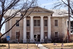 Glasscock County Courthouse and Jaillisted 2011
Population over time
2 figuresGarden City grew from 334 to 334 between 2010 and 2020. These are the recorded population figures Wikidata holds for this place, reached through the Geographic Names Information System number this page is keyed on rather than by name, so they belong to this place and not to another of the same name. Most are census counts, but not all are: an early figure may be a founding or settlement estimate, and an estimate published within five years of a census is left out. The change column is computed, and is left blank where more than 20 years separate a figure from the one before it, because a gap that long is not a change between two counts.
| Year | People | Change |
|---|---|---|
| 2010 | 334 | |
| 2020 | 334 | 0 (0%) |
Topographic sheets covering this place
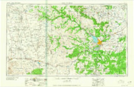
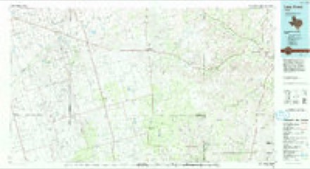
5 surveys from 7 printed sheetsMatched by testing this settlement's coordinate against the published boundary of every sheet in the United States Geological Survey's historical collection. Each opens the scanned sheet at the Survey.
- 1954 USGS San Angelo quadrangle1:250000, 2 printings
- 1958 USGS San Angelo quadrangle1:250000
- 1963 USGS Garden City quadrangle1:24000
- 1965 USGS San Angelo quadrangle1:250000
- 1986 USGS Lacy Creek quadrangle1:100000, 2 printings
Fires near this place
1 since 2011Regional context, not property-specific evidence. The federal wildfire occurrence database lists 1 fire within 5 miles of Garden City in 2011, burning about 4 acres in total. None started naturally. None was recorded as arson. Distance is straight-line from the map coordinates, so a fire counted here may appear on a neighbouring settlement's page as well.
| Reported cause | Fires |
|---|---|
| Equipment and vehicle use | 1 |
The most recent of them, most recent first, with the day each was reported and the service that recorded it.
| Date | Cause | Size | Reported by | Name on the report |
|---|---|---|---|---|
| 11 February 2011 | Equipment and vehicle use | 4.0 acres | Texas A & M Forest Service | LACY DRAW FIRE |
Storms near this place
60 of 150 shownRegional context, not property-specific evidence. The National Weather Service names Garden City in 150 storm reports between 1994 and 2025: 86 hail, 28 thunderstorm wind, 16 tornado, 16 flash flood. No death or injury is recorded in these reports. Each account below is quoted exactly as the forecast office filed it, from the NOAA Storm Events Database, and each date opens the federal record of that event.
| When | Event | Place named | Harm | What the report says |
|---|---|---|---|---|
| May 2016 | Tornado (EF2) | Garden City | $107,000 | A thunderstorm moved across Glasscock County and produced a tornado near Garden City. This tornado developed around 8:56 pm CDT, just over 1.5 miles north northwest of Garden City. This tornado produced a combination of EF-1 and EF-2 damage at two residences. A single-wide manufactured home at Home #1 was rolled and destroyed. This was indicative of damage produced by a tornado of EF-2 intensity. As the tornado moved southwestward and impacted Home #2, a combination of EF-1 and EF-2 damage was noted. Tree damage was indicative of EF-1, while the metal barn appears to have sustained lower-end EF-2 damage. It is noted however that the barn construction made it more susceptible to wind entering the structure, which could have resulted in damage at a lower wind threshold. Wind speeds are estimated at 100-115 mph with this damage.||As the tornado moved southwestward, it was the opinion of the assessment team that the tornado intensified. At approximately 9:01 pm CDT, the tornado knocked over a 320 type pump jack west of County Road 417. With this slightly smaller pump jack type, it was felt that winds in the 120-135 mph range could potentially produce this damage. Thus, the tornado was rated as being a high-end EF-2 intensity. Oil field workers noted that there was damage over open fields farther to the southwest. Using radar estimates, the team concluded that this tornado dissipated at 9:02 pm CDT just short of reaching Highway 158, 1.5 miles west of Garden City. The total path length for tornado #7 was 1.9 miles with its greatest width estimated at 150 yards. The cost of damage is a very rough estimate. |
| April 2015 | Lightning | Garden City | $100,000 | A thunderstorm moved across Glasscock County and lightning struck and caused a tank battery fire near Garden City. The cost of damage is a very rough estimate. There were no injuries reported. |
| May 2022 | Thunderstorm Wind | Garden City | $90,000 | A thunderstorm produced wind damage in Garden City as well as across portions of Glasscock County. This damage included multiple downed power poles, uprooted trees, shingles and roof damage, and numerous cases of wind-driven hail damage. Given that damage was all found oriented in a similar direction across the surveyed area, the damage was determined to be caused by strong downdraft winds. The cost of damage is a very rough estimate. |
| May 2022 | Tornado (EF2) | Garden City | $83,000 | A thunderstorm produced a tornado near State Highway 158 in Glasscock County. This tornado crossed State Highway 158 and lasted about fifteen minutes before dissipating after crossing County Road 130. Power poles were snapped and completely blown over in the opposite direction along Highway 158. A narrow swath of power poles were snapped along County Road 110 and a lone power pole was snapped off County Road 130. Video evidence from Highway 158 shows this tornado was multi-vortex with three to four ground circulations evident. The tornado likely touched down multiple times along the path. The path length and location are estimated by radar and power pole damage locations. The path width is unknown. The cost of damage is a very rough estimate. |
| May 2016 | Tornado (EF3) | Garden City | $45,000 | A thunderstorm moved across Glasscock County and produced a tornado near Garden City. This tornado developed just west of Ranch Road 33, four miles north northwest of Garden City around 8:42 pm CDT. The tornado moved southward, knocking over a 640 type pump jack located approximately two and a quarter miles north of Garden City. This type of occurrence is associated with wind speeds in the 140-160 mph range. Thus, the tornado has been rated as briefly reaching EF-3 intensity. Broken tree limbs were observed by the assessment team two miles north of Garden City, just west of Ranch Road 33. This damage indicator suggested the tornado had weakened to EF-1 intensity at that point. This weakening trend coincided with the tornado taking a more southeast track as it crossed Ranch Road 33. The tornado dissipated at 8:54 pm CDT, two miles north of Garden City. In total, the tornado traveled a 3.7 mile path and had an estimated width of 200 yards. The cost of damage is a very rough estimate. |
| March 2004 | Tornado (F0) | Garden City | $40,000 | A delayed report from a local farmer indicated that a tornado tracked across his property in southeastern Glasscock County. A shed was destroyed and the rafters of a large barn were broken by the tornadic winds. In addition, four utility poles were snapped. The farmer described a well-defined and narrow path through shredded mesquite trees in his pasture. |
| June 2020 | Thunderstorm Wind | Garden City | $30,000 | A thunderstorm moved across Glasscock County and produced wind damage twelve miles north of Garden City. A roof was blown off, a porch was destroyed, and a fence was blown down. The cost of damage is a very rough estimate. |
| May 2019 | Thunderstorm Wind | Garden City | $25,000 | A thunderstorm moved across Glasscock County and produced wind damage 13 miles west of Garden City. Several power poles were blown down along State Highway 158 at State Highway 137. The cost of damage is a very rough estimate. |
| June 2007 | Thunderstorm Wind | Garden City | $20,000 | Extensive tree damage occurred with this storm including many six inch diameter mesquite branches broken and a ten inch diameter tree that broke about four feet off the ground. A windmill also was uprooted including the concrete base pulled out of the ground. Seven power poles were snapped at various heights. One pole was broken in two spots. |
| June 2014 | Hail | Garden City | $15,000 | A thunderstorm moved across Glasscock County and produced golfball sized hail near Garden City. This hail caused significant car damage. The cost of damage is a rough estimate. |
| June 2008 | Thunderstorm Wind | Garden City | $15,000 | A fence was blown down and power was lost in Garden City. |
| August 2002 | Thunderstorm Wind | Garden City | $10,000 | A trained spotter reported hail up to the size of baseballs with damaging winds blowing down trees and power lines. |
| October 2018 | Flash Flood | Garden City | $5,000 | Heavy rain fell across Glasscock County and produced flash flooding west of Garden City. There was road flooding just to the north of Highway 158 on Highway 137. Numerous water crossings were coming up over the road. This forced the closure of the road. |
| June 2006 | Thunderstorm Wind | Garden City | $5,000 | The public reported that winds had damaged windmills, irrigation pivots, and had blown a tractor over north of Garden City. |
| May 1999 | Hail | Garden City | $5,000 | Hail broke out windows in vehicles on State Highway 158. |
| July 1994 | Thunderstorm Wind | Garden City | $5,000 | no account filed |
| March 2017 | Thunderstorm Wind | Garden City | $3,000 | A thunderstorm moved across Glasscock County and produced wind damage northwest of Garden City along Farm to Market Road 415. Power poles were blown down along this road. The cost of damage is a very rough estimate. |
| April 2009 | Tornado (EF0) | Garden City | $3,000 | A trained spotter reported a brief tornado approximately 5 TO 8 miles southeast of the intersection of FM 1379 and TX 158 at 1756 CST. A damage survey was conducted, which confirmed one power pole was snapped near its base and another one was damaged along TX 158. Some minor tree limb damage was also noted near the same area. Please see the attached image. |
| March 2007 | Thunderstorm Wind | Garden City | $2,000 | A trailer house at a drilling rig location north of Garden City on Farm to Market Road 33 was blown over. |
| March 2000 | Hail | Garden City | $2,000 | Hail broke car windows. |
| October 2018 | Flash Flood | Garden City | $1,000 | Heavy rain fell across Glasscock County and produced flash flooding about 26 miles east southeast of Midland. The public reported one foot of water running over Private Road 4281. |
| May 2000 | Thunderstorm Wind | Garden City | $1,000 | Damage to ranch house, trees down. 5 miles north of Highway 137 & 158 intersection. |
| October 1994 | Hail | Garden City | $500 | no account filed |
| June 2025 | Hail | Garden City | - | Ping pong ball-size hail was reported by a storm chaser about 8 miles east of Garden City. The time of occurrence is estimated by radar. |
| June 2025 | Hail | Garden City | - | A storm chaser reported quarter-size hail falling near Garden City. The time of occurrence is estimated by radar. |
| June 2025 | Hail | Garden City | - | Law enforcement in Garden City reported ping pong ball-size hail. The time of occurrence is estimated by radar. |
| April 2024 | Hail | Garden City | - | Time and location were estimated. |
| August 2020 | Thunderstorm Wind | Garden City | - | A thunderstorm moved across Glasscock County and produced a 61 mph wind gust as measured by the mesonet. |
| October 2018 | Flash Flood | Garden City | - | Heavy rain fell across Glasscock County and produced flash flooding about 22 miles east southeast of Midland. There was a public report of six inches of water running over State Highway 137, about one mile north of State Highway 158. |
| March 2017 | Thunderstorm Wind | Garden City | - | A thunderstorm moved across Glasscock County and produced a 65 mph wind gust nine miles southwest of Garden City. |
| May 2016 | Thunderstorm Wind | Garden City | - | A thunderstorm moved across Glasscock County and produced a 60 mph wind gust north of Garden City. No damage was reported. |
| May 2016 | Thunderstorm Wind | Garden City | - | A thunderstorm moved across Glasscock County and produced a 60 mph wind gust northeast of Garden City. |
| May 2016 | Tornado (EF0) | Garden City | - | A thunderstorm moved across Glasscock County and produced a tornado near Garden City. This tornado formed at 9:02 pm CDT, south of Highway 158, approximately three fourths of a mile southwest of Garden City. No damage indicators were noted with this short-lived tornado that remained over open fields during its 1.4 mile path. Radar imagery suggests that the tornado dissipated around 9:08 pm CDT. The intensity of this tornado was estimated at EF-0. |
| May 2014 | Tornado (EF0) | Garden City | - | A thunderstorm moved across Glasscock County and produced a tornado near Garden City. The tornado was reported by a storm chaser as being brief and wrapped in rain. No damage was reported or indicated on a storm survey, so the cost of damage is assumed to be zero. For this reason, the tornado was rated an EF-0. Also, the path length and width were estimated. |
| May 2014 | Tornado (EF0) | Garden City | - | A thunderstorm moved across Glasscock County and produced a tornado near Garden City. The tornado was reported to be north of Highway 158. There was no damage reported or indicated on a storm damage survey, so the tornado was rated an EF-0. The path length and width were estimated, and the cost of damage is assumed to be zero. |
| May 2014 | Tornado (EF0) | Garden City | - | A thunderstorm moved across Glasscock County and produced a tornado near Garden City. A storm spotter reported a multiple vortex tornado near County Road 415 and Highway 158. There was no damage reported or seen during a damage survey. For this reason, the tornado was rated an EF-0 and the path length and width were estimated. The cost of damage is assumed to be zero. |
| April 2012 | Thunderstorm Wind | Garden City | - | A thunderstorm moved across Glasscock County and produced a 60 mph wind gust in Garden City. |
| June 2009 | Thunderstorm Wind | Garden City | - | Although damage was not reported with this wind gust, blowing dust resulted in reduced visibilities. |
| April 2009 | Hail | Garden City | - | The time of this report was estimated. |
| June 2009 | Thunderstorm Wind | Garden City | - | An estimated 60 mph wind gust picked up a camper trailer. No significant damage was reported. |
| April 2009 | Hail | Garden City | - | The duration of the hail was estimated for this event. |
| June 2008 | Thunderstorm Wind | Garden City | - | Strong thunderstorm winds down several trees in Garden City. |
| June 2008 | Flash Flood | Garden City | - | Local law enforcement officials reported at least six inches of flowing water north of Garden City along FM 33, U.S. 87 just south of Big Spring and FM 821 between Forsan and Coahoma. |
| March 2007 | Thunderstorm Wind | Garden City | - | A spotter north of Garden City reported that a storage shed was knocked down and a golf cart was tipped over by thunderstorm winds. |
| March 2007 | Flash Flood | Garden City | - | The Glasscock County Sheriff's Office closed Farm to Market Road 33 north of Garden City to the Glasscock/Howard County border because flash flooding made the road impassable. |
| May 2007 | Thunderstorm Wind | Garden City | - | A 62 mph wind gust was reported from the Reagon and Glasscock County line. No damage was reported. |
| June 2006 | Hail | Garden City | - | The Glasscock County Sheriff's Office reported that marble size hail remained on the ground along Texas Highway 158 east of Garden City half an hour after the storm passed through. Based on radar and environmental observations, original hail size was estimated to be golfball size. |
| May 2006 | Hail | Garden City | - | Quarter to half-dollar size hail fell in Garden City. |
| May 2006 | Flash Flood | Garden City | - | A broadcast meteorologist reported that Texas Highway 158 just west of Garden City was impassable due to flash flooding. |
| May 2005 | Hail | Garden City | - | Spotters reported hail ranging in size from nickels to quarters near Garden City and south along Farm to Market Road 33. |
| August 2005 | Flash Flood | Garden City | - | The Texas Department of Transportation reported water flowing over Farm to Market Road 33 between Texas Highway 158 and Farm to Market Road 2401. |
| May 2004 | Hail | Garden City | - | A severe thunderstorm resulted in penny size hail along Highway 158 west of Garden City. |
| March 2004 | Hail | Garden City | - | Reported on State Route 158. |
| March 2004 | Hail | Garden City | - | Quarter size hail covered the ground along State Route 158. |
| June 2004 | Flash Flood | Garden City | - | Skywarn Spotters reported that portions of Farm to Market Road 33 were barricaded by local highway officials. The highway was deemed impassable from twelve miles north of Garden City to the Howard/Glasscock County line due to flowing water caused by flash flooding. |
| August 2004 | Hail | Garden City | - | A left moving anticyclonic supercell split from the multicell complex over Reagan County and moved north across eastern Glasscock County. This storm produced penny size hail over State Highway 158 just east of Garden City. |
| October 2004 | Hail | Garden City | - | Farmers in southeastern Glasscock County reported that large hail damaged almost 4,000 acres of cotton crops. |
| October 2004 | Hail | Garden City | - | A sheriff's deputy report quarter size hail just east of Garden City. |
| August 2003 | Flash Flood | Garden City | - | Flash flooding resulted in high water flowing over the intersection of Highways 158 and 137. |
| March 2003 | Hail | Garden City | - | Hail covered the ground along State Route 137 at the Midland/Glasscock County line. |
Nearest settlements
The eight closest, with where each one stands in the county. Distances are straight-line, computed from the Geographic Names Information System coordinates.
| Map | Place | Distance | Sheets |
|---|---|---|---|
| Saint Lawrence | 11.5 miles | 7 | |
| Bigby Corner | 14.1 miles | 7 | |
| Lees | 14.6 miles | 11 | |
| Old Houston Place | 16.0 miles | 11 |
Elsewhere
Matched on this settlement's Geographic Names Information System number rather than its name, so it cannot be a different place of the same name in another state.
| Wikipedia article on Garden City | An encyclopaedic summary. Its text is share-alike, so it is linked here rather than copied. |
| Wikidata item Q3025151 | The structured record the population and elevation above come from. Public domain (CC0). |
Provenance
This settlement is recorded in the Geographic Names Information System as feature 1336388. The sheet list is computed by point-in-boundary test against the United States Geological Survey's historical topographic inventory. Both are works of the United States government and carry no copyright under 17 U.S.C. 105.
Wildfire. Short, Karen C. 2022. Spatial wildfire occurrence data for the United States, 1992-2020 [FPA_FOD_20221014]. 6th Edition. Fort Collins, CO: Forest Service Research Data Archive. https://doi.org/10.2737/RDS-2013-0009.6 Collected with United States Government funding and usable without additional permissions or fees.
Storms. NOAA National Centers for Environmental Information, Storm Events Database https://www.ncei.noaa.gov/stormevents/ A work of the United States government, no copyright under 17 U.S.C. 105. Narratives are quoted verbatim from the National Weather Service report and are not edited or summarised.