 Block
BlockGilmer, Texas
12 topographic sheets cover this place, the earliest surveyed in 1956 and the latest in 1986. It stands in the Gilmer census division. It lies in ZIP code area 75644. It lies near Simpson Mountain. The Survey maps it on the Gilmer quadrangle. 4,843 people lived here at the 2020 count. It stands 367 feet above sea level.
Research this city
On record in Gilmer
Buildings and businesses the archive holds for this place. Each opens its own page, with the source record it came from.
On the National Register 1 record
 Upshur County Courthouselisted 2012
Population over time
3 figuresGilmer grew from 386 to 4,843 between 1880 and 2020. These are the recorded population figures Wikidata holds for this place, reached through the Geographic Names Information System number this page is keyed on rather than by name, so they belong to this place and not to another of the same name. Most are census counts, but not all are: an early figure may be a founding or settlement estimate, and an estimate published within five years of a census is left out. The change column is computed, and is left blank where more than 20 years separate a figure from the one before it, because a gap that long is not a change between two counts.
| Year | People | Change |
|---|---|---|
| 1880 | 386 | |
| 2010 | 4,905 | |
| 2020 | 4,843 | -62 (-1%) |
Topographic sheets covering this place
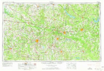
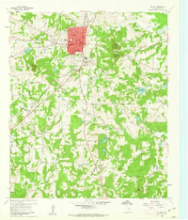
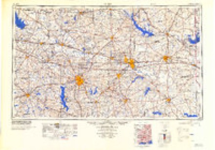
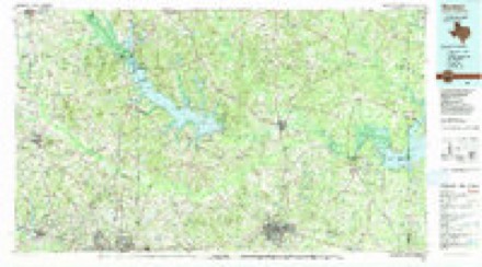
4 surveys from 12 printed sheetsMatched by testing this settlement's coordinate against the published boundary of every sheet in the United States Geological Survey's historical collection. Each opens the scanned sheet at the Survey.
- 1956 USGS Tyler quadrangle1:250000, 5 printings
- 1960 USGS Gilmer quadrangle1:24000, 2 printings
- 1984 USGS Tyler quadrangle1:250000, 3 printings
- 1986 USGS Marshall quadrangle1:100000, 2 printings
Fires near this place
826 since 1992Regional context, not property-specific evidence. The federal wildfire occurrence database lists 826 fires within 5 miles of Gilmer between 1992 and 2020, burning about 2,528 acres in total. 21 started naturally. 17 were recorded as arson. Distance is straight-line from the map coordinates, so a fire counted here may appear on a neighbouring settlement's page as well.
| Reported cause | Fires |
|---|---|
| Debris and open burning | 574 |
| Missing data/not specified/undetermined | 140 |
| Equipment and vehicle use | 23 |
| Power generation/transmission/distribution | 22 |
| Natural | 21 |
| Arson/incendiarism | 17 |
| Misuse of fire by a minor | 8 |
| Smoking | 8 |
| Railroad operations and maintenance | 6 |
| Recreation and ceremony | 4 |
| Fireworks | 3 |
The most recent of them, most recent first, with the day each was reported and the service that recorded it.
| Date | Cause | Size | Reported by | Name on the report |
|---|---|---|---|---|
| 9 September 2019 | Missing data/not specified/undetermined | 1.0 acres | Texas A & M Forest Service | 190328 |
| 9 September 2019 | Debris and open burning | 1.0 acres | Texas A & M Forest Service | 190329 |
| 9 September 2014 | Debris and open burning | 1.0 acres | Texas A & M Forest Service | 14-0299 |
| 9 September 2012 | Debris and open burning | 1.0 acres | Texas A & M Forest Service | 12-262 |
| 9 September 2012 | Debris and open burning | 8.0 acres | Texas A & M Forest Service | LINDEN - 6237 |
| 9 September 2012 | Debris and open burning | 1.0 acres | Texas A & M Forest Service | 12-263 |
| 8 September 2017 | Debris and open burning | 1.0 acres | Texas A & M Forest Service | 17-0320 |
| 8 September 2013 | Missing data/not specified/undetermined | 3.0 acres | Texas A & M Forest Service | 13-0274 |
Settlements close enough to share some of these fires:
Storms near this place
60 of 110 shownRegional context, not property-specific evidence. The National Weather Service names Gilmer in 110 storm reports between 1994 and 2026: 66 thunderstorm wind, 32 hail, 10 flash flood, 1 lightning. The reports record 3 injuries. Each account below is quoted exactly as the forecast office filed it, from the NOAA Storm Events Database, and each date opens the federal record of that event.
| When | Event | Place named | Harm | What the report says |
|---|---|---|---|---|
| November 1994 | Thunderstorm Wind | Gilmer | 2 hurt, $5,000 | Mobile homes were damaged by high winds. There were two minor injuries. |
| January 1998 | Flash Flood | Gilmer | 1 hurt, $6,000 | A woman believed to be a newspaper carrier was trapped for 3 hours when her car was overtaken by floodwaters on Bobwhite Rd. She was rescued by Gilmer firefighters with only minor injuries reported. |
| January 1998 | Hail | Gilmer | $1,100,000 | Three automobile dealerships suffered considerable hail damage to their entire inventories of over 300 vehicles. The hail fell continuously for over 20 minutes. A 24 year veteran in insurance claims said that the hail episode was the second worse he had ever seen in north Texas. |
| January 1998 | Hail | Gilmer | $1,000,000 | Grapefruit to softball size hail went through the roofs of houses and mobile homes. Two to three inch hail drifts remained along Hwy 300 between Longview and Gilmer 17 hours after it fell. |
| September 2009 | Flash Flood | Gilmer | $100,000 | Several businesses were flooded on Michiel Street between Titus Street and US 271 in the city of Gilmer, Texas. |
| April 2008 | Thunderstorm Wind | Gilmer | $100,000 | Several trees and power lines were downed across the county. Several trees were uprooted on Brooksey and the east end of Madelaine Street. One tree fell on a home at 804 N. Bledsoe. The community of Big Sandy were also hit hard where 15 trees were downed on powerlines at one time. A tree also fell across Shattles Road near FM 49. Two trees in the Big Sandy City Park were uprooted. On Wildcat Drive, a tree fell on an empty brown building and split it in half. A huge tree also fell across a boat of a Gilmer resident and across a carport. Another tree fell atop a home at 200 Meason. |
| January 1998 | Thunderstorm Wind | Gilmer | $90,000 | Numerous trees were felled across Hwy 271. Winds turned over a Cessna 150 single engine airplane at the Gilmer Upshur County Airport. Several businesses in Gilmer also suffered wind damage. Winds blew the roof off a barn at a tree farm. A portable workshop building at the Gilmer lumber company suffered minor damage when it blew over onto a truck parked alongside it. |
| June 2011 | Thunderstorm Wind | Gilmer | $70,000 | Heavy wind damage was reported to a local Sconic Drive-In and to the Tefteller Law Office. |
| June 2011 | Thunderstorm Wind | Gilmer | $50,000 | A section of metal roofing was blown off the Roberts Building on Jefferson Street. Trees were also downed blocking sections of Hwy. 155. |
| March 2000 | Thunderstorm Wind | Gilmer | $40,000 | Steel roof was blown off building 1 block from courthouse. Warehouse at intersection of Cass St. and railroad was heavily damaged. |
| September 2011 | Thunderstorm Wind | Gilmer | $25,000 | Trees were downed throughout the county. The roof was blown off a home west of Gilmer, Texas. |
| June 2011 | Thunderstorm Wind | Gilmer | $20,000 | A 20 foot section of roof was removed from the Gilmer Cable TV business. |
| June 1995 | Thunderstorm Wind | Gilmer | $20,000 | A mobile home was destroyed by high winds. |
| May 1995 | Thunderstorm Wind | Gilmer | $15,000 | A large tree was blown down onto a house. |
| June 2007 | Flash Flood | Gilmer | $10,000 | Widespread flooding was reported across the eastern portion of the county. Several roads were under water including US 259 in the south bound lane. Water was reported in one home east of town. Rainfall estimates of 5 to 6 inches were common east of town. Several motorists had to be pulled from their vehicles when fast moving flood waters swept their vehicles from the roadway. |
| May 2007 | Thunderstorm Wind | Gilmer | $5,000 | Thunderstorm winds downed trees in town...one of which fell across a pavilion at the Yamboree Park in town. |
| June 2000 | Thunderstorm Wind | Gilmer | $4,000 | Numerous trees down. A front porch blown off of a house. |
| April 2026 | Hail | Gilmer | - | Quarter size hail reported in Gilmer. |
| April 2025 | Thunderstorm Wind | Gilmer | - | Trees were blown down on South Cypress Street in Gilmer. |
| June 2025 | Thunderstorm Wind | Gilmer | - | A wind gust of 68 mph was recorded via a personal weather station in Gilmer. |
| August 2025 | Thunderstorm Wind | Gilmer | - | Trees downed along Highway 154 West. |
| August 2025 | Thunderstorm Wind | Gilmer | - | Trees downed across Highway 154 East. |
| June 2024 | Thunderstorm Wind | Gilmer | - | Trees and power lines downed in Gilmer. |
| April 2024 | Hail | Gilmer | - | Nickel size hail reported near Gilmer. |
| December 2024 | Thunderstorm Wind | Gilmer | - | Tree limbs downed and a carport partially blown off at a residence in Gilmer. |
| June 2023 | Thunderstorm Wind | Gilmer | - | Numerous large trees downed across Upshur County. |
| July 2023 | Thunderstorm Wind | Gilmer | - | Shingles were blown off the roof of a home in Gilmer. |
| March 2022 | Thunderstorm Wind | Gilmer | - | Numerous reports of power lines downed across Upshur County. |
| June 2021 | Hail | Gilmer | - | Quarter size hail fell at a fast food restaurant on the north side of Gilmer. |
| April 2020 | Hail | Gilmer | - | A picture was posted to social media of penny size hail that fell in Gilmer. |
| March 2019 | Thunderstorm Wind | Gilmer | - | A tree fell on a home in Gilmer. |
| March 2019 | Thunderstorm Wind | Gilmer | - | A National Weather Service storm survey confirmed that straight line winds of up to 100 mph had torn a roof off of Tire Zone tire store in Downtown Gilmer on Highway 271 at Highway 154. |
| March 2019 | Thunderstorm Wind | Gilmer | - | Numerous power lines were downed throughout much of Upshur County as well as the city of Gilmer. |
| June 2019 | Thunderstorm Wind | Gilmer | - | Numerous trees were downed throughout Upshur County. |
| February 2017 | Thunderstorm Wind | Gilmer | - | A tree fell through a home in Gilmer. |
| April 2016 | Hail | Gilmer | - | A photo was posted to the KLTV Facebook page of large hail estimated to be the size of golfballs that fell in Gilmer. |
| April 2016 | Thunderstorm Wind | Gilmer | - | Strong winds blew a large tree down behind a home in Gilmer. |
| March 2016 | Thunderstorm Wind | Gilmer | - | Several trees were blown down in Gilmer. |
| April 2015 | Thunderstorm Wind | Gilmer | - | Numerous trees were downed across the entire county. |
| October 2014 | Thunderstorm Wind | Gilmer | - | Numerous trees were downed across the entire county. |
| July 2014 | Thunderstorm Wind | Gilmer | - | Trees were downed across the entire county. |
| March 2014 | Thunderstorm Wind | Gilmer | - | Trees were downed west of Gilmer, Texas. |
| April 2012 | Thunderstorm Wind | Gilmer | - | Several trees were downed across the entire county. |
| June 2011 | Thunderstorm Wind | Gilmer | - | A large tree was downed across Hwy. 155. |
| June 2011 | Hail | Gilmer | - | Hail was reported at the East Texas Medical Center. |
| June 2011 | Thunderstorm Wind | Gilmer | - | Trees were downed on Hwy. 271 just north of town. |
| January 2010 | Hail | Gilmer | - | Hail fell in the Latch Community, southwest of Gilmer, Texas. |
| April 2010 | Thunderstorm Wind | Gilmer | - | Trees were downed at FM 154 and FM 555 just east of Gilmer, Texas. |
| June 2009 | Thunderstorm Wind | Gilmer | - | Several trees were downed across the county. |
| October 2009 | Thunderstorm Wind | Gilmer | - | Several large trees were downed along with powerlines across the western portion of Upshur County. Several areas were without power. |
| June 2009 | Thunderstorm Wind | Gilmer | - | A large tree was downed north of town along SH 155. Another large tree was downed on CR. 1002. |
| May 2009 | Thunderstorm Wind | Gilmer | - | Trees were downed along Hwy 155 near Gilmer, Texas. |
| July 2009 | Flash Flood | Gilmer | - | Excessive heavy rainfall resulted in high water across several roads in and near town. |
| June 2008 | Thunderstorm Wind | Gilmer | - | Trees were downed on Farm to Market Road 852 and Jaguar Road. |
| June 2007 | Flash Flood | Gilmer | - | TX 155 was closed from Big Sandy to Gilmer. Numerous county roads closed across the entire county. |
| September 2007 | Thunderstorm Wind | Gilmer | - | Numerous trees and power lines down across the eastern half of the county. |
| January 2007 | Flash Flood | Gilmer | - | Locally heavy rainfall resulted in widespread road closures across the county. One motorist had the be rescued from his vehicle from high water. There were no report of injuries. |
| June 2007 | Thunderstorm Wind | Gilmer | - | Several trees and power lines were downed throughout the county. |
| January 2007 | Flash Flood | Gilmer | - | Locally heavy rainfall resulted in widespread road closures across the county. One motorist had the be rescued from his vehicle from high water. There were no report of injuries. |
| April 2007 | Thunderstorm Wind | Gilmer | - | A few trees were downed 3 miles east of the Wood County line along Hwy 154. |
Nearest settlements
The eight closest, with where each one stands in the county. Distances are straight-line, computed from the Geographic Names Information System coordinates.
| Map | Place | Distance | Sheets |
|---|---|---|---|
| Piedmont | 3.0 miles | 12 | |
| Enoch | 3.0 miles | 12 | |
| Indian Rock | 3.9 miles | 12 | |
| Delrose | 4.0 miles | 12 | |
| Friendship | 4.4 miles | 12 | |
| Summerfield | 4.5 miles | 13 | |
| Enon | 5.5 miles | 13 | |
| Pattonfield | 5.6 miles | 12 |
Elsewhere
Matched on this settlement's Geographic Names Information System number rather than its name, so it cannot be a different place of the same name in another state.
| Wikipedia article on Gilmer | An encyclopaedic summary. Its text is share-alike, so it is linked here rather than copied. |
| Wikidata item Q982465 | The structured record the population and elevation above come from. Public domain (CC0). |
Provenance
This settlement is recorded in the Geographic Names Information System as feature 1336535. The sheet list is computed by point-in-boundary test against the United States Geological Survey's historical topographic inventory. Both are works of the United States government and carry no copyright under 17 U.S.C. 105.
Wildfire. Short, Karen C. 2022. Spatial wildfire occurrence data for the United States, 1992-2020 [FPA_FOD_20221014]. 6th Edition. Fort Collins, CO: Forest Service Research Data Archive. https://doi.org/10.2737/RDS-2013-0009.6 Collected with United States Government funding and usable without additional permissions or fees.
Storms. NOAA National Centers for Environmental Information, Storm Events Database https://www.ncei.noaa.gov/stormevents/ A work of the United States government, no copyright under 17 U.S.C. 105. Narratives are quoted verbatim from the National Weather Service report and are not edited or summarised.