 Block
BlockGrey Forest, Texas
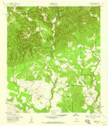
13 topographic sheets cover this place, the earliest surveyed in 1953 and the latest in 1992. It stands in the San Antonio Northwest census division. It lies in ZIP code area 78023. It stands on Lee Creek. The Survey maps it on the Helotes quadrangle. 492 people lived here at the 2020 count. It stands 1,142 feet above sea level.
Population over time
3 figuresGrey Forest grew from 418 to 492 between 2000 and 2020. These are the recorded population figures Wikidata holds for this place, reached through the Geographic Names Information System number this page is keyed on rather than by name, so they belong to this place and not to another of the same name. Most are census counts, but not all are: an early figure may be a founding or settlement estimate, and an estimate published within five years of a census is left out. The change column is computed, and is left blank where more than 20 years separate a figure from the one before it, because a gap that long is not a change between two counts.
| Year | People | Change |
|---|---|---|
| 2000 | 418 | |
| 2010 | 483 | +65 (+16%) |
| 2020 | 492 | +9 (+2%) |
Topographic sheets covering this place
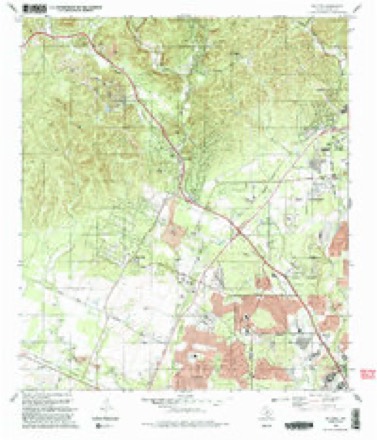
7 surveys from 13 printed sheetsMatched by testing this settlement's coordinate against the published boundary of every sheet in the United States Geological Survey's historical collection. Each opens the scanned sheet at the Survey.
- 1953 USGS Helotes quadrangle1:24000
- 1954 USGS San Antonio quadrangle1:250000, 3 printings
- 1957 USGS San Antonio quadrangle1:250000
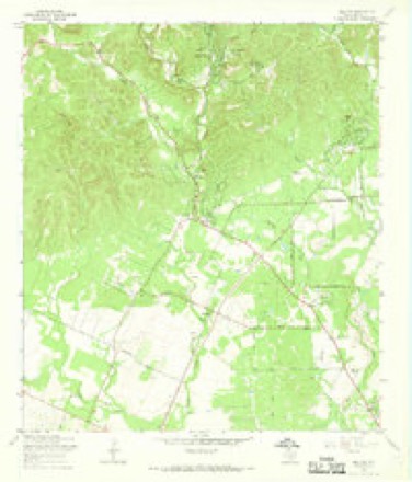
- 1966 USGS Helotes quadrangle1:24000, 3 printings
- 1985 USGS New Braunfels quadrangle1:100000
- 1992 USGS Helotes quadrangle1:24000, 2 printings
- 1992 USGS New Braunfels quadrangle1:100000, 2 printings
Fires near this place
12 since 2005Regional context, not property-specific evidence. The federal wildfire occurrence database lists 12 fires within 5 miles of Grey Forest between 2005 and 2017, burning about 293 acres in total. None started naturally. None was recorded as arson. Distance is straight-line from the map coordinates, so a fire counted here may appear on a neighbouring settlement's page as well.
| Reported cause | Fires |
|---|---|
| Debris and open burning | 6 |
| Missing data/not specified/undetermined | 3 |
| Equipment and vehicle use | 2 |
| Misuse of fire by a minor | 1 |
The most recent of them, most recent first, with the day each was reported and the service that recorded it.
| Date | Cause | Size | Reported by | Name on the report |
|---|---|---|---|---|
| 2 August 2011 | Equipment and vehicle use | 1.0 acres | Texas A & M Forest Service | CEPEDA |
| 13 August 2010 | Debris and open burning | 10 acres | Texas A & M Forest Service | SS COMMAND |
| 2 June 2011 | Missing data/not specified/undetermined | under an acre | Texas A & M Forest Service | RALPH FAIR ROAD |
| 14 May 2006 | Missing data/not specified/undetermined | 85 acres | Texas A & M Forest Service | not named |
| 13 May 2006 | Missing data/not specified/undetermined | 85 acres | Texas A & M Forest Service | not named |
| 12 May 2006 | Debris and open burning | 83 acres | Texas A & M Forest Service | HUNTRESS LANE |
| 27 April 2005 | Debris and open burning | 20 acres | Texas A & M Forest Service | HILL COUNTRY - 3 |
| 25 February 2017 | Debris and open burning | under an acre | Texas A & M Forest Service | BRICEWOOD TREE FIRE |
Settlements close enough to share some of these fires:
Mines and quarries near this place
4 within 5 milesRegional context, not property-specific evidence. The federal mineral resources record lists 4 workings within 5 miles of Grey Forest: 4 producers. All of them still produce. What was taken out: Stone, Crushed/Broken, Sand and Gravel, Construction, Limestone, General, Stone, Crushed/Broken. Distance is straight-line from the map coordinates, so a quarry counted here may appear on a neighbouring settlement's page as well.
| Where | Site | Commodity | Status | Recorded |
|---|---|---|---|---|
| D and B Materials Pit | Sand and Gravel, Construction | Producer | Unconsolidated Sediments | |
| Helotes Quarry | Limestone, General, Stone, Crushed/Broken | Producer | Limestone | |
| Helotes Quarry | Stone, Crushed/Broken | Producer | ||
| Vulcan's Helotes Quarry | Stone, Crushed/Broken | Producer |
Storms near this place
33 since 2004Regional context, not property-specific evidence. The National Weather Service names Grey Forest in 33 storm reports between 2004 and 2026: 13 flash flood, 13 hail, 5 thunderstorm wind, 1 tornado. No death or injury is recorded in these reports. Each account below is quoted exactly as the forecast office filed it, from the NOAA Storm Events Database, and each date opens the federal record of that event.
| When | Event | Place named | Harm | What the report says |
|---|---|---|---|---|
| April 2016 | Hail | Grey Forest | $1,360,000,000 | A thunderstorm produced 4.5 inch hail near Tezel Rd. and Bandera Rd. in northwestern San Antonio. This tied for the largest hailstone ever reported in Bexar County. The hail storm storm moved across northern Bexar County, crossing the northern half of San Antonio. Damage costs in San Antonio are estimated at $1.36 billion making this the costliest hail storm ever in the state of Texas according to the Insurance Council of Texas. Estimates do not include uninsured or commercial losses which will likely push the losses to near 2 billion, especially when including 2 other hail storms that occurred over the same area of Bexar County at the end of the April. Estimates provided by the Insurance Council of Texas and include damage to 136,000 vehicles and 125,000 homes. |
| November 2014 | Flash Flood | Grey Forest | $50,000 | Continued heavy rainfall resulted in Flash Flooding on multiple roadways in north-central and central Bexar county including the city of San Antonio. These reports continue a flash flooding event from a previous warning. Road closure reports included East Houston Street, Brook Hollow Road, George Road, Dreamland Drive, Southwell Road, Stahl Road, Encino Park Road, and Evers Road. All road closures were due to high water on the roadways. These closures encompass mostly north central San Antonio. |
| May 2020 | Thunderstorm Wind | Grey Forest | $20,000 | An NWS storm survey found thunderstorms produced wind gusts estimated at 70 mph that damaged roofs and fences off Grey Fox in far northwest San Antonio. |
| March 2023 | Thunderstorm Wind | Grey Forest | $1,000 | A thunderstorm produced wind gusts estimated at 60 mph that broke some three inch tree limbs in northwestern San Antonio. |
| April 2026 | Flood | Grey Forest | - | Thunderstorms produced heavy rain that led to street flooding around the Cedar Creek Golf Course in northwestern San Antonio. |
| May 2025 | Hail | Grey Forest | - | A thunderstorm produced golf ball size hail near Circle S Dr. in Helotes. |
| June 2025 | Hail | Grey Forest | - | A thunderstorm produced penny size hail in Grey Forest. |
| June 2025 | Thunderstorm Wind | Grey Forest | - | A thunderstorm produced wind gusts estimated at 60 mph along with penny size hail in Grey Forest. |
| March 2024 | Hail | Grey Forest | - | A thunderstorm produced half dollar size hail in northwestern San Antonio near Bandera Rd. and Tezel Rd. |
| April 2023 | Hail | Grey Forest | - | A thunderstorm produced quarter size hail near the Dub Farris Athletic Complex in northwestern San Antonio. |
| April 2023 | Hail | Grey Forest | - | A thunderstorm produced quarter size hail in Grey Forest. |
| April 2023 | Hail | Grey Forest | - | A thunderstorm produced nickel to quarter size hail in Grey Forest. |
| June 2023 | Hail | Grey Forest | - | A thunderstorm produced penny size hail near Helotes. |
| October 2021 | Flash Flood | Grey Forest | - | Thunderstorms produced heavy rain that led to flash flooding. Several low water crossings were flooded with multiple high water rescues in northern and western Bexar County. Rainfall totals in Helotes were up 5.70 inches. |
| April 2019 | Hail | Grey Forest | - | A thunderstorm produced quarter to ping pong ball size hail in Helotes. |
| April 2019 | Hail | Grey Forest | - | A thunderstorm produced three inch hail in Helotes. |
| June 2019 | Hail | Grey Forest | - | A thunderstorm produced one inch hail in Helotes. |
| October 2019 | Flash Flood | Grey Forest | - | Thunderstorms produced heavy rain that led to flash flooding. The San Antonio Fire Department made a water rescue at 11700 S. Hausman Rd. near French Creek in northwestern San Antonio. Rainfall totals in the area were between two and four inches. |
| April 2016 | Hail | Grey Forest | - | A thunderstorm produced two inch hail on Pioneer Gold Rd. in northwestern San Antonio. |
| April 2016 | Flash Flood | Grey Forest | - | Thunderstorms produced heavy rain that caused flash flooding closing Leslie Rd. at Braun Rd. near Helotes Creek. |
| April 2016 | Hail | Grey Forest | - | A thunderstorm produced four inch hail near Bandera Rd. and Loop 1604 in northwestern San Antonio. |
| April 2016 | Flash Flood | Grey Forest | - | Thunderstorms produced heavy rain that caused flash flooding closing S. Hausman Rd. at Champions Gate. |
| May 2015 | Flash Flood | Grey Forest | - | The intersection of Leslie Road and Braun Road was closed due to water over the roadway. |
| October 2015 | Flash Flood | Grey Forest | - | Thunderstorms produced heavy rain that caused flash flooding closing S. Hausman Rd. at Champions Gate in northwestern San Antonio. |
| June 2015 | Flash Flood | Grey Forest | - | Thunderstorms produced heavy rain that caused flash flooding of French Creek closing S. Hausman Rd. between Lake Run and Braefield in northwest San Antonio. |
| June 2015 | Flash Flood | Grey Forest | - | Thunderstorms produced heavy rain that caused flash flooding along Maverick Creek in northwest San Antonio. The fire department reported a water rescue at Roadrunner Way and Jetlyn Dr. near the University of Texas at San Antonio campus. |
| June 2014 | Flash Flood | Grey Forest | - | Thunderstorms produced heavy rain that caused flash flooding closing Leslie Rd. at Braun Rd. |
| April 2013 | Thunderstorm Wind | Grey Forest | - | A thunderstorm produced wind gusts estimated at 58 mph that blew down 4-5 inch diameter tree limbs. |
| April 2013 | Thunderstorm Wind | Grey Forest | - | A thunderstorm produced wind gusts estimated at 58 mph that damaged trees, light poles, and small buildings in Helotes. |
| April 2013 | Flash Flood | Grey Forest | - | Thunderstorms produced heavy rain that caused flash flooding on Bandera Road south of FM 1560. |
| October 2013 | Flash Flood | Grey Forest | - | Thunderstorms produced heavy rain that led to flash flooding sending one foot of water over South Hausman Rd. at a low water crossing near Helotes. The 24 hour rainfall in the area ranged from 3.02 to 4.08 inches. |
| July 2007 | Flash Flood | Grey Forest | - | General 2 to 3 inch rain totals fell over northwest Bexar County, with up to 6 inches near Shavano Park. Most low areas and at least two dozen roads in northwest Bexar County were closed due to flash flooding. More than twenty high water rescues were completed. In one case, a vehicle carrying two young men and two young women was washed off a road into Leon Creek. The occupants climbed into trees and clung to branches for several hours until they were finally rescued by boats. |
| November 2004 | Tornado (F0) | Grey Forest | - | Skywarn-trained Amateur Radio Operators reported a small, short-lived tornado near Babcock Road and Scenic Loop Road. The tornado was estimated at 20 yards wide and touched down in open country, causing no known damage. It was rated F0 on the Fujita Scale. |
Nearest settlements
The eight closest, with where each one stands in the county. Distances are straight-line, computed from the Geographic Names Information System coordinates.
| Map | Place | Distance | Sheets |
|---|---|---|---|
| Cross Mountain | 2.4 miles | 12 | |
| Helotes | 2.6 miles | 13 | |
| Beckmann | 4.2 miles | 12 | |
| Leon Springs | 4.4 miles | 12 | |
| Dominion | 4.5 miles | 11 | |
| San Geronimo | 6.0 miles | 11 | |
| Scenic Oaks | 6.6 miles | 12 | |
| Oakland Estates | 6.9 miles | 12 |
Elsewhere
Matched on this settlement's Geographic Names Information System number rather than its name, so it cannot be a different place of the same name in another state.
| Wikipedia article on Grey Forest | An encyclopaedic summary. Its text is share-alike, so it is linked here rather than copied. |
| Wikidata item Q975297 | The structured record the population and elevation above come from. Public domain (CC0). |
Provenance
This settlement is recorded in the Geographic Names Information System as feature 1337019. The sheet list is computed by point-in-boundary test against the United States Geological Survey's historical topographic inventory. Both are works of the United States government and carry no copyright under 17 U.S.C. 105.
Wildfire. Short, Karen C. 2022. Spatial wildfire occurrence data for the United States, 1992-2020 [FPA_FOD_20221014]. 6th Edition. Fort Collins, CO: Forest Service Research Data Archive. https://doi.org/10.2737/RDS-2013-0009.6 Collected with United States Government funding and usable without additional permissions or fees.
Mines and quarries. USGS Mineral Resources Data System (MRDS) https://mrdata.usgs.gov/mrds/ A work of the United States government, no copyright under 17 U.S.C. 105.
Storms. NOAA National Centers for Environmental Information, Storm Events Database https://www.ncei.noaa.gov/stormevents/ A work of the United States government, no copyright under 17 U.S.C. 105. Narratives are quoted verbatim from the National Weather Service report and are not edited or summarised.