 Block
BlockGribble, Texas
27 topographic sheets cover this place, the earliest surveyed in 1891 and the latest in 1986. It stands in the Northeast Dallas census division. It lies in ZIP code area 75234. It stands on Rawhide Creek. The Survey maps it on the Carrollton quadrangle.
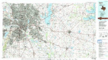
Topographic sheets covering this place
9 surveys from 27 printed sheetsMatched by testing this settlement's coordinate against the published boundary of every sheet in the United States Geological Survey's historical collection. Each opens the scanned sheet at the Survey.
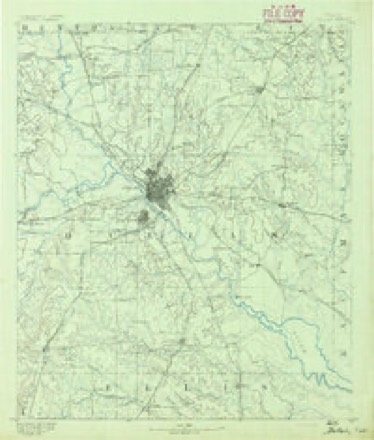
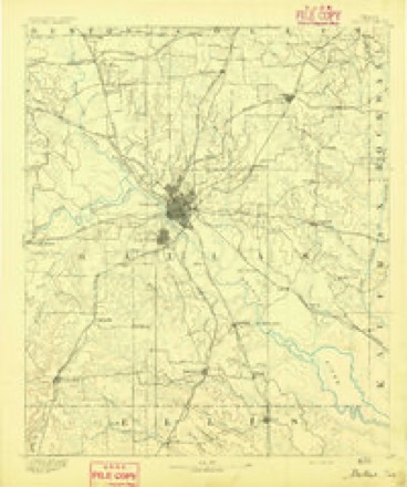
- 1891 USGS Dallas quadrangle1:125000
- 1893 USGS Dallas quadrangle1:125000, 5 printings
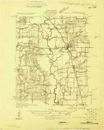
- 1925 USGS Dallas 2-b quadrangle1:48000
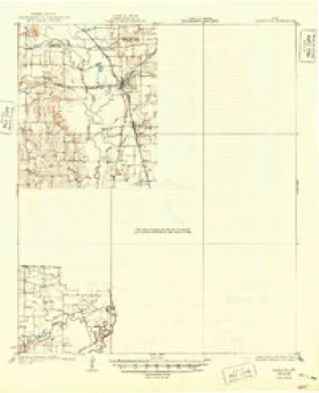
- 1931 USGS Carrollton quadrangle1:62500, 3 printings
- 1954 USGS Dallas quadrangle1:250000, 4 printings
- 1958 USGS Dallas quadrangle1:250000
- 1959 USGS Carrollton quadrangle1:62500
- 1959 USGS Carrollton quadrangle1:24000, 8 printings
- 1986 USGS Dallas quadrangle1:100000, 3 printings
Fires near this place
92 since 2014Regional context, not property-specific evidence. The federal wildfire occurrence database lists 92 fires within 5 miles of Gribble between 2014 and 2017, burning about 16 acres in total. None started naturally. None was recorded as arson. Distance is straight-line from the map coordinates, so a fire counted here may appear on a neighbouring settlement's page as well.
| Reported cause | Fires |
|---|---|
| Missing data/not specified/undetermined | 77 |
| Equipment and vehicle use | 12 |
| Recreation and ceremony | 3 |
The most recent of them, most recent first, with the day each was reported and the service that recorded it.
| Date | Cause | Size | Reported by | Name on the report |
|---|---|---|---|---|
| 9 September 2016 | Missing data/not specified/undetermined | under an acre | Texas A & M Forest Service | 3860 WALNUT HILL |
| 30 September 2015 | Missing data/not specified/undetermined | under an acre | Texas A & M Forest Service | CHAPEL CREEK |
| 3 September 2016 | Missing data/not specified/undetermined | under an acre | Texas A & M Forest Service | 2731 NORTHWEST HWY |
| 3 September 2015 | Missing data/not specified/undetermined | under an acre | Texas A & M Forest Service | CHAPEL |
| 3 September 2015 | Equipment and vehicle use | under an acre | Texas A & M Forest Service | FOREST |
| 25 September 2015 | Missing data/not specified/undetermined | under an acre | Texas A & M Forest Service | LOMBARDY |
| 24 September 2015 | Missing data/not specified/undetermined | under an acre | Texas A & M Forest Service | CHAPEL CREEK |
| 23 September 2015 | Missing data/not specified/undetermined | under an acre | Texas A & M Forest Service | HARWELL |
Settlements close enough to share some of these fires:
Mines and quarries near this place
2 within 5 milesRegional context, not property-specific evidence. The federal mineral resources record lists 2 workings within 5 miles of Gribble: 2 producers. All of them still produce. What was taken out: Sand and Gravel, Construction. Distance is straight-line from the map coordinates, so a quarry counted here may appear on a neighbouring settlement's page as well.
| Where | Site | Commodity | Status | Recorded |
|---|---|---|---|---|
| Farrow Brothers Sand and Gravel | Sand and Gravel, Construction | Producer | ||
| Sparkman Washing & Screening Plant | Sand and Gravel, Construction | Producer |
Storms near this place
23 since 2009Regional context, not property-specific evidence. The National Weather Service names Gribble in 23 storm reports between 2009 and 2025: 11 flash flood, 6 hail, 3 tornado, 2 thunderstorm wind. The reports record 2 deaths. Each account below is quoted exactly as the forecast office filed it, from the NOAA Storm Events Database, and each date opens the federal record of that event.
| When | Event | Place named | Harm | What the report says |
|---|---|---|---|---|
| May 2015 | Flash Flood | Gribble | 1 killed, $125,000 | Emergency management and media reports high water rose quickly near the intersection of Northwest Highway / Loop 12 / and US 114 in the eastern sections of the city of Irving. Several cars were stranded in this area, especially near the intersection of California Crossing and Northwest Highway. Multiple high water rescues were performed, and one flash flood death occurred at this location. |
| August 2012 | Flash Flood | Gribble | 1 killed, $30,000 | Numerous high water rescues were reported around the city of Dallas as the roadways filled with water from heavy rainfall. Rainfall totals as high as 2 in 30 minutes were measured during the heavy rain event. It was also reported that the entrance to Dallas Love Field (KDAL) was closed due to high water. A 38-year old male drowned while attempting to fish in White Rock Creek near Samuell Blvd and Interstate 30 in East Dallas. The man was attempting to cross the creek, slipped, and fell into the rapidly flowing creek. |
| October 2019 | Tornado (EF3) | Gribble | $1,550,000,000 | The tornado formed in northwest Dallas, near State Highway 348 and Luna Road, where large tree damage and minor roof damage was initially observed. This tornado tracked toward the east-northeast, crossing I-35E and impacted numerous commercial structures between this freeway and Harry Hines Blvd.||Extensive damage to many businesses and residences, consistent with EF-1 and EF-2 intensity wind speeds, occurred near the intersection of Harry Hines Blvd and Walnut Hill Lane. As the tornado moved eastward, roughly coincident with Walnut Hill Lane, several gas stations, large commercial buildings, and churches, and at least one multi-story apartment complex sustained significant roof and exterior wall damage. This path of strong EF-1 and EF-2 damage continued east-northeast along Walnut Hill Lane through the Marsh Lane and Midway Road corridors. East of Marsh Lane, the tornado impacted more single-family residences, though commercial structures were still adversely affected at times. Severe damage to large hardwood trees, consistent with EF-1 intensity winds, was observed throughout the damage path from Marsh Lane to US HWY 75. ||Intermittent EF-1 and EF-2 damage also occurred to a number of residences in this area. Many of these damaged homes were large and/or well-established structures that sustained either partial or total roof loss, accompanied by minor exterior wall damage. This damage was consistent with 110-125 mph tornado winds. Within one concentrated region of EF-2 damage along Northaven Road west of US HWY 75, a particular single-family home was surveyed with total roof loss, and multiple collapsed exterior walls. The survey team determined that this damage was consistent with low-end EF-3 intensity winds of approximately 140 mph. This was the only structure that was assigned an EF-3 rating for this tornado. ||The tornado continued eastward, toward US HWY 75 and produced significant roof damage to several businesses near US HWY 75 including office low-rise buildings, a car dealership, and a Home Depot. Damage here was assigned an EF-2 intensity. The tornado crossed over the southern part of the Texas Instruments campus and then began to turn more northeastward and parallel Greenville Avenue. Tree and roof damage consistent with EF-1 occurred as it crossed I-635. Several glass windows were blown out at a mid-rise office building. The tornado crossed an apartment complex near Walnut Street and Greenville Avenue where dozens of units had sections of missing roof consistent with EF-1 damage of 95-110 mph. The tornado moved across the Cutters Point apartment complex where numerous units experienced significant roof loss consistent with 115 mph or EF-2 damage. Another low-rise office building saw numerous windows blown out on all sides. The tornado continued into the Richland Park, Lakes of Buckingham, Richland Meadows, and College Park residential subdivisions where widespread tree and roof damage consistent with 80-95 mph winds occurred. A few homes in this area saw complete or total roof loss where winds were estimated at 110 mph or EF-1. The tornado began to weaken and took a sharp turn to the north near Richardson Square where it tracked to the Huffhines Park areas. Mostly tree damage occurred here with winds estimated near 70 mph or EF-0. The track then turned to the east and became very narrow near Duck Creek with the tornado dissipating as it crossed Jupiter Rd. The tornado had a continuous track for 32 minutes, tracked for just over 15 miles, produced maximum winds of 140 mph, with a maximum width of three-quarters of a mile. |
| April 2012 | Hail | Gribble | $7,000,000 | Hail up to the size of baseballs was reported on the north side of Irving. |
| May 2015 | Tornado (EF1) | Gribble | $600,000 | A National Weather Service damage survey team found evidence of a separate tornado in Dallas County, this time in the city of Irving. The tornado began just north of a golf course in the Los Colinas subdivision, just south of US 114. the tornado moved north and northwest, damaging several trees, two high rise buildings, and several carports. The tornado itself was doing damage for less than three minutes according to eyewitnesses. |
| April 2025 | Flash Flood | Gribble | $100,000 | Dallas PD responded to a high water rescue at Shady Trail and Glenda Ln. Dallas Fire Rescue reported 13 high water rescue calls across the city. |
| September 2018 | Flash Flood | Gribble | $50,000 | A social media report indicated 8 vehicles stranded on Walnut Hill Lane west of Interstate 35 in the city of Dallas, with fire and rescue assisting people from their cars. |
| May 2011 | Hail | Gribble | $20,000 | Golfball sized hail fell at the intersection of Highway 114 and North MacArthur Blvd in Irving. |
| January 2020 | Tornado (EF0) | Gribble | $15,000 | A tornado formed along the eastern edge of the Hackberry Creek neighborhood, near the intersection of Kinwest Parkway and Parkridge Boulevard. Minor roof and tree damage was observed in this area. The tornado moved quickly toward the northeast, producing roof damage to a grocery store and nearby trees, lightpoles, and commercial signage near the intersection of North MacArthur Boulevard and Las Colinas Boulevard. Continuing northeast, exterior wall damage occurred at a nearby hotel, and window and roofing damage impacted two restaurants fronting Interstate 635. The tornado crossed the Interstate and produced minor tree and roof damage before dissipating near Ranchview Drive. This tornado was rated an EF-0 with maximum winds of 75 mph. |
| September 2018 | Flash Flood | Gribble | $15,000 | A social media report indicated vehicles stranded in high water on Las Colinas Blvd in the city of Las Colinas, TX. |
| June 2009 | Flash Flood | Gribble | $15,000 | A car was stranded in 2 feet of water at Harry Hines Blvd and Northwest Highway. The flooding was the result of training echoes over Dallas County. |
| August 2025 | Flash Flood | Gribble | $10,000 | City of Dallas FWRS system reported several roads flooded and closed across northern Dallas, including Luna Rd at Y Street, Tantor Rd at X Street, Goodnight at Walnut Hill Rd, 4201 St. Johns Drive, 7400 Merriman Pkwy, West Lawther at NW Hwy, and the 9500 blk of Lake Highlands Rd. |
| June 2024 | Thunderstorm Wind | Gribble | $8,000 | EM shared photos of wind damage that involved trees, a metal awning, and fencing around the Irving PD. |
| November 2025 | Flash Flood | Gribble | $1,000 | Several road closures were reported due to flooding. |
| May 2015 | Flash Flood | Gribble | $1,000 | A social media report indicated that numerous vehicle rescues were occurring in Dallas, including swift water rescues on Northwest Highway. One fire engine was reported to have stalled in high water. |
| August 2025 | Flash Flood | Gribble | - | The city of Dallas FRWS gauges indicated that Luna Road at Y Street, and Tantor Road at X Street in northwest Dallas were flooded and closed. |
| May 2024 | Flash Flood | Gribble | - | Nearly two dozen roads were reported flooded across the city of Dallas. |
| March 2023 | Hail | Gribble | - | Reported via mPing. |
| June 2023 | Thunderstorm Wind | Gribble | - | A social media report indicated downed tree limbs along Meadow Creek Dr in Irving. |
| March 2019 | Hail | Gribble | - | A social media report indicated quarter size hail in the community of Las Colinas in the north part of the city of Irving, TX. |
| September 2016 | Flood | Gribble | - | Several locations in Dallas County reported high water. |
| March 2009 | Hail | Gribble | - | Nickel size hail was reported at MacArthur Blvd and Interstate 635 in Irving. |
| January 2018 | Hail | Gribble | - | no account filed |
Nearest settlements
The eight closest, with where each one stands in the county. Distances are straight-line, computed from the Geographic Names Information System coordinates.
| Map | Place | Distance | Sheets |
|---|---|---|---|
| Highland | 1.6 miles | 27 | |
| Farmers Branch | 2.0 miles | 27 | |
| Oldham | 2.5 miles | 24 | |
| Carrollton | 3.8 miles | 27 | |
| Inwood | 5.2 miles | 24 | |
| Meaders | 5.3 miles | 24 | |
| Bethel | 5.4 miles | 27 | |
| Trinity Mills | 5.7 miles | 27 |
Elsewhere
Matched on this settlement's Geographic Names Information System number rather than its name, so it cannot be a different place of the same name in another state.
| Wikidata item Q122563437 | The structured record the population and elevation above come from. Public domain (CC0). |
Provenance
This settlement is recorded in the Geographic Names Information System as feature 1378385. The sheet list is computed by point-in-boundary test against the United States Geological Survey's historical topographic inventory. Both are works of the United States government and carry no copyright under 17 U.S.C. 105.
Wildfire. Short, Karen C. 2022. Spatial wildfire occurrence data for the United States, 1992-2020 [FPA_FOD_20221014]. 6th Edition. Fort Collins, CO: Forest Service Research Data Archive. https://doi.org/10.2737/RDS-2013-0009.6 Collected with United States Government funding and usable without additional permissions or fees.
Mines and quarries. USGS Mineral Resources Data System (MRDS) https://mrdata.usgs.gov/mrds/ A work of the United States government, no copyright under 17 U.S.C. 105.
Storms. NOAA National Centers for Environmental Information, Storm Events Database https://www.ncei.noaa.gov/stormevents/ A work of the United States government, no copyright under 17 U.S.C. 105. Narratives are quoted verbatim from the National Weather Service report and are not edited or summarised.