 Block
BlockGuthrie, Texas
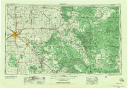
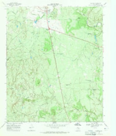
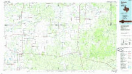
8 topographic sheets cover this place, the earliest surveyed in 1954 and the latest in 1985. It stands in the Guthrie census division. It lies in ZIP code area 79236. The Survey maps it on the Guthrie quadrangle. 151 people lived here at the 2020 count. It stands 1,768 feet above sea level.
Research this city
Population over time
2 figuresGuthrie fell from 160 to 151 between 2010 and 2020. These are the recorded population figures Wikidata holds for this place, reached through the Geographic Names Information System number this page is keyed on rather than by name, so they belong to this place and not to another of the same name. Most are census counts, but not all are: an early figure may be a founding or settlement estimate, and an estimate published within five years of a census is left out. The change column is computed, and is left blank where more than 20 years separate a figure from the one before it, because a gap that long is not a change between two counts.
| Year | People | Change |
|---|---|---|
| 2010 | 160 | |
| 2020 | 151 | -9 (-6%) |
Topographic sheets covering this place
3 surveys from 8 printed sheetsMatched by testing this settlement's coordinate against the published boundary of every sheet in the United States Geological Survey's historical collection. Each opens the scanned sheet at the Survey.
- 1954 USGS Lubbock quadrangle1:250000, 4 printings
- 1968 USGS Guthrie quadrangle1:24000, 2 printings
- 1985 USGS Dickens quadrangle1:100000, 2 printings
Storms near this place
60 of 117 shownRegional context, not property-specific evidence. The National Weather Service names Guthrie in 117 storm reports between 1993 and 2026: 60 hail, 45 thunderstorm wind, 7 tornado, 3 flash flood. No death or injury is recorded in these reports. Each account below is quoted exactly as the forecast office filed it, from the NOAA Storm Events Database, and each date opens the federal record of that event.
| When | Event | Place named | Harm | What the report says |
|---|---|---|---|---|
| May 2012 | Thunderstorm Wind | Guthrie | $350,000 | Multiple storm chasers reported scattered to widespread wind damage in the city of Guthrie from intense rear flank downdraft winds estimated near 90 mph. Several roofs in the city suffered various degrees of damage, with at least one roof partially blown off. A large equipment garage had several bay doors blown out. The intense winds developed shortly after large hail up to baseball size ceased falling. Many large tree limbs were broken in and around the city. Conservative property damage estimates may exceed $350 thousand. |
| June 2008 | Thunderstorm Wind | Guthrie | $100,000 | A local utility company reported the loss of numerous wooden utility poles as severe thunderstorms produced damaging wind gusts along swath over southeastern King County. More than fifty poles were destroyed across King and neighboring Stonewall County, but the exact number damaged in King County is unknown. In addition, a National Weather Service cooperative observer sustained damage to his home and a large metal storage barn near U.S. Highway 82 and Texas Highways 114 and 222 in eastern King County. |
| May 2012 | Hail | Guthrie | $20,000 | Storm chasers in Guthrie documented large hail that grew to baseball size over the course of about two minutes as a mesocyclone tracked just north and east of the city. Although some of this hail did damage building roofs and vehicles, the majority of the damage in the city was caused by destructive straight-line winds that developed shortly after the hail ended. |
| May 1996 | Hail | Guthrie | $20,000 | no account filed |
| May 2006 | Thunderstorm Wind | Guthrie | $15,000 | Severe thunderstorm winds destroyed a horse barn near Guthrie. No additional structural damage was reported. |
| September 2001 | Thunderstorm Wind | Guthrie | $10,000 | Several barns were damaged one mile south of the Highway 83 and Farm-to-Market Road 193 intersection as indicated by an NWS storm survey. |
| May 2009 | Hail | Guthrie | $5,000 | Motorists reported that hail was sufficiently large to lightly damage a vehicle along U.S. Highway 82 east-southeast of Guthrie. The exact hail size is unknown, therefore a minimal severe size estimate is assigned here. |
| July 2009 | Hail | Guthrie | $5,000 | The public reported that huge hail fell on the Masterson Ranch northeast of Guthrie during the very early morning hours on the 19th. Only minor damages were reported, and the event time is estimated based on radar data. |
| May 2000 | Thunderstorm Wind | Guthrie | $5,000 | Strong thunderstorm wind blew out windows, downed large tree limbs, blew over a trailer, and blew down a sign. |
| May 1996 | Thunderstorm Wind | Guthrie | $5,000 | no account filed |
| April 1994 | Thunderstorm Wind | Guthrie | $5,000 | no account filed |
| April 2003 | Hail | Guthrie | $3,000 | Golfball size hail damaged a vehicle. |
| April 2000 | Thunderstorm Wind | Guthrie | $2,000 | Thunderstorm wind blew down two power poles. |
| September 2010 | Thunderstorm Wind | Guthrie | $1,000 | The public reported that thunderstorm winds blew over and destroyed a large chimney at a ranch house along U.S. Highway 83 south of Guthrie. |
| September 2007 | Thunderstorm Wind | Guthrie | $1,000 | A National Weather Service cooperative observer reported that severe thunderstorm wind gusts up to 60 mph damaged tents and other lightweight objects in Guthrie. A National Weather Service survey team found large tree branches up to 5 inches in diameter that were blown down by the winds just west of the city. No structural damage or injuries were reported. |
| March 2026 | Thunderstorm Wind | Guthrie | - | A Texas Tech University West Texas mesonet site near Guthrie measured a wind gust of 58 mph. |
| April 2026 | Thunderstorm Wind | Guthrie | - | A Texas Tech University West Texas mesonet site near Guthrie measured a severe wind gust of 64 mph. |
| April 2026 | Thunderstorm Wind | Guthrie | - | A Texas Tech University West Texas mesonet site near Guthrie measured severe wind gusts from 1736 CST through 1740 CST. A peak wind gust of 72 mph was measured at 1738 CST. |
| May 2025 | Thunderstorm Wind | Guthrie | - | A Texas Tech University West Texas mesonet site near Guthrie measured severe wind gusts from 1952 CST through 1959 CST. A peak wind gust of 67 mph was measured at 1959 CST. |
| April 2025 | Hail | Guthrie | - | Several reports were received of a swath of hail across a portion of King County from south of Guthrie to east of Guthrie. Reported hail ranged in size from golf ball to DVD-size. No damage was reported. |
| April 2025 | Thunderstorm Wind | Guthrie | - | A Texas Tech University West Texas mesonet site near Guthrie measured severe wind gusts from 0112 CST through 0115 CST. A peak wind gust of 62 mph was measured at 0112 CST. |
| April 2024 | Thunderstorm Wind | Guthrie | - | A Texas Tech University West Texas mesonet site near Guthrie measured severe wind gusts from 2345 CST through 2346 CST. A peak wind gust of 65 mph was measured at 2346 CST. |
| August 2024 | Thunderstorm Wind | Guthrie | - | A Texas Tech University West Texas mesonet site near Guthrie measured severe wind gusts from 1413 CST through 1414 CST. A peak wind gust of 63 mph was measured at 1413 CST. |
| May 2024 | Hail | Guthrie | - | A storm chaser reported quarter size hail south of Guthrie along US Highway 83. |
| June 2023 | Thunderstorm Wind | Guthrie | - | A Texas Tech University West Texas mesonet site near Guthrie measured severe wind gusts from 2017 CST through 2038 CST. A peak wind gust of 67 mph was measured at 2034 CST. |
| February 2023 | Thunderstorm Wind | Guthrie | - | A Texas Tech University West Texas mesonet site near Guthrie measured severe wind gusts from 1922 CST through 1928 CST. A peak wind gust of 77 mph was measured at 1922 CST. |
| July 2023 | Thunderstorm Wind | Guthrie | - | A Texas Tech University West Texas mesonet site near Guthrie measured a wind gust to 59 mph. |
| April 2022 | Thunderstorm Wind | Guthrie | - | A Texas Tech University West Texas mesonet site near Guthrie measured severe wind gusts at 1707 and 1708 CST. A peak wind gust of 60 mph was measured at 1708 CST. |
| May 2022 | Thunderstorm Wind | Guthrie | - | A Texas Tech University West Texas mesonet site near Guthrie measured a wind gust of 60 mph. |
| June 2022 | Thunderstorm Wind | Guthrie | - | A Texas Tech University West Texas mesonet site near Guthrie measured severe wind gusts from 0810 CST through 0828 CST. A peak wind gust of 70 mph was measured at 0818 CST. |
| June 2021 | Thunderstorm Wind | Guthrie | - | A Texas Tech University West Texas mesonet site near Guthrie measured a wind gust to 59 mph. |
| October 2021 | Thunderstorm Wind | Guthrie | - | A Texas Tech University West Texas mesonet site near Guthrie measured a wind gust to 60 mph. |
| May 2019 | Hail | Guthrie | - | A storm chaser reported hail up to golf ball size two miles south of Guthrie. |
| May 2017 | Hail | Guthrie | - | Law enforcement in King County and a cooperative weather observer reported hail ranging from quarter size to golf ball size in and around Guthrie. No damage was reported. |
| July 2016 | Thunderstorm Wind | Guthrie | - | A Texas Tech University West Texas mesonet site near Guthrie measured a wind gust to 76 mph. |
| May 2015 | Tornado (EF0) | Guthrie | - | Local fire department officials and a local COOP observer reported a tornado just west of Guthrie and south of Highway 82 near the Four Sixes Ranch. Reports and documentation suggest the tornado lasted about one minute in an open field and did not produce any damage or injuries. |
| April 2015 | Hail | Guthrie | - | A storm chaser photographed hail around golf ball size. Damage was unknown. Time and location were estimated. |
| May 2015 | Thunderstorm Wind | Guthrie | - | A Texas Tech University West Texas mesonet site near Guthrie reported wind gusts up to 64 mph for a five minute period. |
| August 2013 | Heavy Rain | Guthrie | - | Heavy rainfall occurred south and west of Guthrie for about a one hour duration, producing 2.64 inches at the Texas Tech University West Texas Mesonet station. |
| March 2012 | Funnel Cloud | Guthrie | - | A storm chaser broadcasted live video of a funnel cloud and rapidly rotating wall cloud about 16 miles south of Guthrie. |
| May 2012 | Hail | Guthrie | - | A storm chaser reported a swath of tennis ball size hail along U.S. Highway 83 south of Guthrie. No damage was reported. |
| March 2012 | Hail | Guthrie | - | A storm chaser measured quarter size hail 12 miles east-southeast of Guthrie. No damage was reported. |
| November 2011 | Hail | Guthrie | - | An NWS cooperative weather observer reported quarter size hail. No damage was reported. |
| June 2010 | Hail | Guthrie | - | A National Weather Service cooperative observer reported quarter size hail west of Guthrie. |
| October 2009 | Hail | Guthrie | - | A severe thunderstorm produced penny to quarter size hail in the Guthrie vicinity between 14:18 CST and 14:30 CST. The hail fall delayed school releases. |
| April 2009 | Hail | Guthrie | - | Multiple public and law enforcement reports of large hail that ranged in size from nickels to golfballs were received in the Guthrie vicinity. |
| June 2009 | Hail | Guthrie | - | Quarter size hail was reported along Farm to Market Road 222 south of U.S. Highway 82. |
| April 2009 | Hail | Guthrie | - | Another round of more scattered thunderstorms developed along and east of the dryline by the late afternoon hours of the 26th. An isolated storm became severe in King County, and produced a swath of large hail up to the size of golfballs from just west of Guthrie to just north of that town. No damage was reported. |
| April 2009 | Hail | Guthrie | - | An isolated supercell thunderstorm developed near a dryline over the eastern Rolling Plains of west Texas during the mid afternoon hours of the 26th. This storm produced a swath of large hail up to the size of half dollars along U.S. Highway 82, roughly between that highway's intersections with Texas Highway's 365 and 114. No damage was reported. |
| April 2009 | Hail | Guthrie | - | Law enforcement officials reported penny size hail in Guthrie. |
| June 2009 | Hail | Guthrie | - | A National Weather Service cooperative observer reported quarter size hail along U.S. Highway 82 west of Guthrie. |
| June 2009 | Thunderstorm Wind | Guthrie | - | The Texas Tech University West Texas Mesonet site southwest of Guthrie recorded a thunderstorm wind gust of 58 mph. No damage was reported. |
| May 2009 | Thunderstorm Wind | Guthrie | - | A Texas Tech University West Texas Mesonet site measured a 58 mph thunderstorm wind gust southwest of Guthrie. No damage was reported. |
| May 2009 | Hail | Guthrie | - | A National Weather Service cooperative observer reported nickel size hail near Southcamp (10 miles southwest of Guthrie) at 19:45 CST. The public additionally reported penny size hail along Farm to Market Road 222 in extreme eastern King County at 20:05 CST. |
| June 2009 | Hail | Guthrie | - | Law enforcement officials reported that half dollar to golfball size hail covered the ground in Guthrie. A few of the hail stones reportedly were as large as two inches in diameter. No significant damage was reported. |
| July 2009 | Thunderstorm Wind | Guthrie | - | The Texas Tech University West Texas Mesonet site southwest of Guthrie initially recorded a thunderstorm wind gust of 65 mph at 23:45 CST. Additional severe gusts up to 62 mph were measured through 23:55 CST. No damage was reported. |
| May 2008 | Hail | Guthrie | - | The public reported one inch hail at a residence on the Four 6's Ranch east of Guthrie. |
| May 2008 | Thunderstorm Wind | Guthrie | - | The Texas Tech West Texas Mesonet site southwest of Guthrie recorded a severe thunderstorm wind gust of 58 mph at 13:15 CST. The storm continued to produce severe winds as it moved eastward, passing south of Guthrie, and then along U.S. Highway 82 east of the city. A resident at a ranch ten miles east of Guthrie estimated gusts up to 60 mph as the storm passed that location at 13:33. In addition, pea size hail reportedly covered the ground. No damage was reported. |
| May 2008 | Hail | Guthrie | - | The public reported quarter size hail in Guthrie. |
| June 2008 | Thunderstorm Wind | Guthrie | - | The Texas Tech University West Texas Mesonet site recorded a thunderstorm wind gust of 64 mph southwest of Guthrie at 19:05 CST. By 19:22 CST, the public estimated wind gusts up to 80 mph in Guthrie. Since no damage was reported the estimated wind speed appears too high. |
Nearest settlements
The eight closest, with where each one stands in the county. Distances are straight-line, computed from the Geographic Names Information System coordinates.
| Map | Place | Distance | Sheets |
|---|---|---|---|
| Gage Corner Windmill | 10.0 miles | 8 | |
| Corner Windmill | 10.0 miles | 8 | |
| Finney | 11.5 miles | 8 | |
| Grow | 13.1 miles | 7 | |
| Dumont | 16.6 miles | 8 |
Elsewhere
Matched on this settlement's Geographic Names Information System number rather than its name, so it cannot be a different place of the same name in another state.
| Wikipedia article on Guthrie | An encyclopaedic summary. Its text is share-alike, so it is linked here rather than copied. |
| Wikidata item Q979456 | The structured record the population and elevation above come from. Public domain (CC0). |
Provenance
This settlement is recorded in the Geographic Names Information System as feature 1358533. The sheet list is computed by point-in-boundary test against the United States Geological Survey's historical topographic inventory. Both are works of the United States government and carry no copyright under 17 U.S.C. 105.
Storms. NOAA National Centers for Environmental Information, Storm Events Database https://www.ncei.noaa.gov/stormevents/ A work of the United States government, no copyright under 17 U.S.C. 105. Narratives are quoted verbatim from the National Weather Service report and are not edited or summarised.