 Block
BlockHarleton, Texas
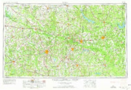
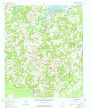
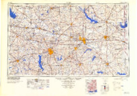
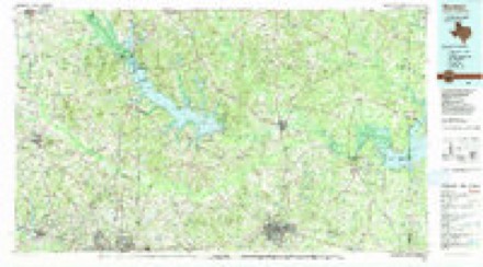
13 topographic sheets cover this place, the earliest surveyed in 1956 and the latest in 1986. It stands in the Harleton census division. It lies in ZIP code area 75651. The Survey maps it on the Harleton quadrangle. It stands 320 feet above sea level.
Topographic sheets covering this place
4 surveys from 13 printed sheetsMatched by testing this settlement's coordinate against the published boundary of every sheet in the United States Geological Survey's historical collection. Each opens the scanned sheet at the Survey.
- 1956 USGS Tyler quadrangle1:250000, 5 printings
- 1961 USGS Harleton quadrangle1:24000, 3 printings
- 1984 USGS Tyler quadrangle1:250000, 3 printings
- 1986 USGS Marshall quadrangle1:100000, 2 printings
Fires near this place
160 since 1992Regional context, not property-specific evidence. The federal wildfire occurrence database lists 160 fires within 5 miles of Harleton between 1992 and 2020, burning about 1,119 acres in total. 6 started naturally. 17 were recorded as arson. Distance is straight-line from the map coordinates, so a fire counted here may appear on a neighbouring settlement's page as well.
| Reported cause | Fires |
|---|---|
| Debris and open burning | 86 |
| Missing data/not specified/undetermined | 26 |
| Arson/incendiarism | 17 |
| Equipment and vehicle use | 15 |
| Natural | 6 |
| Power generation/transmission/distribution | 3 |
| Misuse of fire by a minor | 3 |
| Recreation and ceremony | 2 |
| Smoking | 1 |
| Other causes | 1 |
The most recent of them, most recent first, with the day each was reported and the service that recorded it.
| Date | Cause | Size | Reported by | Name on the report |
|---|---|---|---|---|
| 7 September 2011 | Missing data/not specified/undetermined | 20 acres | Texas A & M Forest Service | BLACKBURN |
| 5 September 2011 | Debris and open burning | under an acre | Texas A & M Forest Service | ALBERT PAGE RD |
| 3 September 2011 | Debris and open burning | 1.0 acres | Texas A & M Forest Service | LINDEN - 530 |
| 28 September 1994 | Debris and open burning | 1.0 acres | Texas A & M Forest Service | not named |
| 26 September 2014 | Equipment and vehicle use | 2.0 acres | Texas A & M Forest Service | 6197 |
| 26 September 1994 | Debris and open burning | 5.0 acres | Texas A & M Forest Service | not named |
| 26 September 1994 | Equipment and vehicle use | 240 acres | Texas A & M Forest Service | not named |
| 20 September 2000 | Misuse of fire by a minor | 3.0 acres | Texas A & M Forest Service | LINDEN - 443 |
Settlements close enough to share some of these fires:
Storms near this place
43 since 1993Regional context, not property-specific evidence. The National Weather Service names Harleton in 43 storm reports between 1993 and 2022: 25 thunderstorm wind, 9 hail, 6 tornado, 3 flash flood. No death or injury is recorded in these reports. Each account below is quoted exactly as the forecast office filed it, from the NOAA Storm Events Database, and each date opens the federal record of that event.
| When | Event | Place named | Harm | What the report says |
|---|---|---|---|---|
| April 2009 | Tornado (EF1) | Harleton | $1,000,000 | This storm developed over western Harrison County, about 7 miles northwest of Hallsville. This tornado first touched down just west Of Will Smith Road at around 9:13 pm, snapping and uprooting numerous trees along the road, with a tree landing atop a mobile home. The tornado continued east, crossing FM 450 near PR 4432 (Charles John Dr.), where several homes were damaged by falling trees, with their windows blown out. A couple of travel trailers were blown off of their locks, while a 14x28ft shop was shoved 2 feet off its foundation. The tornado lifted at approximately 9:23 pm, about 250 yards east of FM 450. This tornado was rated an EF1, with winds of around 100 mph. The path length was 3.1 miles, with a path width of up to 200 yards. |
| January 2010 | Tornado (EF1) | Harleton | $300,000 | A NWS storm survey team determined that the damage near Harleton, Texas was consistent with a short lived tornado. Two brick buildings sustained minor roof and structural damage, and a grocery store sustained some roof and awning damage. Several trees were also uprooted. |
| May 2015 | Flash Flood | Harleton | $100,000 | Harrison County Sherriff's Office reports multiple roads washed out between Marshall and Nesbitt, and Marshall and Hallsville. |
| July 2009 | Flash Flood | Harleton | $100,000 | Widespread flash flooding was reported with over 50 roads across the county closed at one point. Water ranged from one to three feet deep across most roads. Some of these roads were washed out including Walker's Mill Road, the intersection of Cox and Birmingham roads as well as Stagecoach Road. South Washington Avenue also reported some damage. |
| May 2015 | Flash Flood | Harleton | $6,000 | Harrison County Sherriff's Office reported a car was swept off the road between Marshall and Harleton. |
| April 2018 | Tornado (EF1) | Harleton | $5,000 | This is a continuation of the EF-1 tornado from Northeast Gregg County. This tornado, with estimated maximum winds near 90 mph, continued northeast along Dunn Bottoms Road, where it snapped and uprooted several more trees, snapped a wooden utility pole, and lifted the roof off of a hay barn. The tornado lifted along Dunn Bottom Road just south of Highway 154. |
| October 1994 | Thunderstorm Wind | Harleton | $5,000 | Power lines were blown down. |
| November 1994 | Thunderstorm Wind | Harleton | $5,000 | Trees were blown down by high winds. |
| May 1994 | Thunderstorm Wind | Harleton | $5,000 | Trees were blown down onto FM 450 just south of Harleton. |
| November 1993 | Thunderstorm Wind | Harleton | $5,000 | Thunderstorm winds blew down numerous trees, blocking Highway 154. |
| October 1993 | Thunderstorm Wind | Harleton | $5,000 | Thunderstorm winds blew down numerous trees, blocking Highway 154. |
| April 1994 | Thunderstorm Wind | Harleton | $500 | Trees were blown down by high winds. |
| May 2022 | Hail | Harleton | - | Half-dollar sized hail reported southwest of Harleton. |
| June 2019 | Tornado (EF0) | Harleton | - | An EF-0 tornado with maximum estimated winds near 85 mph briefly touched down along Highway 450 along Little Cypress Bayou. Trees were uprooted and large branches were snapped in a convergent pattern which, when paired with radar data, led to the confirmation of a tornado. |
| April 2018 | Thunderstorm Wind | Harleton | - | Several large trees were snapped and uprooted along and over fences and portions of Highway 154 just east of the Upshur County line in Northwest Harrison County. |
| July 2017 | Thunderstorm Wind | Harleton | - | A tree was blown down in Harleton. |
| April 2016 | Thunderstorm Wind | Harleton | - | Trees down along Farm to Market Road 2208. |
| April 2012 | Thunderstorm Wind | Harleton | - | A tree was downed in Harleton, Texas. |
| August 2011 | Thunderstorm Wind | Harleton | - | Trees and powerlines were downed on Gatlin Road and FM. 2879 near Lake Deerwood. |
| June 2008 | Thunderstorm Wind | Harleton | - | Power lines were downed on FM 2208 and on Baker Road in Harleton, Texas. |
| August 2003 | Thunderstorm Wind | Harleton | - | Several large trees down blocking intersection FM 726 and Blackburn Road. |
| May 2003 | Tornado (F1) | Harleton | - | A strong cyclic supercell tornado developed over Mineola, Texas while a strong tornado developed shortly there after and moved to the east northeast. Numerous Pine, Oak, and other species of trees were either snapped or pushed over along the entire tornado track. No structures were along the tornado track in this county. This tornado moved into Harrison County, Texas from Wood and Upshur County and into Marion County of northeast Texas. |
| July 2003 | Thunderstorm Wind | Harleton | - | Several large trees down. |
| February 1998 | Tornado (F1) | Harleton | - | HP Supercell and associated tornado developed along a northeast-southwest orientated cold front and moved slowly east-northeast across Harrison and Marion counties, Texas. The tornado track extended for 16 miles across two counties, however, the damage path was confined to a wooded region away from any population and structures. Damage consisted of small trees and large limbs broken or snapped . |
| October 1998 | Thunderstorm Wind | Harleton | - | Numerous trees down in town. |
| February 1998 | Thunderstorm Wind | Harleton | - | Winds recorded by trained storm spotter. |
| August 1997 | Thunderstorm Wind | Harleton | - | Trees and powerlines were blown down along FM450 and along FM1968. |
| June 1997 | Thunderstorm Wind | Harleton | - | Numerous trees and power lines were toppled. |
| June 1997 | Thunderstorm Wind | Harleton | - | Numerous trees were blown down across FM 1968. |
| October 1997 | Thunderstorm Wind | Harleton | - | Numerous trees toppled around the town. |
| October 1997 | Thunderstorm Wind | Harleton | - | Skywarn Spotters reported trees down across Hwy 135. |
| May 1993 | Thunderstorm Wind | Harleton | - | Several trees blown down by thunderstorm winds. |
| May 2014 | Hail | Harleton | - | no account filed |
| March 2002 | Thunderstorm Wind | Harleton | - | no account filed |
| February 2001 | Hail | Harleton | - | no account filed |
| April 2000 | Hail | Harleton | - | no account filed |
| April 2000 | Hail | Harleton | - | no account filed |
| January 1998 | Hail | Harleton | - | no account filed |
| February 1997 | Thunderstorm Wind | Harleton | - | no account filed |
| June 1997 | Hail | Harleton | - | no account filed |
| February 1996 | Hail | Harleton | - | no account filed |
| April 1996 | Thunderstorm Wind | Harleton | - | no account filed |
| October 1996 | Hail | Harleton | - | no account filed |
Nearest settlements
The eight closest, with where each one stands in the county. Distances are straight-line, computed from the Geographic Names Information System coordinates.
| Map | Place | Distance | Sheets |
|---|---|---|---|
| Morton | 4.4 miles | 12 | |
| Smyrna | 4.5 miles | 12 | |
| Carterville | 5.2 miles | 13 | |
| Mulberry Springs | 5.6 miles | 13 | |
| Walkers Mill | 6.1 miles | 13 | |
| Friendship (historical) | 6.8 miles | 13 | |
| Noonday | 8.5 miles | 13 | |
| Nesbitt | 8.6 miles | 12 |
Elsewhere
Matched on this settlement's Geographic Names Information System number rather than its name, so it cannot be a different place of the same name in another state.
| Wikipedia article on Harleton | An encyclopaedic summary. Its text is share-alike, so it is linked here rather than copied. |
| Wikidata item Q3470499 | The structured record the population and elevation above come from. Public domain (CC0). |
Provenance
This settlement is recorded in the Geographic Names Information System as feature 1337353. The sheet list is computed by point-in-boundary test against the United States Geological Survey's historical topographic inventory. Both are works of the United States government and carry no copyright under 17 U.S.C. 105.
Wildfire. Short, Karen C. 2022. Spatial wildfire occurrence data for the United States, 1992-2020 [FPA_FOD_20221014]. 6th Edition. Fort Collins, CO: Forest Service Research Data Archive. https://doi.org/10.2737/RDS-2013-0009.6 Collected with United States Government funding and usable without additional permissions or fees.
Storms. NOAA National Centers for Environmental Information, Storm Events Database https://www.ncei.noaa.gov/stormevents/ A work of the United States government, no copyright under 17 U.S.C. 105. Narratives are quoted verbatim from the National Weather Service report and are not edited or summarised.