 Block
BlockHunt, Texas
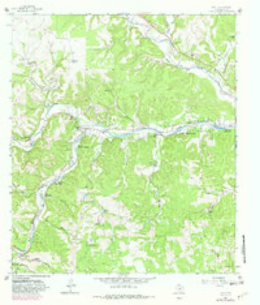
13 topographic sheets cover this place, the earliest surveyed in 1894 and the latest in 1985. It stands in the Ingram census division. It lies in ZIP code area 78024. It stands on South Fork Guadalupe River. The Survey maps it on the Hunt quadrangle. It stands 1,808 feet above sea level.
Topographic sheets covering this place
6 surveys from 13 printed sheetsMatched by testing this settlement's coordinate against the published boundary of every sheet in the United States Geological Survey's historical collection. Each opens the scanned sheet at the Survey.
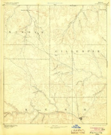
- 1894 USGS Kerrville quadrangle1:125000, 4 printings
- 1954 USGS Llano quadrangle1:250000, 2 printings
- 1955 USGS Llano quadrangle1:250000
- 1956 USGS Llano quadrangle1:250000
- 1964 USGS Hunt quadrangle1:24000, 3 printings
- 1985 USGS Kerrville quadrangle1:100000, 2 printings
Fires near this place
62 since 2006Regional context, not property-specific evidence. The federal wildfire occurrence database lists 62 fires within 5 miles of Hunt between 2006 and 2017, burning about 1,316 acres in total. 9 started naturally. None was recorded as arson. Distance is straight-line from the map coordinates, so a fire counted here may appear on a neighbouring settlement's page as well.
| Reported cause | Fires |
|---|---|
| Debris and open burning | 33 |
| Missing data/not specified/undetermined | 14 |
| Natural | 9 |
| Equipment and vehicle use | 3 |
| Power generation/transmission/distribution | 2 |
| Recreation and ceremony | 1 |
The most recent of them, most recent first, with the day each was reported and the service that recorded it.
| Date | Cause | Size | Reported by | Name on the report |
|---|---|---|---|---|
| 4 September 2010 | Debris and open burning | under an acre | Texas A & M Forest Service | JOHN DAVIS FIRE |
| 27 September 2011 | Natural | 1.0 acres | Texas A & M Forest Service | RIVER BEND / BLUE SAGE |
| 19 September 2011 | Natural | under an acre | Texas A & M Forest Service | 174 CEDAR ROCK |
| 19 September 2011 | Natural | 2.0 acres | Texas A & M Forest Service | RUSH RD |
| 26 August 2015 | Natural | under an acre | Texas A & M Forest Service | RIVER BEND LIGHTNING FIRE |
| 8 July 2011 | Equipment and vehicle use | 1.5 acres | Texas A & M Forest Service | BURR OAK FIRE |
| 31 July 2017 | Natural | under an acre | Texas A & M Forest Service | TREE FIRE HWY 39 |
| 31 July 2012 | Debris and open burning | under an acre | Texas A & M Forest Service | WILDMAN 2 |
Settlements close enough to share some of these fires:
Storms near this place
48 since 1996Regional context, not property-specific evidence. The National Weather Service names Hunt in 48 storm reports between 1996 and 2025: 27 hail, 15 flash flood, 3 thunderstorm wind, 2 flood. The reports record 107 deaths. Each account below is quoted exactly as the forecast office filed it, from the NOAA Storm Events Database, and each date opens the federal record of that event.
| When | Event | Place named | Harm | What the report says |
|---|---|---|---|---|
| July 2025 | Flash Flood | Hunt | 61 killed, $200,000,000 | There was catastrophic and deadly flash flooding along the South Fork Guadalupe River after around ten inches of rain fell in approximately four hours. On Hwy 39 the debris started at the confluence of Mullen Creek and South Fork Guadalupe River. The South Fork Guadalupe River topped the Hwy 39 bridge west of Auld Rd. S. and the high-water mark was 23.77 feet above the river. Five feet of water damaged the bottom floor of the River Inn and Resort. There were large sections of the exterior walls removed by water. Water reached 7.5 feet in a house along Hwy 39 which destroyed the building. Water reached the Hunt Volunteer Fire Department station on Fisher Ranch Rd. 400 feet from the river. Heart Othe Hills Camp and many houses nearby were demolished. There was major damage to Criders Rodeo and Dance Hall. Several homes near Hwy 39 and Rustic Hill Rd. were wiped off their foundations. The Hunt Post Office and the Hunt Store were destroyed. The first floor of a house near the confluence of the North and South Fork flooded and the residents sheltered on the second floor. Another nearby house had only one floor, and the homeowner escaped and floated on a mattress until rescued by a helicopter. Debris damaged the Hwy 39 bridge over the river in Hunt. The river gage at Hunt was destroyed, and the USGS estimated the river crested at a record 37.51 feet. Sixty-one people died in the flood along this stretch of the river, and one was still missing. Twenty-seven of the fatalities were at Camp Mystic, a summer camp for girls, including the owner of the camp, two counselors, and 25 girls ages 8-10 years old. There were 12 fatalities at the Casa Bonita neighborhood where a number of homes were washed away. Most the other fatalities were in homes along the river that were washed away. One man had helped his family escape their house through a bedroom window, but was not able to make it out himself. One person was in a vehicle trying to escape the flood water, but was washed away. Across Kerr County damage to public property and infrastructure was estimated to be $200 million. There was no damage estimate for private property. County officials estimated 2,000 structures were damaged. |
| July 2025 | Flash Flood | Hunt | 45 killed | There was catastrophic and deadly flash flooding along the Guadalupe River after around ten inches of rain fell in approximately four hours over the headwaters of the river. The flood wave moved downstream from Hunt to Kerrville. An NWS Flood Survey team found water in some houses along the Guadalupe downstream of Hunt reached eight feet. Numerous homes were flooded in the Bumble Bee Hills subdivision. Water reached as high as 5.5 feet in houses. The Cade Loop bridge over the Guadalupe was shifted by flood water. The guardrail and roadway of the Indian Creek Rd. bridge were damaged. The guardrail was torn away as were pieces of the roadway. Two RV parks and campgrounds in Ingram were wiped away by flood water. There were 46 people killed by flood waters, and one person was still missing. All of the fatalities along this stretch of the river were in the Ingram area and most of them were from the RV parks. One man died when he severed an artery breaking a window to help his family escape their flooded house. Across Kerr County damage to public property and infrastructure was estimated to be $200 million. There was no damage estimate for private property. County officials estimated 2,000 structures were damaged or destroyed. |
| April 2010 | Flash Flood | Hunt | 1 killed, $20,000 | Flood waters swept a truck off FM 1340 resulting in a fatality. A local resident of Hunt was headed home from a local school board meeting when he tried to cross a low water crossing. By the time rescuers responded he was apparently swept downstream and drowned. His body was discovered several days later about a mile downstream at another low water crossing. |
| June 2003 | Thunderstorm Wind | Hunt | $80,000 | Thunderstorm wind gusts estimated at between 55 and 65 knots blew down trees and power lines in the Ingram area. Three hundred homes were without power early Wednesday morning. |
| April 2010 | Flash Flood | Hunt | $30,000 | A slow moving thunderstorm produced heavy rain and flooding which washed a vehicle off Hwy 39 southwest of Hunt. A family was rescued from their van which was washed off the road. |
| July 2025 | Flash Flood | Hunt | - | Thunderstorms produced heavy rain leading to flash flooding. Cypress Creek flooded low water crossings southwest of Hunt. |
| July 2025 | Flash Flood | Hunt | - | Thunderstorms produced heavy rain leading to flash flooding. Water was a foot deep over Hwy 39 along the Guadalupe River between Hunt and Ingram. |
| July 2025 | Flood | Hunt | - | Thunderstorms produced heavy rain that caused the North Fork of the Guadalupe River to go into flood. The fire department closed RM 1340 due to water over the road. |
| July 2025 | Flash Flood | Hunt | - | An NWS Flood Survey team found a large section of highway surface was removed by flood water on FM 1340 at Bee Caves Creek near the confluence with the North Fork Guadalupe River. |
| July 2025 | Flash Flood | Hunt | - | An NWS Flood Survey team found debris along the side of FM 1340 along the North Fork Guadalupe River was eight feet above the roadway. |
| July 2025 | Flash Flood | Hunt | - | An NWS Flood Survey team found debris along the side of FM 1340 at Patio Ranch Rd. W. near the confluence of Bear Creek and the North Fork Guadalupe River was ten feet above the roadway. |
| July 2025 | Flash Flood | Hunt | - | An NWS Flood Survey team found large piles of debris and the guardrail destroyed at the North Fork Guadalupe River crossing on FM 1340 just west of River Bend Rd. W. |
| July 2025 | Flash Flood | Hunt | - | An NWS Flood Survey team found a section of road surface removed by flood water on FM 1340 at River Rd. just north Hunt. The highway runs parallel to the river at this point and is 500 feet from the bank. |
| June 2023 | Hail | Hunt | - | A thunderstorm produced two inch diameter hail near Hunt. |
| June 2023 | Hail | Hunt | - | A thunderstorm produced tennis ball size hail in Hunt. |
| June 2023 | Thunderstorm Wind | Hunt | - | A thunderstorm produced wind gusts estimated at 60 mph that knocked down tree limbs at the intersection of RM 187 and Hwy 39 west of Hunt. |
| September 2023 | Hail | Hunt | - | A thunderstorm produced golf ball size hail north of Hunt. |
| May 2022 | Hail | Hunt | - | A thunderstorm produced hail up to the size of half dollars north of Hunt. |
| May 2022 | Hail | Hunt | - | A thunderstorm produced ping pong ball size hail north-northeast of Hunt. |
| October 2018 | Flash Flood | Hunt | - | Thunderstorms produced heavy rain that led to flash flooding closing multiple low water crossings along FM 1340 west of Hunt along the North Fork of the Guadalupe River. |
| May 2018 | Hail | Hunt | - | A thunderstorm produced hail for over 15 minutes west of Hunt. By the time it ended there was about two inches of hail covering the ground. The largest hail stones were quarter size. |
| May 2016 | Hail | Hunt | - | A thunderstorm produced hail up to the size of ping pong balls that cover the ground near Hunt. |
| May 2015 | Flash Flood | Hunt | - | Thunderstorms produced heavy rain that caused flash flooding closing multiple low water crossings on FM 1340 west of Hunt. |
| May 2013 | Hail | Hunt | - | A thunderstorm produced hail that covered Hwy 16 12 miles southwest of Kerrville. The largest hail was penny size. |
| March 2012 | Hail | Hunt | - | A thunderstorm produced hail from ping pong ball to baseball size south of Hunt. |
| April 2010 | Flash Flood | Hunt | - | A slow moving thunderstorm produced heavy rain and flooding which closed FM 1340 along the upper Guadalupe River west of Hunt. |
| July 2009 | Heavy Rain | Hunt | - | A COOP observer west of Ingram recorded 1.33 inches of rain in 40 minutes. |
| October 2009 | Hail | Hunt | - | Cars were dented from the large hail. |
| March 2008 | Hail | Hunt | - | The COOP observer 2 miles east of Hunt reported quarter size hail. |
| March 2008 | Hail | Hunt | - | The COOP observer two miles east of Hunt reported a hail storm with a maximum size of golf ball. Most of the hail was quarter size. |
| May 2007 | Flood | Hunt | - | The Guadalupe River at Hunt crested at 15.00 ft at 0200 CST on May 25, where flood stage is 10 ft. |
| June 2007 | Thunderstorm Wind | Hunt | - | Severe thunderstorm winds blew down trees and knocked over power lines along SH39 between Hunt and Ingram. |
| July 2007 | Flash Flood | Hunt | - | Thunderstorms produced between 2 and 3 inches of rain over western Kerr and northern Real Counties, causing flash flooding west of Hunt. FM187 was closed for several hours in the evening. |
| April 2006 | Hail | Hunt | - | Hail slightly larger than baseballs, propelled by winds estimated at 40 mph, broke the windows of homes and the windows and windshields of vehicles south of Kerrville. |
| May 2019 | Hail | Hunt | - | no account filed |
| March 2016 | Hail | Hunt | - | no account filed |
| March 2016 | Hail | Hunt | - | no account filed |
| May 2013 | Hail | Hunt | - | no account filed |
| May 2013 | Hail | Hunt | - | no account filed |
| May 2013 | Hail | Hunt | - | no account filed |
| March 2013 | Hail | Hunt | - | no account filed |
| April 2013 | Hail | Hunt | - | no account filed |
| May 2013 | Hail | Hunt | - | no account filed |
| March 2012 | Hail | Hunt | - | no account filed |
| April 2008 | Hail | Hunt | - | no account filed |
| April 2008 | Hail | Hunt | - | no account filed |
| December 2002 | Hail | Hunt | - | no account filed |
| April 1996 | Hail | Hunt | - | no account filed |
Nearest settlements
The eight closest, with where each one stands in the county. Distances are straight-line, computed from the Geographic Names Information System coordinates.
| Map | Place | Distance | Sheets |
|---|---|---|---|
| Waltonia | 2.4 miles | 13 | |
| Ingram | 5.2 miles | 13 | |
| Mountain Home | 7.5 miles | 11 | |
| Stowers Corner Windmill | 9.2 miles | 8 | |
| Mount Wesley | 9.5 miles | 13 | |
| Kerrville | 10.6 miles | 13 | |
| Legion | 12.2 miles | 12 | |
| Guadalupe Heights | 13.6 miles | 9 |
Elsewhere
Matched on this settlement's Geographic Names Information System number rather than its name, so it cannot be a different place of the same name in another state.
| Wikipedia article on Hunt | An encyclopaedic summary. Its text is share-alike, so it is linked here rather than copied. |
| Wikidata item Q5943840 | The structured record the population and elevation above come from. Public domain (CC0). |
Provenance
This settlement is recorded in the Geographic Names Information System as feature 1338302. The sheet list is computed by point-in-boundary test against the United States Geological Survey's historical topographic inventory. Both are works of the United States government and carry no copyright under 17 U.S.C. 105.
Wildfire. Short, Karen C. 2022. Spatial wildfire occurrence data for the United States, 1992-2020 [FPA_FOD_20221014]. 6th Edition. Fort Collins, CO: Forest Service Research Data Archive. https://doi.org/10.2737/RDS-2013-0009.6 Collected with United States Government funding and usable without additional permissions or fees.
Storms. NOAA National Centers for Environmental Information, Storm Events Database https://www.ncei.noaa.gov/stormevents/ A work of the United States government, no copyright under 17 U.S.C. 105. Narratives are quoted verbatim from the National Weather Service report and are not edited or summarised.