 Block
BlockJacksonville, Texas
10 topographic sheets cover this place, the earliest surveyed in 1951 and the latest in 1984. It stands in the Jacksonville census division. It lies in ZIP code area 75766. The Survey maps it on the Jacksonville West quadrangle. 13,997 people lived here at the 2020 count. It stands 522 feet above sea level.
On record in Jacksonville
Buildings and businesses the archive holds for this place. Each opens its own page, with the source record it came from.
On the National Register 3 records
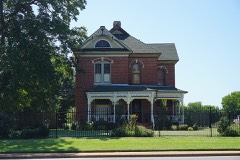 Aber and Haberle Houseslisted 1984
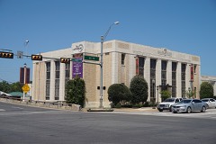 Jacksonville Post Officelisted 2004
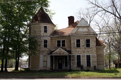 William Walter Newton Houselisted 1982
Population over time
2 figuresJacksonville fell from 14,544 to 13,997 between 2010 and 2020. These are the recorded population figures Wikidata holds for this place, reached through the Geographic Names Information System number this page is keyed on rather than by name, so they belong to this place and not to another of the same name. Most are census counts, but not all are: an early figure may be a founding or settlement estimate, and an estimate published within five years of a census is left out. The change column is computed, and is left blank where more than 20 years separate a figure from the one before it, because a gap that long is not a change between two counts.
| Year | People | Change |
|---|---|---|
| 2010 | 14,544 | |
| 2020 | 13,997 | -547 (-4%) |
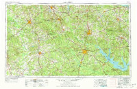
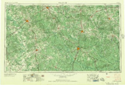
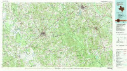
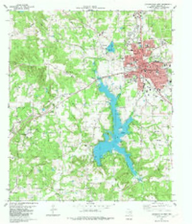
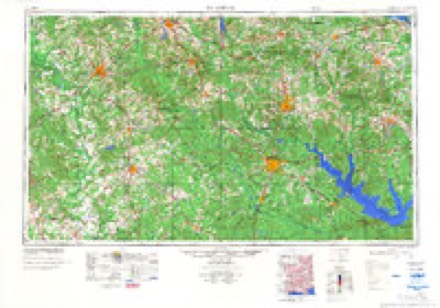
Topographic sheets covering this place
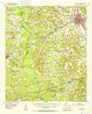
6 surveys from 10 printed sheetsMatched by testing this settlement's coordinate against the published boundary of every sheet in the United States Geological Survey's historical collection. Each opens the scanned sheet at the Survey.
- 1951 USGS Jacksonville quadrangle1:62500, 2 printings
- 1953 USGS Palestine quadrangle1:250000, 2 printings
- 1957 USGS Palestine quadrangle1:250000
- 1981 USGS Palestine quadrangle1:100000
- 1982 USGS Jacksonville West quadrangle1:24000
- 1984 USGS Palestine quadrangle1:250000, 3 printings
Fires near this place
511 since 1992Regional context, not property-specific evidence. The federal wildfire occurrence database lists 511 fires within 5 miles of Jacksonville between 1992 and 2020, burning about 1,793 acres in total. 6 started naturally. 19 were recorded as arson. Distance is straight-line from the map coordinates, so a fire counted here may appear on a neighbouring settlement's page as well.
| Reported cause | Fires |
|---|---|
| Debris and open burning | 307 |
| Missing data/not specified/undetermined | 87 |
| Power generation/transmission/distribution | 25 |
| Equipment and vehicle use | 22 |
| Arson/incendiarism | 19 |
| Smoking | 17 |
| Misuse of fire by a minor | 13 |
| Railroad operations and maintenance | 7 |
| Natural | 6 |
| Recreation and ceremony | 5 |
| Other causes | 2 |
| Fireworks | 1 |
The most recent of them, most recent first, with the day each was reported and the service that recorded it.
| Date | Cause | Size | Reported by | Name on the report |
|---|---|---|---|---|
| 9 September 2012 | Missing data/not specified/undetermined | 1.0 acres | Texas A & M Forest Service | HENDERSON - 7127 |
| 8 September 2019 | Debris and open burning | under an acre | Texas A & M Forest Service | 4462 CR 3108 |
| 7 September 1993 | Debris and open burning | 1.0 acres | Texas A & M Forest Service | not named |
| 6 September 1993 | Debris and open burning | 1.0 acres | Texas A & M Forest Service | not named |
| 5 September 1993 | Debris and open burning | 1.0 acres | Texas A & M Forest Service | not named |
| 4 September 2011 | Power generation/transmission/distribution | under an acre | Texas A & M Forest Service | COUNTRY CLUB |
| 30 September 2015 | Debris and open burning | under an acre | Texas A & M Forest Service | NELSON |
| 30 September 2011 | Power generation/transmission/distribution | under an acre | Texas A & M Forest Service | HENDERSON - 587 |
Settlements close enough to share some of these fires:
Mines and quarries near this place
1 within 5 milesRegional context, not property-specific evidence. The federal mineral resources record lists 1 working within 5 miles of Jacksonville: 1 producer. All of them still produce. What was taken out: Iron. Distance is straight-line from the map coordinates, so a quarry counted here may appear on a neighbouring settlement's page as well.
| Where | Site | Commodity | Status | Recorded |
|---|---|---|---|---|
| Mount Haven | Iron | Producer |
Storms near this place
60 of 95 shownRegional context, not property-specific evidence. The National Weather Service names Jacksonville in 95 storm reports between 1993 and 2026: 55 thunderstorm wind, 30 hail, 8 flash flood, 1 tornado. The reports record 4 injuries. Each account below is quoted exactly as the forecast office filed it, from the NOAA Storm Events Database, and each date opens the federal record of that event.
| When | Event | Place named | Harm | What the report says |
|---|---|---|---|---|
| September 2012 | Lightning | Jacksonville | 4 hurt | Four people were taken to the hospital after lightning struck the Fred Douglass Elementary School parking lot in Jacksonville, Texas. Officials said the incident happened around 3:45 p.m. in the school pickup line. The school superintendent said that from what he understands, two teachers were helping students into cars. Another teacher and her daughter were walking to their car to go home. He said he believes lightening probably struck a puddle in the parking lot and electricity was conducted through the water.|The names of the victims have not been released by authorities, but they did confirm two of the victims were white female teachers, between the ages of 30 and 40, helping students into the vehicles. The others were a white teacher in her mid-20s and her five-to-six year old daughter. One of the ladies was holding an umbrella, and it went into her arm and she felt it go through her chest said a captain with the |Jacksonville Fire Department. Three were taken to Mother Frances Hospital Jacksonville and one to East Texas Medical Center Jacksonville. The injuries were said to be minor. |
| July 2007 | Flash Flood | Jacksonville | $250,000 | Hwy. 79 was closed near Jacksonville, Texas due to high water. Nearly 20 homes suffered flood damage when Lake Jacksonville rose two feet above normal. The lake had to be closed as several secondary roadways leading into and around the lake were flooded. |
| June 2004 | Thunderstorm Wind | Jacksonville | $60,000 | Large trees downed including some across a few automobiles. No injuries reported. |
| December 2006 | Tornado (F0) | Jacksonville | $50,000 | The National Weather Service conducted a storm survey in Northwest Cherokee County, Texas. It was concluded that a supercell thunderstorm produced a Tornado approximately 13 miles northwest of the town of Jacksonville, Texas. Several trees were uprooted and snapped off a mid trunk along FM 346. One large tree fell on top of a mobile home in the Shady Brook Mobile Home Community. |
| October 1994 | Thunderstorm Wind | Jacksonville | $50,000 | Trees were blown down by high winds. Numerous county roads were closed by fallen trees. |
| November 1996 | Thunderstorm Wind | Jacksonville | $50,000 | no account filed |
| November 2000 | Thunderstorm Wind | Jacksonville | $40,000 | Wind damage reported to a jail house and numerous trees down. |
| October 2010 | Thunderstorm Wind | Jacksonville | $15,000 | A metal roof was blown off a house in the community of Cove Springs along CR. 3406 northeast of Jacksonville, Texas. |
| July 2007 | Flash Flood | Jacksonville | $10,000 | Moderate flooding was reported in the areas surrounding Jacksonville, Texas. Local law enforcement closed some city streets. One vehicle was seen floating down a flooded roadway. Stretches of Hwy 69 and 79 near town were flooded as well. |
| May 1994 | Thunderstorm Wind | Jacksonville | $5,000 | Trees were blown down by thunderstorm winds. |
| July 1994 | Thunderstorm Wind | Jacksonville | $5,000 | Trees and power lines were blown down by thunderstorm winds. |
| May 1994 | Thunderstorm Wind | Jacksonville | $5,000 | Trees were blown down by thunderstorm winds. |
| May 2015 | Thunderstorm Wind | Jacksonville | $2,000 | A large tree was downed on a privacy fence just northwest of Jacksonville, Texas. |
| June 1995 | Thunderstorm Wind | Jacksonville | $2,000 | Power lines were blown down by high winds. |
| November 1996 | Thunderstorm Wind | Jacksonville | $1,000 | no account filed |
| April 2026 | Hail | Jacksonville | - | Half dollar size hail reported in Jacksonville. |
| May 2025 | Flash Flood | Jacksonville | - | The intersection of Canada and Beaumont Streets in Jacksonville was closed due to flooding. |
| March 2025 | Hail | Jacksonville | - | Golf ball size hail reported in the city of Jacksonville. |
| April 2025 | Flash Flood | Jacksonville | - | The intersection of Canada Street and Beaumont Street in Jacksonville was closed due to flooding. |
| June 2024 | Flash Flood | Jacksonville | - | Flash flooding reported with several roads closed in Jacksonville. |
| April 2024 | Thunderstorm Wind | Jacksonville | - | Numerous trees downed across the northern and central portions of Cherokee County. |
| April 2023 | Hail | Jacksonville | - | A picture was posted to social media of quarter to half dollar size hail that fell near Jacksonville High School. |
| May 2023 | Thunderstorm Wind | Jacksonville | - | A power line was blown down on Ragsdale Street in Jacksonville. |
| June 2023 | Hail | Jacksonville | - | Golf ball size hail reported in Jacksonville via social media. |
| June 2023 | Thunderstorm Wind | Jacksonville | - | Numerous trees and power lines downed across northern Cherokee County, including in Jacksonville. |
| September 2023 | Thunderstorm Wind | Jacksonville | - | Numerous trees and power lines downed across northern Cherokee County, including along Highway 79 between Highways 204 and 110. A tree also fell onto a home in Jacksonville. |
| May 2022 | Thunderstorm Wind | Jacksonville | - | Several trees and power lines reported down across the central part of Cherokee County. |
| May 2022 | Thunderstorm Wind | Jacksonville | - | Numerous trees and power lines reported down across Cherokee County. |
| June 2021 | Thunderstorm Wind | Jacksonville | - | Several trees were blown down in Jacksonville. |
| March 2020 | Hail | Jacksonville | - | Quarter size hail fell at the intersection of Highway 69 and 79 in Jacksonville. Report from Facebook. |
| March 2020 | Hail | Jacksonville | - | Quarter size hail was reported at the Exxon gas station on Highway 69 on the southeast side of Jacksonville. |
| April 2019 | Hail | Jacksonville | - | Pea to quarter size hail fell in Jacksonville. Report via social media. |
| July 2016 | Thunderstorm Wind | Jacksonville | - | Several trees were downed in Jefferson on Wilson and MLK roads. |
| April 2015 | Thunderstorm Wind | Jacksonville | - | A large tree was downed on Hwy. 175 west of Jacksonville, Texas. |
| July 2014 | Thunderstorm Wind | Jacksonville | - | Trees and powerlines were downed across the entire county. |
| May 2014 | Thunderstorm Wind | Jacksonville | - | Trees were downed across Hwy. 135 near Jacksonville, as well as on CR. 3305 and one on Kilo Monument Road and on FM. 177. |
| October 2014 | Thunderstorm Wind | Jacksonville | - | Numerous trees and powerlines were downed throughout the entire county. |
| May 2013 | Thunderstorm Wind | Jacksonville | - | Powerlines were downed along Hwy. 79 in Jacksonville, Texas. |
| May 2013 | Thunderstorm Wind | Jacksonville | - | Trees were downed in Jacksonville, Texas. |
| December 2012 | Thunderstorm Wind | Jacksonville | - | Numerous trees were downed in the Jacksonville, Texas community. |
| May 2012 | Hail | Jacksonville | - | Dime to Penny sized hail was reported near Loves Lookout north of Jacksonville, Texas. |
| July 2012 | Thunderstorm Wind | Jacksonville | - | Several trees are downed across the city of Jacksonville, Texas. |
| July 2012 | Thunderstorm Wind | Jacksonville | - | Trees were downed in the city of Jacksonville, Texas. |
| July 2011 | Thunderstorm Wind | Jacksonville | - | Trees and large limbs were downed near Myrtle Drive in Jacksonville, Texas. |
| November 2011 | Hail | Jacksonville | - | Nickel sized hail fell on Hwy. 69 just north of Jacksonville, Texas. |
| May 2009 | Thunderstorm Wind | Jacksonville | - | Numerous trees were reported down across the county. The worst tree damage was in a straight line from Maydelle to FM 241 where several roads were closed due to the downed trees. |
| March 2008 | Thunderstorm Wind | Jacksonville | - | Trees were downed on FM. 22, one mile east of U.S. 69. |
| March 2008 | Thunderstorm Wind | Jacksonville | - | Trees and power lines were downed on County Road 1616. |
| May 2008 | Thunderstorm Wind | Jacksonville | - | Trees were downed along FM 3301. |
| June 2008 | Thunderstorm Wind | Jacksonville | - | Several trees were downed across the northern portion of the county. |
| March 2008 | Flash Flood | Jacksonville | - | Severe street flooding across portions of Jacksonville, Texas. |
| August 2008 | Flash Flood | Jacksonville | - | Several roads were barricaded due to high water. |
| March 2008 | Thunderstorm Wind | Jacksonville | - | Trees were downed on FM. 347. Powerlines were also downed on Hwy. 204. |
| June 2007 | Thunderstorm Wind | Jacksonville | - | Trees were downed across FM 2064 east of town. A car hit a downed tree resulting in 3 injuries. |
| June 2007 | Thunderstorm Wind | Jacksonville | - | Up to six trees downed between the towns of Troup and Jacksonville, Texas along Hwy 79 and Hwy 110. |
| May 2007 | Thunderstorm Wind | Jacksonville | - | Several trees downed on the north side of town. |
| March 2006 | Thunderstorm Wind | Jacksonville | - | Trees downed. |
| July 2005 | Thunderstorm Wind | Jacksonville | - | Trees were downed onto FM 346. |
| August 2005 | Thunderstorm Wind | Jacksonville | - | Trees down across Hwy 135. |
| April 2005 | Hail | Jacksonville | - | Tea cup sized hail fell at Cherokee Landing on the east side of Lake Palestine on the southern end of the lake near the dam. |
Nearest settlements
The eight closest, with where each one stands in the county. Distances are straight-line, computed from the Geographic Names Information System coordinates.
| Map | Place | Distance | Sheets |
|---|---|---|---|
| Lake View | 2.0 miles | 10 | |
| Mittie | 2.3 miles | 12 | |
| Church Hill | 3.2 miles | 10 | |
| Mountain Heaven | 3.3 miles | 10 | |
| Pomona | 3.4 miles | 14 | |
| New Hope | 3.4 miles | 10 | |
| Hume | 3.6 miles | 10 | |
| Craft | 3.7 miles | 12 |
Elsewhere
Matched on this settlement's Geographic Names Information System number rather than its name, so it cannot be a different place of the same name in another state.
| Wikipedia article on Jacksonville | An encyclopaedic summary. Its text is share-alike, so it is linked here rather than copied. |
| Wikidata item Q685644 | The structured record the population and elevation above come from. Public domain (CC0). |
Provenance
This settlement is recorded in the Geographic Names Information System as feature 1374262. The sheet list is computed by point-in-boundary test against the United States Geological Survey's historical topographic inventory. Both are works of the United States government and carry no copyright under 17 U.S.C. 105.
Wildfire. Short, Karen C. 2022. Spatial wildfire occurrence data for the United States, 1992-2020 [FPA_FOD_20221014]. 6th Edition. Fort Collins, CO: Forest Service Research Data Archive. https://doi.org/10.2737/RDS-2013-0009.6 Collected with United States Government funding and usable without additional permissions or fees.
Mines and quarries. USGS Mineral Resources Data System (MRDS) https://mrdata.usgs.gov/mrds/ A work of the United States government, no copyright under 17 U.S.C. 105.
Storms. NOAA National Centers for Environmental Information, Storm Events Database https://www.ncei.noaa.gov/stormevents/ A work of the United States government, no copyright under 17 U.S.C. 105. Narratives are quoted verbatim from the National Weather Service report and are not edited or summarised.