 Block
BlockJusticeburg, Texas
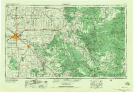
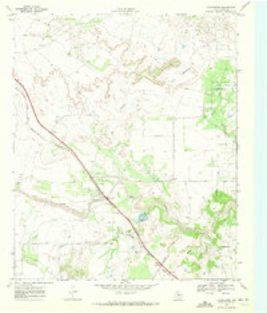
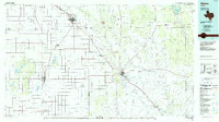
7 topographic sheets cover this place, the earliest surveyed in 1954 and the latest in 1986. It stands in the Post East census division. It lies in ZIP code area 79330. It stands on Salt Branch. The Survey maps it on the Justiceburg quadrangle. It stands 2,254 feet above sea level.
Topographic sheets covering this place
3 surveys from 7 printed sheetsMatched by testing this settlement's coordinate against the published boundary of every sheet in the United States Geological Survey's historical collection. Each opens the scanned sheet at the Survey.
- 1954 USGS Lubbock quadrangle1:250000, 4 printings
- 1969 USGS Justiceburg quadrangle1:24000
- 1986 USGS Slaton quadrangle1:100000, 2 printings
Fires near this place
2 since 2011Regional context, not property-specific evidence. The federal wildfire occurrence database lists 2 fires within 5 miles of Justiceburg between 2011 and 2020, burning about 6,032 acres in total. None started naturally. None was recorded as arson. Distance is straight-line from the map coordinates, so a fire counted here may appear on a neighbouring settlement's page as well.
| Reported cause | Fires |
|---|---|
| Missing data/not specified/undetermined | 1 |
| Power generation/transmission/distribution | 1 |
The most recent of them, most recent first, with the day each was reported and the service that recorded it.
| Date | Cause | Size | Reported by | Name on the report |
|---|---|---|---|---|
| 28 August 2020 | Power generation/transmission/distribution | 32 acres | Texas A & M Forest Service | GOBBLER CREEK |
| 3 April 2011 | Missing data/not specified/undetermined | 6,000 acres | Texas A & M Forest Service | JUSTICE BURG FIRE |
Storms near this place
52 since 1995Regional context, not property-specific evidence. The National Weather Service names Justiceburg in 52 storm reports between 1995 and 2024: 34 hail, 13 thunderstorm wind, 2 flash flood, 2 tornado. The reports record 1 injury. Each account below is quoted exactly as the forecast office filed it, from the NOAA Storm Events Database, and each date opens the federal record of that event.
| When | Event | Place named | Harm | What the report says |
|---|---|---|---|---|
| May 2006 | Thunderstorm Wind | Justiceburg | 1 hurt, $350,000 | A wet microburst produced destructive winds that spread south through a small mobile home community at Lake Alan Henry near the intersection of Farm to Market Roads 2458 and 3519. One resident of the community was injured during the storm. A National Weather Service damage survey team estimated that winds associated with the microburst exceeded 90 MPH. One mobile home was blown toward the south and impacted two vehicles that were parked in front of an adjacent home. Debris, including the steel-frame structure of the mobile home, pushed the two vehicles up to 40 feet while the remains of the home were blown more than 40 yards into an open field. One vehicle was crushed by the weight of the flying debris. Another vehicle, a large truck, was reported by one of the residents to have been lifted in the front-end and then pushed across the yard. The tracks on the ground from the rear tires were noted by the survey team. Another mobile home was completely removed from its foundation and blown approximately 40 yards to the southeast into an open field. Lighter debris was scattered over 100 yards toward the south.Four other vehicles in the mobile home community also were damaged from flying debris. The front-end of a large truck was struck by a dumpster. A small sports utility Vehicle was impaled through a passenger side window by a ladder. Two other mobile homes sustained roof and window damages. An object impaled the top of one home, and residents reported major damage to the home's interior. The Texas Tech West Texas Mesonet station located one mile northwest of Lake Alan Henry measured a wind gust of 79 mph from the west/northwest at 7:40 PM. |
| April 2009 | Hail | Justiceburg | $30,000 | Operators at the Lake Alan Henry Marina reported giant hail near Turkey Ridge at the intersection of Farm to Market Roads 3519 and 2458. Hail up to the size of softballs damaged a number of roofs and vehicles in the area. No injuries were reported. |
| April 2009 | Hail | Justiceburg | $25,000 | The owners of a general store located between Justiceburg and Lake Alan Henry along Farm to Market Road 3519 reported tennis ball size hail as an intense supercell storm impacted the area between 17:00 and 17:30 CST. The hail damaged air conditioning units on the store's roof and caused damage to vehicles. |
| May 2001 | Hail | Justiceburg | $25,000 | Storm spotters reported golfball size hail. |
| April 2009 | Hail | Justiceburg | $20,000 | An intense supercell thunderstorm impacted areas from near Justiceburg northeastward to the Lake Alan Henry vicinity. Large, and occasionally giant hail was reported along its track. ||Residents interviewed during a post-storm National Weather Service survey described a swath of ping pong ball (and occasionally larger) hail that impacted areas from Justiceburg to north of Lake Alan Henry. The hail caused minor roof damage to a few homes, however, much larger hail stones caused more extensive damage east and northeast of Justiceburg near Lake Alan Henry. |
| April 2000 | Hail | Justiceburg | $20,000 | no account filed |
| December 2018 | Thunderstorm Wind | Justiceburg | $5,000 | A carport at Turkey Ridge was blown over and damaged. |
| May 1995 | Hail | Justiceburg | $5,000 | no account filed |
| April 2009 | Tornado (EF0) | Justiceburg | $1,000 | Yet another intense supercell storm moved northeastward over southeastern Garza County during the 18:00 CST hour. ||Mutliple storm chasers and the public observed a deeply occluded mesocyclone with a well-developed funnel-shaped lowering southwest of Justiceburg. A veteran storm chaser near the storm observed intermittent wisps of condensation at the ground at 18:20 CST. The brief tornado lasted approximately one minute and remained over open country. Shingles were reportedly blown off of a home in the area, but no other damages were reported. |
| May 2006 | Hail | Justiceburg | $1,000 | A motorist reported that hail, at least as large as ping pong balls, shattered their vehicle's windsheild while traveling along U.S. Highway 84 southeast of Justiceburg. |
| April 2024 | Hail | Justiceburg | - | A report was received of quarter size hail just to the north of Lake Alan Henry. |
| April 2024 | Thunderstorm Wind | Justiceburg | - | A Texas Tech University West Texas mesonet site near Lake Alan Henry measured severe wind gusts from 0548 CST through 0549 CST. A peak wind gust of 69 mph was measured at 0548 CST. |
| April 2024 | Hail | Justiceburg | - | A public report was received of quarter size hail on the north side of Lake Alan Henry. |
| May 2024 | Hail | Justiceburg | - | A webcam feed near Lake Alan Henry showed hail up to golf ball size. |
| May 2024 | Hail | Justiceburg | - | A live webcam showed hail up to the size of quarters. |
| May 2021 | Hail | Justiceburg | - | A report from the public was received of quarter size hail near Justiceburg along US Highway 84. |
| June 2021 | Flash Flood | Justiceburg | - | Tropical like rain showers repeatedly trained over eastern Garza County on the morning of the 28th. The Lake Alan Henry Texas Tech University West Texas mesonet site measured 5.18 inches of rainfall in the span of mostly three hours. The Garza County sheriff's office reported multiple areas of water running over US Highway 84 between Post and Justiceburg. Additionally, some structures became inundated near Lake Alan Henry. |
| August 2020 | Thunderstorm Wind | Justiceburg | - | A Texas Tech University West Texas mesonet site near Lake Alan Henry measured a wind gust to 58 mph. |
| April 2019 | Hail | Justiceburg | - | No damage was reported. |
| April 2019 | Hail | Justiceburg | - | No damage was reported. |
| June 2019 | Hail | Justiceburg | - | A picture posted to social media showed quarter size hail at Lake Alan Henry. |
| June 2019 | Hail | Justiceburg | - | A trained spotter reported golf ball size hail near Lake Alan Henry. No damage was reported. |
| May 2018 | Hail | Justiceburg | - | Damage information was not available. |
| May 2018 | Thunderstorm Wind | Justiceburg | - | Measured by a Texas Tech University West Texas mesonet. |
| June 2018 | Thunderstorm Wind | Justiceburg | - | A Texas Tech University West Texas mesonet site near Lake Alan Henry measured a wind gust to 74 mph. |
| March 2017 | Thunderstorm Wind | Justiceburg | - | A metal security gate was torn off its mounts. Time estimated. |
| May 2017 | Hail | Justiceburg | - | No damage information was available. |
| May 2017 | Hail | Justiceburg | - | The public measured hail as large as 0.90 inches in diameter. Damage, if any, was not available. |
| June 2013 | Thunderstorm Wind | Justiceburg | - | A Texas Tech University West Texas mesonet site near Lake Alan Henry recorded a 62 mph wind gust. |
| April 2012 | Hail | Justiceburg | - | A storm chaser measured one inch hail north of the Polar community. No damage was reported. |
| June 2012 | Thunderstorm Wind | Justiceburg | - | Measured by a Texas Tech University West Texas mesonet station. |
| April 2012 | Hail | Justiceburg | - | Law enforcement estimated nickel size hail. No damage was reported. |
| April 2012 | Hail | Justiceburg | - | The public estimated one inch hail. No damage was reported. |
| October 2011 | Thunderstorm Wind | Justiceburg | - | A Texas Tech University West Texas mesonet measured a wind gust to 63 mph. No damage was reported. |
| July 2010 | Flood | Justiceburg | - | Flash flooding which occurred early on the 4th subsided toward standing flood waters near swollen playa lakes and the Double Mountain Fork of the Brazos River by the mid afternoon hours. This flooding persisted and resulted in the continued closure of many rural county roads and portions of U.S. Highway 380 in western Garza County before finally subsiding on the 10th. Local agricultural officials reported that upwards of 5,000 acres were flooded, but they estimated that only 250 acres were destroyed.||State and county officials estimated the total economic loss in the county at $1.7 million. For the purposes of this report, these damages are differientiated here by flash flood and flood at $1.5 million and $200,000 respectively. |
| June 2009 | Thunderstorm Wind | Justiceburg | - | The Texas Tech University West Texas Mesonet site near Lake Alan Henry recorded a 72 mph thunderstorm wind gust at 15:45 CST. No damage was reported. |
| June 2008 | Thunderstorm Wind | Justiceburg | - | The Garza County Sheriff's Office estimated thunderstorm wind gusts up to 60 mph at Lake Alan Henry. No damages was reported. |
| July 2008 | Thunderstorm Wind | Justiceburg | - | A Texas Tech University West Texas Mesonet station recorded a peak thunderstorm wind gust of 60 mph near Lake Alan Henry. No damage was reported. |
| June 2007 | Tornado (EF0) | Justiceburg | - | Storm chasers reported a tornado in open country southwest of Justiceburg. Local officials indicated that the tornado caused minor tree damage, but no structural damage was reported. |
| June 2007 | Hail | Justiceburg | - | Public reports indicated tennis ball size hail in rural areas southwest of Justiceburg. No reports of significant damage were received. |
| April 2007 | Hail | Justiceburg | - | Golfball size hail was reported in Justiceburg. No damage was reported. |
| October 2000 | Flash Flood | Justiceburg | - | Roads in and around town were reported flooded, including portions of Highway 84. |
| June 2005 | Hail | Justiceburg | - | no account filed |
| July 2004 | Hail | Justiceburg | - | no account filed |
| July 2004 | Hail | Justiceburg | - | no account filed |
| April 2000 | Hail | Justiceburg | - | no account filed |
| March 2000 | Hail | Justiceburg | - | no account filed |
| May 1997 | Hail | Justiceburg | - | no account filed |
| May 1997 | Hail | Justiceburg | - | no account filed |
| June 1997 | Hail | Justiceburg | - | no account filed |
| May 1995 | Hail | Justiceburg | - | no account filed |
| October 1995 | Hail | Justiceburg | - | no account filed |
Nearest settlements
The eight closest, with where each one stands in the county. Distances are straight-line, computed from the Geographic Names Information System coordinates.
| Map | Place | Distance | Sheets |
|---|---|---|---|
| Augustus | 7.9 miles | 7 | |
| Post | 13.8 miles | 7 | |
| Graham | 16.0 miles | 7 | |
| Verbena | 16.0 miles | 7 | |
| Close City | 19.0 miles | 7 | |
| Pleasant Valley | 22.4 miles | 7 | |
| Buenos | 23.3 miles | 7 | |
| Hackberry | 25.2 miles | 7 |
Elsewhere
Matched on this settlement's Geographic Names Information System number rather than its name, so it cannot be a different place of the same name in another state.
| Wikipedia article on Justiceburg | An encyclopaedic summary. Its text is share-alike, so it is linked here rather than copied. |
| Wikidata item Q6317209 | The structured record the population and elevation above come from. Public domain (CC0). |
Provenance
This settlement is recorded in the Geographic Names Information System as feature 1378510. The sheet list is computed by point-in-boundary test against the United States Geological Survey's historical topographic inventory. Both are works of the United States government and carry no copyright under 17 U.S.C. 105.
Wildfire. Short, Karen C. 2022. Spatial wildfire occurrence data for the United States, 1992-2020 [FPA_FOD_20221014]. 6th Edition. Fort Collins, CO: Forest Service Research Data Archive. https://doi.org/10.2737/RDS-2013-0009.6 Collected with United States Government funding and usable without additional permissions or fees.
Storms. NOAA National Centers for Environmental Information, Storm Events Database https://www.ncei.noaa.gov/stormevents/ A work of the United States government, no copyright under 17 U.S.C. 105. Narratives are quoted verbatim from the National Weather Service report and are not edited or summarised.