 Block
BlockKanawha, Texas
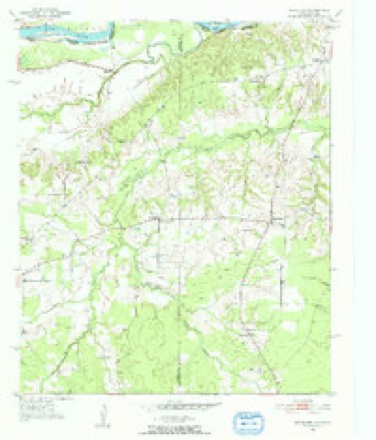
9 topographic sheets cover this place, the earliest surveyed in 1951 and the latest in 1991. It stands in the Manchester census division. It lies in ZIP code area 75436. It stands on Tanyard Creek. The Survey maps it on the Woodland quadrangle.
Topographic sheets covering this place
5 surveys from 9 printed sheetsMatched by testing this settlement's coordinate against the published boundary of every sheet in the United States Geological Survey's historical collection. Each opens the scanned sheet at the Survey.
- 1951 USGS Woodland quadrangle1:24000, 2 printings
- 1953 USGS Texarkana quadrangle1:250000, 4 printings
- 1956 USGS Texarkana quadrangle1:250000
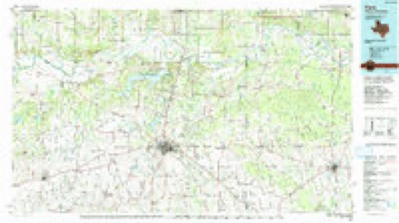
- 1985 USGS Paris quadrangle1:100000
- 1991 USGS Paris quadrangle1:100000
Fires near this place
78 since 1993Regional context, not property-specific evidence. The federal wildfire occurrence database lists 78 fires within 5 miles of Kanawha between 1993 and 2017, burning about 1,916 acres in total. 5 started naturally. 7 were recorded as arson. Distance is straight-line from the map coordinates, so a fire counted here may appear on a neighbouring settlement's page as well.
| Reported cause | Fires |
|---|---|
| Debris and open burning | 38 |
| Missing data/not specified/undetermined | 19 |
| Equipment and vehicle use | 7 |
| Arson/incendiarism | 7 |
| Natural | 5 |
| Power generation/transmission/distribution | 1 |
| Recreation and ceremony | 1 |
The most recent of them, most recent first, with the day each was reported and the service that recorded it.
| Date | Cause | Size | Reported by | Name on the report |
|---|---|---|---|---|
| 9 September 2013 | Debris and open burning | 7.0 acres | Texas A & M Forest Service | 6306 |
| 30 September 2011 | Equipment and vehicle use | 1.0 acres | Texas A & M Forest Service | FISH CAMP |
| 3 September 2005 | Missing data/not specified/undetermined | 5.0 acres | Texas A & M Forest Service | not named |
| 13 September 2004 | Missing data/not specified/undetermined | 1.0 acres | Texas A & M Forest Service | not named |
| 7 August 2000 | Equipment and vehicle use | 85 acres | Texas A & M Forest Service | LINDEN - 219 |
| 7 August 1999 | Debris and open burning | 15 acres | Texas A & M Forest Service | not named |
| 31 August 1998 | Debris and open burning | 20 acres | Texas A & M Forest Service | not named |
| 29 August 1995 | Debris and open burning | 10 acres | Texas A & M Forest Service | not named |
Settlements close enough to share some of these fires:
Storms near this place
3 since 2000Regional context, not property-specific evidence. The National Weather Service names Kanawha in 3 storm reports between 2000 and 2018: 1 tornado, 1 flood, 1 flash flood. No death or injury is recorded in these reports. Each account below is quoted exactly as the forecast office filed it, from the NOAA Storm Events Database, and each date opens the federal record of that event.
| When | Event | Place named | Harm | What the report says |
|---|---|---|---|---|
| February 2018 | Flash Flood | Kanawha | - | Water covered numerous roadways across much of Red River County. |
| June 2015 | Flood | Kanawha | - | Excessive heavy rainfall during the month of May resulted in very high water on the Red River bordering McCurtain County in Southeast Oklahoma and Red River and Bowie Counties in Northeast Texas during the entire month of June. Rainfall amounts during the month of May across the Upper and Middle Red River basins of Southern Oklahoma and Northern Texas totaled over 20 inches of rain. The Oklahoma state climatologist reported that May of 2015 was the all time wettest month of any month in state history. Lake Texhoma, a flood control reservoir to the Red River upstream of Arthur City, Texas rose to its highest pool stage on record early on June 1st at 645.66 feet with peak releases of around 140,000 CFS. The Muddy Boggy Creek tributary to the Red River rose to near its flood of record cresting near 55 feet earlier on May 29th with inflows upwards of 70,000 CFS into the Red River. Muddy Boggy Creek crested just shy of the 1990 flood of record with 55.27 feet near Unger, Oklahoma. Other tributaries of the Red River also crested at very high levels during the final week of May and early in June, 2015 below Lake Texhoma including Bois D'Arc and Bokchito Creeks. Finally the Kiamichi River at Hugo Reservoir crested just below a new pool stage record after May 25th and contributed peak releases of near 60,000 CFS as well to the Red River. This excessive heavy rainfall and inflow into the Red River resulted river levels that eclipsed the flood of May of 1990 at Pecan Point and was just shy of the Red River flood of May of 1908 at Pecan Point. The Red River at Pecan Point north of Dekalb, Texas went above the 24 foot flood stage on May 10th, 2015 and remained above that flood stage through the entire month of June and did not fall below flood stage until until July, 2015. The Red River at Pecan Point north of Dekalb, Texas went above the 30 foot major flood stage on May 24th, 2015 and crested at a stage of 35.0 feet on June 2nd, 2015. This is the 3rd highest crest in recorded history at the gauging location, eclipsed only by the flood of record of 36.0 feet in 1938 and 35.5 feet in 1908. The river fell below the 30 foot major flood stage on June 10th. A secondary rise on the Red River developed because of excessive heavy rainfall once again in the middle Red River Basin from the remnants of Tropical Storm Bill. As a result, the Red River went back above the 30 foot major flood stage on June 22nd and crested at a stage of 32.5 feet on June 24th. The Red River then fell below the 30 foot major flood stage on June 28th. Thousands of acres of pasture and and farm land were flooded and livestock had to be evacuated. Bank erosion was extreme on the McCurtain County side of the Red River as well as the Red River and Bowie County sides of the river. The United States Highway 259 bridge going over the Red River was closed and while the Highway 37 bridge between Clarksville, Texas and Idabel, Oklahoma was threatened, it was not closed. The number of structures and homes suffering damage from the rising river in Red River County as well as a monetary amount of damage was not available for this writing. |
| April 2000 | Tornado (F2) | Kanawha | - | Tornado occurred across farm land and wooded areas with few structures or homes present. The county sheriff, his deputy, and a farmer were talking when the tornado, which was described as a long tube, moved out of the woods to their east and crossed within several hundred yards to their north. |
Nearest settlements
The eight closest, with where each one stands in the county. Distances are straight-line, computed from the Geographic Names Information System coordinates.
| Map | Place | Distance | Sheets |
|---|---|---|---|
| Kiomatia | 2.5 miles | 8 | |
| Addielou | 3.8 miles | 8 | |
| Woodland | 3.9 miles | 9 | |
| Manchester | 5.0 miles | 8 | |
| Davenport | 7.6 miles | 8 | |
| Blakeney | 8.9 miles | 10 | |
| Silver City | 10.3 miles | 10 | |
| Midway | 10.7 miles | 8 |
Provenance
This settlement is recorded in the Geographic Names Information System as feature 1360492. The sheet list is computed by point-in-boundary test against the United States Geological Survey's historical topographic inventory. Both are works of the United States government and carry no copyright under 17 U.S.C. 105.
Wildfire. Short, Karen C. 2022. Spatial wildfire occurrence data for the United States, 1992-2020 [FPA_FOD_20221014]. 6th Edition. Fort Collins, CO: Forest Service Research Data Archive. https://doi.org/10.2737/RDS-2013-0009.6 Collected with United States Government funding and usable without additional permissions or fees.
Storms. NOAA National Centers for Environmental Information, Storm Events Database https://www.ncei.noaa.gov/stormevents/ A work of the United States government, no copyright under 17 U.S.C. 105. Narratives are quoted verbatim from the National Weather Service report and are not edited or summarised.