 Block
BlockKilgore, Texas
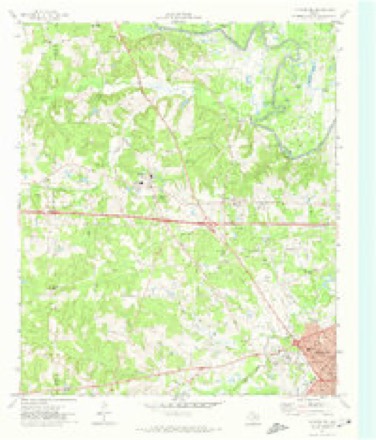
15 topographic sheets cover this place, the earliest surveyed in 1936 and the latest in 1986. It stands in the Kilgore census division. It lies in ZIP code area 75662. It stands on Turkey Creek. The Survey maps it on the Kilgore NW quadrangle. 13,470 people lived here at the 2024 count. It stands 358 feet above sea level.
Population over time
3 figuresKilgore grew from 300 to 13,376 between 1880 and 2020. These are the recorded population figures Wikidata holds for this place, reached through the Geographic Names Information System number this page is keyed on rather than by name, so they belong to this place and not to another of the same name. Most are census counts, but not all are: an early figure may be a founding or settlement estimate, and an estimate published within five years of a census is left out. The change column is computed, and is left blank where more than 20 years separate a figure from the one before it, because a gap that long is not a change between two counts.
| Year | People | Change |
|---|---|---|
| 1880 | 300 | |
| 2010 | 12,975 | |
| 2020 | 13,376 | +401 (+3%) |
Topographic sheets covering this place
7 surveys from 15 printed sheetsMatched by testing this settlement's coordinate against the published boundary of every sheet in the United States Geological Survey's historical collection. Each opens the scanned sheet at the Survey.
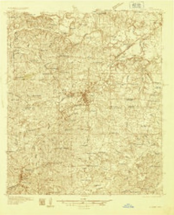
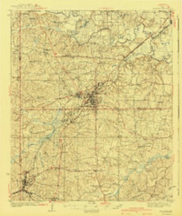
- 1936 USGS Kilgore quadrangle1:48000
- 1936 USGS Kilgore quadrangle1:62500
- 1940 USGS Kilgore quadrangle1:62500, 2 printings
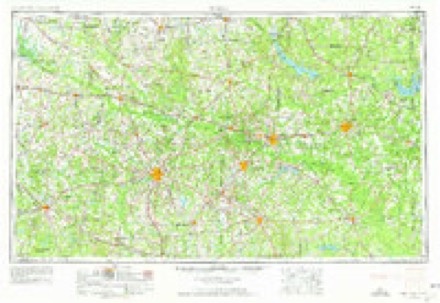
- 1956 USGS Tyler quadrangle1:250000, 5 printings
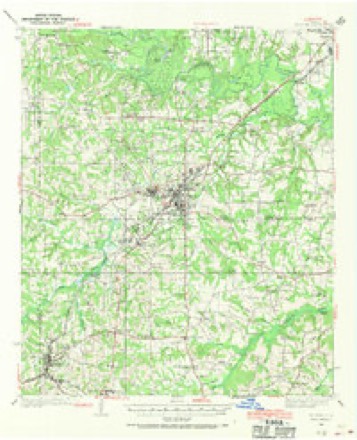
- 1971 USGS Kilgore NW quadrangle1:24000
- 1984 USGS Tyler quadrangle1:250000, 3 printings
- 1986 USGS Henderson quadrangle1:100000, 2 printings
Fires near this place
470 since 1992Regional context, not property-specific evidence. The federal wildfire occurrence database lists 470 fires within 5 miles of Kilgore between 1992 and 2020, burning about 2,698 acres in total. 14 started naturally. 45 were recorded as arson. Distance is straight-line from the map coordinates, so a fire counted here may appear on a neighbouring settlement's page as well.
| Reported cause | Fires |
|---|---|
| Debris and open burning | 249 |
| Missing data/not specified/undetermined | 95 |
| Arson/incendiarism | 45 |
| Power generation/transmission/distribution | 20 |
| Equipment and vehicle use | 18 |
| Natural | 14 |
| Misuse of fire by a minor | 11 |
| Smoking | 7 |
| Recreation and ceremony | 5 |
| Railroad operations and maintenance | 4 |
| Fireworks | 1 |
| Other causes | 1 |
The most recent of them, most recent first, with the day each was reported and the service that recorded it.
| Date | Cause | Size | Reported by | Name on the report |
|---|---|---|---|---|
| 8 September 2013 | Debris and open burning | under an acre | Texas A & M Forest Service | TRASH FIRE |
| 7 September 2009 | Missing data/not specified/undetermined | 50 acres | Texas A & M Forest Service | HENDERSON - 206 |
| 7 September 1993 | Arson/incendiarism | 2.0 acres | Texas A & M Forest Service | not named |
| 6 September 2011 | Power generation/transmission/distribution | 12 acres | Texas A & M Forest Service | HENDERSON - 512 |
| 6 September 2009 | Misuse of fire by a minor | 1.0 acres | Texas A & M Forest Service | HENDERSON - 205 |
| 6 September 1993 | Debris and open burning | 2.0 acres | Texas A & M Forest Service | not named |
| 5 September 2006 | Missing data/not specified/undetermined | 1.0 acres | Texas A & M Forest Service | HENDERSON - 525 |
| 5 September 1998 | Missing data/not specified/undetermined | 8.0 acres | Texas A & M Forest Service | not named |
Settlements close enough to share some of these fires:
Mines and quarries near this place
1 within 5 milesRegional context, not property-specific evidence. The federal mineral resources record lists 1 working within 5 miles of Kilgore: 1 producer. All of them still produce. What was taken out: Clay. Distance is straight-line from the map coordinates, so a quarry counted here may appear on a neighbouring settlement's page as well.
| Where | Site | Commodity | Status | Recorded |
|---|---|---|---|---|
| Kilgore Ceramics Corp Plant | Clay | Producer |
Storms near this place
60 of 80 shownRegional context, not property-specific evidence. The National Weather Service names Kilgore in 80 storm reports between 1993 and 2025: 45 thunderstorm wind, 13 flash flood, 11 hail, 4 lightning. The reports record 2 injuries. Each account below is quoted exactly as the forecast office filed it, from the NOAA Storm Events Database, and each date opens the federal record of that event.
| When | Event | Place named | Harm | What the report says |
|---|---|---|---|---|
| May 1999 | Tornado (F2) | Kilgore | 2 hurt, $19,000,000 | Major damage to homes and businesses. Stoneridge Apartment complex lost portions of its roof and walls collapsed. The complex was condemned. This tornado is separate from the Gree County to Rusk County to Gregg County tornado event which occurred at the same time. |
| May 1999 | Tornado (F2) | Kilgore | $6,000,000 | Numerous homes and businesses damages. This tornado continued into Rusk County, TX then reentered Gregg County, TX. |
| January 1999 | Thunderstorm Wind | Kilgore | $640,000 | Numerous roofs were damaged. Several mobile homes were destroyed and extensive roof damage to an apartment complex. |
| March 2008 | Thunderstorm Wind | Kilgore | $500,000 | A roof was blown off a gas station on Highway 259 in Kilgore, Texas. Numerous trees and powerlines were downed in town. Damage was also reported to 5 local schools in and near the Kilgore, Texas area. |
| August 2002 | Thunderstorm Wind | Kilgore | $150,000 | Numerous trees down. Several trees fell on a house doing considerable damage to the roof and frame of the home while another tree crushed a pickup truck. |
| October 2025 | Tornado (EF1) | Kilgore | $115,000 | An EF-1 tornado with estimated maximum winds near 94 mph touched down along CR 1122 in Southern Gregg County, just east of FM 2012 west of Kilgore, where a few trees were snapped and uprooted. A doublewide manufactured home lost most of its metal skirting and sustained the loss of about half of its roof and porch covering. The tornado continued east and caused significant roof damage to a second doublewide manufactured home. As the tornado entered the city of Kilgore, two businesses along Industrial Blvd lost most of their roofs. The tornado then tracked across Commerce Street at the Harris Street Park, where multiple trees were snapped and uprooted, and dugouts were damaged at Driller Park. The tornado then took a slight southeast turn, crossing into Northern Rusk County. |
| April 2019 | Lightning | Kilgore | $50,000 | The Sabine Fire Department reported that a tank battery was struck by lightning on Watson Road, causing the tank to catch fire. Officials stated that mud and high water prevented them from getting equipment close enough to extinguish the flames. The fire melted power lines hanging near the tanks. No injuries were reported. |
| March 2008 | Thunderstorm Wind | Kilgore | $50,000 | Numerous trees and power lines downed across the northern portion of the county. Many residents without power. One tree fell across a home on Vinewood Street. |
| September 1993 | Thunderstorm Wind | Kilgore | $50,000 | Thunderstorm winds damaged trees and power lines. A few trees were blown onto houses, and some windows were broken from flying debris. |
| October 1993 | Thunderstorm Wind | Kilgore | $50,000 | Strong winds blew power lines down. Signs were also blown down. |
| November 1993 | Thunderstorm Wind | Kilgore | $50,000 | Strong winds blew power lines down. Signs were also blown down. |
| May 2014 | Thunderstorm Wind | Kilgore | $35,000 | Several large trees were downed in Kilgore, Texas. One tree fell on top of a carport on Lantrip Street off of Hwy. 259. Another tree fell across a fence in town. Trees were also downed at the Kilgore, Police Department and a tin roof was blown off a building. |
| May 1999 | Tornado (F2) | Kilgore | $25,000 | Minor damage to homes and a school lost a few shingles. This tornado is continued from the Gregg County to Rusk County, TX tornado event. |
| June 2009 | Thunderstorm Wind | Kilgore | $20,000 | Strong wind gusts lifted damaged a roof under repair at the Kilgore College Longview campus allowing water to flow inside and flood the Joe Hendrix and Cosmetology buildings. The storm also blew down trees in Liberty City and near Shiloh Road. Another large tree was downed in Longview, Texas on Lakeshore Drive. |
| July 1997 | Thunderstorm Wind | Kilgore | $7,000 | A couple of homes suffered roof damage when trees fell on them. |
| October 1993 | Hail | Kilgore | $5,000 | Car windshields were damaged by hail. |
| November 1993 | Hail | Kilgore | $5,000 | Car windshields were damaged by hail. |
| July 1997 | Lightning | Kilgore | $2,000 | Lightning struck the side of a house causing a small house fire on Monroe Street. Damage was minor and no injuries occurred. |
| August 1995 | Thunderstorm Wind | Kilgore | $2,000 | Numerous reports were received of trees and power lines being blown down leaving over 1,000 people without electricity. |
| August 2006 | Thunderstorm Wind | Kilgore | $1,000 | Trees down and the tin was torn off a carport at Rabbit Creek RV Park near I-20 and exit 587. |
| July 1997 | Lightning | Kilgore | $1,000 | Lightning struck a church sparking a small fire with was quickly extinguished by the fire department. |
| May 2025 | Flash Flood | Kilgore | - | Highway 135 north of the traffic circle in Kilgore was flooded. |
| August 2025 | Flash Flood | Kilgore | - | High water covered Nolen Street in Kilgore. |
| February 2024 | Hail | Kilgore | - | Quarter size hail reported via social media. |
| May 2024 | Thunderstorm Wind | Kilgore | - | Tree downed on FM Road 1639 west of Kilgore. |
| April 2022 | Thunderstorm Wind | Kilgore | - | A tree was downed on Denman Road. |
| May 2022 | Thunderstorm Wind | Kilgore | - | Trees and power lines down in Kilgore. |
| May 2021 | Thunderstorm Wind | Kilgore | - | Trees were downed on FM 1639 just west of Kilgore. |
| March 2019 | Thunderstorm Wind | Kilgore | - | Significant tree damage, structural damage, and vehicle damage was reported in Kilgore as a result of a downburst. Numerous power lines were downed. |
| March 2019 | Thunderstorm Wind | Kilgore | - | Large pine trees 1.5 - 2 feet in diameter were downed near Kilgore Intermediate School. |
| May 2019 | Flash Flood | Kilgore | - | Numerous roads were flooded and closed in Kilgore. |
| May 2019 | Thunderstorm Wind | Kilgore | - | Numerous trees were blown down across Kilgore. |
| April 2018 | Hail | Kilgore | - | Quarter size hail fell in Kilgore. |
| July 2018 | Thunderstorm Wind | Kilgore | - | Trees and power lines were downed throughout Kilgore. A downed power line and utility pole temporarily closed Highway 259 near Stone Road. |
| December 2018 | Flood | Kilgore | - | The Highway 135 overpass in Kilgore was closed due to flooding. |
| December 2018 | Flood | Kilgore | - | Willow Springs Road between Moccasin Trail and Woodway Street along Bighead Creek was closed due to high water well after the heavier rains had ended. |
| October 2018 | Thunderstorm Wind | Kilgore | - | Several trees were blown down across Kilgore. |
| October 2018 | Thunderstorm Wind | Kilgore | - | A large oak tree fell down blocking the 2900 block of Florence Street in Kilgore. |
| April 2017 | Hail | Kilgore | - | Penny size hail fell on Dudley Road on the southeast side of Kilgore. |
| April 2017 | Flash Flood | Kilgore | - | Highway 259 in Kilgore was reduced to one lane in each direction due to flash flooding. |
| May 2017 | Thunderstorm Wind | Kilgore | - | Trees and power lines were blown down in Kilgore. |
| March 2016 | Flash Flood | Kilgore | - | Multiple high water rescues were reported in Kilgore, Texas. |
| March 2016 | Flash Flood | Kilgore | - | Road closures were reported near Hwy. 259 and Hwy 31 between Interstate 20 and the Kilgore city limits. Both southbound and northbound lanes were closed. |
| March 2016 | Flash Flood | Kilgore | - | Road closures from flooding in the Kilgore, Texas area included Turkey Creed, Houston Street, Stone Road, Pentecost Road, the Highway 135 underpass, Andrews Street, East North Street and Scene Street. A State Of Emergency was declared for the city of Kilgore, Texas as Turkey Creek, Big Head Creek and Rabbit Creeks had water pouring out of them so fast that it swamped roads, automobiles and homes. The park near Turkey Creek and the homes surrounding it were totally swallowed by the floodwaters. Mandatory evacuations were ordered. A Union Pacific train became stuck on the tracks off of FM. 349 and began to flood. Union Pacific workers were forced to abandon the train and climb to higher ground. |||Three shelters were set up to help residents with the emergency flood threat in the city of Kilgore, Texas. The total number of structures and their monetary damage estimates were not available for this entry. |
| May 2015 | Flash Flood | Kilgore | - | Several roads were flooded and closed in and around Kilgore, Texas. |
| May 2015 | Thunderstorm Wind | Kilgore | - | Trees and powerlines were downed near Hwy. 259 near Kilgore, Texas. |
| October 2014 | Thunderstorm Wind | Kilgore | - | A tree was downed west of Kilgore, Texas. |
| April 2014 | Flash Flood | Kilgore | - | Excessive heavy rainfall resulted in the closure of the Circle in Kilgore, Texas. |
| April 2012 | Thunderstorm Wind | Kilgore | - | A tree was downed near U.S. Hwy. 259 just south of Kilgore, Texas. |
| August 2012 | Thunderstorm Wind | Kilgore | - | Powerlines were downed southeast of town at the 11000 block of CR. 173. |
| October 2010 | Hail | Kilgore | - | One inch hail fell at Hwy. 43 and Interstate 20 just north of Kilgore, Texas. |
| August 2010 | Thunderstorm Wind | Kilgore | - | A few trees were downed in Kilgore, Texas. |
| February 2009 | Thunderstorm Wind | Kilgore | - | Numerous trees were reported downed in the city of Kilgore, Texas. |
| August 2009 | Thunderstorm Wind | Kilgore | - | A tree was downed onto a powerline in Kilgore, Texas. |
| May 2008 | Flash Flood | Kilgore | - | Several roads were under water including Hwy 135. |
| March 2008 | Hail | Kilgore | - | Hail reported on Stone Road. |
| July 2007 | Thunderstorm Wind | Kilgore | - | Several trees were blown down along county road 2011. |
| August 2006 | Thunderstorm Wind | Kilgore | - | Trees were downed along Hwy. 2087 on the east side of town. |
| August 2006 | Thunderstorm Wind | Kilgore | - | Trees were downed near Hwy 349 and 1208. |
| June 2004 | Thunderstorm Wind | Kilgore | - | Trees downed. |
Nearest settlements
The eight closest, with where each one stands in the county. Distances are straight-line, computed from the Geographic Names Information System coordinates.
| Map | Place | Distance | Sheets |
|---|---|---|---|
| Danville | 2.8 miles | 16 | |
| Rolling Meadows | 4.0 miles | 16 | |
| Kinsloe | 4.3 miles | 16 | |
| Fredonia | 4.4 miles | 16 | |
| Liberty City | 5.6 miles | 15 | |
| Elderville | 7.9 miles | 16 | |
| Greggton | 8.9 miles | 16 | |
| Lakeport | 9.2 miles | 16 |
Elsewhere
Matched on this settlement's Geographic Names Information System number rather than its name, so it cannot be a different place of the same name in another state.
| Wikipedia article on Kilgore | An encyclopaedic summary. Its text is share-alike, so it is linked here rather than copied. |
| Wikidata item Q973998 | The structured record the population and elevation above come from. Public domain (CC0). |
Provenance
This settlement is recorded in the Geographic Names Information System as feature 1339101. The sheet list is computed by point-in-boundary test against the United States Geological Survey's historical topographic inventory. Both are works of the United States government and carry no copyright under 17 U.S.C. 105.
Wildfire. Short, Karen C. 2022. Spatial wildfire occurrence data for the United States, 1992-2020 [FPA_FOD_20221014]. 6th Edition. Fort Collins, CO: Forest Service Research Data Archive. https://doi.org/10.2737/RDS-2013-0009.6 Collected with United States Government funding and usable without additional permissions or fees.
Mines and quarries. USGS Mineral Resources Data System (MRDS) https://mrdata.usgs.gov/mrds/ A work of the United States government, no copyright under 17 U.S.C. 105.
Storms. NOAA National Centers for Environmental Information, Storm Events Database https://www.ncei.noaa.gov/stormevents/ A work of the United States government, no copyright under 17 U.S.C. 105. Narratives are quoted verbatim from the National Weather Service report and are not edited or summarised.