 Block
BlockKingsville, Texas
9 topographic sheets cover this place, the earliest surveyed in 1950 and the latest in 1989. It stands in the Kingsville census division. It lies in ZIP code area 78363. The Survey maps it on the Kingsville East quadrangle. 25,402 people lived here at the 2020 count. It stands 59 feet above sea level.
Research this city
On record in Kingsville
Buildings and businesses the archive holds for this place. Each opens its own page, with the source record it came from.
On the National Register 5 records
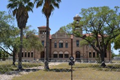 Henrietta M. King High Schoollisted 1983
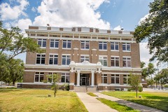 Kleberg County Courthouselisted 2010
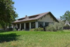 Nance-Jones Houselisted 2006
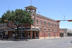 John B. Ragland Mercantile Company Buildinglisted 1993
- Kingsville Downtown Historic Districtlisted 2018
Population over time
2 figuresKingsville fell from 26,213 to 25,402 between 2010 and 2020. These are the recorded population figures Wikidata holds for this place, reached through the Geographic Names Information System number this page is keyed on rather than by name, so they belong to this place and not to another of the same name. Most are census counts, but not all are: an early figure may be a founding or settlement estimate, and an estimate published within five years of a census is left out. The change column is computed, and is left blank where more than 20 years separate a figure from the one before it, because a gap that long is not a change between two counts.
| Year | People | Change |
|---|---|---|
| 2010 | 26,213 | |
| 2020 | 25,402 | -811 (-3%) |
Topographic sheets covering this place
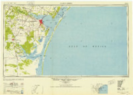
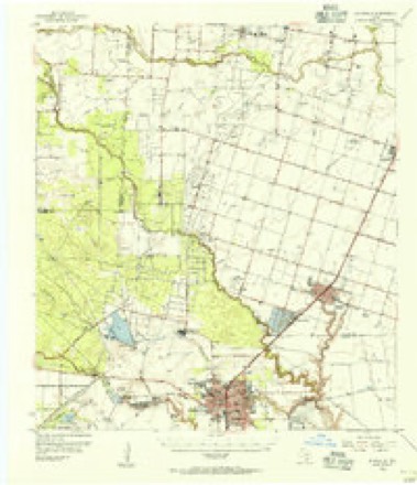
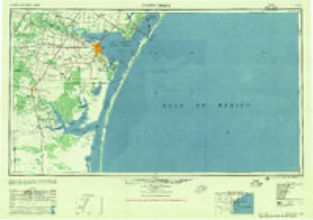
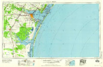
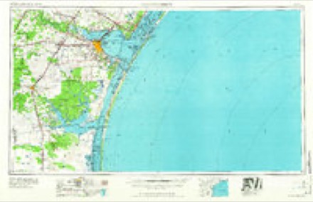
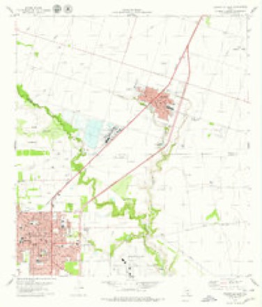
8 surveys from 9 printed sheetsMatched by testing this settlement's coordinate against the published boundary of every sheet in the United States Geological Survey's historical collection. Each opens the scanned sheet at the Survey.
- 1950 USGS Corpus Christi quadrangle1:250000
- 1954 USGS Kingsville quadrangle1:62500, 2 printings
- 1956 USGS Corpus Christi quadrangle1:250000
- 1960 USGS Corpus Christi quadrangle1:250000
- 1966 USGS Corpus Christi quadrangle1:250000
- 1979 USGS Kingsville East quadrangle1:24000
- 1984 USGS Corpus Christi quadrangle1:100000
- 1989 USGS Corpus Christi quadrangle1:250000
Fires near this place
28 since 2006Regional context, not property-specific evidence. The federal wildfire occurrence database lists 28 fires within 5 miles of Kingsville between 2006 and 2016, burning about 1,008 acres in total. None started naturally. 1 was recorded as arson. Distance is straight-line from the map coordinates, so a fire counted here may appear on a neighbouring settlement's page as well.
| Reported cause | Fires |
|---|---|
| Missing data/not specified/undetermined | 19 |
| Debris and open burning | 4 |
| Power generation/transmission/distribution | 2 |
| Smoking | 2 |
| Arson/incendiarism | 1 |
The most recent of them, most recent first, with the day each was reported and the service that recorded it.
| Date | Cause | Size | Reported by | Name on the report |
|---|---|---|---|---|
| 6 September 2011 | Power generation/transmission/distribution | 200 acres | Texas A & M Forest Service | PAN AM SCHOOL FIRE |
| 1 July 2016 | Debris and open burning | 5.0 acres | Texas A & M Forest Service | KLEBERG BRUSH PILES |
| 20 June 2013 | Missing data/not specified/undetermined | 1.5 acres | Texas A & M Forest Service | HWY 77 SB |
| 18 May 2009 | Debris and open burning | 10 acres | Texas A & M Forest Service | TRANT FIRE |
| 6 April 2013 | Missing data/not specified/undetermined | under an acre | Texas A & M Forest Service | 6010 HWY 77 NB |
| 22 April 2012 | Missing data/not specified/undetermined | 50 acres | Texas A & M Forest Service | 4082059 |
| 7 March 2008 | Missing data/not specified/undetermined | 5.0 acres | Texas A & M Forest Service | BRAHMA - 89 |
| 6 March 2014 | Missing data/not specified/undetermined | 1.0 acres | Texas A & M Forest Service | N/A |
Settlements close enough to share some of these fires:
Storms near this place
60 of 88 shownRegional context, not property-specific evidence. The National Weather Service names Kingsville in 88 storm reports between 1993 and 2026: 30 flash flood, 26 thunderstorm wind, 23 hail, 4 tornado. No death or injury is recorded in these reports. Each account below is quoted exactly as the forecast office filed it, from the NOAA Storm Events Database, and each date opens the federal record of that event.
| When | Event | Place named | Harm | What the report says |
|---|---|---|---|---|
| May 2016 | Tornado (EF1) | Kingsville | $2,500,000 | An EF-1 tornado touched down at the intersection of Brahma Boulevard and East General Cavazos Boulevard. It traveled northwest crossing Business Highway 77 near Otis Street before lifting. Windows were broken and shingles were blown off the roof of an apartment complex. Vehicle windows were smashed. A portion of a roof was blown off of a home. Numerous large trees and power poles were snapped. Estimated peak wind speed was 110 mph. |
| June 2019 | Thunderstorm Wind | Kingsville | $500,000 | NWS survey team concluded that a downburst of straight-line winds impacted Kingsville during the early evening. Damaging winds were observed across north Kingsville with the highest concentration of damage along Corral Avenue. Wind speeds were estimated between 80 to 90 mph. Widespread tree damaged occurred along with several large trees being uprooted. Power poles were snapped and moderate to major damage occurred to 15 structures. Wind speeds decreased as the winds propagated to the southeast. Winds were measured at 77 mph by the Naval Air Station Kingsville ASOS. The damage path was 2 miles wide and 9 miles in length. |
| April 1993 | Tornado (F1) | Kingsville | $500,000 | The Department of Public Safety and the Kingsville Police Department reported a tornado in the northeast part of Kingsville. A travel-trailer was destroyed and some buildings sustained structural damage. A portion of the roof on the Sage Motel was blown off. Several trees in the areas were uprooted. |
| May 2016 | Flash Flood | Kingsville | $100,000 | Vehicles were flooded near Texas A&M University at Kingsville and near Avenue G. Water approached homes and porches. A foot of water was on the roads. Several cars and trucks were stranded in high water. Roads were flooded on 17th Street, Caesar Avenue, and 14th through 16th Streets. |
| September 2014 | Flash Flood | Kingsville | $100,000 | Rainfall amounts between 5 and 7 inches occurred over western Kleberg County. This produced major flooding in the city of Kingsville. Water was 1 to 1 and 1/2 feet deep in some areas of Kingsville. Several cars were stranded in high water. |
| April 2007 | Heavy Rain | Kingsville | $60,000 | The roof at the Kingsville Recycling Center collapsed due to heavy rain. No one was inside the facility at the time the roof collapsed.| |
| April 2015 | Thunderstorm Wind | Kingsville | $50,000 | Winds blew down many power lines across the city of Kingsville. Power outages were widespread in the city. |
| April 1993 | Hail | Kingsville | $50,000 | Golf ball-size hail was reported in Kingsville. Several cars were damaged and some minor tree damage was also reported. |
| March 2016 | Thunderstorm Wind | Kingsville | $25,000 | Roof damage occurred at a home near North Armstrong Street and I Avenue. The roof to a car port was blown off. |
| May 2015 | Thunderstorm Wind | Kingsville | $25,000 | Picture submitted through social media of a large tree blown on to power lines and a house in Kingsville. |
| May 2016 | Hail | Kingsville | $20,000 | Spotter reported quarter sized hail in the southeast part of Kingsville near the high school. |
| July 2007 | Thunderstorm Wind | Kingsville | $20,000 | Four to five inch diameter tree branches were snapped across the city. Multiple power lines were downed as well. |
| March 2007 | Thunderstorm Wind | Kingsville | $15,000 | A 59 mph wind gust was measured at the NAS Kinsville ASOS. Tree limbs were reported down thoughout Kingsville. One hundred three nursing home residents were evacuated from a nursing home after the winds broke windows, removed roof shingles and blew a roof air conditioner off the building. No injuries were reported. |
| March 2023 | Thunderstorm Wind | Kingsville | $10,000 | Public sent a picture of the roof of a Sunoco gas station blown over in Kingsville. |
| June 2019 | Hail | Kingsville | $10,000 | Quarter sized hail occurred near the Texas A&M Kingsville campus. |
| May 2019 | Thunderstorm Wind | Kingsville | $10,000 | Large tree limbs were blown down at the intersection of Corral Avenue and 6th Street in Kingsville. |
| May 2020 | Thunderstorm Wind | Kingsville | $5,000 | Public reported big tree branches blown down around Kingsville through social media. |
| March 2016 | Thunderstorm Wind | Kingsville | $5,000 | Large tree limbs were blown down along Lee Avenue in Kingsville. |
| March 2016 | Thunderstorm Wind | Kingsville | $5,000 | Large tree limbs were blown down in Kingsville. |
| May 2012 | Hail | Kingsville | $5,000 | Spotter reported quarter sized hail occurred at intersection of 6th Street and King Avenue. |
| May 2012 | Hail | Kingsville | $5,000 | Quarter sized hail occurred at Kingsville High School. |
| May 2006 | Hail | Kingsville | $5,000 | Tennis ball-sized hail damaged all mobile home in the Country Estates Mobile Ranch on F.M. 1717. Over 100 windows were broken by the hail. |
| April 1994 | Thunderstorm Wind | Kingsville | $5,000 | The Kingsville Police reported a power pole and several power lines downed in Kingsville. |
| May 2010 | Thunderstorm Wind | Kingsville | $3,000 | Trained spotter estimated wind gust to 65 mph and observed penny sized hail. Several medium to large sized tree limbs were snapped on the west side of the city, and a few older trees and power lines were blown down. |
| May 2022 | Thunderstorm Wind | Kingsville | $1,000 | Winds snapped a tree in Kingsville. Report received through social media. |
| February 2026 | Thunderstorm Wind | Kingsville | - | Mesonet station FW9607 Kingsville. |
| May 2025 | Thunderstorm Wind | Kingsville | - | Southern damage extent. Small hardwood tree limbs broken (up to 1 inch diameter). |
| May 2024 | Hail | Kingsville | - | Nickel to quarter sized hail near St. Gertrudes Catholic Church. |
| August 2023 | Flash Flood | Kingsville | - | Flooding of streets occurred on 14th Street between Ailsie and Caesar Avenues in Kingsville. |
| November 2022 | Flood | Kingsville | - | Trained spotter posted a picture of street flooding at an intersection on West Alice Avenue in Kingsville. |
| May 2021 | Flash Flood | Kingsville | - | The intersection of 14th Street and Santa Gertrudis Avenue was flooded in Kingsville. |
| May 2021 | Flash Flood | Kingsville | - | Multiple roads flooded in and around Kingsville. |
| May 2016 | Flash Flood | Kingsville | - | Roads were closed due to flooding at the intersection of North 17th Street and Lee Avenue. |
| May 2016 | Hail | Kingsville | - | Quarter sized hail was reported in Kingsville. |
| March 2016 | Flash Flood | Kingsville | - | Texas Department of Transportation reported Farm to Market Road 2045 was closed due to flooding from Highway 77 to the King Ranch entrance. |
| May 2015 | Flash Flood | Kingsville | - | Several streets were flooded in Kingsville. |
| September 2014 | Flash Flood | Kingsville | - | Tenth Street between Nettie Avenue and Avenue A in Kingsville was closed due to low water crossings being flooded. |
| November 2014 | Thunderstorm Wind | Kingsville | - | Kingsville Police Department reported some trees were blown down. |
| September 2013 | Flash Flood | Kingsville | - | Rainfall amounts around 3 inches produced flooding of roads in Kingsville. Several intersections were under water. |
| May 2012 | Hail | Kingsville | - | Quarter sized hail occurred on the west side of Kingsville. |
| May 2012 | Flash Flood | Kingsville | - | Heavy rainfall caused some intersections in Kingsville to become impassable. Water came over the road over portions of King Avenue. |
| May 2011 | Hail | Kingsville | - | Spotter reported penny sized hail 2 miles west of the Kingsville Naval Air Station. |
| May 2010 | Flash Flood | Kingsville | - | Between 1 and 3 inches fell within one hour, causing wide-spread flash flooding of city streets in Kingsville. King Avenue and 14th streets were completely flooded. Several manhole covers came off causing sewage to flow into city streets. Flash flooding along Tranquitas Creek made 14th and 17th streets impassable. |
| July 2010 | Flash Flood | Kingsville | - | City streets in Kingsville became inundated and impassable, due to heavy rainfall. |
| September 2010 | Funnel Cloud | Kingsville | - | Spotter reported a funnel cloud near Kingsville. |
| September 2010 | Funnel Cloud | Kingsville | - | Law enforcement and spotters reported a funnel cloud over Kingsville near King Avenue. |
| September 2010 | Flash Flood | Kingsville | - | Shelly Blvd. between Ailsie Avenue and General Cavazos Boulevard barricaded due to water over the roadway. |
| September 2010 | Flash Flood | Kingsville | - | Tranquitas Creek flooded and overflowed 17th Street near the Lee Avenue intersection. 17th Street was barricaded near this intersection. The intersection of 14th Street and King Avenue was barricaded due to high water. |
| July 2008 | Heavy Rain | Kingsville | - | Between 3 and 7 inches of rain fell across the southern Coastal Bend of South Texas over a two period. This rainfall was associated with rain bands from Hurricane Dolly. Unfortunately, the primary impact from the rainfall was to cotton and sorghum crops across the region. Much of the cotton crop was waiting to be harvested, and the rainfall either severaly damaged or destoyed it. At the time of this writing, estimates on agriculture losses were very rough and final figures were still pending. |
| July 2007 | Flash Flood | Kingsville | - | A quick 2 to 3 inches of heavy rainfall reslted in street flooding in Kingsville. Hardest hit was an impassable North Loop 772 and Trent Road. |
| July 2007 | Flash Flood | Kingsville | - | Between 3 and 5 inches of rain fell across western Kleberg county. 4.5 inches of rainfall was recorded in the city of Kingsville where flash flooding occurred. Creeks running through the city flooded. U.S. 77 frontage roads were flooded with 1 to 2 feet of water. High water rescues were done around the city. Reports were received of a few businesses and a church along U.S. 77 with minor flooding.| |
| July 2007 | Flash Flood | Kingsville | - | Between 2 and 4 inches of rain fell across western Kleberg county. Most city streets in Kingsville became flooded and impassable, with several cars stranded in the high water.| |
| April 2007 | Flash Flood | Kingsville | - | Over a 1 to 2 hour period 3.19 of rain fell in the city of Kingsville causing flash flooding. Several cars became stalled in flood waters throughout the city. Tranquitas Creek flooded in the city. The heavy rain also resulted in a roof collapsing at the Kingsville Recycling Center. See the Heavy Rain event for more information. |
| April 2007 | Hail | Kingsville | - | Penny size hail reported. |
| May 2005 | Hail | Kingsville | - | Golf ball size hail was reported by law enforcement at Highway 77 and FM 1717. |
| May 2004 | Flash Flood | Kingsville | - | Some city streets in Kingsville reported flooded with up to 8 inches of water over the roadway. Radar estimated 2 to 3 inches of rain fell near Kingsville. See episode narrative below for additional rainfall totals. |
| June 2004 | Flash Flood | Kingsville | - | Radar estimated between 2 and 3 inches of rain fell over Kingsville. 6th street in Kingsville was floodeed and impassable. Several other city streets experienced minor flooding. |
| February 2003 | Thunderstorm Wind | Kingsville | - | Tree limbs blown down along State Highway 141. |
| December 2002 | Hail | Kingsville | - | Dime sized hail reported between U.S. 77 and Kingsville N.A.S. |
| May 2002 | Thunderstorm Wind | Kingsville | - | Large trees and power lines down. |
Nearest settlements
The eight closest, with where each one stands in the county. Distances are straight-line, computed from the Geographic Names Information System coordinates.
| Map | Place | Distance | Sheets |
|---|---|---|---|
| Ricardo | 6.5 miles | 9 | |
| Vattmannville | 13.8 miles | 9 | |
| Vattman | 13.9 miles | 12 | |
| Riviera | 15.1 miles | 9 | |
| Loyola Beach | 15.2 miles | 12 | |
| Riviera Beach | 18.6 miles | 12 | |
| Ojo de Angua | 23.3 miles | 10 | |
| El Martillo | 24.8 miles | 10 |
Elsewhere
Matched on this settlement's Geographic Names Information System number rather than its name, so it cannot be a different place of the same name in another state.
| Wikipedia article on Kingsville | An encyclopaedic summary. Its text is share-alike, so it is linked here rather than copied. |
| Wikidata item Q970495 | The structured record the population and elevation above come from. Public domain (CC0). |
Provenance
This settlement is recorded in the Geographic Names Information System as feature 1374386. The sheet list is computed by point-in-boundary test against the United States Geological Survey's historical topographic inventory. Both are works of the United States government and carry no copyright under 17 U.S.C. 105.
Wildfire. Short, Karen C. 2022. Spatial wildfire occurrence data for the United States, 1992-2020 [FPA_FOD_20221014]. 6th Edition. Fort Collins, CO: Forest Service Research Data Archive. https://doi.org/10.2737/RDS-2013-0009.6 Collected with United States Government funding and usable without additional permissions or fees.
Storms. NOAA National Centers for Environmental Information, Storm Events Database https://www.ncei.noaa.gov/stormevents/ A work of the United States government, no copyright under 17 U.S.C. 105. Narratives are quoted verbatim from the National Weather Service report and are not edited or summarised.