 Block
BlockLaredo, Texas
10 topographic sheets cover this place, the earliest surveyed in 1956 and the latest in 1985. It stands in the Laredo census division. It lies in ZIP code area 78040. It stands on Zacata Creek. The Survey maps it on the Laredo West quadrangle. 255,205 people lived here at the 2020 count. It stands 449 feet above sea level.
Research this city
On record in Laredo
Buildings and businesses the archive holds for this place. Each opens its own page, with the source record it came from.
On the National Register 8 records
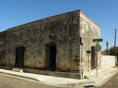 Barrio Azteca Historic Districtlisted 2003
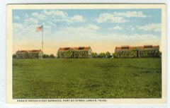 Fort McIntoshlisted 1975
 Hamilton Hotellisted 1992
 Laredo US Post Office, Court House and Custom Houselisted 2001
 San Augustin de Laredo Historic Districtlisted 1973
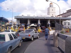 U.S. Inspection Station-Laredo, Texaslisted 2014
 Webb County Courthouselisted 1981
- Pan-American Courts and Cafelisted 2022
Population over time
2 figuresLaredo grew from 236,091 to 255,205 between 2010 and 2020. These are the recorded population figures Wikidata holds for this place, reached through the Geographic Names Information System number this page is keyed on rather than by name, so they belong to this place and not to another of the same name. Most are census counts, but not all are: an early figure may be a founding or settlement estimate, and an estimate published within five years of a census is left out. The change column is computed, and is left blank where more than 20 years separate a figure from the one before it, because a gap that long is not a change between two counts.
| Year | People | Change |
|---|---|---|
| 2010 | 236,091 | |
| 2020 | 255,205 | +19,114 (+8%) |
Topographic sheets covering this place
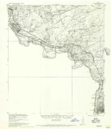
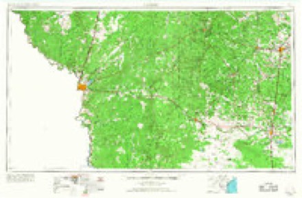
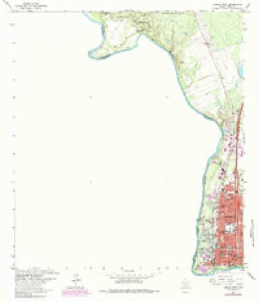
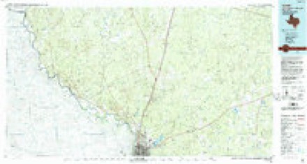
4 surveys from 10 printed sheetsMatched by testing this settlement's coordinate against the published boundary of every sheet in the United States Geological Survey's historical collection. Each opens the scanned sheet at the Survey.
- 1956 USGS Islitas quadrangle1:62500
- 1956 USGS Laredo quadrangle1:250000, 3 printings
- 1965 USGS Laredo West quadrangle1:24000, 3 printings
- 1985 USGS Laredo quadrangle1:100000, 3 printings
Fires near this place
11 since 2013Regional context, not property-specific evidence. The federal wildfire occurrence database lists 11 fires within 5 miles of Laredo between 2013 and 2017, burning about 6 acres in total. None started naturally. None was recorded as arson. Distance is straight-line from the map coordinates, so a fire counted here may appear on a neighbouring settlement's page as well.
| Reported cause | Fires |
|---|---|
| Debris and open burning | 7 |
| Railroad operations and maintenance | 1 |
| Power generation/transmission/distribution | 1 |
| Equipment and vehicle use | 1 |
| Missing data/not specified/undetermined | 1 |
The most recent of them, most recent first, with the day each was reported and the service that recorded it.
| Date | Cause | Size | Reported by | Name on the report |
|---|---|---|---|---|
| 4 July 2017 | Debris and open burning | under an acre | Texas A & M Forest Service | LOS BOTINES |
| 19 July 2017 | Debris and open burning | under an acre | Texas A & M Forest Service | MANGANA HEIN |
| 30 June 2017 | Equipment and vehicle use | under an acre | Texas A & M Forest Service | IH 35 |
| 31 May 2017 | Debris and open burning | under an acre | Texas A & M Forest Service | LAS LOMAS |
| 21 May 2013 | Debris and open burning | under an acre | Texas A & M Forest Service | 9777 HWY 31 |
| 14 April 2017 | Debris and open burning | 1.4 acres | Texas A & M Forest Service | 1706065-GRASS & WOODS |
| 31 January 2017 | Missing data/not specified/undetermined | 1.0 acres | Texas A & M Forest Service | IH 35 25 |
| 28 January 2017 | Debris and open burning | 1.0 acres | Texas A & M Forest Service | MILO RANCH |
Settlements close enough to share some of these fires:
Mines and quarries near this place
7 within 5 milesRegional context, not property-specific evidence. The federal mineral resources record lists 7 workings within 5 miles of Laredo: 7 producers. All of them still produce. What was taken out: Sand and Gravel, Construction, Antimony, Clay. Distance is straight-line from the map coordinates, so a quarry counted here may appear on a neighbouring settlement's page as well.
| Where | Site | Commodity | Status | Recorded |
|---|---|---|---|---|
| Laredo Brick Plant | Clay | Producer | ||
| Nl Industries Inc | Antimony | Producer | ||
| Garcia Sand and Gravel Patino Plant | Sand and Gravel, Construction | Producer | ||
| Laredo Ready Mix Pit | Sand and Gravel, Construction | Producer | Gravel, Sand | |
| No. 1 Pit & Plant | Sand and Gravel, Construction | Producer | ||
| Sand and Gravel Pit | Sand and Gravel, Construction | Producer | Gravel, Sand | |
| Sand and Gravel Pit | Sand and Gravel, Construction | Producer | Gravel, Sand |
Storms near this place
60 of 143 shownRegional context, not property-specific evidence. The National Weather Service names Laredo in 143 storm reports between 1993 and 2025: 47 hail, 44 flash flood, 35 thunderstorm wind, 14 heavy rain. The reports record 2 deaths. Each account below is quoted exactly as the forecast office filed it, from the NOAA Storm Events Database, and each date opens the federal record of that event.
| When | Event | Place named | Harm | What the report says |
|---|---|---|---|---|
| June 2007 | Flash Flood | Laredo | 1 killed, $1,000,000 | A widespread 4 to 6 inches of torrential rainfall fell across Laredo during the early morning hours with localized amounts possibly up to 8 inches. 4.29 was recorded by a television station on the north side of town. 5.41 was recorded at the Laredo International Airport between 1 and 3 AM CDT before lightning knocked out the AWISS site. Widespread flash flooding occurred on many city streets and several creeks and storm drainage ditches across Laredo. Over 100 vehicles were stalled in high water and many vehicles were carried off of streets by the high water. A van with 6 family members drove into high water near Century Blvd and Loop 20. The van became buoyant and was swept into Chacon Creek shortly before 330 AM CDT. The family abandoned the van and 5 members were able to escape to higher ground, however a 14 year girl drowned in the creek. Another vehicle was also swept into the same creek. All four occupants of this vehicle were able to escape to higher ground.||The high water resulted in major damage to 18 homes and minor damage to 50 others. An unspecified number of businesses in sections of the city also had damage from the high water.||| |
| September 1996 | Hail | Laredo | 1 killed | no account filed |
| June 2003 | Thunderstorm Wind | Laredo | $33,000,000 | A NWS storm survey team observed the most severe damage at the Laredo International Airport and homes and businesses surrounding the airport. $750,000 in damage was done to city owned buildings at the airport. An estimated $2 million in damage was done to privately owned buildings and hangars on airport grounds. Twenty five aircraft were damaged, most in hangars which failed. A parked Boeing 737 was blown off a runway and through a chain linked fence. An American Eagle plane suffered punctures when a jet way was flipped over into it. The main terminal building suffered minor roof damage. Runways were closed until the next morning so crews could survey them for damage. Thirty two homes, mobile home and apartments sustained major damage along the path of the storm in Laredo. A total of $3.5 million in damage was done to buildings and facilities belonging to the City of Laredo. Twenty five thousand homes were left without power that night. Power officials reported 40 electrical poles snapped in half. |
| April 1994 | Hail | Laredo | $500,000 | Thunderstorms formed just before 0100 CST just to the west of Laredo in Mexico and began moving toward the northeast. At 0135 CST the sheriff's department in Laredo reported golf ball-sized hail that was accumulating up to six inches deep in places on Highway 83 South. Power was reported out in the downtown area and the southern parts of the city. Some of the low areas in Laredo were briefly flooded by the accompanying heavy rain. |
| September 1993 | Thunderstorm Wind | Laredo | $500,000 | Wind gusts to 90 mph were recorded at the Laredo Airport. Damage was reported to several buildings, vehicles and aircraft. |
| May 2020 | Thunderstorm Wind | Laredo | $300,000 | The strong winds toppled trees and damaged the roof of a business in the downtown area. Many branches were broken and left in the middle of streets due to the strong winds. Perez Elementary in south Laredo suffered significant roof damage due to the storm. Multiple power lines were blown down. |
| May 2021 | Thunderstorm Wind | Laredo | $250,000 | The broadcast media reported some downed power poles and reports of wind damage to a few buildings within Laredo. Severe damage was reported at the Sacred Heart Childrens Home with partial roof loss over the dining room as well as smaller cottages around the facility. |
| May 2015 | Flash Flood | Laredo | $250,000 | Rainfall of 3 to 3 and half inches in an hour produced major flooding in the northern portions of Laredo. Flood waters were in several houses in Del Mar area of north Laredo. The North Creek shopping center at Del Mar and Interstate 35 had several cars with water to roof. |
| May 2020 | Flood | Laredo | $200,000 | Vehicles were stalled in water on the streets. Two individuals were rescued from flooding in their home. Water was approximately 1.5 feet deep in parts of the city of Rio Bravo. |
| May 2020 | Thunderstorm Wind | Laredo | $200,000 | Ten utility poles were snapped along the Zapata Highway near La Pita Mangana Road in south Laredo. Power was cut off from 9000 customers in south Laredo. Road signs were blown over also. |
| July 2014 | Thunderstorm Wind | Laredo | $125,000 | A wet microburst of short duration occurred over the northern portion of Laredo. the winds caused damage at a car dealership with windows blown out of several cars along with a few office windows. Approximately 20 cars were damaged at a Mercedes dealership. Several light posts were blown down along with some power lines. |
| May 2017 | Flash Flood | Laredo | $100,000 | Cars were half submerged under water in parts of Laredo. Report was received through social media. |
| September 2017 | Flash Flood | Laredo | $100,000 | Several water rescues of individuals trying to drive through low water crossings around Laredo. Most were on the south side of town but a few were on the northwest side and in the center of town. Flooding occurred near Laredo Community College. |
| September 2012 | Heavy Rain | Laredo | $100,000 | A rainfall observer reported very heavy rain occurred near intersection of Saldana and Jacaman Road. The observer measured 5.62 inches of rain. Widespread flooding was reported in the area. |
| April 2000 | Hail | Laredo | $100,000 | no account filed |
| April 1995 | Thunderstorm Wind | Laredo | $80,000 | Severe thunderstorm winds ripped the roof from a fire station, knocked down a tower and toppled two tractor semi-trailer trucks. Dozens of trees were knocked down and extensive damage to windows was also reported. Heavy rainfall accompanied the thunderstorm |
| February 2017 | Thunderstorm Wind | Laredo | $75,000 | Video from KGNS-TV showed damage to the Laredo Public Works Department building just to the west of the airport. The roof was blown off the building. A tower was blown over also. |
| August 2022 | Flash Flood | Laredo | $50,000 | Houses were flooded near Barrios Street and near Arkansas Avenue in southeast Laredo. |
| August 2022 | Flash Flood | Laredo | $50,000 | Flood waters entered homes in northwest Laredo. |
| March 2016 | Hail | Laredo | $50,000 | Quarter sized hail occurred at KGNS-TV location in Laredo. |
| May 2006 | Flash Flood | Laredo | $50,000 | The severe supercell that tracked through Laredo also produced 3 to 6 inches of rainfall and flash flooding. 4.42 inches of rainfall was recorded at a local television station. Several cars were caught in the flood waters, requiring high water rescues by the fire department. No injuries were reported. |
| August 1995 | Thunderstorm Wind | Laredo | $40,000 | In addition to minor roof and vegetation damage across the city, winds destroyed a partially-complete school band hall under construction. The 40-foot inner wall of the structure had not yet been tied to outer walls or otherwise reinforced, and knocked over the side walls as it fell. It also crushed a mobile home as it fell. The outer wall was not destroyed. |
| July 2013 | Flash Flood | Laredo | $25,000 | Heavy rain caused flooding of low lying areas across the central and northern portions of the city. A motorist was stranded in high water near North Bartlett and North Malinche Avenues. Some of the exits and on-ramps on Interstate 35 were flooded.|Flooding occurred near Jacaman Road and McPherson Road and near Shiloh Drive and McPherson Road. |
| October 2013 | Flash Flood | Laredo | $20,000 | Heavy rainfall produced flooding on several roads and streets within the city of Laredo|including Jacaman Road, Bartlett Avenue, and McPherson Road. |
| June 2007 | Thunderstorm Wind | Laredo | $20,000 | High winds with a thunderstorm snapped 10 electrical and telephone poles along San Francisco Street and Azteca Creek.| |
| September 2006 | Flash Flood | Laredo | $20,000 | Widespread street flooding was reported in the communities of Rio Bravo and El Cenizo in far southwest Webb county. Water was reported up to the tops of some cars. Some homes were reported to have water in them. |
| June 1995 | Thunderstorm Wind | Laredo | $20,000 | Trees down, roofs damaged by high winds. |
| May 2020 | Thunderstorm Wind | Laredo | $10,000 | Power lines were blown down in Rio Bravo. |
| March 2012 | Hail | Laredo | $10,000 | A spotter reported quarter sized hail at the intersection of Lindenwood and Del Mar. |
| March 2012 | Hail | Laredo | $10,000 | Quarter sized hail was reported near the intersection of Del Mar Boulevard and Interstate 35. |
| September 2006 | Flash Flood | Laredo | $10,000 | Flooding was reported on several streets throughout Laredo, including but not limited to I-35 at Loop 20, Jacaman St., and Del Mar Blvd at Santa Ursula and San Dario Avenues. Several cars became stranded in the high water. There were also reports of water entering a few homes. |
| May 2022 | Hail | Laredo | $5,000 | Lime sized hail damaged the rear window of a car in Ranchos Pernitas West on the northwest side of Laredo. |
| July 2004 | Thunderstorm Wind | Laredo | $3,000 | Wet microburst damaged roof of United Way building and the backdoors of a nearby warehouse. |
| May 2024 | Thunderstorm Wind | Laredo | $2,000 | Social media reported a fence down in the Santa Rita Subdivision of Laredo, TX. |
| April 2023 | Thunderstorm Wind | Laredo | $2,000 | Public reported a wooden fence was blown down. |
| March 1994 | Hail | Laredo | $500 | As the cold front moved southward through south-central Texas, thunderstorms began to form along the boundary. As the cold front reached the city of Laredo, one storm became severe. It produced golf ball-sized hail along with brief heavy rain and strong winds. Windspeeds were not known, but were sufficient to blow down several trees. Power was out to parts of the city through the afternoon. |
| May 2025 | Hail | Laredo | - | Exxon station in Rio Bravo reported Nickel sized hail (0.88). |
| May 2025 | Flood | Laredo | - | Video of notable street flooding in El Cenizo, time estimated from video author. |
| September 2025 | Heavy Rain | Laredo | - | Weather station in Laredo measured 5.78 inches. |
| September 2025 | Heavy Rain | Laredo | - | Weather station south of the airport measured 4.18 inches. |
| September 2025 | Heavy Rain | Laredo | - | Weather station north of the airport measured 3.13 inches. |
| September 2025 | Heavy Rain | Laredo | - | HADS weather station west of airport measured 3.56 inches. |
| September 2025 | Heavy Rain | Laredo | - | Canal station measured 5.00 inches. |
| September 2025 | Heavy Rain | Laredo | - | Bustamante station measured 5.10 inches. |
| September 2025 | Heavy Rain | Laredo | - | Jefferson WTP station measured 5.30 inches. |
| September 2025 | Heavy Rain | Laredo | - | Jefferson station measured 5.60 inches. |
| September 2025 | Heavy Rain | Laredo | - | Zacatecas station measured 4.20 inches. |
| September 2025 | Heavy Rain | Laredo | - | Environmental Dept station measured 5.20 inches. |
| September 2025 | Heavy Rain | Laredo | - | Guerrero measured 5.60 inches. |
| September 2025 | Heavy Rain | Laredo | - | S Laredo WWTP station measured 4.50 inches. |
| September 2025 | Flash Flood | Laredo | - | Numerous streets flooded on south side of Laredo. |
| September 2025 | Flash Flood | Laredo | - | Reports of water in homes, rescues beginning. Some streets flowing like rivers. |
| May 2024 | Hail | Laredo | - | Quarter size hail reported by a resident in Laredo, TX. |
| September 2024 | Flash Flood | Laredo | - | TV station KGNS stated that law enforcement in Laredo reported several streets flooded and water rescues across the city. A total of 9 children and adults were rescued from their vehicle in flooded waters. Moderate to heavy rain was falling from 10 PM CST to 5 AM CST with flooded streets persisting through the rest of the morning. |
| September 2024 | Flood | Laredo | - | A few streets remained flooded through the morning hours across the city of Laredo. |
| April 2023 | Hail | Laredo | - | Public sent picture of quarter sized hail in central Laredo. |
| April 2023 | Flash Flood | Laredo | - | Public reported street flooding on the south side of Laredo. |
| August 2023 | Flash Flood | Laredo | - | Flooding occurred on Highway 83 at Sierra Vista Boulevard on the extreme south side of Laredo. |
| September 2023 | Flash Flood | Laredo | - | Public weather station recorded 3.66 inches in under an hour with a storm total near 4.5 inches. This caused flooding of roads on the south side of Laredo. |
| May 2022 | Hail | Laredo | - | Lime sized hail occurred to the northwest of Ranchos Pernitas West. |
Nearest settlements
The eight closest, with where each one stands in the county. Distances are straight-line, computed from the Geographic Names Information System coordinates.
| Map | Place | Distance | Sheets |
|---|---|---|---|
| Fort McIntosh | 0.8 miles | 10 | |
| Nye | 3.7 miles | 10 | |
| Larga Vista | 4.1 miles | 9 | |
| Larga Vista Colonia | 4.1 miles | 9 | |
| Del Mar | 4.5 miles | 9 | |
| Old Milwaukee West Colonia | 4.5 miles | 9 | |
| Old Milwaukee East Colonia | 4.7 miles | 9 | |
| Los Altos Colonia | 6.5 miles | 9 |
Elsewhere
Matched on this settlement's Geographic Names Information System number rather than its name, so it cannot be a different place of the same name in another state.
| Wikipedia article on Laredo | An encyclopaedic summary. Its text is share-alike, so it is linked here rather than copied. |
| Wikidata item Q16868 | The structured record the population and elevation above come from. Public domain (CC0). |
Provenance
This settlement is recorded in the Geographic Names Information System as feature 1339633. The sheet list is computed by point-in-boundary test against the United States Geological Survey's historical topographic inventory. Both are works of the United States government and carry no copyright under 17 U.S.C. 105.
Wildfire. Short, Karen C. 2022. Spatial wildfire occurrence data for the United States, 1992-2020 [FPA_FOD_20221014]. 6th Edition. Fort Collins, CO: Forest Service Research Data Archive. https://doi.org/10.2737/RDS-2013-0009.6 Collected with United States Government funding and usable without additional permissions or fees.
Mines and quarries. USGS Mineral Resources Data System (MRDS) https://mrdata.usgs.gov/mrds/ A work of the United States government, no copyright under 17 U.S.C. 105.
Storms. NOAA National Centers for Environmental Information, Storm Events Database https://www.ncei.noaa.gov/stormevents/ A work of the United States government, no copyright under 17 U.S.C. 105. Narratives are quoted verbatim from the National Weather Service report and are not edited or summarised.