 Block
BlockLautz, Texas
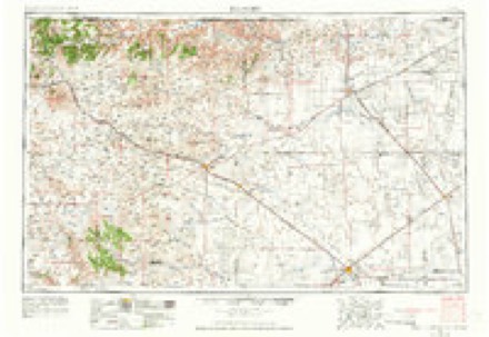
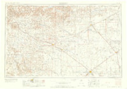
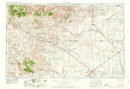
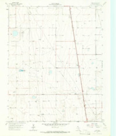
6 topographic sheets cover this place, the earliest surveyed in 1954 and the latest in 1965. It stands in the Stratford census division. It lies in ZIP code area 79084. The Survey maps it on the Lautz quadrangle.
Topographic sheets covering this place
4 surveys from 6 printed sheetsMatched by testing this settlement's coordinate against the published boundary of every sheet in the United States Geological Survey's historical collection. Each opens the scanned sheet at the Survey.
- 1954 USGS Dalhart quadrangle1:250000, 2 printings
- 1958 USGS Dalhart quadrangle1:250000, 2 printings
- 1962 USGS Dalhart quadrangle1:250000
- 1965 USGS Lautz quadrangle1:24000
Fires near this place
7 since 2006Regional context, not property-specific evidence. The federal wildfire occurrence database lists 7 fires within 5 miles of Lautz between 2006 and 2020, burning about 447 acres in total. 2 started naturally. None was recorded as arson. Distance is straight-line from the map coordinates, so a fire counted here may appear on a neighbouring settlement's page as well.
| Reported cause | Fires |
|---|---|
| Missing data/not specified/undetermined | 2 |
| Natural | 2 |
| Equipment and vehicle use | 2 |
| Power generation/transmission/distribution | 1 |
The most recent of them, most recent first, with the day each was reported and the service that recorded it.
| Date | Cause | Size | Reported by | Name on the report |
|---|---|---|---|---|
| 9 August 2008 | Missing data/not specified/undetermined | under an acre | Texas A & M Forest Service | not named |
| 13 July 2020 | Natural | 116 acres | Texas A & M Forest Service | COUNTY ROAD Y FIRE |
| 4 June 2006 | Natural | 10 acres | Texas A & M Forest Service | not named |
| 24 May 2013 | Missing data/not specified/undetermined | 20 acres | Texas A & M Forest Service | CR Y |
| 3 April 2009 | Power generation/transmission/distribution | under an acre | Texas A & M Forest Service | XCEL POWER LINE 54 E |
| 18 December 2008 | Equipment and vehicle use | 150 acres | Texas A & M Forest Service | not named |
| 18 December 2008 | Equipment and vehicle use | 150 acres | Texas A & M Forest Service | not named |
Storms near this place
60 of 79 shownRegional context, not property-specific evidence. The National Weather Service names Lautz in 79 storm reports between 1998 and 2025: 38 hail, 32 thunderstorm wind, 7 tornado, 1 flood. No death or injury is recorded in these reports. Each account below is quoted exactly as the forecast office filed it, from the NOAA Storm Events Database, and each date opens the federal record of that event.
| When | Event | Place named | Harm | What the report says |
|---|---|---|---|---|
| September 2012 | Thunderstorm Wind | Lautz | $40,000 | A storm chaser reported significant damage to a center pivot system due to the strong thunderstorm wind gusts on the north side of Texas State Highway 15 east of Stratford, Texas. There were no reports of injuries or fatalities. |
| August 2013 | Thunderstorm Wind | Lautz | $1,000 | A supercell thunderstorm moved southward across the Texas Panhandle during the evening hours of the 14th. A member of the public reported that horse trailers were blown over by a thunderstorm wind gust 15 miles east-southeast of Stratford (Sherman County). The thunderstorm continued moving southward after producing this gust. |
| April 2025 | Thunderstorm Wind | Lautz | - | The mesonet located nine miles north northeast of Sunray measured a 61mph wind gust at 1909 CST, followed by a 63mph wind gust at 1911 CST. |
| April 2025 | Thunderstorm Wind | Lautz | - | The mesonet located nine miles north northeast of Sunray measured a 70mph wind gust. |
| May 2024 | Thunderstorm Wind | Lautz | - | A period of severe wind gusts occurred at the 9NNE Sunray mesonet site. The first recorded wind gust of 58mph occurred at 5:04pm, with the peak gust of 74mph occurred at 5:14pm. Severe wind gusts continued for about ten minutes. |
| June 2024 | Thunderstorm Wind | Lautz | - | The Sunray mesonet station measured a 58 mph gust with lightning in the area. |
| May 2023 | Tornado (EFU) | Lautz | - | This tornado was reported and verified by video. No damage was found. Therefore, no survey was able to be conducted and the tornado was classified as an EF-Unknown. |
| July 2023 | Tornado (EFU) | Lautz | - | Tornado was captured on video by a storm chaser. The video showed there were twin tornadoes from the same circulation in very close proximity briefly. They remained in open county and didn't encounter any damage indicators. |
| May 2021 | Tornado (EFU) | Lautz | - | The tornado was documented via pictures and video by multiple|storm chasers and local media. It remained in open country|grassland and encountered no damage indicators. Path was|estimated based on reports and radar signatures. |
| May 2021 | Tornado (EF0) | Lautz | - | Multiple storm chasers recorded a large tornado crossing Highway|15 east of Stratford around 750 pm CDT. The tornado did not|damage the power lines along the highway and this was the basis|for the EF0 rating. Otherwise the tornado stayed in open country|grassland and farmlands and survey team found no damage anywhere|along the path which was estimated based on video and radar|evidence. |
| March 2020 | Tornado (EF0) | Lautz | - | A landspout tornado touched down approximately 10 miles north of Sunray. The tornado moved very little, remained in a field and did no damage, before lifting approximately 10 miles north of Sunray. This tornado was rated EF-0 with an estimated peak wind speed of 75 MPH. Location and path details are estimated based on photographs from a local storm spotter. |
| June 2020 | Hail | Lautz | - | Tennis ball size hail fell 5 miles northeast of Cactus. |
| April 2020 | Funnel Cloud | Lautz | - | This report of a funnel cloud 6 miles southwest of Stratford was received via mPING. |
| July 2019 | Thunderstorm Wind | Lautz | - | Tractor-trailer flipped on US Highway 287 between Cactus and Stratford. |
| May 2019 | Hail | Lautz | - | Chaser had a late report of golf ball hail. |
| June 2018 | Hail | Lautz | - | Spotter also reported very heavy rainfall. |
| June 2018 | Flood | Lautz | - | Heavy rain allowed for water to fill over the roadways. |
| May 2018 | Hail | Lautz | - | Late report of quarter size hail, with time estimated from radar. |
| May 2017 | Hail | Lautz | - | Golf ball hail southeast of Stratford. |
| May 2017 | Hail | Lautz | - | Hail dented car, cracked windshield. |
| June 2017 | Thunderstorm Wind | Lautz | - | Trained Spotter estimated 65 mph wind gust. |
| June 2017 | Thunderstorm Wind | Lautz | - | Late report of thunderstorm wind gusts between 65 to 70 mph. |
| June 2017 | Thunderstorm Wind | Lautz | - | Damage survey indicated a microburst associated with a severe thunderstorm caused damage to a well built structure and bent a radio tower 90 degrees, along with some irrigation and farm equipment. |
| June 2017 | Thunderstorm Wind | Lautz | - | Patio roof was blown off and also ripped the metal roof off part of the house. |
| June 2017 | Thunderstorm Wind | Lautz | - | Five to 6 power poles blown over onto FM Road 1573 seven miles east of HWY 287. |
| June 2017 | Thunderstorm Wind | Lautz | - | A microburst associated with a severe thunderstorm damaged center pivots of irrigation equipment and snapped 13 power poles. The damage path associated with the microburst had a path length of 2.3 miles, a path width of 2.1 miles, and ended around 912 PM CDT. |
| June 2015 | Hail | Lautz | - | Hail ranging from quarter to golf ball size fell 12 miles east of Stratford. Most of the hailstones were around the size of quarters with only a few golf ball size stones. |
| August 2015 | Thunderstorm Wind | Lautz | - | A wind gust of 60 mph was estimated by storm spotters. |
| November 2015 | Hail | Lautz | - | Golf ball size hail was reported 8 miles north of Sunray. |
| July 2014 | Thunderstorm Wind | Lautz | - | A discrete supercell thunderstorm developed over northern Sherman County during the evening hours of the 16th. As this storm moved southeastward towards the town of Gruver (Hansford County), a storm chaser estimated a 70 mph wind gust 14 miles west-southwest of Gruver (Sherman County). After producing this gust the storm continued moving southeastward across the county. |
| July 2014 | Hail | Lautz | - | A discrete supercell thunderstorm developed over northern Sherman County during the evening hours of the 16th. As this storm moved southeastward towards the town of Gruver (Hansford County), a storm chaser reported quarter size hail (1.00 inch) 14 miles west of Gruver (Sherman County). After producing this hail the storm continued moving southeastward across the county. |
| June 2013 | Thunderstorm Wind | Lautz | - | Scattered thunderstorms moved into the northern Texas Panhandle during the late night hours of the 18th. A thunderstorm produced a downburst 10 miles east of the town of Stratford (Sherman County). A storm spotter in this location reported he was almost blown off the road by the gust and estimated the winds to be 60 mph. |
| April 2007 | Tornado (EF0) | Lautz | - | The tornado touched down in open country just north of the Moore County line approximately twenty-two and a half miles southeast of Stratford at 1958 CST. The tornado traveled northeast and dissipated at 2012 CST just north of Farm to Market Road 1573 approximately twenty-one and a half miles east southeast of Stratford. No damage or injuries were reported. |
| October 2007 | Hail | Lautz | - | Reported five miles north of Sunray. |
| October 2007 | Hail | Lautz | - | Reported seventeen miles southwest of Gruver. |
| June 2006 | Tornado (F0) | Lautz | - | A small landspout tornado remained over open country. The path width and path length were estimated. No damage or injuries were reported. |
| August 2025 | Thunderstorm Wind | Lautz | - | no account filed |
| June 2025 | Thunderstorm Wind | Lautz | - | no account filed |
| May 2024 | Thunderstorm Wind | Lautz | - | no account filed |
| May 2024 | Thunderstorm Wind | Lautz | - | no account filed |
| July 2024 | Thunderstorm Wind | Lautz | - | no account filed |
| July 2024 | Thunderstorm Wind | Lautz | - | no account filed |
| June 2024 | Thunderstorm Wind | Lautz | - | no account filed |
| February 2023 | Thunderstorm Wind | Lautz | - | no account filed |
| August 2023 | Thunderstorm Wind | Lautz | - | no account filed |
| August 2023 | Thunderstorm Wind | Lautz | - | no account filed |
| May 2023 | Thunderstorm Wind | Lautz | - | no account filed |
| May 2023 | Hail | Lautz | - | no account filed |
| May 2023 | Hail | Lautz | - | no account filed |
| May 2023 | Thunderstorm Wind | Lautz | - | no account filed |
| July 2023 | Thunderstorm Wind | Lautz | - | no account filed |
| July 2023 | Thunderstorm Wind | Lautz | - | no account filed |
| June 2023 | Hail | Lautz | - | no account filed |
| April 2022 | Thunderstorm Wind | Lautz | - | no account filed |
| June 2022 | Thunderstorm Wind | Lautz | - | no account filed |
| May 2021 | Hail | Lautz | - | no account filed |
| June 2019 | Hail | Lautz | - | no account filed |
| May 2019 | Hail | Lautz | - | no account filed |
| June 2018 | Hail | Lautz | - | no account filed |
| May 2017 | Hail | Lautz | - | no account filed |
Nearest settlements
The eight closest, with where each one stands in the county. Distances are straight-line, computed from the Geographic Names Information System coordinates.
Provenance
This settlement is recorded in the Geographic Names Information System as feature 1380065. The sheet list is computed by point-in-boundary test against the United States Geological Survey's historical topographic inventory. Both are works of the United States government and carry no copyright under 17 U.S.C. 105.
Wildfire. Short, Karen C. 2022. Spatial wildfire occurrence data for the United States, 1992-2020 [FPA_FOD_20221014]. 6th Edition. Fort Collins, CO: Forest Service Research Data Archive. https://doi.org/10.2737/RDS-2013-0009.6 Collected with United States Government funding and usable without additional permissions or fees.
Storms. NOAA National Centers for Environmental Information, Storm Events Database https://www.ncei.noaa.gov/stormevents/ A work of the United States government, no copyright under 17 U.S.C. 105. Narratives are quoted verbatim from the National Weather Service report and are not edited or summarised.