 Block
BlockLewisville, Texas
13 topographic sheets cover this place, the earliest surveyed in 1925 and the latest in 1985. It stands in the Lewisville-Flower Mound census division. It lies in ZIP code area 75057. It stands on Prairie Creek. The Survey maps it on the Lewisville East quadrangle. 111,822 people lived here at the 2020 count. It stands 558 feet above sea level.
Research this city
Population over time
2 figuresLewisville grew from 95,290 to 111,822 between 2010 and 2020. These are the recorded population figures Wikidata holds for this place, reached through the Geographic Names Information System number this page is keyed on rather than by name, so they belong to this place and not to another of the same name. Most are census counts, but not all are: an early figure may be a founding or settlement estimate, and an estimate published within five years of a census is left out. The change column is computed, and is left blank where more than 20 years separate a figure from the one before it, because a gap that long is not a change between two counts.
| Year | People | Change |
|---|---|---|
| 2010 | 95,290 | |
| 2020 | 111,822 | +16,532 (+17%) |
Topographic sheets covering this place
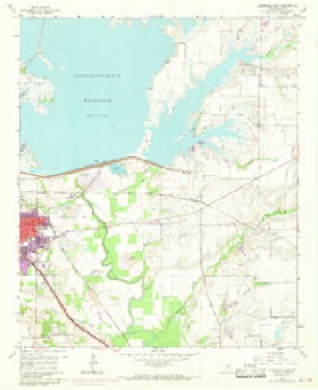
6 surveys from 13 printed sheetsMatched by testing this settlement's coordinate against the published boundary of every sheet in the United States Geological Survey's historical collection. Each opens the scanned sheet at the Survey.
- 1925 USGS Mc Kinney 3-c quadrangle1:48000
- 1929 USGS Frisco quadrangle1:62500, 2 printings
- 1954 USGS Sherman quadrangle1:250000, 2 printings
- 1958 USGS Sherman quadrangle1:250000
- 1960 USGS Lewisville East quadrangle1:24000, 5 printings
- 1985 USGS McKinney quadrangle1:100000, 2 printings
What the histories say of this town
414 words1 chapter about Lewisville from the published histories of the county, public domain and reproduced complete.
| Chapter | From | Length |
|---|---|---|
| History | History and Reminiscences of Denton County (1918) | 414 words |
Fires near this place
37 since 2005Regional context, not property-specific evidence. The federal wildfire occurrence database lists 37 fires within 5 miles of Lewisville between 2005 and 2017, burning about 94 acres in total. None started naturally. 1 was recorded as arson. Distance is straight-line from the map coordinates, so a fire counted here may appear on a neighbouring settlement's page as well.
| Reported cause | Fires |
|---|---|
| Missing data/not specified/undetermined | 19 |
| Smoking | 9 |
| Equipment and vehicle use | 4 |
| Misuse of fire by a minor | 2 |
| Arson/incendiarism | 1 |
| Power generation/transmission/distribution | 1 |
| Debris and open burning | 1 |
The most recent of them, most recent first, with the day each was reported and the service that recorded it.
| Date | Cause | Size | Reported by | Name on the report |
|---|---|---|---|---|
| 27 August 2010 | Smoking | 1.0 acres | Texas A & M Forest Service | 1601 JUSTIN |
| 2 August 2010 | Debris and open burning | under an acre | Texas A & M Forest Service | 2221 SHUMARD |
| 5 July 2013 | Missing data/not specified/undetermined | under an acre | Texas A & M Forest Service | GRASS FIRE |
| 4 July 2013 | Missing data/not specified/undetermined | under an acre | Texas A & M Forest Service | GRASS FIRE |
| 6 April 2011 | Smoking | under an acre | Texas A & M Forest Service | 5208 CORAL SPRINGS |
| 25 April 2017 | Missing data/not specified/undetermined | 1.0 acres | Texas A & M Forest Service | NONE |
| 22 April 2010 | Equipment and vehicle use | under an acre | Texas A & M Forest Service | 1704 KIRKPATRICK |
| 20 March 2013 | Missing data/not specified/undetermined | under an acre | Texas A & M Forest Service | GRASS FIRE |
Settlements close enough to share some of these fires:
Mines and quarries near this place
10 of 11 shownRegional context, not property-specific evidence. The federal mineral resources record lists 11 workings within 5 miles of Lewisville: 5 producers, 5 past producers, 1 unknown. 5 still produce. What was taken out: Sand and Gravel, Construction. Distance is straight-line from the map coordinates, so a quarry counted here may appear on a neighbouring settlement's page as well.
| Where | Site | Commodity | Status | Recorded |
|---|---|---|---|---|
| Butch Villanueva Abandoned Pit | Sand and Gravel, Construction | Past Producer | ||
| Fred Lueck Excavating Operation | Sand and Gravel, Construction | Producer | ||
| H S Jackson S & G Operations-Plant | Sand and Gravel, Construction | Unknown | ||
| Sparkman Sand and Gravel Operation | Sand and Gravel, Construction | Producer | ||
| Swor Sand and Gravel Pit Three | Sand and Gravel, Construction | Producer | ||
| Ten Hagen Pit | Sand and Gravel, Construction | Producer | ||
| Tom Conley and Associates Operation | Sand and Gravel, Construction | Producer | ||
| Unknown | Sand and Gravel, Construction | Past Producer | ||
| Unknown | Sand and Gravel, Construction | Past Producer | ||
| Unknown | Sand and Gravel, Construction | Past Producer |
Storms near this place
60 of 128 shownRegional context, not property-specific evidence. The National Weather Service names Lewisville in 128 storm reports between 1993 and 2025: 72 hail, 36 thunderstorm wind, 10 flash flood, 4 tornado. The reports record 3 deaths and 2 injuries. Each account below is quoted exactly as the forecast office filed it, from the NOAA Storm Events Database, and each date opens the federal record of that event.
| When | Event | Place named | Harm | What the report says |
|---|---|---|---|---|
| July 2012 | Thunderstorm Wind | Lewisville | 2 killed | Two teenage brothers drowned at Lake Lewisville after 40 MPH outflow winds moved across the lake. The boys were swimming at the time and one brother was swept out due to the strong winds. The other went out to help him. Both boys were recovered that evening by dive teams. |
| June 2022 | Flood | Lewisville | 1 killed, 1 hurt | Broadcast media reported that a woman drowned after waters rose in a ravine that she and her husband were located in near the intersection of Southwest Parkway and Bellaire Blvd in Lewisville, TX. The man broke his legs while fleeing the rising waters. |
| September 1997 | Lightning | Lewisville | 1 hurt | A girl was struck and injured by lightning outside her high school. |
| March 2016 | Hail | Lewisville | $50,000,000 | Hail up to the size of golf balls fell near Business 121 and Southwest Parkway in Lewisville. |
| March 2016 | Hail | Lewisville | $50,000,000 | A social media report indicated ping pong to golf-ball sized hail in Lewisville, TX. |
| April 2012 | Hail | Lewisville | $2,000,000 | Hen egg sized hail was reported near State Highway 121 and MacArthur Blvd in Lewisville. |
| March 2017 | Tornado (EF1) | Lewisville | $600,000 | A National Weather Service survey crew determined a tornado produced EF-1 damage in the city of Lewisville. The damage began near the intersection of Fox avenue and Boxwood, before moving to the north and northeast, ending near I-35E. Severe damage was done to about ten homes, with 5 homes losing part of the roof, along with blown out windows. The damage was most concentrated at the beginning of the tornado, yet several businesses and government buildings suffered damage as the storm quickly moved through part of Lewisville. |
| June 2023 | Hail | Lewisville | $500,000 | A trained spotter reported tennis ball sized hail in Lewisville. |
| June 2023 | Hail | Lewisville | $500,000 | A trained spotter reported hail up to 3-inches in diameter in Highland Village. |
| April 2012 | Hail | Lewisville | $500,000 | Golf ball sized hail was reported near Lake Lewisville. |
| September 1993 | Tornado (F1) | Lewisville | $500,000 | to 3 NE Little Elm,A tornado touched down at Farm-to-Market Road 3040 and Interstate 35E, then moved north-northeast to 3 miles northeast of Little Elm before lifting. Damage to several homes was reported, and a mobile home was destroyed. A furniture truck was blown onto a car, severely damaging both vehicles. |
| August 1995 | Thunderstorm Wind | Lewisville | $400,000 | A microburst destroyed the Pier 21 Marina, damaged 40 boats and sunk four others. |
| May 2024 | Thunderstorm Wind | Lewisville | $300,000 | Intense thunderstorm winds caused damage across the City of Lewisville. Trees and powerlines were down, one structure collapsed, an 18 wheeler overturned near Hwy 121 and Josey, and multiple wrecks were reported on I-35 north and south. |
| June 2023 | Hail | Lewisville | $200,000 | Oblong 2.5-inch diameter hail was reported between Highland Village and Lewisville. |
| June 2009 | Tornado (EF1) | Lewisville | $200,000 | The Villas at Waterchase apartment complex in Lewisville was hit by an EF-1 tornado. Sixteen units sustained some type of structural damage. Four chimneys were snapped off roofs on various buildings, a brick wall crumpled on one building and the roof of the same building was peeled back exposing the apartment homes. |
| June 1997 | Thunderstorm Wind | Lewisville | $120,000 | Strong winds overturned a mobile home. Trees and power lines were also downed by the strong winds. A large tree was blown onto a house resulting in major damage. |
| March 2016 | Hail | Lewisville | $100,000 | Walnut sized hail was reported south of Lewisville. |
| March 2000 | Thunderstorm Wind | Lewisville | $100,000 | Two homes destroyed, several other Houses unroofed. Occurred in The Colony. |
| June 2023 | Hail | Lewisville | $100,000 | no account filed |
| October 1996 | Hail | Lewisville | $100,000 | no account filed |
| December 2002 | Tornado (F0) | Lewisville | $75,000 | A small tornado briefly touched down in The Colony at Alta Oaks Lane and Alta Oaks Court, doing widespread damage to fences, trees, and unroofing two houses. There were no injuries. |
| August 2001 | Lightning | Lewisville | $70,000 | Lightning started a fire in Flower Mound. |
| May 2015 | Lightning | Lewisville | $50,000 | Lightning struck a home in the 1300 block of Saddleback Lane in Lewisville, TX, damaging the home and destroying 2 cars in the garage. |
| April 2011 | Hail | Lewisville | $50,000 | no account filed |
| June 1996 | Thunderstorm Wind | Lewisville | $50,000 | no account filed |
| July 1996 | Thunderstorm Wind | Lewisville | $50,000 | no account filed |
| November 2015 | Thunderstorm Wind | Lewisville | $30,000 | An 18 wheeler was flipped over in the Walmart parking lot on Round Grove Road in Lewisville. |
| June 2024 | Flash Flood | Lewisville | $20,000 | Local emergency management reported several stranded vehicles in high water at several locations across the city of Flower Mound, but all occupants were out of their vehicles by report time. |
| March 2017 | Hail | Lewisville | $20,000 | A social media report indicated hail from quarter sized to baseball sized near Lewisville, TX. |
| August 1995 | Thunderstorm Wind | Lewisville | $20,000 | Two homes were damaged by high winds on the east shore of the Lake. |
| March 2019 | Hail | Lewisville | $15,000 | Two inch hail was reported to the EM on social media near the intersection of Jones St. and North Mill St in Lewisville. |
| June 2009 | Thunderstorm Wind | Lewisville | $15,000 | Part of the roof of City Garage at Princeton Street and Valley Parkway was torn off and landed on a nearby home. The Lewisville Visitor's Center also sustained roof damage and had to be closed. |
| June 2003 | Thunderstorm Wind | Lewisville | $15,000 | Roof damage was reported by a spotter. A home under construction had the second story blown off by high winds. |
| June 2011 | Thunderstorm Wind | Lewisville | $12,000 | Severe thunderstorm winds tore the roof off of Ojedas Mexican Restaurant in Lewisville. The roof was blown into an apartment complex behind the restaurant. |
| September 2018 | Flash Flood | Lewisville | $10,000 | Emergency management reported that several intersections were blocked due to high water, and one house was flooded near the 100 block of Stuart Street. |
| July 2016 | Thunderstorm Wind | Lewisville | $10,000 | A dock on Lake Lewisville broke free of its anchoring and collided with another dock due to gusty winds from a thunderstorm. |
| May 1999 | Lightning | Lewisville | $10,000 | Lightning started a fire that did 10,000 dollars worth of damage to a home under construction in Flower Mound. |
| May 2024 | Hail | Lewisville | $8,000 | Social media picture reported golf ball hail just to the SSE of Lewisville. |
| June 2011 | Thunderstorm Wind | Lewisville | $8,000 | Severe thunderstorm winds around 65 MPH were estimated 2 miles southeast of Highland Village. |
| April 2011 | Hail | Lewisville | $7,000 | Half dollar sized hail was reported northeast of Flower Mound. |
| April 2011 | Thunderstorm Wind | Lewisville | $6,000 | A trained spotter estimated 60 mph winds near Lewisville. |
| June 2009 | Thunderstorm Wind | Lewisville | $6,000 | A 3 foot diameter tree fell onto a house near College Avenue and Kilpatrick Lane. At the intersection of Whitney and Merritt, several large bradford pear trees and silver maple trees were knocked down. Other downed tree branches, uprooted trees, downed power lines, and downed fences were reported throughout Flower Mound. |
| June 2019 | Thunderstorm Wind | Lewisville | $5,000 | Emergency management reported five power poles were knocked down near College Pkwy and Kirkpatrick in Flower Mound from thunderstorm outflow winds. Other minor damage was reported on the east side of town. |
| June 2019 | Thunderstorm Wind | Lewisville | $5,000 | Emergency management reported multiple trees and power lines down in the city of Lewisville, TX. The report also mentioned: ||1200 Valley Ridge Blvd - Trees knocked down into the street|1000 N Summit - Large Tree down in the road|SRT SB @ 35 large sign knocked down|1000 W Round Grove Power Lines Down|1200 Cloudy Sky - Tree Down|1300 W Corporate - Power Poles Snapped|700 E 121 Business Car Canopy blown down multiple power poles snapped|400 Crockett - Power Lines Down|1125 Pebblebrook Power Lines Down|243 Teakwood - Tree blocking entrance of the house|350 E Corporate - Multiple trees down. |
| March 2016 | Hail | Lewisville | $5,000 | A public report indicated half-dollar sized hail near the intersection of Yaggi Drive and China Berry Drive in Flower Mound, TX. Half dollar sized hail was also reported around other parts of Flower Mound for several minutes. |
| June 2009 | Thunderstorm Wind | Lewisville | $5,000 | Tree limbs that were 3-6 inches in diameter were broken off near the border of Flower Mound and Lewisville. |
| July 2004 | Thunderstorm Wind | Lewisville | $2,000 | There were numerous reports of trees down in the city. |
| February 1999 | Thunderstorm Wind | Lewisville | $2,000 | Thunderstorm winds blew down power lines. |
| June 1997 | Thunderstorm Wind | Lewisville | $2,000 | Strong winds blew down power lines |
| June 1996 | Thunderstorm Wind | Lewisville | $2,000 | no account filed |
| April 1996 | Thunderstorm Wind | Lewisville | $2,000 | no account filed |
| July 2016 | Thunderstorm Wind | Lewisville | $1,000 | Large tree limbs and branches (>2) down in Flower Mound. |
| March 2025 | Hail | Lewisville | - | Public report of half dollar sized hail in Lewisville. |
| June 2025 | Flash Flood | Lewisville | - | Broadcast media reported that a section of I-35 was flooded and impassable in Lewisville. |
| June 2025 | Thunderstorm Wind | Lewisville | - | A trained spotter reported a measured wind gust of 65 mph near the intersection of Interstate 35E and Highway 407 northwest of Lewisville. |
| May 2024 | Hail | Lewisville | - | Report from mPING: Quarter (1.00 in.). |
| May 2024 | Hail | Lewisville | - | Report from mPING: Dime (0.75 in.). |
| May 2024 | Hail | Lewisville | - | Report from mPING: Quarter (1.00 in.). |
| May 2023 | Hail | Lewisville | - | Penny size hail was reported via mPING. |
| May 2023 | Hail | Lewisville | - | An emergency manager reported quarter size hail in Flower Mound. |
Nearest settlements
The eight closest, with where each one stands in the county. Distances are straight-line, computed from the Geographic Names Information System coordinates.
| Map | Place | Distance | Sheets |
|---|---|---|---|
| Highland Village | 4.2 miles | 12 | |
| Lake Dallas | 5.3 miles | 12 | |
| Harbor Grove | 5.5 miles | 12 | |
| Hidden Hill | 5.8 miles | 12 | |
| Hickory Creek | 5.9 miles | 12 | |
| Flower Mound | 5.9 miles | 12 | |
| Double Oak | 6.3 miles | 12 | |
| Copper Canyon | 6.4 miles | 12 |
Elsewhere
Matched on this settlement's Geographic Names Information System number rather than its name, so it cannot be a different place of the same name in another state.
| Wikipedia article on Lewisville | An encyclopaedic summary. Its text is share-alike, so it is linked here rather than copied. |
| Wikidata item Q26495 | The structured record the population and elevation above come from. Public domain (CC0). |
Provenance
This settlement is recorded in the Geographic Names Information System as feature 1339860. The sheet list is computed by point-in-boundary test against the United States Geological Survey's historical topographic inventory. Both are works of the United States government and carry no copyright under 17 U.S.C. 105.
Wildfire. Short, Karen C. 2022. Spatial wildfire occurrence data for the United States, 1992-2020 [FPA_FOD_20221014]. 6th Edition. Fort Collins, CO: Forest Service Research Data Archive. https://doi.org/10.2737/RDS-2013-0009.6 Collected with United States Government funding and usable without additional permissions or fees.
Mines and quarries. USGS Mineral Resources Data System (MRDS) https://mrdata.usgs.gov/mrds/ A work of the United States government, no copyright under 17 U.S.C. 105.
Storms. NOAA National Centers for Environmental Information, Storm Events Database https://www.ncei.noaa.gov/stormevents/ A work of the United States government, no copyright under 17 U.S.C. 105. Narratives are quoted verbatim from the National Weather Service report and are not edited or summarised.