 Block
BlockLufkin, Texas
14 topographic sheets cover this place, the earliest surveyed in 1949 and the latest in 1992. It stands in the Lufkin census division. It lies in ZIP code area 75901. The Survey maps it on the Lufkin quadrangle. 34,143 people lived here at the 2020 count. It stands 312 feet above sea level.
Research this city
On record in Lufkin
Buildings and businesses the archive holds for this place. Each opens its own page, with the source record it came from.
On the National Register 12 of 38 shown
 Abercrombie-Cavanaugh Houselisted 1988
 Angelina River Bridgelisted 1988
 Banks-Ogg Houselisted 1988
 Behannon-Kenley Houselisted 1988
 Binion-Casper Houselisted 1989
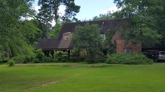 Bowers-Felts Houselisted 1988
 Boynton-Kent Houselisted 1988
 Brookshire, Houston-Yeates Houselisted 1988
 Byus-Kirkland Houselisted 1988
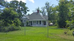 Clark-Whitton Houselisted 1988
 Corstone Sales Companylisted 1988
 Everitt-Cox Houselisted 1988
Every listing in Angelina County
Surveyed buildings and structures 1 record
- John Gann House, Route 94 Vicinity, Lufkinfederal building survey, 2 photographs
Population over time
3 figuresLufkin grew from 32,709 to 34,143 between 2000 and 2020. These are the recorded population figures Wikidata holds for this place, reached through the Geographic Names Information System number this page is keyed on rather than by name, so they belong to this place and not to another of the same name. Most are census counts, but not all are: an early figure may be a founding or settlement estimate, and an estimate published within five years of a census is left out. The change column is computed, and is left blank where more than 20 years separate a figure from the one before it, because a gap that long is not a change between two counts.
| Year | People | Change |
|---|---|---|
| 2000 | 32,709 | |
| 2010 | 35,067 | +2,358 (+7%) |
| 2020 | 34,143 | -924 (-3%) |
Topographic sheets covering this place
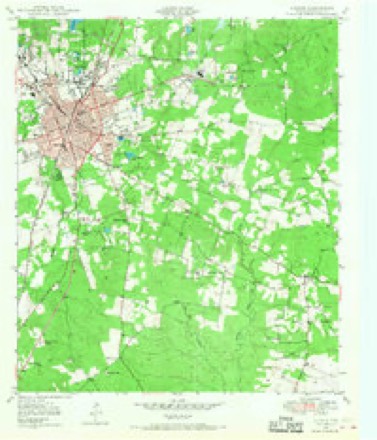
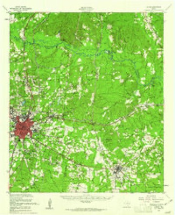
8 surveys from 14 printed sheetsMatched by testing this settlement's coordinate against the published boundary of every sheet in the United States Geological Survey's historical collection. Each opens the scanned sheet at the Survey.
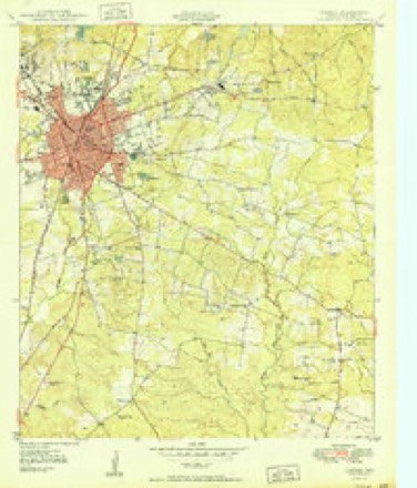
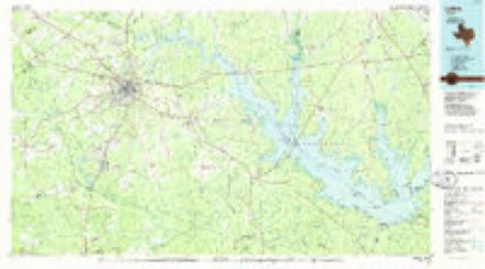
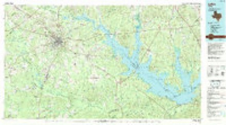
- 1949 USGS Lufkin quadrangle1:24000, 3 printings
- 1949 USGS Lufkin quadrangle1:62500, 2 printings
- 1950 USGS Lufkin quadrangle1:24000
- 1953 USGS Palestine quadrangle1:250000, 2 printings
- 1957 USGS Palestine quadrangle1:250000
- 1984 USGS Palestine quadrangle1:250000, 3 printings
- 1986 USGS Lufkin quadrangle1:100000
- 1992 USGS Lufkin quadrangle1:100000
Photographs
8 of 41 photographs shown, 1943 to 2022Taken for the Office of War Information and the Farm Security Administration, who photographed the country between 1935 and 1944. Works of United States government photographers, with no known restriction on use. Each opens its catalogue record.
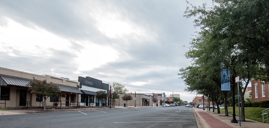
Highsmith, Carol M, 2022. Library of Congress

Vachon, John, 1943. Library of Congress
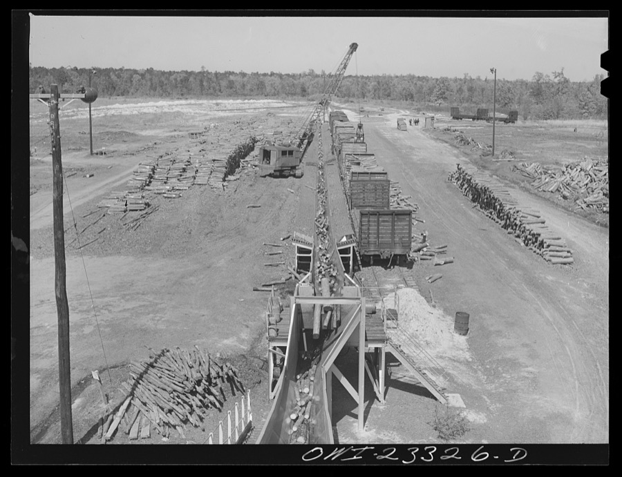
Vachon, John, 1943. Library of Congress

Vachon, John, 1943. Library of Congress

Vachon, John, 1943. Library of Congress

Vachon, John, 1943. Library of Congress

Vachon, John, 1943. Library of Congress

Vachon, John, 1943. Library of Congress
Every photograph of Angelina County
Fires near this place
273 since 1992Regional context, not property-specific evidence. The federal wildfire occurrence database lists 273 fires within 5 miles of Lufkin between 1992 and 2020, burning about 1,405 acres in total. 3 started naturally. 32 were recorded as arson. Distance is straight-line from the map coordinates, so a fire counted here may appear on a neighbouring settlement's page as well.
| Reported cause | Fires |
|---|---|
| Debris and open burning | 176 |
| Arson/incendiarism | 32 |
| Missing data/not specified/undetermined | 32 |
| Equipment and vehicle use | 9 |
| Power generation/transmission/distribution | 7 |
| Smoking | 5 |
| Misuse of fire by a minor | 4 |
| Natural | 3 |
| Fireworks | 2 |
| Railroad operations and maintenance | 2 |
| Recreation and ceremony | 1 |
The most recent of them, most recent first, with the day each was reported and the service that recorded it.
| Date | Cause | Size | Reported by | Name on the report |
|---|---|---|---|---|
| 8 September 2011 | Debris and open burning | 1.0 acres | Texas A & M Forest Service | GRASS/WOODS/FM 2251 |
| 5 September 2013 | Debris and open burning | 1.0 acres | Texas A & M Forest Service | GRASS WOODS/3226 HWY 69N |
| 5 September 2013 | Debris and open burning | 1.0 acres | Texas A & M Forest Service | GRASS WOODS/CROSSTIMBERS |
| 4 September 2019 | Missing data/not specified/undetermined | 1.0 acres | Texas A & M Forest Service | GRASS FIRE HWY 69 NORTH |
| 4 September 2000 | Equipment and vehicle use | 30 acres | Texas A & M Forest Service | WOODVILLE - 655 |
| 4 September 2000 | Arson/incendiarism | 1.0 acres | Texas A & M Forest Service | WOODVILLE - 667 |
| 4 September 2000 | Debris and open burning | 40 acres | Texas A & M Forest Service | WOODVILLE - 660 |
| 30 September 2008 | Debris and open burning | 2.0 acres | Texas A & M Forest Service | not named |
Settlements close enough to share some of these fires:
Mines and quarries near this place
2 within 5 milesRegional context, not property-specific evidence. The federal mineral resources record lists 2 workings within 5 miles of Lufkin: 1 past producer, 1 producer. 1 still produces. What was taken out: Bentonite. Distance is straight-line from the map coordinates, so a quarry counted here may appear on a neighbouring settlement's page as well.
| Where | Site | Commodity | Status | Recorded |
|---|---|---|---|---|
| Southern Clay Products Pit | Bentonite | Producer | ||
| Unnamed Pit | Bentonite | Past Producer | Sedimentary |
Storms near this place
60 of 176 shownRegional context, not property-specific evidence. The National Weather Service names Lufkin in 176 storm reports between 1993 and 2025: 72 thunderstorm wind, 68 hail, 31 flash flood, 2 lightning. The reports record 1 death and 4 injuries. Each account below is quoted exactly as the forecast office filed it, from the NOAA Storm Events Database, and each date opens the federal record of that event.
| When | Event | Place named | Harm | What the report says |
|---|---|---|---|---|
| May 2013 | Lightning | Lufkin | 1 killed | A woman was struck by lightning and killed outside an eating establishment during the nighttime hours of May 21st. She was standing outside adjacent to the restaurant holding an umbrella when she was struck. According to a Lufkin Police spokesman, lightning entered her upper torso and exited her feet. A chunk of concrete was blown out of the parking lot in a space to the side of the business where she was hit.|A witness said he was inside the restaurant when he heard and saw an explosion followed by sparks flying off of her and her umbrella. At first she had stopped breathing, then began again and was put inside an ambulance but she died a short time later at an area hospital. |
| December 2009 | Tornado (EF3) | Lufkin | 2 hurt, $10,000,000 | An EF3 tornado touched down on the south side of Lufkin, on Loop 287 near Olive Garden just west of the intersections Loop 287 and South Chestnut Street. The tornado then tracked north northeast causing roof and tree damage to several homes behind Morgan Insurance Company on Loop 287. The tornado continued its north northeastward track then crossed South Chestnut causing major damage|to Gibson Funeral Home. It then tracked northward through a residential neighborhood causing more tree and roof damage, before destroying Max Welding Shop on Denman Rd. The tornado crossed Denman Road moving through another residential area causing moderate to major tree and roof damage. The tornado then destroyed the VFW building just before crossing Lufkin Avenue. More residential damage was observed between Lufkin Avenue and Atkinson Drive. The tornado crossed Atkinson Drive causing major damage by tossing several 18-wheelers parked at a trucking|company on Loop 287. The tornado then crossed Loop 287, damaging Goodyear Tires and Jim Walter Homes. The storm then tracked north into a wooded area before reaching Kit McConnico Park and causing moderate to major damage to the park. The|tornado lifted on the northern end of Kit McConnico Park around 10:07 PM. |
| May 2001 | Thunderstorm Wind | Lufkin | 1 hurt, $22,000 | Tree fell through a travel trailer at Hanks Creek Park at Sam Rayburn Reservoir. |
| January 1997 | Lightning | Lufkin | 1 hurt | no account filed |
| February 1998 | Thunderstorm Wind | Lufkin | $2,500,000 | Winds were recorded at the Lufkin Airport. Reports of 150 power poles were toppled with numerous trees across homes and vehicles. |
| November 2000 | Flash Flood | Lufkin | $500,000 | A 2 lane wood and steel bridge collapsed on County Road off Highway 69 due to excessive flooding. |
| December 2007 | Thunderstorm Wind | Lufkin | $200,000 | Half a dozen trees and several powerlines were downed in the Brookhollow and Mantooth neighboorhoods in Lufkin, Texas. One tree fell on top of an automobile. a local church had two large plate glass windows blown inward by the winds. Parts of air conditioning units were also blown off the roof of the Angelina Village and the Lufkin Mall. The winds also peeled off a metal roof of a rectory at the St. Andrew Church. With the roof gone, rain quickly soaked and collapsed the ceilings into the interior of the home. |
| December 2013 | Thunderstorm Wind | Lufkin | $150,000 | Wind damage was quite extensive in and around the Lufkin, Texas area. Numerous trees and power lines were downed including a tree down on a house on the 1700 block of Courtney Lane. A local retailer on FM 58 lost at least two of its portable buildings in the wake of the strong winds. An entire wall on a South Chestnut Street business was completely torn down by the winds. Another local retailer experienced damage to its AC units along with falling ceiling tiles. At the DPS office in Lufkin, the storm shattered the back window of a DPS truck and broke the windows of an employee's personal vehicle. |
| May 2017 | Tornado (EF0) | Lufkin | $100,000 | An EF0 tornado first touched down at the intersection of Church Street and Grant Avenue and began to move east southeast through southeast Lufkin. During this stretch, several large trees were uprooted , knocking over power poles and taking down power lines. A few of these trees fell directly on to homes. The tornado crossed the 287 loop between Highway 69 and CR 841. Several large trees were uprooted and numerous large branches were broken off as it paralleled Fannie Carrell Road as it continued southeast, eventually crossing CR 841 near Fish Road. The tornado lifted near the intersection of Flen Gary Road and CR 326 but not before knocking over several more large trees there, with one on a home. |
| July 1994 | Hail | Lufkin | $50,000 | Trees and power lines were blown down by thunderstorm winds. |
| July 1994 | Thunderstorm Wind | Lufkin | $50,000 | Trees and power lines were blown down by thunderstorm winds. |
| April 2005 | Thunderstorm Wind | Lufkin | $40,000 | A downburst resulted in two trees falling on a home along Hwy 69. The downburst also resulted in minor roof damage to other homes along with two business signs blown over and a dumpster overturned near Hwy 69 north and north of loop 287. |
| September 2000 | Thunderstorm Wind | Lufkin | $40,000 | A home roof was damaged and street lamps were pushed over along with numerous trees. |
| June 2007 | Thunderstorm Wind | Lufkin | $30,000 | Portion of a roof was completely blown off a building in town. |
| January 2005 | Thunderstorm Wind | Lufkin | $25,000 | Several trees uprooted and a roof was partially removed from a house. Several powerlines downed. |
| July 2005 | Thunderstorm Wind | Lufkin | $25,000 | A tree was blown down onto a home in town. |
| July 2005 | Flash Flood | Lufkin | $25,000 | A few city streets had to be closed due to excessive heavy rainfall and the resulting high water. |
| June 2004 | Thunderstorm Wind | Lufkin | $20,000 | Trees downed throughout the county...including one on a home in town. |
| August 1998 | Thunderstorm Wind | Lufkin | $12,000 | Trees and powerlines toppled along FM 842 and SR 103. |
| December 2012 | Thunderstorm Wind | Lufkin | $10,000 | A roof was blown off a mobile home on Hwy. 103 east in Lufkin, Texas. Large tree limbs were also blown down. |
| June 2004 | Flash Flood | Lufkin | $10,000 | High water on Hwys 58, 59, 818, 819 and FM 324 caused considerable problems in and south of town. High water went into a few homes and flooded an automobile. |
| October 1994 | Thunderstorm Wind | Lufkin | $5,000 | Trees were blown down. |
| May 1993 | Thunderstorm Wind | Lufkin | $5,000 | Dime-size hail was reported north of Lufkin along Highway 59. Minor wind damage was reported to some roofs. |
| September 1993 | Thunderstorm Wind | Lufkin | $5,000 | A tree was blown onto powerlines on Farm-to-Market Road 2021. |
| March 1995 | Thunderstorm Wind | Lufkin | $3,000 | Trees and power lines were blown down by high winds. |
| November 1996 | Thunderstorm Wind | Lufkin | $3,000 | no account filed |
| July 1995 | Thunderstorm Wind | Lufkin | $2,000 | Trees and power lines were blown down by high winds. |
| March 2025 | Thunderstorm Wind | Lufkin | - | Report from Mping. |
| January 2024 | Flash Flood | Lufkin | - | Flash flooding was reported along Pershing Avenue near Chambers Park. |
| January 2024 | Flash Flood | Lufkin | - | Flash flooding was reported along Frank Avenue in front of Chi-St. Luke's Health Memorial Hospital. |
| June 2024 | Thunderstorm Wind | Lufkin | - | Trees downed in and around Lufkin. |
| May 2024 | Thunderstorm Wind | Lufkin | - | Large tree downed on a public pathway at Ellen Trout Zoo. |
| May 2024 | Thunderstorm Wind | Lufkin | - | Large oak tree split and uprooted, blocking the roadway on Willow Drive. |
| May 2024 | Thunderstorm Wind | Lufkin | - | Several trees downed in Lufkin as well as Diboll and Etoile. |
| April 2023 | Flash Flood | Lufkin | - | Tulane Drive at the Highway 287 Loop and South Medford Drive in Lufkin was flooded. |
| March 2022 | Hail | Lufkin | - | Quarter size hail fell on the south side of Lufkin. |
| August 2022 | Flash Flood | Lufkin | - | The intersection of Jefferson Avenue and Raguet Street in Downtown Lufkin was flooded. |
| April 2021 | Thunderstorm Wind | Lufkin | - | A large tree was snapped off ten feet above the ground, with the top of the tree landing on a home on Willow Oak Drive in Lufkin. |
| April 2021 | Hail | Lufkin | - | Penny size hail fell in Lufkin. |
| May 2021 | Thunderstorm Wind | Lufkin | - | A power line was downed across a vehicle on Tulane Street, trapping the two occupants inside. No injuries were reported. |
| May 2021 | Flash Flood | Lufkin | - | Multiple streets were flooded in the Briarwood subdivision in Lufkin. Numerous cars were stranded in the area. |
| April 2021 | Flash Flood | Lufkin | - | The northbound flyover and the southbound lane of Highway 287 at Tulane Drive and South First Street was closed due to flooding. |
| October 2021 | Thunderstorm Wind | Lufkin | - | A NWS Storm Survey determined that straight-line winds with estimated wind gusts up to 80 mph produced various wind damage in Downtown Lufkin. Sporadic damage was first observed near the Lufkin Police Station on East Shepherd Ave. where a small tree was toppled. As the wind pushed across South 4th Street, small and large branches were broken off of hardwood trees. A billboard on East Lufkin Ave. was destroyed and a few branches on trees were broken along K. Morgan Ave. ||Surveillance footage and emergency officials observed a narrow circulation at the ground which was determined to be a turbulent eddy that developed as the damaging winds came to the surface. The damage was determined to be non-tornadic as there was no evidence of vertical motion with the damage pattern oriented in a northeasterly direction. In addition, there was no evident funnel cloud from the footage shared that would indicate the circulation was vertically attached to rotation from the parent storm. |
| October 2020 | Thunderstorm Wind | Lufkin | - | A few trees and power lines were blown down in Downtown Lufkin. |
| July 2018 | Flash Flood | Lufkin | - | TxDOT reported via Twitter that vehicles were stranded in high water at the Frank Street Underpass as well as in between Timberland Drive and Denman Avenue in Lufkin. |
| December 2018 | Flash Flood | Lufkin | - | Scott Street was covered in high water, with water encroaching on homes. |
| May 2017 | Flash Flood | Lufkin | - | Low water crossings were flooded 3 miles south of Lufkin on Hwy. 59. |
| August 2015 | Thunderstorm Wind | Lufkin | - | Powerlines were downed at the intersection of Kurth Drive and Lakeview Street in Lufkin, Texas. |
| May 2015 | Flash Flood | Lufkin | - | Highway 69 south of Lufkin was flooded and closed. |
| March 2014 | Thunderstorm Wind | Lufkin | - | Widespread wind damage was reported across all of Angelina County. Numerous trees were downed, along with many powerlines resulting in widespread power outages. Some structural damage was also reported with roof damage either from the wind or from fallen trees, along with trees on automobiles. |
| February 2014 | Thunderstorm Wind | Lufkin | - | The local police department reported that a large tree top was blown onto Hwy. 69 in the southern portion of town just outside the loop. |
| July 2014 | Hail | Lufkin | - | Quarter size hail was reported on North Timberland Drive near the intersection of Kurth Drive. |
| January 2013 | Thunderstorm Wind | Lufkin | - | Some trees were downed in the Lufkin area. |
| March 2012 | Hail | Lufkin | - | Angelina College and Crown Colony reported dime sized hail. |
| December 2012 | Thunderstorm Wind | Lufkin | - | Trees were downed across the county. |
| January 2012 | Thunderstorm Wind | Lufkin | - | Scattered trees were downed throughout the county. |
| January 2012 | Thunderstorm Wind | Lufkin | - | A wooden guard shack at a food plant was blown over and moved approximately 50 feet. |
| April 2012 | Hail | Lufkin | - | Hail was reported in Lufkin, Texas. |
| December 2012 | Thunderstorm Wind | Lufkin | - | Trees were downed on Oakwood Road in Lufkin, Texas. |
| April 2012 | Hail | Lufkin | - | Hail was reported in Lufkin, Texas. |
Nearest settlements
The eight closest, with where each one stands in the county. Distances are straight-line, computed from the Geographic Names Information System coordinates.
| Map | Place | Distance | Sheets |
|---|---|---|---|
| Keltys | 2.0 miles | 11 | |
| Herty | 2.7 miles | 14 | |
| Hudson | 2.8 miles | 11 | |
| Cedar Grove | 3.2 miles | 15 | |
| Woodlawn | 3.5 miles | 11 | |
| Providence | 3.7 miles | 11 | |
| Davisville | 4.6 miles | 15 | |
| Redland | 4.6 miles | 15 |
Elsewhere
Matched on this settlement's Geographic Names Information System number rather than its name, so it cannot be a different place of the same name in another state.
| Wikipedia article on Lufkin | An encyclopaedic summary. Its text is share-alike, so it is linked here rather than copied. |
| Wikidata item Q975590 | The structured record the population and elevation above come from. Public domain (CC0). |
Provenance
This settlement is recorded in the Geographic Names Information System as feature 1382208. The sheet list is computed by point-in-boundary test against the United States Geological Survey's historical topographic inventory. Both are works of the United States government and carry no copyright under 17 U.S.C. 105.
Wildfire. Short, Karen C. 2022. Spatial wildfire occurrence data for the United States, 1992-2020 [FPA_FOD_20221014]. 6th Edition. Fort Collins, CO: Forest Service Research Data Archive. https://doi.org/10.2737/RDS-2013-0009.6 Collected with United States Government funding and usable without additional permissions or fees.
Mines and quarries. USGS Mineral Resources Data System (MRDS) https://mrdata.usgs.gov/mrds/ A work of the United States government, no copyright under 17 U.S.C. 105.
Storms. NOAA National Centers for Environmental Information, Storm Events Database https://www.ncei.noaa.gov/stormevents/ A work of the United States government, no copyright under 17 U.S.C. 105. Narratives are quoted verbatim from the National Weather Service report and are not edited or summarised.