 Block
BlockMarathon, Texas
12 topographic sheets cover this place, the earliest surveyed in 1920 and the latest in 1985. It stands in the Marathon census division. It lies in ZIP code area 79842. The Survey maps it on the Marathon quadrangle. 410 people lived here at the 2020 count. It stands 4,055 feet above sea level.
On record in Marathon
Buildings and businesses the archive holds for this place. Each opens its own page, with the source record it came from.
On the National Register 1 record
 Gage Hotellisted 2020
Population over time
2 figuresMarathon fell from 430 to 410 between 2010 and 2020. These are the recorded population figures Wikidata holds for this place, reached through the Geographic Names Information System number this page is keyed on rather than by name, so they belong to this place and not to another of the same name. Most are census counts, but not all are: an early figure may be a founding or settlement estimate, and an estimate published within five years of a census is left out. The change column is computed, and is left blank where more than 20 years separate a figure from the one before it, because a gap that long is not a change between two counts.
| Year | People | Change |
|---|---|---|
| 2010 | 430 | |
| 2020 | 410 | -20 (-5%) |
Topographic sheets covering this place
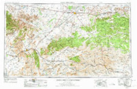
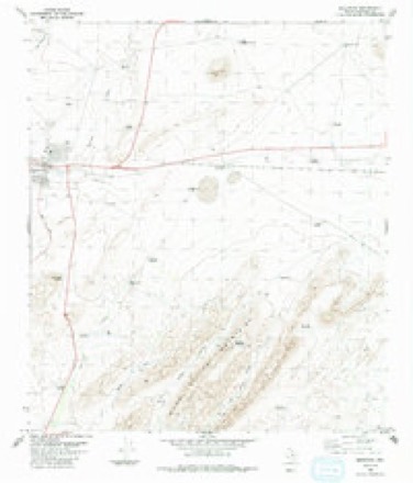
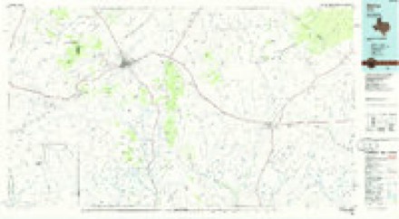
7 surveys from 12 printed sheetsMatched by testing this settlement's coordinate against the published boundary of every sheet in the United States Geological Survey's historical collection. Each opens the scanned sheet at the Survey.
- 1920 USGS Marathon quadrangle1:62500
- 1921 USGS Marathon quadrangle1:62500, 2 printings
- 1954 USGS Fort Stockton quadrangle1:250000, 3 printings
- 1958 USGS Fort Stockton quadrangle1:250000
- 1973 USGS Fort Stockton quadrangle1:250000
- 1983 USGS Marathon quadrangle1:24000, 2 printings
- 1985 USGS Alpine quadrangle1:100000, 2 printings
Fires near this place
3 since 2008Regional context, not property-specific evidence. The federal wildfire occurrence database lists 3 fires within 5 miles of Marathon between 2008 and 2009, burning about 1 acre in total. None started naturally. None was recorded as arson. Distance is straight-line from the map coordinates, so a fire counted here may appear on a neighbouring settlement's page as well.
| Reported cause | Fires |
|---|---|
| Debris and open burning | 1 |
| Equipment and vehicle use | 1 |
| Missing data/not specified/undetermined | 1 |
The most recent of them, most recent first, with the day each was reported and the service that recorded it.
| Date | Cause | Size | Reported by | Name on the report |
|---|---|---|---|---|
| 18 March 2008 | Missing data/not specified/undetermined | under an acre | Texas A & M Forest Service | not named |
| 4 January 2009 | Debris and open burning | under an acre | Texas A & M Forest Service | GARCIA-GONZALES |
| 28 January 2008 | Equipment and vehicle use | under an acre | Texas A & M Forest Service | not named |
Settlements close enough to share some of these fires:
Mines and quarries near this place
2 within 5 milesRegional context, not property-specific evidence. The federal mineral resources record lists 2 workings within 5 miles of Marathon: 1 occurrence, 1 producer. 1 still produces. What was taken out: Manganese, Fluorine-Fluorite. Distance is straight-line from the map coordinates, so a quarry counted here may appear on a neighbouring settlement's page as well.
| Where | Site | Commodity | Status | Recorded |
|---|---|---|---|---|
| Clark Prospect | Manganese | Occurrence | Iron | |
| Marathon Plant | Fluorine-Fluorite | Producer |
Storms near this place
60 of 105 shownRegional context, not property-specific evidence. The National Weather Service names Marathon in 105 storm reports between 1993 and 2025: 69 hail, 16 flash flood, 15 thunderstorm wind, 3 tornado. No death or injury is recorded in these reports. Each account below is quoted exactly as the forecast office filed it, from the NOAA Storm Events Database, and each date opens the federal record of that event.
| When | Event | Place named | Harm | What the report says |
|---|---|---|---|---|
| April 2010 | Hail | Marathon | $150,000 | Several windows, roofs and other structural items were damaged at the Gage Hotel in Marathon, TX. |
| June 2012 | Hail | Marathon | $122,000 | A thunderstorm moved over Brewster County and produced golfball hail in Marathon. Windows were broken and vehicles were dented from the hail. The cost of damage is a very rough estimate. |
| May 1998 | Hail | Marathon | $100,000 | This small, but intense storm formed on an outflow boundary from storms to the north in Pecos County. The storm built right over the town of Marathon then slow moved to the southeast and weakened. |
| June 2002 | Thunderstorm Wind | Marathon | $45,000 | Severe thunderstorm winds resulted in the downing of three power poles, and the roofs being blown off of three trailer houses. |
| April 2003 | Flash Flood | Marathon | $20,000 | Local authorities reported minor damage to a few houses from flash flooding. |
| May 2019 | Thunderstorm Wind | Marathon | $10,000 | A thunderstorm moved across Brewster County and produced wind damage near Marathon. At least four power poles were snapped off just above the ground along US 90. There was a transformer fire. The cost of damage is a very rough estimate. |
| May 2019 | Thunderstorm Wind | Marathon | $6,000 | A thunderstorm moved across Brewster County and produced wind damage in Marathon. There was structural damage with a roof off on the west side of town. The cost of damage is a very rough estimate. |
| June 2005 | Thunderstorm Wind | Marathon | $5,000 | A porch was blown off a rural residence near U.S. Highway 90 in northeastern Brewster County. Large hail up to the size of nickels accompanied the damaging wind gusts. |
| July 1998 | Thunderstorm Wind | Marathon | $5,000 | Three utility poles were knocked down by thunderstorm outflow winds. Power company officials estimated the wind to have been near 100 mph since the poles were a higher grade than most utility poles. Power was knocked out to customers over a vast area in parts of Brewster County. |
| June 2010 | Thunderstorm Wind | Marathon | $2,000 | The local law enforcement reported power lines down at the border patrol checkpoint. |
| May 2003 | Hail | Marathon | $1,000 | Trained storm spotters reported very large hail along Highway 385 south of Marathon. Stones ranging in size from quarters to tennis balls were reported. No significant damage was reported. Hail accumulated over one foot deep and persisted in drifts beyond 2015 CST. |
| May 2025 | Hail | Marathon | - | A storm chaser reported half dollar-size hail on US 90 west of Marathon. The time of occurrence was estimated by radar. |
| June 2025 | Flash Flood | Marathon | - | A CoCoRAHS observer reports flash flooding in Marathon. The duration of flash flooding is an estimation. |
| June 2025 | Flash Flood | Marathon | - | The local fire department reported 2 to 3 feet of water over Avenue B and other local roads across the western half of Marathon. The duration of flash flooding is an estimation. |
| June 2025 | Thunderstorm Wind | Marathon | - | The Mesonet station UR285 4.4 E Marathon measured at 61 mph wind gust. The total time of occurrence is estimated. |
| May 2024 | Hail | Marathon | - | CoCoRaHs observer reports the largest hail of quarter size. |
| May 2024 | Hail | Marathon | - | Accumulating quarter-size hail was reported on the west side of Marathon. |
| June 2024 | Flash Flood | Marathon | - | A spotter reported 4 inches of flowing water over portions of US Highway 385 northeast of Marathon. |
| June 2024 | Thunderstorm Wind | Marathon | - | This wind gust was likely caused by an outflow boundary ahead of severe thunderstorms to the north. |
| June 2024 | Flash Flood | Marathon | - | This was a report shared via mPing. The same person also shared pictures of several inches of standing and flowing water at this location. |
| May 2021 | Tornado (EFU) | Marathon | - | A thunderstorm produced a tornado 13 miles south southwest of Marathon. The tornado lasted approximately five minutes. It occurred on private land in an open field and no damage was reported. It was rated as an EF-U. |
| June 2020 | Thunderstorm Wind | Marathon | - | A thunderstorm moved across Brewster County and produced an estimated 60 mph wind gust. |
| June 2019 | Thunderstorm Wind | Marathon | - | A thunderstorm moved across Brewster County and produced a 60 mph wind gust five miles south of Marathon. |
| April 2016 | Heavy Rain | Marathon | - | Very heavy rainfall along with half inch hail fell near Marathon as a thunderstorm moved across Brewster County. |
| May 2016 | Heavy Rain | Marathon | - | A thunderstorm moved across Brewster County and produced heavy rain and minor flooding on Highway 385 in Marathon. |
| May 2016 | Flash Flood | Marathon | - | A thunderstorm moved across Brewster County and produced flash flooding south of Marathon. Highway 385 was impassable south of Marathon. No damage was reported. |
| April 2013 | Hail | Marathon | - | A severe thunderstorm developed in Brewster County and produced quarter sized hail in Marathon. |
| April 2013 | Hail | Marathon | - | A severe thunderstorm developed over Brewster County and moved south of Marathon producing nickel size hail. Hail was located over highway 385 and covered the ground. |
| May 2013 | Hail | Marathon | - | A thunderstorm moved over Brewster County and produced golfball sized hail sixteen miles south of Marathon. |
| April 2013 | Hail | Marathon | - | A severe thunderstorm developed 29 miles east of Marathon and produced quarter sized hail. |
| September 2012 | Hail | Marathon | - | A thunderstorm moved over Brewster County and produced eight inches to one foot of marble to penny sized hail. |
| May 2009 | Hail | Marathon | - | The hail covered the road and was about 2 inches deep. |
| March 2007 | Hail | Marathon | - | Penny to nickel size hail fell in Marathon. |
| July 2007 | Flash Flood | Marathon | - | A trained spotter reported water up to one and a half feet on local roads. |
| August 2006 | Flash Flood | Marathon | - | The Brewster County Sheriff's Office reported that a foot and a half of water was flowing over U.S. Highway 90 in Marathon. They also reported very heavy rain with visibility below 10 feet. |
| August 2006 | Flash Flood | Marathon | - | A rancher reported that flash flooding occurred along the Pecos/Brewster county line near where National Weather Service radar estimates indicated at least two inches of rain had fallen. |
| May 2005 | Flash Flood | Marathon | - | Very heavy rainfall associated with the severe storm over Marathon resulted in street flooding of many city streets. Motorists traveling along U.S. Highway 385 between Fort Stockton and Marathon reported intermittent flash flooding along that route in northern Brewster County. The Texas Department of Transportation was dispatched to barricade portions of the highway. |
| June 2005 | Hail | Marathon | - | Golfball size hail was reported along U.S. Highway 385 northeast of Marathon. |
| June 2005 | Tornado (F0) | Marathon | - | Two ranchers in southern Pecos and northern Brewster Counties independently observed a tornado along the Pecos and Brewster County line. The tornado remained in open rangeland and caused no damage. |
| June 2005 | Tornado (F0) | Marathon | - | A rancher discovered tornado damage on his property in far northeastern Brewster County, just north of U.S. Highway 90. A relatively long and narrow swath of tornadic winds were evident in several groves of trees on the Longfellow Ranch. A stand of oak trees, many four inches in diameter, were snapped at the lower portions of the trunk. No damage to man made structures occurred as a result of the tornado. |
| June 2005 | Hail | Marathon | - | Nickel size hail was accompanied by damaging thunderstorm winds along U.S. Highway 90 in northeastern Brewster County. |
| May 2005 | Hail | Marathon | - | Reports of large hail were received as an isolated severe thunderstorm tracked along U.S. Highway 90 near Marathon. Initial reports indicated golfball size hail west of town. Nickel size hail was reported as the storm moved over Marathon. |
| May 2005 | Hail | Marathon | - | Quarter size hail was reported in Marathon. |
| June 2004 | Hail | Marathon | - | Severe multicell thunderstorms affected the Marathon area on the afternoon of the 8th. The U.S. Border Patrol reported three quarter inch hail at the check point south of Marathon on U.S. Highway 385. |
| June 2004 | Hail | Marathon | - | Penny size hail was reported in Marathon. |
| June 2004 | Hail | Marathon | - | A second severe thunderstorm affected Marathon, and produced penny size hail in the city. This storm continued to produce large hail as it moved to the east. A motorist traveling along U.S. Highway 90 encountered nickel size hail east of Marathon. |
| October 2004 | Hail | Marathon | - | A local radio station relayed reports of golfball size hail along U.S. Highway 90 east of Marathon. |
| October 2004 | Hail | Marathon | - | Penny size hail was reported in Marathon. |
| April 2003 | Hail | Marathon | - | A member of the general public returning home around midnight CST reported penny hail covering the ground some five hours after the severe thunderstorm moved over the area. |
| May 2003 | Flash Flood | Marathon | - | Flash flooding resulted in high water over Highway 385. |
| May 2003 | Hail | Marathon | - | Trained storm spotters reported quarter size hail along Highway 118 near the Altuda community. |
| May 2003 | Hail | Marathon | - | Reported on Highway 385. |
| July 2003 | Flash Flood | Marathon | - | Flash flooding resulted in high water covering Highway 385 south of Marathon. |
| October 2003 | Flash Flood | Marathon | - | U.S. Highway 90 was inundated by high water. |
| June 2002 | Hail | Marathon | - | Dime to golfball size hail was reported by the public. |
| July 2002 | Flash Flood | Marathon | - | Flooding was reported along Highway 90 between Marathon and Altuda. |
| October 2000 | Flash Flood | Marathon | - | Significant street flooding was reported in Marathon. |
| April 1999 | Hail | Marathon | - | A multicell severe storm that formed in central Brewster County. The storm slowly declined as it moved away to the northeast. |
| June 1997 | Hail | Marathon | - | Half dollar size hail was reported at a ranch. |
| May 1997 | Flash Flood | Marathon | - | A moist upslope flow into the mountains of southwest Texas developed thunderstorms in the afternoon that persisted into the evening. A slow-moving cluster of storms in the Marathon area rained 2-3 inches over the town and caused flooding. Water was up to one foot deep in some locations. |
Nearest settlements
The eight closest, with where each one stands in the county. Distances are straight-line, computed from the Geographic Names Information System coordinates.
| Map | Place | Distance | Sheets |
|---|---|---|---|
| Old Beekley Place | 1.9 miles | 12 | |
| Fourmile Crossing | 3.4 miles | 12 | |
| Walker Place | 4.9 miles | 12 | |
| Louis Granger Place | 5.1 miles | 12 | |
| Mitchell Place | 5.2 miles | 12 | |
| Shoemaker Place | 5.5 miles | 12 | |
| Ansley Place | 6.2 miles | 12 | |
| Causey Place | 7.4 miles | 11 |
Elsewhere
Matched on this settlement's Geographic Names Information System number rather than its name, so it cannot be a different place of the same name in another state.
| Wikipedia article on Marathon | An encyclopaedic summary. Its text is share-alike, so it is linked here rather than copied. |
| Wikidata item Q970057 | The structured record the population and elevation above come from. Public domain (CC0). |
Provenance
This settlement is recorded in the Geographic Names Information System as feature 1340927. The sheet list is computed by point-in-boundary test against the United States Geological Survey's historical topographic inventory. Both are works of the United States government and carry no copyright under 17 U.S.C. 105.
Wildfire. Short, Karen C. 2022. Spatial wildfire occurrence data for the United States, 1992-2020 [FPA_FOD_20221014]. 6th Edition. Fort Collins, CO: Forest Service Research Data Archive. https://doi.org/10.2737/RDS-2013-0009.6 Collected with United States Government funding and usable without additional permissions or fees.
Mines and quarries. USGS Mineral Resources Data System (MRDS) https://mrdata.usgs.gov/mrds/ A work of the United States government, no copyright under 17 U.S.C. 105.
Storms. NOAA National Centers for Environmental Information, Storm Events Database https://www.ncei.noaa.gov/stormevents/ A work of the United States government, no copyright under 17 U.S.C. 105. Narratives are quoted verbatim from the National Weather Service report and are not edited or summarised.