 Block
BlockMarfa, Texas
11 topographic sheets cover this place, the earliest surveyed in 1895 and the latest in 1985. It stands in the Marfa census division. It lies in ZIP code area 79843. It lies near Mimms Draw. The Survey maps it on the Marfa quadrangle. 1,788 people lived here at the 2020 count. It stands 4,685 feet above sea level.
Research this city
On record in Marfa
Buildings and businesses the archive holds for this place. Each opens its own page, with the source record it came from.
On the National Register 6 records
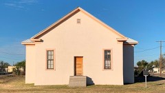 Blackwell Schoollisted 2019
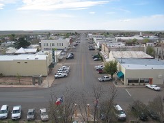 Central Marfa Historic Districtlisted 2022
 El Paisano Hotellisted 1978
 Presidio County Courthouselisted 1977
- Building 98, Fort D.A. Russelllisted 2004
- Fort D.A. Russell Historic Districtlisted 2006
Population over time
2 figuresMarfa fell from 1,981 to 1,788 between 2010 and 2020. These are the recorded population figures Wikidata holds for this place, reached through the Geographic Names Information System number this page is keyed on rather than by name, so they belong to this place and not to another of the same name. Most are census counts, but not all are: an early figure may be a founding or settlement estimate, and an estimate published within five years of a census is left out. The change column is computed, and is left blank where more than 20 years separate a figure from the one before it, because a gap that long is not a change between two counts.
| Year | People | Change |
|---|---|---|
| 2010 | 1,981 | |
| 2020 | 1,788 | -193 (-10%) |
Topographic sheets covering this place
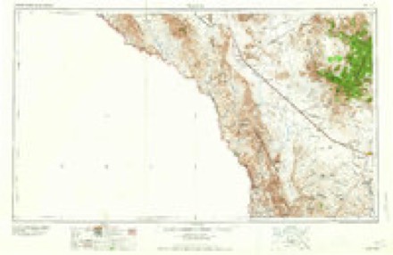
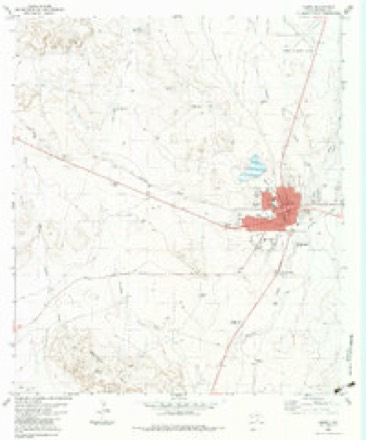
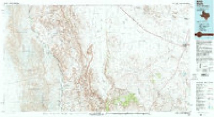
5 surveys from 11 printed sheetsMatched by testing this settlement's coordinate against the published boundary of every sheet in the United States Geological Survey's historical collection. Each opens the scanned sheet at the Survey.
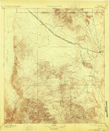
- 1895 USGS Marfa quadrangle1:125000, 5 printings
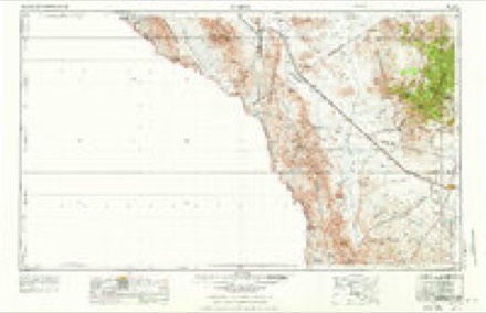
- 1959 USGS Marfa quadrangle1:250000, 2 printings
- 1965 USGS Marfa quadrangle1:250000
- 1983 USGS Marfa quadrangle1:24000
- 1985 USGS Marfa quadrangle1:100000, 2 printings
Fires near this place
57 since 2007Regional context, not property-specific evidence. The federal wildfire occurrence database lists 57 fires within 5 miles of Marfa between 2007 and 2020, burning about 2,106 acres in total. 14 started naturally. 1 was recorded as arson. Distance is straight-line from the map coordinates, so a fire counted here may appear on a neighbouring settlement's page as well.
| Reported cause | Fires |
|---|---|
| Missing data/not specified/undetermined | 17 |
| Natural | 14 |
| Equipment and vehicle use | 9 |
| Smoking | 5 |
| Debris and open burning | 5 |
| Railroad operations and maintenance | 4 |
| Power generation/transmission/distribution | 1 |
| Recreation and ceremony | 1 |
| Arson/incendiarism | 1 |
The most recent of them, most recent first, with the day each was reported and the service that recorded it.
| Date | Cause | Size | Reported by | Name on the report |
|---|---|---|---|---|
| 7 September 2010 | Missing data/not specified/undetermined | under an acre | Texas A & M Forest Service | PHILADELPHIA ST. GRASS FIRE |
| 16 August 2014 | Natural | 1.0 acres | Texas A & M Forest Service | PAISANO CATTLE CO. |
| 5 July 2020 | Natural | 1.0 acres | Texas A & M Forest Service | GAGE RANCH |
| 31 July 2012 | Railroad operations and maintenance | under an acre | Texas A & M Forest Service | 3.5 MILES E. HWY 90 |
| 3 July 2018 | Debris and open burning | under an acre | Texas A & M Forest Service | ORDENAR STREET FIRE |
| 27 July 2011 | Natural | 1.0 acres | Texas A & M Forest Service | MARFA WEST 7 MILES |
| 25 July 2009 | Debris and open burning | under an acre | Texas A & M Forest Service | CULBERSON RESIDENCE |
| 24 July 2012 | Natural | under an acre | Texas A & M Forest Service | TY MITCHELL W. MARFA |
Settlements close enough to share some of these fires:
Storms near this place
51 since 1993Regional context, not property-specific evidence. The National Weather Service names Marfa in 51 storm reports between 1993 and 2025: 30 hail, 13 thunderstorm wind, 8 flash flood. The reports record 1 death. Each account below is quoted exactly as the forecast office filed it, from the NOAA Storm Events Database, and each date opens the federal record of that event.
| When | Event | Place named | Harm | What the report says |
|---|---|---|---|---|
| June 2021 | Flash Flood | Marfa | 1 killed, $20,000 | Heavy rain resulted in flash flooding in Marfa. Law enforcement officials announced the fatality of a gentleman who got his car swept away from flash flooding within the town of Marfa. The cost of damage is a very rough estimate. |
| June 2005 | Hail | Marfa | $100,000 | Hen egg size hail mixed with smaller hailstones to produce damage to roofs and vehicles in Marfa. This hail occurred during the second of two severe storms to impact the Marfa vicinity during the late evening and early morning hours of the 2nd and 3rd. |
| June 2005 | Hail | Marfa | $50,000 | Large hail fell over Marfa again as a second severe storm affected the area shortly after midnight CST. Reports indicated that hail up to the size of half-dollars persisted for nearly twenty-five minutes. The long duration of one and a half inch diameter hail and occasionally larger stones, resulted in damage to numerous roofs and vehicles. |
| June 2005 | Hail | Marfa | $25,000 | The first of two hail storms to affect the Marfa area struck at 23:00 CST. Large hail ranging in size from ping pong balls to golfballs fell along U.S. Highway 67 near the city. This initial storm is believed to be responsible for minor roof damage, however, a more significant hail storm impacted Marfa just an hour later and likely produced a majority of the damage. |
| June 2002 | Flash Flood | Marfa | $20,000 | A local radio station reported that two vehicles were stranded in high water which resulted from flash flooding on Highway 67. |
| June 2003 | Thunderstorm Wind | Marfa | $15,000 | A tractor-trailer carrying cattle was overturned by severe thunderstorm winds on Highway 67/90 one mile east of the Marfa Lights Viewing Area. Reports did not indicate the status of the cattle. |
| October 2006 | Thunderstorm Wind | Marfa | $10,000 | The Presidio County Sheriff's Office reported that the roof on a brand new mobile home was blown off. |
| July 1996 | Thunderstorm Wind | Marfa | $10,000 | no account filed |
| June 1998 | Thunderstorm Wind | Marfa | $5,000 | Sheet metal was blown off roofs in town and a 72 mph wind gust was recorded by the KMRF AWOS station at the airport. |
| June 2013 | Thunderstorm Wind | Marfa | $300 | A thunderstorm moved across Presidio County and produced 50 to 60 mph wind gusts in Marfa. Four inch diameter tree limbs were knocked down as a result of these winds. The cost of damage is a rough estimate. |
| July 2025 | Flash Flood | Marfa | - | Extremely heavy rain around Marfa and Fort Davis produced widespread street flooding. The time of occurrence is estimated by radar. No damage was reported. |
| March 2019 | Thunderstorm Wind | Marfa | - | A thunderstorm moved across Presidio County and produced a 60 mph wind gust in Marfa. |
| March 2019 | Thunderstorm Wind | Marfa | - | A thunderstorm moved across Presidio County and produced a 73 mph wind gust one mile east southeast of Marfa. |
| June 2013 | Hail | Marfa | - | A thunderstorm moved over Presidio County and produced nickel to golfball sized hail on FM 2810 seven miles west southwest of Marfa. |
| June 2013 | Hail | Marfa | - | A thunderstorm moved over Presidio County and produced pingpong ball sized hail on Pinto Canyon Road eight miles west southwest of Marfa. |
| May 2007 | Hail | Marfa | - | Golfball sized hail fell on U.S. Highway 90 for a duration of ten minutes. |
| May 2007 | Hail | Marfa | - | Tennis ball sized hail fell along Farm to Market Road 2810. |
| October 2006 | Hail | Marfa | - | A convenience store employee in Marfa reported penny to quarter sized hail and very strong winds. |
| October 2006 | Hail | Marfa | - | Sheriff's office reported penny sized hail in Marfa. |
| June 2005 | Hail | Marfa | - | Motorists traveling along U.S. Highway 90 reported nickel size hail just west of Paisano Pass in far northeastern Presidio County. |
| June 2005 | Hail | Marfa | - | Hail up to the size of nickels began to fall on the west side of Marfa at 13:06 CST. The hailstones increased in size during the next ten minutes, and local law enforcement officials reported dime to quarter size hail on the south side of the city between 13:10 and 13:20 CST. No damage was reported. |
| March 2004 | Hail | Marfa | - | A severe thunderstorm tracked southeast across northern Presidio County and resulted in large hail. Nickel size hail covered the ground along U.S. Highway 90 nineteen miles northwest of Marfa. Quarter size hail accumulated up to three inches deep over the highway just west of Marfa, and crews were required to clear the hail from the roadway. Dime to nickel size hail was also reported at a U.S. Border Patrol check point along U.S. Highway 67 south of Marfa. No damage reports were received. |
| June 2004 | Hail | Marfa | - | Hail was reported along a nine mile stretch of U.S. Highway 90. |
| June 2004 | Thunderstorm Wind | Marfa | - | A severe thunderstorm wind gust was measured by the Marfa AWOS. |
| July 2004 | Flash Flood | Marfa | - | Officials reported flash flooding that briefly resulted in the closing of U.S. Highway 90 just west of Paisano Pass. |
| June 2003 | Hail | Marfa | - | Multiple reports of hail ranging from nickel to ping pong ball size were received from the Marfa vicinity as an isolated severe thunderstorm affected the area. |
| May 2003 | Hail | Marfa | - | Nickel size hail was reported by motorists and the U.S. Border Patrol near the check point station south of Marfa on Highway 67. |
| June 2003 | Thunderstorm Wind | Marfa | - | A severe thunderstorm wind gust of 70 MPH was measured at a federal government facility in northern Presidio County. |
| July 2002 | Flash Flood | Marfa | - | The Texas Department of Transportation reported flooding of secondary roads south of Marfa including Farm to Market Road 169. |
| June 2002 | Flash Flood | Marfa | - | Local officials reported that Highway 67 was closed due to high water. |
| May 1999 | Flash Flood | Marfa | - | Torrential rains of 2 inches fell in 16 minutes at the Marfa Aerostat Site. |
| June 1998 | Thunderstorm Wind | Marfa | - | A 70 mph wind was reported at the Aerostat site west of Marfa. |
| May 1998 | Thunderstorm Wind | Marfa | - | A thunderstorm moving to the northeast through northwestern Presidio County formed a bow as it crossed U.S. Highway 90. A 62 knot gust was recorded at the Marfa Aerostat site. Power was lost at the site for about 5 hours. |
| February 1993 | Thunderstorm Wind | Marfa | - | A fast moving thunderstorm produced downburst winds of 55 to 65 mph across northern Presidio County. Winds gusted to 63 mph at the Loral Aerospace site and to 66 mph at the Marfa Municipal Airport. No damage resulted. |
| February 1993 | Thunderstorm Wind | Marfa | - | A fast moving thunderstorm produced downburst winds of 55 to 65 mph across northern Presidio County. Winds gusted to 63 mph at the Loral Aerospace site and to 66 mph at the Marfa Municipal Airport. No damage resulted. |
| May 2021 | Hail | Marfa | - | no account filed |
| May 2021 | Hail | Marfa | - | no account filed |
| June 2019 | Hail | Marfa | - | no account filed |
| May 2019 | Hail | Marfa | - | no account filed |
| May 2016 | Hail | Marfa | - | no account filed |
| June 2013 | Hail | Marfa | - | no account filed |
| August 2012 | Hail | Marfa | - | no account filed |
| May 2007 | Hail | Marfa | - | no account filed |
| August 2007 | Hail | Marfa | - | no account filed |
| April 2004 | Hail | Marfa | - | no account filed |
| April 2004 | Hail | Marfa | - | no account filed |
| June 2004 | Hail | Marfa | - | no account filed |
| October 2000 | Hail | Marfa | - | no account filed |
| May 1999 | Hail | Marfa | - | no account filed |
| May 1996 | Hail | Marfa | - | no account filed |
| September 1996 | Flash Flood | Marfa | - | no account filed |
Nearest settlements
The eight closest, with where each one stands in the county. Distances are straight-line, computed from the Geographic Names Information System coordinates.
| Map | Place | Distance | Sheets |
|---|---|---|---|
| Nopal | 5.1 miles | 14 | |
| Tinaja | 8.5 miles | 14 | |
| Ryan | 17.1 miles | 11 | |
| Quebec | 24.5 miles | 15 | |
| Plata | 29.8 miles | 12 | |
| Chaffin Place | 32.4 miles | 12 | |
| Pueblo Nuevo | 36.4 miles | 12 | |
| Shafter | 36.9 miles | 12 |
Elsewhere
Matched on this settlement's Geographic Names Information System number rather than its name, so it cannot be a different place of the same name in another state.
| Wikipedia article on Marfa | An encyclopaedic summary. Its text is share-alike, so it is linked here rather than copied. |
| Wikidata item Q982507 | The structured record the population and elevation above come from. Public domain (CC0). |
Provenance
This settlement is recorded in the Geographic Names Information System as feature 1340942. The sheet list is computed by point-in-boundary test against the United States Geological Survey's historical topographic inventory. Both are works of the United States government and carry no copyright under 17 U.S.C. 105.
Wildfire. Short, Karen C. 2022. Spatial wildfire occurrence data for the United States, 1992-2020 [FPA_FOD_20221014]. 6th Edition. Fort Collins, CO: Forest Service Research Data Archive. https://doi.org/10.2737/RDS-2013-0009.6 Collected with United States Government funding and usable without additional permissions or fees.
Storms. NOAA National Centers for Environmental Information, Storm Events Database https://www.ncei.noaa.gov/stormevents/ A work of the United States government, no copyright under 17 U.S.C. 105. Narratives are quoted verbatim from the National Weather Service report and are not edited or summarised.