 Block
BlockMorrill, Texas
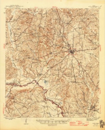
10 topographic sheets cover this place, the earliest surveyed in 1946 and the latest in 1984. It stands in the Alto census division. It lies in ZIP code area 75925. The Survey maps it on the Forest quadrangle.
Topographic sheets covering this place
6 surveys from 10 printed sheetsMatched by testing this settlement's coordinate against the published boundary of every sheet in the United States Geological Survey's historical collection. Each opens the scanned sheet at the Survey.
- 1946 USGS Alto quadrangle1:62500, 2 printings
- 1953 USGS Palestine quadrangle1:250000, 2 printings
- 1957 USGS Palestine quadrangle1:250000
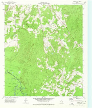
- 1973 USGS Forest quadrangle1:24000
- 1981 USGS Palestine quadrangle1:100000
- 1984 USGS Palestine quadrangle1:250000, 3 printings
Fires near this place
179 since 1992Regional context, not property-specific evidence. The federal wildfire occurrence database lists 179 fires within 5 miles of Morrill between 1992 and 2020, burning about 1,495 acres in total. 11 started naturally. None was recorded as arson. Distance is straight-line from the map coordinates, so a fire counted here may appear on a neighbouring settlement's page as well.
| Reported cause | Fires |
|---|---|
| Debris and open burning | 119 |
| Missing data/not specified/undetermined | 28 |
| Natural | 11 |
| Equipment and vehicle use | 10 |
| Power generation/transmission/distribution | 8 |
| Fireworks | 1 |
| Smoking | 1 |
| Misuse of fire by a minor | 1 |
The most recent of them, most recent first, with the day each was reported and the service that recorded it.
| Date | Cause | Size | Reported by | Name on the report |
|---|---|---|---|---|
| 9 September 2011 | Equipment and vehicle use | 30 acres | Texas A & M Forest Service | HENDERSON - 536 |
| 9 September 2011 | Misuse of fire by a minor | 1.0 acres | Texas A & M Forest Service | GRASS |
| 6 September 2000 | Missing data/not specified/undetermined | 6.0 acres | Texas A & M Forest Service | HENDERSON - 483 |
| 30 September 2008 | Debris and open burning | under an acre | Texas A & M Forest Service | not named |
| 3 September 2011 | Debris and open burning | under an acre | Texas A & M Forest Service | TRASH FIRE |
| 27 September 2016 | Debris and open burning | 1.0 acres | Texas A & M Forest Service | GRASS FIRE |
| 24 September 2014 | Equipment and vehicle use | 1.0 acres | Texas A & M Forest Service | GRASS FIRE |
| 19 September 2016 | Debris and open burning | 1.0 acres | Texas A & M Forest Service | BRUSH FIRE |
Settlements close enough to share some of these fires:
Mines and quarries near this place
1 within 5 milesRegional context, not property-specific evidence. The federal mineral resources record lists 1 working within 5 miles of Morrill: 1 unknown. None of them still produces. What was taken out: Silica. Distance is straight-line from the map coordinates, so a quarry counted here may appear on a neighbouring settlement's page as well.
| Where | Site | Commodity | Status | Recorded |
|---|---|---|---|---|
| Padreco-Alto Sands | Silica | Unknown |
Storms near this place
12 since 2012Regional context, not property-specific evidence. The National Weather Service names Morrill in 12 storm reports between 2012 and 2023: 5 flood, 3 tornado, 3 thunderstorm wind, 1 hail. The reports record 1 death and 20 injuries. Each account below is quoted exactly as the forecast office filed it, from the NOAA Storm Events Database, and each date opens the federal record of that event.
| When | Event | Place named | Harm | What the report says |
|---|---|---|---|---|
| April 2019 | Tornado (EF3) | Morrill | 1 killed, 20 hurt, $10,000,000 | An EF-3 tornado with maximum estimated winds near 160 mph that originally touched down in Houston County about 9 miles northeast of Crockett crossed the Neches River into Southwest Cherokee County, where it snapped and uprooted thousands of trees along its path. The tornado paralleled Highway 21 before reaching the city of Alto, where it severely damaged or destroyed approximately 20 homes. Included along the damage path southwest of Alto was the Caddo Mounds Sate Historic Site building, which had its roof torn off, nearly all of its exterior walls removed, and was left to only a few interior rooms in the building. Several people were outside running to get inside for safety when the building was destroyed, resulting in one fatality and a number of serious injuries. Multiple cars in the parking lot were thrown 150 yards into trees and across Highway 21. The tornado then went on to lift and destroy a double wide mobile home, throwing it 50 yards. As the tornado continued along Highway 21, its most significant damage was at a single family home and the St. Thomas Chapel which saw their roofs and exterior walls collapsed. Winds were estimated at 150 mph at this point. ||As the tornado neared Alto, it destroyed three homes along Highway 294 and Singletary Street, recording high end EF-3 damage as it wiped the lower level of a two story home off of its foundation and left the top story of the home 20 yards away from the foundation. This damage was reviewed by tornado damage experts from the National Weather Service (NWS) Southern Region Headquarters, NWS Norman, and the Warning Decision Training Division who all agreed it was high end EF-3 damage (with maximum estimated winds near 160 mph) based off how the home walls were separated from the bolts which anchored them to the foundation. Surrounding damage indicators also validated the EF-3 tornado determination. ||The storm then went on to destroy several homes and mobile homes at nearby Alto Elementary School and Alto High School. It also snapped a metal power pole before crossing Highway 69, where it went on to snap and debark several trees in rural Cherokee County north of Alto before crossing FM 343 and into extreme Northwest Nacogdoches County. |
| April 2016 | Tornado (EF2) | Morrill | $700,000 | An EF-2 tornado with winds estimated between 105-115 mph touched down along County Road 2807 just east of Farm To Market Road 220 South about 4.5 miles southwest of Alto, and lifted north of County Road 2438 about 3 miles north of Alto. Over 27 homes sustained damage, including two homes that completely lost their roofs. Several outbuildings were damaged or destroyed, and at least two travel trailers were destroyed. The total path length was 7.3 miles. |
| April 2019 | Tornado (EF2) | Morrill | $250,000 | An EF-2 tornado with maximum estimated winds near 120 mph touched down in a rural field approximately 2 miles north of the Neches River. It initially snapped several hundred hardwood and softwood trees at their trunks before destroying two single wide mobile homes and ripping the roof off of a single family home at the end of FM 220 near County Road 2806. There, winds were estimated to be at their strongest at approximately 120 mph. The tornado also tossed several antique vehicles near the home and then went on to snap another 20 trees before lifting along FM 220. |
| June 2023 | Thunderstorm Wind | Morrill | - | Several trees snapped and uprooted along County Road 2707 south of Alto. |
| May 2021 | Flood | Morrill | - | Widespread rainfall amounts of fifteen to in excess of twenty inches fell across the Neches River basin of East Texas during May. As a result, the Neches River southwest of Alto near Highway 21 rose above the 16 foot flood stage at 1030 pm on May 9th, reached the 18 foot moderate flood stage at 9 pm on the 19th, before cresting at 19.2 feet at 9 am on the 24th. A slow recession commenced afterwards, with the Neches River falling to near 17.7 feet by midnight on the 31st. Additional heavy rainfall moved into the Neches River basin late in the day on the 31st, which resulted in a sharp and significant secondary crest above the 20 foot major flood stage on June 1st. ||This flooding resulted in moderate to severe flooding of the heavily wooded floodplain, with boat ramps and picnic areas completely inundated. |
| June 2021 | Flood | Morrill | - | Widespread rainfall amounts of fifteen to in excess of twenty inches fell across the Neches River basin of East Texas during May, including three to in excess of eight inches that fell May 31st. As a result, a secondary crest occurred on the Neches River southwest of Alto near Highway 21, rising back above the 18 foot moderate flood stage at 1215 pm on June 1st, surpassing the 20 foot major flood stage at 315 pm on the 1st, before cresting at 20.3 feet at 8 pm that evening. A sharp recession occurred afterwards, with the river falling below 20 feet at 730 am on June 2nd, and below 18 feet at 8 am on the 4th. This flooding resulted in moderate to severe flooding of the heavily wooded floodplain, with boat ramps and picnic areas completely inundated. |
| February 2020 | Flood | Morrill | - | Widespread rainfall amounts of five to seven inches fell across the Neches River basin of East Texas during February. As a result, the Neches River southwest of Alto near Highway 21 rose above the 16 foot flood stage at 10 am on February 19th, reached the 18 foot moderate flood stage at 4 am on the 21st, before reaching a flat crest of 18.4 feet on the 22nd through the 24th. The Neches River remained near 18 feet through 6 pm on the 26th, before slowly falling through the remainder of the month. ||This flooding resulted in moderate to severe flooding of the heavily wooded floodplain, with boat ramps and picnic areas completely inundated. |
| January 2019 | Flood | Morrill | - | Moderate flooding continued along the Neches River near Alto through the first week and a half of January, with the river cresting a second time (since December) to near 19.1 feet at 9 am on January 5th. The Neches River near Alto began a slow recession to end the first full week of 2019, falling below the 18 foot moderate flood stage at 5 pm on January 10th. Minor flooding continued along the Neches River throughout the remainder of the month. ||This continued flooding resulted in moderate to severe flooding of the heavily wooded floodplain, with boat ramps and picnic areas completely inundated. |
| October 2019 | Thunderstorm Wind | Morrill | - | A tree was blown down onto a power line on FM 1911-South about 3 miles south of Alto. |
| December 2018 | Flood | Morrill | - | Widespread rainfall amounts of two to four inches fell across the Neches River Basin of East Texas on December 26th-27th, atop already saturated grounds where six to ten inches of rain had fallen throughout the month of December. As a result, the Neches River southwest of Alto near Highway 21 rose above the 16 foot flood stage at 7 am on December 27th, reached the 18 foot moderate flood stage at 1115 pm on the 27th, and crested at 18.45 feet at 445 am on the 28th. The Neches River remained near 18 feet for the remainder of December, with a new and higher crest occurring after the first of the new year in 2019 due to additional rains that had fallen. ||This flooding resulted in moderate to severe flooding of the heavily wooded floodplain, with boat ramps and picnic areas completely inundated. |
| May 2017 | Thunderstorm Wind | Morrill | - | Trees were blown down on Highway 21 near the Saint Thomas Church. |
| April 2012 | Hail | Morrill | - | Hail was reported two miles south of Alto, Texas. |
Nearest settlements
The eight closest, with where each one stands in the county. Distances are straight-line, computed from the Geographic Names Information System coordinates.
| Map | Place | Distance | Sheets |
|---|---|---|---|
| Brunswick | 0.8 miles | 10 | |
| Alto | 3.9 miles | 10 | |
| Weeping Mary | 5.0 miles | 12 | |
| Wild Hurst | 5.4 miles | 10 | |
| Forest | 6.1 miles | 10 | |
| Linwood | 6.3 miles | 11 | |
| Redlawn | 6.6 miles | 10 | |
| Cross Roads | 6.8 miles | 11 |
Provenance
This settlement is recorded in the Geographic Names Information System as feature 1382324. The sheet list is computed by point-in-boundary test against the United States Geological Survey's historical topographic inventory. Both are works of the United States government and carry no copyright under 17 U.S.C. 105.
Wildfire. Short, Karen C. 2022. Spatial wildfire occurrence data for the United States, 1992-2020 [FPA_FOD_20221014]. 6th Edition. Fort Collins, CO: Forest Service Research Data Archive. https://doi.org/10.2737/RDS-2013-0009.6 Collected with United States Government funding and usable without additional permissions or fees.
Mines and quarries. USGS Mineral Resources Data System (MRDS) https://mrdata.usgs.gov/mrds/ A work of the United States government, no copyright under 17 U.S.C. 105.
Storms. NOAA National Centers for Environmental Information, Storm Events Database https://www.ncei.noaa.gov/stormevents/ A work of the United States government, no copyright under 17 U.S.C. 105. Narratives are quoted verbatim from the National Weather Service report and are not edited or summarised.