 Block
BlockNew Braunfels, Texas
14 topographic sheets cover this place, the earliest surveyed in 1925 and the latest in 1992. It stands in the New Braunfels census division. It lies in ZIP code area 78130. It stands on Dry Comal Creek. The Survey maps it on the New Braunfels East quadrangle. 90,403 people lived here at the 2020 count. It stands 630 feet above sea level.
Research this city
On record in New Braunfels
Buildings and businesses the archive holds for this place. Each opens its own page, with the source record it came from.
On the National Register 12 of 22 shown
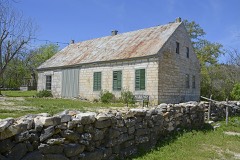 Arnold-Rauch-Brandt Homesteadlisted 2018
 Brauntex Theaterlisted 2008
 Andreas Breustedt Houselisted 1982
 Central Fire Stationlisted 2019
 Comal County Courthouselisted 1976
 Comal Hotel and Klein-Kuse Houselisted 1986
 Comal Power Plantlisted 2004
 Faust Street Bridgelisted 2009
 First Protestant Churchlisted 1971
 Carl W.A. Groos Houselisted 2000
 Guadalupe Hotellisted 1975
 Holz-Forshage-Krueger Buildinglisted 1997
Population over time
2 figuresNew Braunfels grew from 57,740 to 90,403 between 2010 and 2020. These are the recorded population figures Wikidata holds for this place, reached through the Geographic Names Information System number this page is keyed on rather than by name, so they belong to this place and not to another of the same name. Most are census counts, but not all are: an early figure may be a founding or settlement estimate, and an estimate published within five years of a census is left out. The change column is computed, and is left blank where more than 20 years separate a figure from the one before it, because a gap that long is not a change between two counts.
| Year | People | Change |
|---|---|---|
| 2010 | 57,740 | |
| 2020 | 90,403 | +32,663 (+57%) |
Topographic sheets covering this place
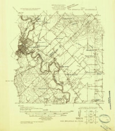
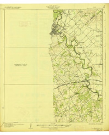
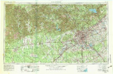
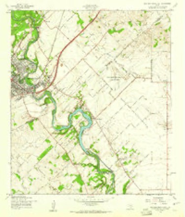
7 surveys from 14 printed sheetsMatched by testing this settlement's coordinate against the published boundary of every sheet in the United States Geological Survey's historical collection. Each opens the scanned sheet at the Survey.
- 1925 USGS New Braunfels No 1 quadrangle1:48000
- 1927 USGS New Braunfels quadrangle1:62500, 3 printings
- 1954 USGS San Antonio quadrangle1:250000, 3 printings
- 1957 USGS San Antonio quadrangle1:250000
- 1958 USGS New Braunfels East quadrangle1:24000, 3 printings
- 1985 USGS New Braunfels quadrangle1:100000
- 1992 USGS New Braunfels quadrangle1:100000, 2 printings
Fires near this place
193 since 2005Regional context, not property-specific evidence. The federal wildfire occurrence database lists 193 fires within 5 miles of New Braunfels between 2005 and 2020, burning about 3,226 acres in total. 2 started naturally. 10 were recorded as arson. Distance is straight-line from the map coordinates, so a fire counted here may appear on a neighbouring settlement's page as well.
| Reported cause | Fires |
|---|---|
| Missing data/not specified/undetermined | 101 |
| Debris and open burning | 26 |
| Smoking | 14 |
| Equipment and vehicle use | 13 |
| Arson/incendiarism | 10 |
| Recreation and ceremony | 10 |
| Power generation/transmission/distribution | 9 |
| Misuse of fire by a minor | 7 |
| Natural | 2 |
| Railroad operations and maintenance | 1 |
The most recent of them, most recent first, with the day each was reported and the service that recorded it.
| Date | Cause | Size | Reported by | Name on the report |
|---|---|---|---|---|
| 9 September 2019 | Missing data/not specified/undetermined | under an acre | Texas A & M Forest Service | 1101 FIRE |
| 8 September 2011 | Power generation/transmission/distribution | 1.0 acres | Texas A & M Forest Service | NOV-30 |
| 5 September 2011 | Power generation/transmission/distribution | 1.0 acres | Texas A & M Forest Service | NOV-62 |
| 3 September 2011 | Recreation and ceremony | 1.0 acres | Texas A & M Forest Service | NOV-02 |
| 27 September 2011 | Smoking | 1.0 acres | Texas A & M Forest Service | NOV-23 |
| 2 September 2011 | Missing data/not specified/undetermined | 1.0 acres | Texas A & M Forest Service | NOV-65 |
| 18 September 2019 | Recreation and ceremony | under an acre | Texas A & M Forest Service | FAUST FIRE |
| 18 September 2005 | Arson/incendiarism | 5.0 acres | Texas A & M Forest Service | not named |
Settlements close enough to share some of these fires:
Mines and quarries near this place
10 of 12 shownRegional context, not property-specific evidence. The federal mineral resources record lists 12 workings within 5 miles of New Braunfels: 11 producers, 1 past producer. 11 still produce. What was taken out: Limestone, General, Stone, Crushed/Broken, Sand and Gravel, Construction, Sulfur. Distance is straight-line from the map coordinates, so a quarry counted here may appear on a neighbouring settlement's page as well.
| Where | Site | Commodity | Status | Recorded |
|---|---|---|---|---|
| Tilden Sulfur Plant | Sulfur | Producer | ||
| Hays County Gravel Company Pit | Sand and Gravel, Construction | Producer | ||
| Kollman Pit | Sand and Gravel, Construction | Producer | Gravel, Sand | |
| Unnamed Pit | Sand and Gravel, Construction | Producer | Gravel, Sand | |
| Brauntex Materials | Stone, Crushed/Broken | Producer | ||
| Brauntex Pit & Plant | Limestone, General | Producer | ||
| General Portland Cement Plant | Stone, Crushed/Broken | Past Producer | ||
| New Braunfels Quarry & Plant | Limestone, General | Producer | ||
| New Braunfels Quarry & Plant No.265 | Limestone, General | Producer | ||
| Odgen Quarry & Plant | Stone, Crushed/Broken | Producer |
Storms near this place
60 of 69 shownRegional context, not property-specific evidence. The National Weather Service names New Braunfels in 69 storm reports between 1993 and 2025: 39 hail, 15 thunderstorm wind, 13 flash flood, 2 tornado. The reports record 2 deaths. Each account below is quoted exactly as the forecast office filed it, from the NOAA Storm Events Database, and each date opens the federal record of that event.
| When | Event | Place named | Harm | What the report says |
|---|---|---|---|---|
| June 2010 | Flash Flood | New Braunfels | 1 killed, $10,000,000 | A storm survey along the Guadalupe River from River Road down into the city of New Braunfels showed devastation along the banks of the river. The river rose some 20+ feet in less than 2 hours sweeping campers, cars, trailers, tubes, and other debris down the river toward New Braunfels and Seguin. Campsites downstream of the 3rd River Road crossing where demolished and swept clean due to the power of water. The campsites along the stretch of River Road near Camp Hueco Springs were especially hit hard as Elm creek flooded and brought tremendous water into the Guadalupe. A death occurred at this location as a man was swept downstream. Other campers were rescued down in New Braunfels after being swept miles downstream. Tubing businesses along the Guadalupe suffered major losses along with homes from Gruene down into Seguin. Thirty vehicles and 14 RVs were removed from the River in Comal County. One hundred twenty-one homes and businesses suffered damage. Damage estimate does not include other insured losses. |
| October 2013 | Flash Flood | New Braunfels | 1 killed, $100,000 | Thunderstorms produced heavy rain that led to flash flooding in Comal County. People were evacuated along River Road in New Braunfels, and near Spring Branch, Elm Creek was running 40 to 50 feet wide where it is normally about four feet. The 24 hour rainfall in the River Rd. area ranged from 3.81 to 6.58 inches while in the Spring Branch area there was between 10.40 and 11.75 inches. A man fell into the Guadalupe River near the horseshoe just down from Canyon Dam. The man was trying to retrieve some equipment while the river was quickly rising. The 26 year old drown and his body was recovered a few days later. Portions of River Road just west of New Braunfels became flooded between 1 and 2 am in the morning. |
| March 1994 | Thunderstorm Wind | New Braunfels | $5,000,000 | no account filed |
| July 2006 | Flash Flood | New Braunfels | $500,000 | Thunderstorms that had formed in the late afternoon over Comal County spread over the area from New Braunfels to Gruene and remained stationary for several hours. Up to 4 inches of rain had fallen in Gruene by 1800CST with as much as 8 inches of rain just west of New Braunfels. Widespread street flooding was reported along with flash flooding that closed East Common Street and River Road through the early evening and most roads in and near New Braunfels toward the end of the event. A short section of IH-35 was even closed due to the high water. For the first time since 1979, the rain caused flooding at the Holiday Inn in New Braunfels, where more than 50 rooms were damaged. A half dozen rescues from vehicles were required. |
| October 2001 | Thunderstorm Wind | New Braunfels | $100,000 | An off-duty NWS employee reported trees blown down with widespread damage to the roofs and windows of homes just west of New Braunfels. |
| October 2021 | Flash Flood | New Braunfels | $50,000 | Thunderstorms produced heavy rain that led to flash flooding. A couple of trailers at the RV park on the Guadalupe River under I-35 were washed into the river. No one was in the trailers. |
| March 2000 | Hail | New Braunfels | $50,000 | Large hail fell across much of the city of New Braunfels. The worst damage was reported to a store at the intersection of SH46 and I-35. Most of the windows in the store front were destroyed by the hail. |
| September 1997 | Thunderstorm Wind | New Braunfels | $50,000 | no account filed |
| June 2003 | Thunderstorm Wind | New Braunfels | $20,000 | An NWS off-duty employee reported that high winds, estimated near 65 mph, had knocked down trees in New Braunfels. |
| August 2003 | Thunderstorm Wind | New Braunfels | $20,000 | A severe thunderstorm produced damaging winds that knocked down trees and blew over power lines in the New Braunfels area. Additional minor damage was reported to roofs of homes and outbuildings |
| August 2012 | Thunderstorm Wind | New Braunfels | $10,000 | A thunderstorm produced wind gusts estimated at 58 mph that blew a three foot diameter tree onto a house in New Braunfels. |
| June 1999 | Thunderstorm Wind | New Braunfels | $10,000 | no account filed |
| April 1996 | Thunderstorm Wind | New Braunfels | $10,000 | no account filed |
| July 1995 | Thunderstorm Wind | New Braunfels | $8,000 | Winds estimated near 60 mph blew down trees and power lines. |
| July 2013 | Thunderstorm Wind | New Braunfels | $5,000 | A thunderstorm produced wind gusts estimated at 60 mph that blew down and damaged numerous trees in Landa Park. |
| June 1996 | Thunderstorm Wind | New Braunfels | $5,000 | no account filed |
| August 2023 | Thunderstorm Wind | New Braunfels | $2,000 | A thunderstorm generated by the remnants of Tropical Storm Harold produced wind gusts estimated at 60 mph that knocked down a six diameter Pecan tree branch at the Comal County Courthouse in New Braunfels. |
| October 2019 | Thunderstorm Wind | New Braunfels | $1,000 | A thunderstorm produced wind gusts estimated at 60 mph that knocked down large tree limbs at an apartment complex near New Braunfels High School. |
| May 2025 | Hail | New Braunfels | - | A thunderstorm produced quarter size hail in New Braunfels. |
| April 2024 | Hail | New Braunfels | - | A thunderstorm produced ping pong ball size hail on the westside of New Braunfels. |
| March 2022 | Hail | New Braunfels | - | A thunderstorm produced two inch diameter hail in New Braunfels. |
| March 2022 | Hail | New Braunfels | - | A thunderstorm produced golf ball size hail in New Braunfels. |
| March 2022 | Hail | New Braunfels | - | A thunderstorm produced half dollar size hail in New Braunfels. |
| March 2022 | Hail | New Braunfels | - | A thunderstorm produced half dollar size hail in New Braunfels. |
| May 2021 | Hail | New Braunfels | - | A thunderstorm produced quarter and larger size hail on the west side of New Braunfels. |
| May 2021 | Flash Flood | New Braunfels | - | Thunderstorms produced heavy rain that led to flash flooding. A low water crossing was flooded on Hueco Springs Loop Rd. near Elm Creek Rd. in New Braunfels. |
| April 2021 | Hail | New Braunfels | - | A thunderstorm produced quarter size hail in northwestern New Braunfels. |
| February 2017 | Thunderstorm Wind | New Braunfels | - | A thunderstorm produced wind gusts estimated at 75 mph that tore part of the roof off a barn, knocked down a road sign, uprooted a tree, and knocked down several tree branches up to three inches diameter along Hueco Springs Loop Rd. in New Braunfels. |
| September 2016 | Flash Flood | New Braunfels | - | Thunderstorms produced heavy rain that caused flash flooding closing Hueco Springs Loop Rd. at Elm Creek Rd. in northwestern New Braunfels. |
| May 2016 | Flash Flood | New Braunfels | - | Thunderstorms produced heavy rain that caused flash flooding resulting in several high water rescues in New Braunfels. |
| June 2010 | Flash Flood | New Braunfels | - | Thunderstorms produced heavy rain which caused flooding and the evacuation of the RV park along the Guadalupe River at I-35. |
| May 2010 | Flash Flood | New Braunfels | - | Thunderstorms produced 1.3 inches of rain in 37 minutes causing minor flooding. |
| September 2009 | Flash Flood | New Braunfels | - | Heavy rain caused numerous road closures in and around New Braunfels including Landa Street from Mission Drive to Walnut Avenue and South Business I35 from Seguin Avenue to Old McQueeney Road. Bulverde Road at the Cibolo Creek crossing at the Comal/Bexar County line was also closed in this time frame. |
| January 2007 | Flash Flood | New Braunfels | - | Flooding that had occurred earlier in the New Braunfels area ended in the mid morning with a brief break in the rainfall. Around 1130 am, additional storms associated with the cold front began producing more rainfall. This second event produced between 2 and 3 additional inches of rain in New Braunfels and streets and roads in and around the city again were closed due to flash flooding. |
| July 2007 | Flash Flood | New Braunfels | - | Between 3 and 5 inches of rain fell across much of northeastern Comal County, with up to 8 inches in New Braunfels . Flash flooding closed FM306 and FM758. Comal County reported 4 high water rescues. |
| January 2007 | Flash Flood | New Braunfels | - | The thunderstorms produced a general 1 inch rain over southeast Comal County, with up to 3 inches in just over an hour in the city of New Braunfels. Loop 337, FM306 and FM2722 were closed briefly due to high water through the mid morning period. |
| November 2001 | Tornado (F0) | New Braunfels | - | An F0 tornado formed just east of New Braunfels in Comal County and moved northeastward toward the National Weather Service Office near the New Braunfels Airport in Guadalupe County. The tornado was mostly in open country in Comal County and caused no significant damage. |
| May 1993 | Tornado (F0) | New Braunfels | - | A pilot reported two tornados over the north part of Comal County. No damage was reported. The Bulverde Police Department reported dime-size hail in town. |
| April 2017 | Hail | New Braunfels | - | no account filed |
| May 2013 | Hail | New Braunfels | - | no account filed |
| May 2013 | Hail | New Braunfels | - | no account filed |
| May 2013 | Hail | New Braunfels | - | no account filed |
| May 2013 | Hail | New Braunfels | - | no account filed |
| May 2013 | Hail | New Braunfels | - | no account filed |
| May 2013 | Hail | New Braunfels | - | no account filed |
| May 2013 | Hail | New Braunfels | - | no account filed |
| April 2013 | Hail | New Braunfels | - | no account filed |
| April 2013 | Hail | New Braunfels | - | no account filed |
| May 2013 | Hail | New Braunfels | - | no account filed |
| April 2007 | Hail | New Braunfels | - | no account filed |
| May 2006 | Hail | New Braunfels | - | no account filed |
| May 2006 | Hail | New Braunfels | - | no account filed |
| March 2005 | Hail | New Braunfels | - | no account filed |
| April 2005 | Hail | New Braunfels | - | no account filed |
| December 2002 | Hail | New Braunfels | - | no account filed |
| April 2002 | Hail | New Braunfels | - | no account filed |
| May 2002 | Hail | New Braunfels | - | no account filed |
| October 2002 | Hail | New Braunfels | - | no account filed |
| March 2001 | Hail | New Braunfels | - | no account filed |
| March 2000 | Hail | New Braunfels | - | no account filed |
Nearest settlements
The eight closest, with where each one stands in the county. Distances are straight-line, computed from the Geographic Names Information System coordinates.
| Map | Place | Distance | Sheets |
|---|---|---|---|
| Landa Park Highlands | 1.4 miles | 14 | |
| Jentsch Acres | 1.9 miles | 14 | |
| Preiss Heights | 2.6 miles | 14 | |
| Gruene | 2.7 miles | 14 | |
| Thorn Hill | 3.1 miles | 14 | |
| Freiheit | 3.1 miles | 14 | |
| Dittlinger | 3.3 miles | 14 | |
| Solms | 3.6 miles | 14 |
Elsewhere
Matched on this settlement's Geographic Names Information System number rather than its name, so it cannot be a different place of the same name in another state.
| Wikipedia article on New Braunfels | An encyclopaedic summary. Its text is share-alike, so it is linked here rather than copied. |
| Wikidata item Q574612 | The structured record the population and elevation above come from. Public domain (CC0). |
Provenance
This settlement is recorded in the Geographic Names Information System as feature 1342440. The sheet list is computed by point-in-boundary test against the United States Geological Survey's historical topographic inventory. Both are works of the United States government and carry no copyright under 17 U.S.C. 105.
Wildfire. Short, Karen C. 2022. Spatial wildfire occurrence data for the United States, 1992-2020 [FPA_FOD_20221014]. 6th Edition. Fort Collins, CO: Forest Service Research Data Archive. https://doi.org/10.2737/RDS-2013-0009.6 Collected with United States Government funding and usable without additional permissions or fees.
Mines and quarries. USGS Mineral Resources Data System (MRDS) https://mrdata.usgs.gov/mrds/ A work of the United States government, no copyright under 17 U.S.C. 105.
Storms. NOAA National Centers for Environmental Information, Storm Events Database https://www.ncei.noaa.gov/stormevents/ A work of the United States government, no copyright under 17 U.S.C. 105. Narratives are quoted verbatim from the National Weather Service report and are not edited or summarised.