 Block
BlockNew Home, Texas
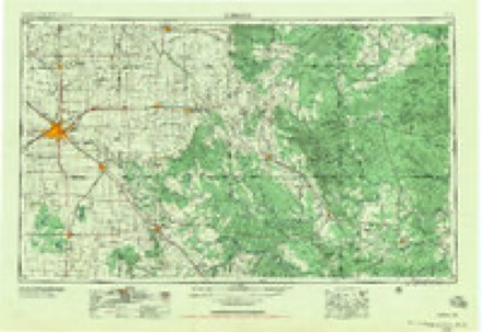
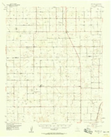
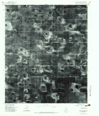
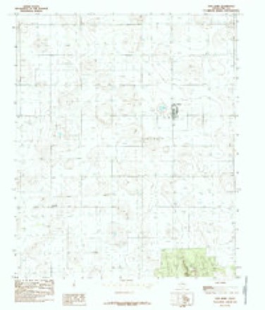
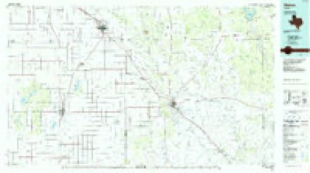
10 topographic sheets cover this place, the earliest surveyed in 1954 and the latest in 1986. It stands in the Tahoka census division. It lies in ZIP code area 79383. The Survey maps it on the New Home quadrangle.
Topographic sheets covering this place
5 surveys from 10 printed sheetsMatched by testing this settlement's coordinate against the published boundary of every sheet in the United States Geological Survey's historical collection. Each opens the scanned sheet at the Survey.
- 1954 USGS Lubbock quadrangle1:250000, 4 printings
- 1957 USGS New Home quadrangle1:62500
- 1976 USGS New Home SW quadrangle1:24000, 2 printings
- 1985 USGS New Home quadrangle1:24000
- 1986 USGS Slaton quadrangle1:100000, 2 printings
Fires near this place
7 since 2007Regional context, not property-specific evidence. The federal wildfire occurrence database lists 7 fires within 5 miles of New Home between 2007 and 2014, burning about 1,031 acres in total. 2 started naturally. None was recorded as arson. Distance is straight-line from the map coordinates, so a fire counted here may appear on a neighbouring settlement's page as well.
| Reported cause | Fires |
|---|---|
| Missing data/not specified/undetermined | 3 |
| Natural | 2 |
| Equipment and vehicle use | 1 |
| Debris and open burning | 1 |
The most recent of them, most recent first, with the day each was reported and the service that recorded it.
| Date | Cause | Size | Reported by | Name on the report |
|---|---|---|---|---|
| 29 September 2011 | Missing data/not specified/undetermined | 500 acres | Texas A & M Forest Service | COUNTY FARM 2 |
| 11 August 2011 | Natural | 25 acres | Texas A & M Forest Service | T-BAR |
| 1 April 2008 | Natural | 480 acres | Texas A & M Forest Service | not named |
| 4 March 2014 | Equipment and vehicle use | under an acre | Texas A & M Forest Service | NORA BAR DITCH |
| 25 March 2013 | Debris and open burning | 5.0 acres | Texas A & M Forest Service | MAEKERS GRASS |
| 22 February 2014 | Missing data/not specified/undetermined | 20 acres | Texas A & M Forest Service | CR11 |
| 13 October 2007 | Missing data/not specified/undetermined | 1.0 acres | Texas A & M Forest Service | not named |
Settlements close enough to share some of these fires:
Storms near this place
43 since 1995Regional context, not property-specific evidence. The National Weather Service names New Home in 43 storm reports between 1995 and 2025: 25 hail, 10 thunderstorm wind, 3 flash flood, 3 tornado. No death or injury is recorded in these reports. Each account below is quoted exactly as the forecast office filed it, from the NOAA Storm Events Database, and each date opens the federal record of that event.
| When | Event | Place named | Harm | What the report says |
|---|---|---|---|---|
| June 2015 | Hail | New Home | $50,000 | Hail of quarter to ping pong ball size was estimated by NWS employees along County Road 211. About 50 vehicles parked outdoors at a nearby wedding reception received minor hail damage. |
| May 1999 | Hail | New Home | $50,000 | no account filed |
| May 2007 | Flash Flood | New Home | $30,000 | Local emergency management officials reported that most Farm to Market Roads west of New Home in northwestern Lynn County were covered by fast moving high water. Newspaper accounts suggest that between four and six inches of rainfall was measured by several locals along the storm's path. Reports indicated that a number of people were stranded in flooded vehicles. No injuries were reported. |
| July 1997 | Thunderstorm Wind | New Home | $25,000 | no account filed |
| April 2003 | Hail | New Home | $20,000 | The Emergency Manager reported golfball size hail. |
| May 2019 | Thunderstorm Wind | New Home | $10,000 | From 1446 through 1450 CST, severe wind gusts were observed by the Texas Tech University West Texas mesonet site in New Home. The strongest gust reached 75 mph along with one-minute sustained winds of 64 mph. Furthermore, pictures on social media revealed that a few power lines were downed by these high winds. |
| May 2006 | Hail | New Home | $10,000 | The public reported that giant baseball size hailstones briefly fell in New Home. Minor property damage was reported. |
| June 2000 | Thunderstorm Wind | New Home | $1,000 | Strong thunderstorm wind snapped a power pole on Farm-to-Market Road 1317. |
| April 2025 | Thunderstorm Wind | New Home | - | A Texas Tech University West Texas mesonet site in New Home measured severe wind gusts from 1453 CST through 1502 CST. A peak wind gust of 64 mph was measured at 1453 and 1554 CST. |
| June 2025 | Hail | New Home | - | An emergency management official reported golf ball size hail near New Home. |
| June 2025 | Thunderstorm Wind | New Home | - | A Texas Tech University West Texas mesonet site near New Home measured severe wind gusts from 1933 CST to 1934 CST. A peak wind gust of 80 mph was measured at 2034 CST. Additionally, irrigation center pivots were reportedly knocked over in central Lynn County, north of Tahoka. |
| August 2022 | Flash Flood | New Home | - | Numerous reports were received of widespread flooding along US Highway 87 from the Lubbock/Lynn County Line into Tahoka. An estimated two to four inches of rain fell within an hour causing flooding. A rain gage in Tahoka reported a rainfall total of 3.50 inches. |
| May 2020 | Thunderstorm Wind | New Home | - | Social media posts depicted minor thunderstorm wind damage around Woodrow to near New Home in Lynn County. |
| May 2020 | Hail | New Home | - | A spotter observed hail on the ground up to quarter size while driving through New Home. The time of the hail was estimated from radar data. |
| June 2020 | Thunderstorm Wind | New Home | - | A Texas Tech University West Texas mesonet site near New Home measured a peak wind gust of 71 mph at 1820 CST. Severe wind gusts were measured from 1819 CST to 1821 CST. |
| June 2020 | Thunderstorm Wind | New Home | - | A Texas Tech University West Texas mesonet site near New Home measured a wind gust to 58 mph from 2319 through 2320 CST. |
| October 2018 | Hail | New Home | - | An insurance adjuster relayed hail damage to cotton crops in northwest Lynn County. Approximately 300 acres of cotton and sorghum sustained moderate to heavy damage. |
| July 2017 | Thunderstorm Wind | New Home | - | Measured by a Texas Tech University West Texas mesonet station in New Home. |
| April 2016 | Hail | New Home | - | Report received via Twitter. No damage was noted. |
| June 2010 | Thunderstorm Wind | New Home | - | The public estimated thunderstorm wind gusts in excess of 60 mph and blowing dust which restricted visibility. No damages were reported. |
| July 2010 | Heavy Rain | New Home | - | Scattered showers and thunderstorms initially began to produce rainfall around midday on the 1st. This activity gradually evolved toward heavy tropical downpours, especially during the evening hours of the 3rd through the morning hours of the 4th.||Storm total rainfall amounts measured by the Texas Tech University West Texas Mesonet and by National Weather Service cooperative observers included: 14.20 inches at Draw, 10.24 inches at O'Donnell, and 7.78 inches at Tahoka. |
| June 2010 | Tornado (EF0) | New Home | - | A National Weather Service meteorologist observed a short-lived landspout tornado over an open field north of New Home. The landspout tornado formed during the initiation stage of a thunderstorm which eventually showed Doppler radar-based evidence of large hail. No damage was reported. |
| May 2007 | Hail | New Home | - | Numerous reports of large hail were received as a multi-cell cluster of severe storms slowly propagated southwestward over northern Lynn County. Initial reports were received at 19:34 CST of penny size hail along U.S. Highway 87 just south of the Lubbock and Lynn County line. Hailstones reportedly grew in size as the storm propagated southwestward over northern Lynn County. Newspaper accounts indicated that many acres of young cotton plants were stripped and that farmers will be hard pressed to replant by the insurance dictated deadlines. |
| June 2007 | Hail | New Home | - | Local agricultural officials reported that pea to nickel size hail damaged cotton crops along the Terry and Lynn County line between Meadow and New Home. |
| August 2007 | Tornado (EF0) | New Home | - | Numerous reports were received of a tornado in extreme northwestern Lynn County. The tornado was highly visible from Lubbock, Wolfforth, and even from portions of Terry County. ||A Texas Tech University West Texas Mesonet meteorologist initially witnessed a developing funnel cloud to the distant south from Reese Center at 12:49 CST. A ground circulation was first seen at 12:51 CST, and the tornado reportedly dissipated rapidly at 12:55 CST. ||The tornado remained over open fields southwest of the intersection of Farm to Market Roads 179 and 41 (intersection actually in extreme southwestern Lubbock County). A Wolfforth city employee observed the tornado from just south of Farm to Market Road 41 west of that intersection, and reported that it was south of his location, in extreme northwestern Lynn County. Radar additionally indicated a weak convective shower there. Initial reports indicated that debris was spotted in the tornadic circulation, but no damage was discovered by local authorities. |
| May 2006 | Tornado (F0) | New Home | - | The public observed a tornado near the intersection of Farm to Market Roads 179 and 211 around 16:30 CST. The tornado, which developed beneath a rapidly intensifying supercell thunderstorm, remained over open farmland and no damage was reported. |
| May 2006 | Hail | New Home | - | The public reported baseball size hail at a rural residence east of New Home. No significant damage was reported. |
| May 2006 | Hail | New Home | - | Storm chasers reported that large hail up to the size of golfballs fell along a swath near New Home as a tornadic supercell tracked over northern Lynn and southern Lubbock Counties. The hail was intermittently mixed with giant stones. |
| May 2006 | Hail | New Home | - | The previously tornadic high-precipitation supercell over Terry County propagated eastward into northwestern Lynn County. This storm produced large hail up to the size of nickels west of New Home, where a tornadic storm had resulted in very large hail just one hour earlier. |
| June 2003 | Hail | New Home | - | A storm spotter reported golfball size hail. |
| April 2000 | Hail | New Home | - | Penny to quarter size hail covered the ground. |
| June 2000 | Flash Flood | New Home | - | A very slow moving thunderstorm produced locally heavy rainfall that resulted in flooding of Farm-to-Market Road 1317 in several places west of Highway 87. The water was one to two feet deep in some places. |
| September 2016 | Funnel Cloud | New Home | - | no account filed |
| September 2005 | Hail | New Home | - | no account filed |
| May 2004 | Hail | New Home | - | no account filed |
| May 2002 | Hail | New Home | - | no account filed |
| May 2002 | Hail | New Home | - | no account filed |
| August 2001 | Hail | New Home | - | no account filed |
| February 2000 | Hail | New Home | - | no account filed |
| May 1996 | Hail | New Home | - | no account filed |
| June 1995 | Hail | New Home | - | no account filed |
| June 1995 | Hail | New Home | - | no account filed |
| June 1995 | Hail | New Home | - | no account filed |
Nearest settlements
The eight closest, with where each one stands in the county. Distances are straight-line, computed from the Geographic Names Information System coordinates.
Provenance
This settlement is recorded in the Geographic Names Information System as feature 1363716. The sheet list is computed by point-in-boundary test against the United States Geological Survey's historical topographic inventory. Both are works of the United States government and carry no copyright under 17 U.S.C. 105.
Wildfire. Short, Karen C. 2022. Spatial wildfire occurrence data for the United States, 1992-2020 [FPA_FOD_20221014]. 6th Edition. Fort Collins, CO: Forest Service Research Data Archive. https://doi.org/10.2737/RDS-2013-0009.6 Collected with United States Government funding and usable without additional permissions or fees.
Storms. NOAA National Centers for Environmental Information, Storm Events Database https://www.ncei.noaa.gov/stormevents/ A work of the United States government, no copyright under 17 U.S.C. 105. Narratives are quoted verbatim from the National Weather Service report and are not edited or summarised.