 Block
BlockNorthfield, Texas
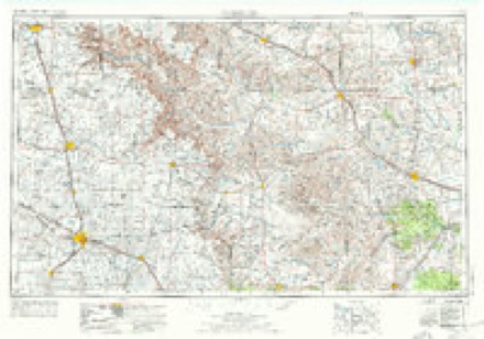
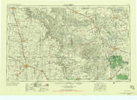
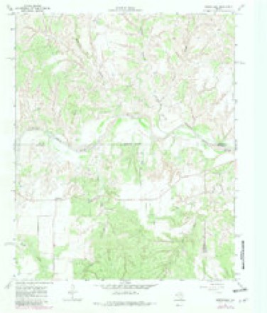
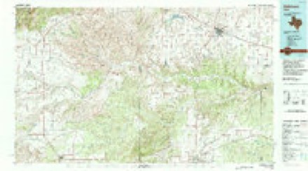
8 topographic sheets cover this place, the earliest surveyed in 1954 and the latest in 1986. It stands in the North Motley census division. It lies in ZIP code area 79201. The Survey maps it on the Northfield quadrangle.
Topographic sheets covering this place
4 surveys from 8 printed sheetsMatched by testing this settlement's coordinate against the published boundary of every sheet in the United States Geological Survey's historical collection. Each opens the scanned sheet at the Survey.
- 1954 USGS Plainview quadrangle1:250000, 3 printings
- 1958 USGS Plainview quadrangle1:250000
- 1967 USGS Northfield quadrangle1:24000, 2 printings
- 1986 USGS Childress quadrangle1:100000, 2 printings
Fires near this place
11 since 2003Regional context, not property-specific evidence. The federal wildfire occurrence database lists 11 fires within 5 miles of Northfield between 2003 and 2020, burning about 2,310 acres in total. 6 started naturally. 1 was recorded as arson. Distance is straight-line from the map coordinates, so a fire counted here may appear on a neighbouring settlement's page as well.
| Reported cause | Fires |
|---|---|
| Natural | 6 |
| Arson/incendiarism | 1 |
| Recreation and ceremony | 1 |
| Equipment and vehicle use | 1 |
| Debris and open burning | 1 |
| Power generation/transmission/distribution | 1 |
The most recent of them, most recent first, with the day each was reported and the service that recorded it.
| Date | Cause | Size | Reported by | Name on the report |
|---|---|---|---|---|
| 8 September 2015 | Natural | 1,200 acres | Texas A & M Forest Service | LUCKEY KNOB |
| 29 September 2003 | Natural | 500 acres | Texas A & M Forest Service | ROLLING PLAINS - 20 |
| 20 September 2011 | Natural | 10 acres | Texas A & M Forest Service | 100 |
| 20 September 2011 | Natural | 200 acres | Texas A & M Forest Service | NORTH NORTHFIELD |
| 29 August 2015 | Recreation and ceremony | 5.0 acres | Texas A & M Forest Service | CEEVEE ROAD |
| 10 August 2016 | Natural | 10 acres | Texas A & M Forest Service | MULTER |
| 12 June 2006 | Natural | 1.0 acres | Texas A & M Forest Service | not named |
| 9 April 2014 | Equipment and vehicle use | 350 acres | Texas A & M Forest Service | TIMMON |
Settlements close enough to share some of these fires:
Storms near this place
54 since 1996Regional context, not property-specific evidence. The National Weather Service names Northfield in 54 storm reports between 1996 and 2025: 33 thunderstorm wind, 18 hail, 2 tornado, 1 flash flood. No death or injury is recorded in these reports. Each account below is quoted exactly as the forecast office filed it, from the NOAA Storm Events Database, and each date opens the federal record of that event.
| When | Event | Place named | Harm | What the report says |
|---|---|---|---|---|
| April 2010 | Tornado (EF2) | Northfield | $100,000 | Multiple storm chasers observed a large and rain-wrapped tornado that moved east-northeastward across the Motley and Cottle County line south-southeast of Northfield and southwest of Cee Vee during the 18:00 CST hour on the 22nd. ||Doppler radar, along with post-storm ground and aerial surveys, suggest that the tornado developed at approximately 18:20 CST 9 miles south-southwest of Northfield, just east of Farm to Market Road 94. Storm chasers first obtained a visual confirmation of the tornado at 18:37 CST as it partially emerged from obscuring rain curtains. Photographs show a very large wedge-shaped tornado, with only the southern portion of the vortex visible through the wrapping precipitation. ||The tornado's track across northeastern Motley County remained over uninhabited ranch land. A National Weather Service cooperative observer, however, reported a loud roar as the tornado passed south of her home south of Northfield. Surveys of adjacent ranch land, conducted by private land owners as well as National Weather Service and Texas Tech University West Texas Mesonet meteorologists, revealed that the tornado destroyed four windmills, severely damaged mesquite trees, and snapped at least a half dozen wooden utility poles. The damage path was measured to be three-quarters of a mile wide. ||The tornado again became totally obscured by rain and hail within the parent high precipitation supercell storm before it crossed the Motley and Cottle County line approximately 8.25 miles south-southeast of Northfield at 18:42 CST. It likely dissipated just a few minutes later at approximately 18:45 CST southwest of Cee Vee in northwestern Motley County.||The total path length of the tornado across portions of Motley and Cottle Counties was approximately 9 miles, with a 25-minute duration. Enhanced-Fujita Scale damage indicators for both free-standing metal towers and metal electrical transmission line poles were considered to gauge expected wind speeds for the destroyed windmills. The lower bounds for degrees of damage 2 and 5 respectively were accepted, yielding estimated wind speeds between 110 and 115 mph. Winds of at least this magnitude are additionally supported by the expected value for snapped wooden utility poles, which were additionally observed along the damage path. Therefore an EF-2 rating was assigned for this tornado. |
| April 2003 | Hail | Northfield | $25,000 | Golfball size hail was reported by the public. |
| April 1999 | Thunderstorm Wind | Northfield | $15,000 | Strong wind blew windows out of a truck and farm equipment, blew down trees, destroyed an antenna, blew the roof off a storage shed, damaged the roof of a cottage, and damaged a box car. NWS storm survey estimated winds to have been about 80 mph. |
| June 2019 | Thunderstorm Wind | Northfield | $1,000 | A Texas Tech University West Texas mesonet site near Northfield measured a wind gust to 82 mph. Additionally, an NWS cooperative weather observer near Northfield reported several trees blown down. |
| May 2016 | Hail | Northfield | $400 | A storm chaser observed wind-driven hail as large as tennis balls. The hail fell immediately west of what would become a significant tornado just a few minutes later. Minor hail damage occurred to the storm chaser's vehicle. |
| August 2013 | Thunderstorm Wind | Northfield | $200 | A NWS Cooperative Observer reported tree limbs broken, shingles blown off a roof and a stock trailer blown 200 feet by severe winds. Although a Texas Tech University West Texas Mesonet station located one mile south of Northfield only measured a peak gust of 57 mph at 4:05 pm CST, the winds associated with the damage in Northfield were likely higher. |
| June 2025 | Thunderstorm Wind | Northfield | - | A Texas Tech University West Texas mesonet site near Northfield measured a wind gust of 59 mph. |
| June 2025 | Thunderstorm Wind | Northfield | - | A Texas Tech University West Texas mesonet site near Northfield measured severe wind gusts from 1851 CST through 1853 CST. A peak wind gust of 65 mph was measured at 1852 CST. |
| June 2025 | Thunderstorm Wind | Northfield | - | A Texas Tech University West Texas mesonet site near Northfield measured severe wind gusts from 1851 CST through 1853 CST. A peak wind gust of 65 mph was measured at 1852 CST. Additionally, a storm chaser that sever power poles were bent over the roadway northeast of Northfield. |
| May 2023 | Thunderstorm Wind | Northfield | - | A Texas Tech University West Texas mesonet site near Northfield measured severe wind gusts from 1605 CST through 1608 CST. A peak wind gust of 64 mph was measured at 1608 CST. |
| May 2023 | Thunderstorm Wind | Northfield | - | A Texas Tech University West Texas mesonet site near Northfield measured a wind gust of 60 mph. |
| September 2023 | Thunderstorm Wind | Northfield | - | A Texas Tech University West Texas mesonet site near Northfield measured wind gusts of 59 mph from 1938 CST through 1939 CST. |
| May 2022 | Thunderstorm Wind | Northfield | - | A Texas Tech University West Texas mesonet site near Northfield measured severe wind gusts from 2141 CST through 2144 CST. A peak wind gust of 72 mph was measured at 2143 CST. |
| May 2022 | Thunderstorm Wind | Northfield | - | A Texas Tech University West Texas mesonet site near Northfield measured severe wind gusts from 2119 CST through 2121 CST. A peak wind gust of 61 mph was measured at 2120 CST. |
| July 2020 | Hail | Northfield | - | A NWS cooperative weather observer in Northfield estimated half dollar size hail. |
| August 2020 | Thunderstorm Wind | Northfield | - | A Texas Tech University West Texas mesonet site near Northfield measured a wind gust to 60 mph. |
| August 2020 | Thunderstorm Wind | Northfield | - | A Texas Tech University West Texas mesonet site near Northfield measured a peak wind gust of 65 mph at 1610 CST. Severe wind gusts were measured from 1555 through 1615 CST. |
| March 2019 | Thunderstorm Wind | Northfield | - | Measured by a Texas Tech University West Texas mesonet. |
| August 2019 | Thunderstorm Wind | Northfield | - | A Texas Tech University West Texas mesonet site near Northfield measured a wind gust to 66 mph. |
| May 2018 | Thunderstorm Wind | Northfield | - | A Texas Tech University West Texas mesonet site near Northfield measured a wind gust to 77 mph. |
| May 2018 | Hail | Northfield | - | An NWS cooperative weather observer reported hail up to ping pong ball size. |
| May 2018 | Thunderstorm Wind | Northfield | - | Measured by a Texas Tech University West Texas mesonet. |
| March 2017 | Thunderstorm Wind | Northfield | - | Measured by a Texas Tech University West Texas mesonet station. |
| June 2017 | Thunderstorm Wind | Northfield | - | Measured by a Texas Tech University West Texas mesonet. |
| September 2017 | Thunderstorm Wind | Northfield | - | Measured by a Texas Tech University West Texas mesonet. |
| August 2017 | Thunderstorm Wind | Northfield | - | Measured by a Texas Tech University West Texas mesonet near Northfield. |
| October 2017 | Thunderstorm Wind | Northfield | - | A Texas Tech University West Texas mesonet site near Northfield measured a wind gust to 64 mph. |
| May 2016 | Tornado (EFU) | Northfield | - | A large multi-vortex tornado developed in far north-central Motley County at 2033 CST. This tornado was nearly stationary at first, before drifting slowly north followed by an abrupt acceleration to the northwest into Hall County (continued below). Several storm spotters observed this tornado and debris cloud as it crossed Farm-to-Market Road 656. This tornado tracked over open ranch and canyon lands resulting in very few damage indicators. A limited road network and flooded roads prevented a post-storm ground survey conducted by National Weather Service meteorologists from assessing damage. Therefore, the tornado was given a rating of EF-unknown while in Motley County. |
| July 2016 | Thunderstorm Wind | Northfield | - | A Texas Tech University West Texas mesonet site near Northfield measured a wind gust to 64 mph. |
| July 2016 | Thunderstorm Wind | Northfield | - | Measured by a Texas Tech University West Texas mesonet station. |
| July 2016 | Thunderstorm Wind | Northfield | - | Measured by a Texas Tech University West Texas mesonet station located near Northfield. |
| July 2016 | Thunderstorm Wind | Northfield | - | Measured by a Texas Tech University West Texas mesonet station. |
| July 2016 | Hail | Northfield | - | A NWS cooperative weather observer reported a swath of wind blown hail that damaged a 12 mile long stretch of cotton in Motley and Hall Counties between Northfield and Turkey. |
| April 2015 | Thunderstorm Wind | Northfield | - | Measured by a Texas Tech University West Texas mesonet near Northfield. |
| August 2014 | Thunderstorm Wind | Northfield | - | Measured by a Texas Tech University West Texas Mesonet station near Northfield. A gust to 58 mph occurred at 1550 CST. |
| April 2013 | Thunderstorm Wind | Northfield | - | A Texas Tech University West Texas Mesonet station about one mile south of Northfield observed a 67 mph severe thunderstorm wind gust. |
| April 2013 | Hail | Northfield | - | A cooperative observer in Northfield reported hail as large as walnuts along with high winds of unknown intensity for about 3 minutes. No damage was reported. |
| June 2013 | Flash Flood | Northfield | - | Law enforcement reported that all roads in northern Motley County had some degree of flooding. Torrential rainfall created several mud and debris flows that in some cases deposited in excess of one foot of mud along sections of roads. No known damage occurred to any of the road surfaces. |
| December 2012 | Thunderstorm Wind | Northfield | - | Measured by a Texas Tech University West Texas mesonet site. |
| June 2012 | Hail | Northfield | - | Hail up to 1.25 inches was observed 12S Northfield. No damage was reported. |
| June 2012 | Hail | Northfield | - | The public reported dime size hail with a few quarter-size hailstones in Northfield. No damage was reported. |
| April 2011 | Hail | Northfield | - | The public reported that quarter size hail briefly accompanied a thunderstorm at Northfield shortly after 14:00 CST. |
| October 2010 | Thunderstorm Wind | Northfield | - | The Texas Tech University West Texas Mesonet site near Northfield recorded a peak thunderstorm wind gust of 61 mph at 20:00 CST. No damage was reported. |
| April 2010 | Hail | Northfield | - | A National Weather Service cooperative observer reported golfball size hail that intermittently mixed with larger two inch-diameter hailstones at Northfield. No damages were reported. |
| April 2010 | Hail | Northfield | - | A National Weather Service cooperative observer reported that very large tennis ball hailstones intermittently mixed with more numerous golfball size hail at Northfield. No damages were reported. |
| May 2009 | Hail | Northfield | - | The public reported penny size hail along Farm to Market Road 94 just south-southwest of Northfield. |
| June 2009 | Hail | Northfield | - | A National Weather Service cooperative observer reported quarter size hail near Northfield. |
| September 2007 | Thunderstorm Wind | Northfield | - | Storm spotters reported that severe thunderstorm winds downed tree limbs in Northfield. |
| July 2004 | Hail | Northfield | - | Golfball size hail was reported by a storm chaser. |
| May 2006 | Thunderstorm Wind | Northfield | - | no account filed |
| June 2002 | Hail | Northfield | - | no account filed |
| May 1996 | Hail | Northfield | - | no account filed |
| May 1996 | Hail | Northfield | - | no account filed |
| May 1996 | Hail | Northfield | - | no account filed |
Nearest settlements
The eight closest, with where each one stands in the county. Distances are straight-line, computed from the Geographic Names Information System coordinates.
| Map | Place | Distance | Sheets |
|---|---|---|---|
| Folley | 18.0 miles | 8 | |
| Whiteflat | 19.9 miles | 8 | |
| Whitestar | 20.6 miles | 8 | |
| Flomot | 21.1 miles | 8 | |
| Matador | 22.4 miles | 8 | |
| Russellville | 25.8 miles | 8 | |
| Roaring Springs | 30.1 miles | 8 | |
| Mac Bain | 33.7 miles | 8 |
Provenance
This settlement is recorded in the Geographic Names Information System as feature 1364213. The sheet list is computed by point-in-boundary test against the United States Geological Survey's historical topographic inventory. Both are works of the United States government and carry no copyright under 17 U.S.C. 105.
Wildfire. Short, Karen C. 2022. Spatial wildfire occurrence data for the United States, 1992-2020 [FPA_FOD_20221014]. 6th Edition. Fort Collins, CO: Forest Service Research Data Archive. https://doi.org/10.2737/RDS-2013-0009.6 Collected with United States Government funding and usable without additional permissions or fees.
Storms. NOAA National Centers for Environmental Information, Storm Events Database https://www.ncei.noaa.gov/stormevents/ A work of the United States government, no copyright under 17 U.S.C. 105. Narratives are quoted verbatim from the National Weather Service report and are not edited or summarised.