 Block
BlockPalestine, Texas
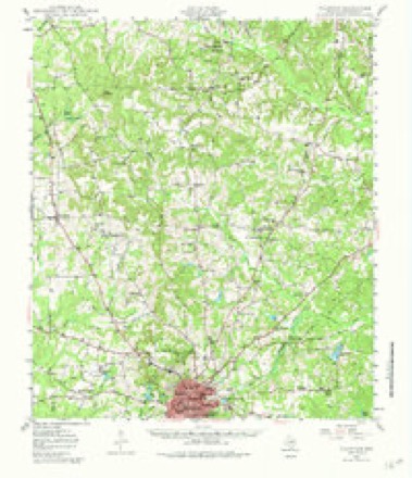
13 topographic sheets cover this place, the earliest surveyed in 1949 and the latest in 1984. It stands in the Palestine census division. It lies in ZIP code area 75801. The Survey maps it on the Northwest Palestine quadrangle. 18,544 people lived here at the 2020 count. It stands 482 feet above sea level.
Research this city
On record in Palestine
Buildings and businesses the archive holds for this place. Each opens its own page, with the source record it came from.
On the National Register 12 of 23 shown
 Anderson County Courthouselisted 1992
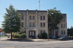 Anderson County Jaillisted 1998
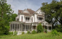 William and Caroline Broyles Houselisted 1988
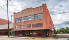 Denby Buildinglisted 1998
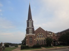 First Presbyterian Churchlisted 1998
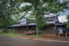 Gatewood-Shelton Ginlisted 1998
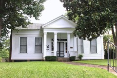 Howard Houselisted 1993
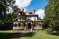 Link Houselisted 1980
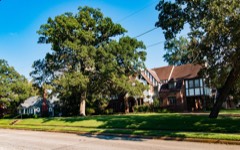 Michaux Park Historic Districtlisted 2004
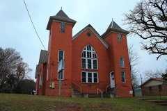 Mount Vernon African Methodist Episcopal Churchlisted 1998
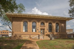 Palestine Carnegie Librarylisted 1988
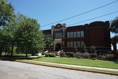 Palestine High Schoollisted 1986
Every listing in Anderson County
Surveyed buildings and structures 5 records
- Dorsett House, Palestinefederal building survey, 2 photographs
- George Pessony House, Palestinefederal building survey, 3 photographs
- Mallard-Alexander-McNaughton House, 407 East Kolstad Street, Palestinefederal building survey, 3 photographs
- Red Brick Schoolhouse, Palestinefederal building survey, 3 photographs
- Schwirter House, Palestinefederal building survey, 3 photographs
Population over time
2 figuresPalestine fell from 18,712 to 18,544 between 2010 and 2020. These are the recorded population figures Wikidata holds for this place, reached through the Geographic Names Information System number this page is keyed on rather than by name, so they belong to this place and not to another of the same name. Most are census counts, but not all are: an early figure may be a founding or settlement estimate, and an estimate published within five years of a census is left out. The change column is computed, and is left blank where more than 20 years separate a figure from the one before it, because a gap that long is not a change between two counts.
| Year | People | Change |
|---|---|---|
| 2010 | 18,712 | |
| 2020 | 18,544 | -168 (-1%) |
Topographic sheets covering this place
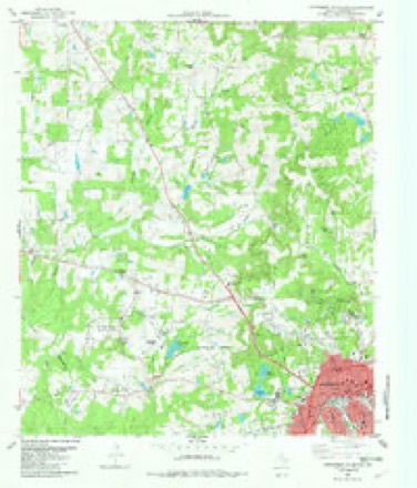
7 surveys from 13 printed sheetsMatched by testing this settlement's coordinate against the published boundary of every sheet in the United States Geological Survey's historical collection. Each opens the scanned sheet at the Survey.
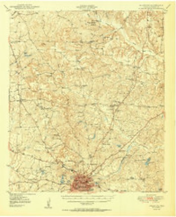
- 1949 USGS Palestine quadrangle1:62500, 3 printings
- 1950 USGS Palestine quadrangle1:62500, 2 printings
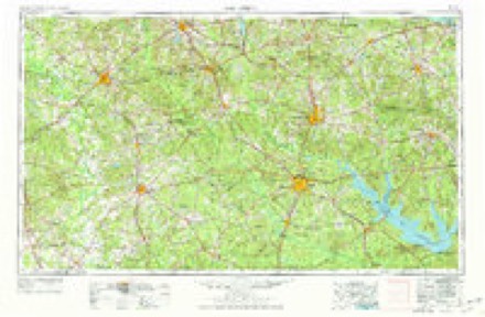
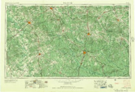
- 1953 USGS Palestine quadrangle1:250000, 2 printings
- 1957 USGS Palestine quadrangle1:250000
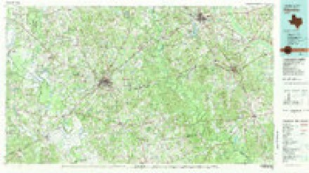
- 1981 USGS Palestine quadrangle1:100000
- 1982 USGS Northwest Palestine quadrangle1:24000
- 1984 USGS Palestine quadrangle1:250000, 3 printings
Photographs
5 photographs,Taken for the Office of War Information and the Farm Security Administration, who photographed the country between 1935 and 1944. Works of United States government photographers, with no known restriction on use. Each opens its catalogue record.
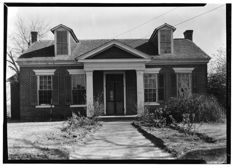
Photographer not recorded. Library of Congress
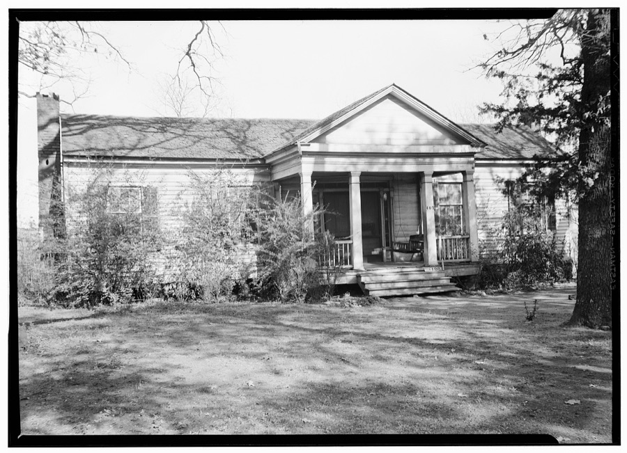
Photographer not recorded. Library of Congress
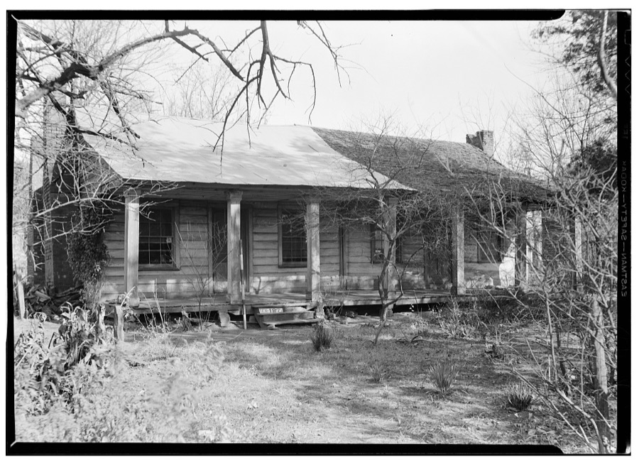
Photographer not recorded. Library of Congress
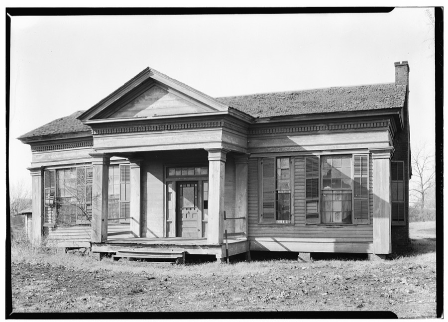
Photographer not recorded. Library of Congress
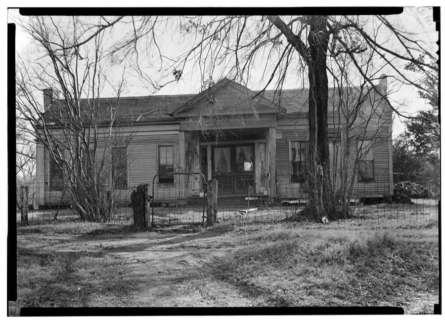
Photographer not recorded. Library of Congress
Fires near this place
286 since 1992Regional context, not property-specific evidence. The federal wildfire occurrence database lists 286 fires within 5 miles of Palestine between 1992 and 2020, burning about 1,548 acres in total. 6 started naturally. 8 were recorded as arson. Distance is straight-line from the map coordinates, so a fire counted here may appear on a neighbouring settlement's page as well.
| Reported cause | Fires |
|---|---|
| Debris and open burning | 167 |
| Missing data/not specified/undetermined | 64 |
| Equipment and vehicle use | 18 |
| Power generation/transmission/distribution | 14 |
| Arson/incendiarism | 8 |
| Natural | 6 |
| Smoking | 2 |
| Fireworks | 2 |
| Misuse of fire by a minor | 2 |
| Recreation and ceremony | 2 |
| Railroad operations and maintenance | 1 |
The most recent of them, most recent first, with the day each was reported and the service that recorded it.
| Date | Cause | Size | Reported by | Name on the report |
|---|---|---|---|---|
| 8 September 2015 | Debris and open burning | 3.0 acres | Texas A & M Forest Service | COLMAN |
| 8 September 2009 | Smoking | 1.0 acres | Texas A & M Forest Service | 2101 FIRE |
| 8 September 2005 | Missing data/not specified/undetermined | 1.0 acres | Texas A & M Forest Service | HENDERSON - 227 |
| 8 September 2005 | Debris and open burning | 15 acres | Texas A & M Forest Service | not named |
| 8 September 1993 | Arson/incendiarism | 3.0 acres | Texas A & M Forest Service | not named |
| 7 September 2011 | Missing data/not specified/undetermined | 2.0 acres | Texas A & M Forest Service | HENDERSON - 523 |
| 6 September 2020 | Debris and open burning | under an acre | Texas A & M Forest Service | 200 FIELD ST |
| 6 September 2005 | Debris and open burning | 4.0 acres | Texas A & M Forest Service | not named |
Settlements close enough to share some of these fires:
Mines and quarries near this place
2 within 5 milesRegional context, not property-specific evidence. The federal mineral resources record lists 2 workings within 5 miles of Palestine: 1 producer, 1 past producer. 1 still produces. What was taken out: Talc-Soapstone, Ball Clay, Clay. Distance is straight-line from the map coordinates, so a quarry counted here may appear on a neighbouring settlement's page as well.
| Where | Site | Commodity | Status | Recorded |
|---|---|---|---|---|
| Palestine Pit | Clay | Past Producer | ||
| Southern Clay Products Plant | Talc-Soapstone, Ball Clay | Producer |
Storms near this place
60 of 119 shownRegional context, not property-specific evidence. The National Weather Service names Palestine in 119 storm reports between 1993 and 2025: 53 thunderstorm wind, 39 hail, 18 flash flood, 4 tornado. The reports record 6 deaths and 1 injury. Each account below is quoted exactly as the forecast office filed it, from the NOAA Storm Events Database, and each date opens the federal record of that event.
| When | Event | Place named | Harm | What the report says |
|---|---|---|---|---|
| April 2016 | Flash Flood | Palestine | 5 killed, $800,000 | Significant and deadly flash flooding happened on Timber Drive in Palestine after 7.5 of water fell in one hour. A family of 5 died in this location while drying to escape the flood waters. Six of 10 homes on the cul-de-sac were completely destroyed by flood waters. Some residents had to be rescued from the roofs of their homes and the water was reported to be 12 feet deep inside some homes. |
| April 2016 | Flash Flood | Palestine | 1 killed, $1,000,000 | Nearly 7.5 of rain fell over Palestine in about one hour causing flooding across the city. Cars were flooded in downtown Palestine. Newspapers also reported that businesses and homes in low-lying areas across the city were flooded and damaged. A total of 35 homes sustained major damage and 3 businesses in Old Town Palestine were damaged. the railroad track at Sycamore and Gillespie streets were washed out. Flooding was also reported at Loop 256 and Highway 84 on the east side of Palestine. To the southwest of Palestine, part of Shamrock Drive was washed out. |
| August 1997 | Heavy Rain | Palestine | 1 hurt, $4,000 | Heavy rain, in excess of 7 inches, that fell in the area saturated soils and weakened the root system of many trees. One tree collapsed onto a car and injured one of its occupants. |
| November 1996 | Thunderstorm Wind | Palestine | $500,000 | no account filed |
| October 2010 | Thunderstorm Wind | Palestine | $400,000 | Significant tree damage occurred in Palestine with several large trees falling on roofs. Some trees also fell on cars causing significant damage. The newspaper also reported that several metal portable buildings were blown onto the east loop, and the roof was blown off The Silver Lady on West Oak Street in downtown Palestine. The store sustained significant damage to the interior. Thousands of residents lost power during and after the storm. |
| July 2007 | Flash Flood | Palestine | $200,000 | Several roads and highways were closed, including CR 448 in the Montalba area and CR 425 off of FM 322. A few bridges were washed out across the county. A 20' x 40' swath of CR 4034 was washed away, stranding several households. A water line servicing about twenty homes was also swept away. |
| December 2006 | Tornado (F1) | Palestine | $200,000 | Structural damage to homes was reported near the intersection of FM 1990 and Highway 294. Roofs were partially removed, trees were blown onto houses, and trees and power lines blown down. One house on CR 2137 just off FM 1990 had the ceiling cave in. In addition, the front porch was completely removed from the house and found in pieces over a hundred yards away. A horse trailer in the backyard was thrown about fifty yards from its original location and landed on its side. |
| May 2012 | Lightning | Palestine | $175,000 | Lightning was believed to have started a house fire in the Quail Valley mobile home park north of Palestine. The single wide mobile home was a complete loss. |
| May 1994 | Thunderstorm Wind | Palestine | $50,000 | A packing plant was unroofed by high winds. |
| April 2006 | Thunderstorm Wind | Palestine | $40,000 | Trees were blown down in roads in and around Palestine. In Neches, a 68-foot porch was entirely ripped off of a house and was strewn 100 feet away. Shingles were also torn off the roof. Also in Neches, more than 15 large trees and numerous power lines were uprooted near FM 2574, a trampoline was thrown across a highway into a tree, and numerous chicken coops were destroyed. A truck later ran into one of the trees laying across FM 2574. |
| June 2025 | Flash Flood | Palestine | $30,000 | The emergency manager reported about 3 to 4 inches of rain. In Palestine, water had been running over the road near 325 Spring Street, and cars were stalled in water near 936 W Oak. |
| May 2007 | Flash Flood | Palestine | $30,000 | CR 425 was underwater and had to be barricaded. In addition, a large section of CR 2232 washed away, leaving residents stranded without another road to use. The flooding broke a large pipe under the road and left a hole about eight feet wide and twelve feet across. The school bus could not pick up children, the mail could not be delivered, and the trash could not be picked up. |
| December 2006 | Tornado (F1) | Palestine | $30,000 | A tornado formed near the intersection of CR 403 and CR 404 and moved north to near Elmwood, causing damage to homes, trees, sheds, and power lines. Trees were split, twisted, and uprooted. The county judge surveyed the damage and found the worst to be between FM 315 and CR 404. |
| June 2012 | Lightning | Palestine | $25,000 | Lightning started a house fire on Sylvan Avenue in Palestine. |
| June 2025 | Flash Flood | Palestine | $20,000 | Local law enforcement reported widespread flooding across Anderson County including 225 Spring St, FM 320, ACR 425, ACR 4251, ACR 422, ACR 4253, ACR 2202, ACR 370, and Salt Works Rd. Cars were still stalled in flood waters on 936 W Oak St. in Palestine as well. |
| June 2006 | Thunderstorm Wind | Palestine | $20,000 | Numerous trees were split and blown down along U.S. 79 and CR 367 between Palestine and Neches. Tree limbs and lawn furniture were blown across yards, and a window of a house was broken. |
| December 2006 | Thunderstorm Wind | Palestine | $20,000 | Downed trees and power lines blocked numerous areas of downtown Palestine including South Magnolia at Bowers Street and Stephanie Drive, and Pecan, West Carolina, Timberline, and East Neches Streets. |
| January 2020 | Thunderstorm Wind | Palestine | $15,000 | Roof damage was reported in Palestine and power poles were also damaged. The report from a member of the nearby NASA balloon facility wrote: a microburst occurred in Palestine near the Courthouse by the intersection of Church and Poplar Street. The power poles that snapped were blown in one direction. Palestine Transmission Service suffered roof damage, and a metal building including beams was destroyed and blown across the street. There was no other damage in the immediate area.. |
| January 2013 | Thunderstorm Wind | Palestine | $15,000 | Anderson County amateur radio operators reported a section of metal roofing was blown off of the Wal Mart distribution center, in the southern sections of Palestine. The debris from the metal roofing damaged a neighboring church. |
| May 2005 | Lightning | Palestine | $15,000 | A transformer was struck by lightning and caught on fire, causing power outages. |
| June 1995 | Thunderstorm Wind | Palestine | $15,000 | High winds over-turned a mobile home. |
| June 1996 | Thunderstorm Wind | Palestine | $12,000 | no account filed |
| January 2013 | Thunderstorm Wind | Palestine | $10,000 | A microburst occurred in the city of Palestine. There were numerous reports of damage within the city, including several trees which were blown down and several buildings which suffered roof and shingle damage. |
| June 2008 | Thunderstorm Wind | Palestine | $10,000 | Trees were blown down in and just south of town. Large limbs fell on roads and power lines. |
| May 2005 | Thunderstorm Wind | Palestine | $10,000 | Damage to roofs, carports, and sheds occurred. Several large trees were uprooted and power lines were knocked down. |
| May 2009 | Thunderstorm Wind | Palestine | $8,000 | A wood frame house was damaged on ACR 367. |
| February 2017 | Thunderstorm Wind | Palestine | $5,000 | Anderson County Sheriff's department reported trees and powerlines down across Anderson County. |
| June 2010 | Thunderstorm Wind | Palestine | $5,000 | Large trees were blown down near Palestine. The wind gust was estimated at 65 mph. |
| June 2009 | Thunderstorm Wind | Palestine | $5,000 | Trees and large tree limbs were down in Palestine. Power lines were also knocked down and approximately 2,000 customers were without power during the peak of the storm. |
| July 2005 | Thunderstorm Wind | Palestine | $5,000 | Trees knocked down across the county by non-severe winds. |
| June 2004 | Thunderstorm Wind | Palestine | $5,000 | Trees and power lines were blown down by high winds. |
| July 2003 | Thunderstorm Wind | Palestine | $5,000 | On County Road 397, 30 large oak and pine trees were blown down by high winds. |
| April 1999 | Tornado (F0) | Palestine | $5,000 | Numerous trees and outbuildings were destroyed by a brief tornado in Broyles Chapel. |
| February 1998 | Thunderstorm Wind | Palestine | $5,000 | Trees and power lines were blown down across the county. |
| May 1994 | Thunderstorm Wind | Palestine | $5,000 | Trees and power lines were blown down by thunderstorm winds. |
| April 1996 | Thunderstorm Wind | Palestine | $5,000 | no account filed |
| August 2010 | Lightning | Palestine | $3,000 | Lightning struck a utility pole on Cottage Avenue that resulted in a small fire and damage to the pole. |
| April 2022 | Thunderstorm Wind | Palestine | $2,000 | Multiple trees were knocked down and power poles were snapped near West Oak and Ferguson Street. |
| June 2007 | Flash Flood | Palestine | $2,000 | County and farm roads were flooded north of Palestine. |
| July 2007 | Flash Flood | Palestine | $2,000 | Several roads were flooded and closed east of Palestine. |
| June 1996 | Thunderstorm Wind | Palestine | $2,000 | no account filed |
| June 1996 | Thunderstorm Wind | Palestine | $2,000 | no account filed |
| June 2021 | Thunderstorm Wind | Palestine | $1,000 | An mPing report stated small tree limbs were broken along with power poles. |
| July 2014 | Thunderstorm Wind | Palestine | $1,000 | Ten large trees and four utility poles were knocked down in Palestine. |
| March 1999 | Thunderstorm Wind | Palestine | $1,000 | Twelve trees were blown down by thunderstorm winds. Several signs were also blown down. |
| November 2015 | Thunderstorm Wind | Palestine | $500 | Strong thunderstorm winds knocked down a few trees and power lines and possibly damaged a garage along Anderson County Road 142 between Palestine and Elkhart. |
| April 1999 | Thunderstorm Wind | Palestine | $500 | Thunderstorms blew down several trees. |
| August 1993 | Thunderstorm Wind | Palestine | $500 | A tree was blown down on the east side of town. |
| March 1999 | Thunderstorm Wind | Palestine | $200 | Trees were blown down by thunderstorms. |
| November 2025 | Thunderstorm Wind | Palestine | - | A social media report indicated a tree down on County Road 2202 one half mile from Westwood Elementary School in Palestine. |
| May 2024 | Hail | Palestine | - | Report from mPING: Dime (0.75 in.). |
| March 2022 | Hail | Palestine | - | Hail up to 1 in diameter was reported on the SE side of Palestine. |
| March 2022 | Hail | Palestine | - | A CoCoRahs observer reported quarter to ping pong ball sized hail in Palestine, TX. |
| April 2022 | Hail | Palestine | - | A public report indicated dime sized hail about 4 miles northeast of Palestine, TX. |
| April 2022 | Hail | Palestine | - | A public report indicated dime sized hail about 3 miles southeast of Palestine, TX. |
| March 2020 | Thunderstorm Wind | Palestine | - | A possible tornado occurred near Hwy 19 and FM 150 between Palestine and Elkhart, but the report could not be corroborated by local residents, video or radar. Some trees were snapped and large tree limbs were torn down in a confined area which could have been caused by a microburst. Minor damage to objects on roofs were also reported. |
| April 2020 | Hail | Palestine | - | A public report indicated quarter sized hail approximately 3 miles west-southwest of the city of Palestine, TX. |
| April 2019 | Hail | Palestine | - | A trained spotter reported nickel size hail approximately one mile northeast of the city of Palestine, TX. |
| April 2019 | Thunderstorm Wind | Palestine | - | Broadcast media reported several large trees blown down near the Palestine Armory. |
| January 2017 | Thunderstorm Wind | Palestine | - | Anderson County Sheriff's Department reported numerous trees of various sizes blown down in the city of Palestine, TX. |
Nearest settlements
The eight closest, with where each one stands in the county. Distances are straight-line, computed from the Geographic Names Information System coordinates.
| Map | Place | Distance | Sheets |
|---|---|---|---|
| Wells Creek | 4.7 miles | 13 | |
| Deanwright | 5.0 miles | 10 | |
| Cronin | 6.0 miles | 10 | |
| Crystal Lake | 6.8 miles | 10 | |
| Kossuth | 7.1 miles | 11 | |
| Lakeview Assembly | 7.7 miles | 10 | |
| Mound Prairie | 8.1 miles | 13 | |
| Harmony | 8.6 miles | 12 |
Elsewhere
Matched on this settlement's Geographic Names Information System number rather than its name, so it cannot be a different place of the same name in another state.
| Wikipedia article on Palestine | An encyclopaedic summary. Its text is share-alike, so it is linked here rather than copied. |
| Wikidata item Q617602 | The structured record the population and elevation above come from. Public domain (CC0). |
Provenance
This settlement is recorded in the Geographic Names Information System as feature 1364714. The sheet list is computed by point-in-boundary test against the United States Geological Survey's historical topographic inventory. Both are works of the United States government and carry no copyright under 17 U.S.C. 105.
Wildfire. Short, Karen C. 2022. Spatial wildfire occurrence data for the United States, 1992-2020 [FPA_FOD_20221014]. 6th Edition. Fort Collins, CO: Forest Service Research Data Archive. https://doi.org/10.2737/RDS-2013-0009.6 Collected with United States Government funding and usable without additional permissions or fees.
Mines and quarries. USGS Mineral Resources Data System (MRDS) https://mrdata.usgs.gov/mrds/ A work of the United States government, no copyright under 17 U.S.C. 105.
Storms. NOAA National Centers for Environmental Information, Storm Events Database https://www.ncei.noaa.gov/stormevents/ A work of the United States government, no copyright under 17 U.S.C. 105. Narratives are quoted verbatim from the National Weather Service report and are not edited or summarised.