 Block
BlockPanther Junction, Texas
10 topographic sheets cover this place, the earliest surveyed in 1903 and the latest in 1985. It stands in the Alpine census division. It lies in ZIP code area 79834. It lies near Lone Mountain. The Survey maps it on the Panther Junction quadrangle. It stands 3,721 feet above sea level.
On record in Panther Junction
Buildings and businesses the archive holds for this place. Each opens its own page, with the source record it came from.
On the National Register within a mile 1 record
The National Register names another town for these. They stand within one mile of this settlement's coordinate.
 Panther Junction Mission 66 Historic Districtlisted 2014 · 0.5 miles away
Surveyed buildings and structures 3 records
- Barker Lodge, Garage, Panther Junctionfederal building survey, 2 photographs
- Barker Lodge, Main House, Panther Junctionfederal building survey, 13 photographs
- K-Bar Ranch, Main House & Garage, Panther Junctionfederal building survey, 11 photographs
Topographic sheets covering this place
5 surveys from 10 printed sheetsMatched by testing this settlement's coordinate against the published boundary of every sheet in the United States Geological Survey's historical collection. Each opens the scanned sheet at the Survey.
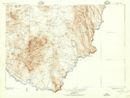
- 1903 USGS Chisos Mountains quadrangle1:125000
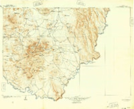
- 1905 USGS Chisos Mountains quadrangle1:125000, 2 printings
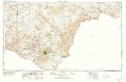
- 1959 USGS Emory Peak quadrangle1:250000, 3 printings
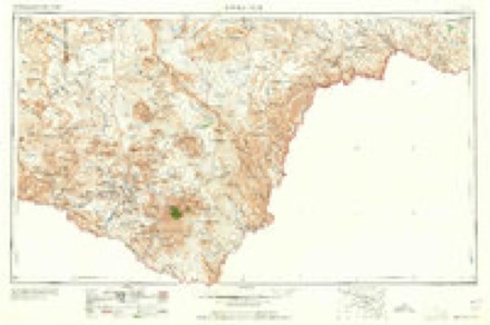
- 1965 USGS Emory Peak quadrangle1:250000
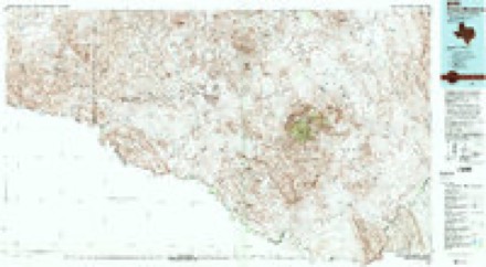
- 1985 USGS Chisos Mountains quadrangle1:100000, 3 printings
Fires near this place
52 since 1992Regional context, not property-specific evidence. The federal wildfire occurrence database lists 52 fires within 5 miles of Panther Junction between 1992 and 2020, burning about 8,376 acres in total. 41 started naturally. None was recorded as arson. Distance is straight-line from the map coordinates, so a fire counted here may appear on a neighbouring settlement's page as well.
| Reported cause | Fires |
|---|---|
| Natural | 41 |
| Equipment and vehicle use | 3 |
| Power generation/transmission/distribution | 3 |
| Smoking | 2 |
| Misuse of fire by a minor | 2 |
| Recreation and ceremony | 1 |
The most recent of them, most recent first, with the day each was reported and the service that recorded it.
| Date | Cause | Size | Reported by | Name on the report |
|---|---|---|---|---|
| 18 September 2001 | Natural | 2.7 acres | Big Bend National Park | SMUGGLER |
| 9 August 2016 | Natural | under an acre | Big Bend National Park | SOLO |
| 29 August 2019 | Power generation/transmission/distribution | under an acre | Big Bend National Park | TRANSFORMER |
| 28 August 2019 | Natural | under an acre | Big Bend National Park | LONE MTN |
| 11 August 2011 | Natural | 1.0 acres | Big Bend National Park | GUN RANGE |
| 9 July 1994 | Natural | 3,774 acres | Big Bend National Park | ESTUFA |
| 31 July 2006 | Natural | under an acre | Big Bend National Park | GREEN |
| 28 July 2010 | Natural | under an acre | Big Bend National Park | JOSELYN |
Settlements close enough to share some of these fires:
Storms near this place
60 since 1996Regional context, not property-specific evidence. The National Weather Service names Panther Junction in 60 storm reports between 1996 and 2025: 34 hail, 15 thunderstorm wind, 9 flash flood, 1 lightning. The reports record 1 death and 1 injury. Each account below is quoted exactly as the forecast office filed it, from the NOAA Storm Events Database, and each date opens the federal record of that event.
| When | Event | Place named | Harm | What the report says |
|---|---|---|---|---|
| February 2003 | Lightning | Panther Junction | 1 killed | A thunderstorm which moved across the Chisos Basin of the Texas Big Bend resulted in a lightning fatality. A man who was hiking in the Chisos Mountains died when he was struck by lightning. The man was reported missing by his wife two days later, and National Park rangers located his body within a few hours of the report. An autopsy confirmed a lightning strike was the cause of death. The time of the event is estimated based on archived satellite and lightning data. |
| May 2005 | Hail | Panther Junction | 1 hurt, $5,000 | The National Weather Service Cooperative Observer at Heath Canyon, noted in the previous entry, sustained minor injuries when he was struck on the head by a very large hail stone. Baseball size stones were sporadically mixed with smaller hail, but additionally caused damage to a nearby trailer. |
| April 2004 | Hail | Panther Junction | $50,000 | House windows and cars were heavily damaged. |
| April 1999 | Hail | Panther Junction | $40,000 | This storm crossed the Rio Grande moving northeast over Castolon. The storm then turned right and displayed supercell characteristics. By the time the storm reached Rio Grande Village tennis ball size hail was falling as the storm proceeded straight east. The storm soon crossed into Mexico. |
| September 2022 | Flash Flood | Panther Junction | $30,000 | Heavy rain resulted in flash flooding in the Big Bend National Park. A section of the Lost Mine Trail collapsed which resulted in heavy damage to that section of trail. The bottom of the trail was covered in rocks and the top of the trail was too narrow to safely cross. The trail was closed as a result. Also, high water and debris crossed the pavement along the Ross Maxwell Scenic Drive. The pavement was broken off and washed away. Logs and rocks were washed onto the road which made it unsafe to travel. The damage and debris resulted in the road being closed. The cost of damage is a very rough estimate. |
| October 2009 | Thunderstorm Wind | Panther Junction | $20,000 | Rio Grande Electric Coop reported 2 power poles were downed near Panther Junction, TX. The severe winds also damaged a roof to a hotel/lodge near the same area. |
| May 2005 | Hail | Panther Junction | $15,000 | A National Weather Service Cooperative Observer reported walnut to golfball size hail at Heath Canyon. The hail persisted for ten minutes, and caused damage to a travel trailer. |
| September 2022 | Flash Flood | Panther Junction | $5,000 | Heavy rain resulted in flooding in Big Bend National Park. All dirt roads, backcountry roadside campsites, and at least one paved road were closed throughout Big Bend National Park due to flooding. The cost of damage is a very rough estimate. |
| October 2021 | Flash Flood | Panther Junction | $5,000 | Heavy rain resulted in flash flooding in Big Bend National Park near Rio Grande Village. Several dirt roads were reported closed or impassible due to debris and mud remaining from localized flash flooding. The cost of damage is a very rough estimate. |
| June 1997 | Hail | Panther Junction | $3,000 | Baseball size hail broke windows in at least one car in the northern portions of Big Bend National Park on the extension of U.S. Highway 385. |
| June 1999 | Hail | Panther Junction | $1,000 | Supercell storm moved to the southeast across Brewster County, mostly in open country. The hail hit the Persimmon Gap Visitor's Center at Big Bend National Park where it broke windows and dented an air conditioning hood. The storm continued to the Rio Grande where 1/2 inch hail covered the ground. |
| May 2025 | Thunderstorm Wind | Panther Junction | - | The RAWS Station (RGET2) Big Bend Rio Grande Village recorded a maximum wind gust of 59 MPH near a thunderstorm. Time is an approximation. |
| May 2025 | Hail | Panther Junction | - | A report was received from the public of golf ball-size hail in the Chisos Basin. |
| July 2025 | Flash Flood | Panther Junction | - | Emergency Management reported many evacuations of campgrounds in the Big Bend area due to flash flooding. The time of occurrence is estimated by radar. No damages were reported. |
| August 2019 | Thunderstorm Wind | Panther Junction | - | A thunderstorm moved across Brewster County and produced a 64 mph wind gust at Persimmon Gap. It was a delayed report due to the cell tower being down. The Mesonet site also had 1.21 inches of rain with this storm. |
| January 2017 | Thunderstorm Wind | Panther Junction | - | A thunderstorm developed across Brewster County and produced a 59 mph wind gust at the mesonet at Persimmon Gap. |
| April 2015 | Thunderstorm Wind | Panther Junction | - | A thunderstorm moved across Brewster County and produced a 59 mph wind gust at the Panther Junction RAWS station. |
| May 2014 | Heavy Rain | Panther Junction | - | Heavy rain moved across Brewster County with 0.75 - 0.99 inches of rain reported within two hours at Panther Junction. |
| July 2013 | Thunderstorm Wind | Panther Junction | - | A thunderstorm moved across Brewster County and produced a 63 mph wind gust at Panther Junction. No damage was reported. |
| June 2009 | Flash Flood | Panther Junction | - | Several large rocks up to the size of basketballs were removed from SH 118 due to the flash flooding across the highway. |
| May 2009 | Flash Flood | Panther Junction | - | The National Park Dispatch Center reported flowing water over SH 120 just north of the Rio Grande Village. Although multiple vehicles hydroplaned near this location, no accidents or injuries were reported. |
| April 2007 | Flash Flood | Panther Junction | - | Two feet of water flowed over Big Bend National Park Route 15 north-northwest of Panther Junction. |
| March 2007 | Hail | Panther Junction | - | Big Bend National Park staff at Persimmon Gap reported penny to quarter size hail. |
| April 2006 | Thunderstorm Wind | Panther Junction | - | Severe thunderstorm winds broke three inch diameter tree limbs off a tree in Rio Grande Village. |
| June 2005 | Flash Flood | Panther Junction | - | Strong thunderstorms affected parts of the west Texas Big Bend region during the late afternoon and evening of the 18th. Locally heavy rainfall east of Panther Junction resulted in flash flooding along Texas Route 118. Running water was reported to have rendered the highway impassable between Panther Junction and Rio Grande Village. |
| June 2005 | Hail | Panther Junction | - | National Park Service rangers reported nickel size hail at the entrance to Big Bend National Park at Persimmon Gap. The hail persisted for twenty minutes. |
| June 2005 | Hail | Panther Junction | - | Park rangers also reported that hail up to the size of golfballs accompanied the storm along the Rio Grande from near Rio Grande Village to Heath Canyon. The large hail generally remained over open rangeland in the eastern parts of the Big Bend National Park. No damage resulted. |
| June 2005 | Thunderstorm Wind | Panther Junction | - | National Park Service rangers reported damaging thunderstorm winds that downed a large tree in Rio Grande Village, in the eastern part of Big Bend National Park. The severe winds were followed by large hail. |
| June 2005 | Hail | Panther Junction | - | Half-dollar size hail was reported at Terlingua Ranch in Big Bend National Park. |
| May 2004 | Hail | Panther Junction | - | An isolated severe thunderstorm produced dime to quarter size hail at Heath Canyon. |
| May 2004 | Hail | Panther Junction | - | Penny size hail was reported in Rio Grande Village. |
| May 2004 | Hail | Panther Junction | - | Several strong to severe thunderstorms developed along the higher terrain of southwest Texas during the late afternoon of the 6th. A cell merger over the northern parts of Big Bend National Park resulted in the development of a severe multicell storm over Persimmon Gap. The National Park Service reported dime to quarter size hail along with strong winds. No wind speed estimates were reported. |
| June 2004 | Hail | Panther Junction | - | Quarter to golfball size hail was reported at the Big Bend National Park headquarters. |
| June 2004 | Hail | Panther Junction | - | Strong to severe thunderstorms erupted late in the afternoon of the 18th over the Big Bend. A park ranger reported golfball size hail at the Big Bend National Park headquarters. The event time listed is an estimatation. |
| June 2002 | Thunderstorm Wind | Panther Junction | - | Wind speeds around 60 mph persisted for almost one hour. |
| June 2002 | Hail | Panther Junction | - | Big Bend National Park rangers reported golfball size hail. |
| June 1998 | Hail | Panther Junction | - | This storm formed near Lajitas and moved eastward into the northwestern sections of Big Bend National Park where it briefly became severe. Conditions in the vicinity of the storm were estimated as a temperature near 90 degrees and a dew point in the mid 50s. |
| June 1997 | Thunderstorm Wind | Panther Junction | - | Gravel from the side of the road was blown onto the park road 11-14 miles north of the Park Headquarters. All of the gravel was 1/2 to 3/4 inch in diameter. The event was not seen but was concluded by Park officials after noting there was no silt or smaller debris which would have suggested flash flooding. During one short stretch of the road, there was an extensive amount of gravel on the road. |
| September 1996 | Flash Flood | Panther Junction | - | Flash flooding occurred near the Big Bend National Park Headquarters |
| May 2019 | Hail | Panther Junction | - | no account filed |
| May 2019 | Hail | Panther Junction | - | no account filed |
| May 2018 | Hail | Panther Junction | - | no account filed |
| April 2015 | Thunderstorm Wind | Panther Junction | - | no account filed |
| April 2015 | Thunderstorm Wind | Panther Junction | - | no account filed |
| May 2014 | Hail | Panther Junction | - | no account filed |
| June 2013 | Hail | Panther Junction | - | no account filed |
| May 2012 | Hail | Panther Junction | - | no account filed |
| May 2012 | Hail | Panther Junction | - | no account filed |
| May 2012 | Hail | Panther Junction | - | no account filed |
| May 2012 | Hail | Panther Junction | - | no account filed |
| June 2009 | Hail | Panther Junction | - | no account filed |
| October 2009 | Hail | Panther Junction | - | no account filed |
| July 2008 | Hail | Panther Junction | - | no account filed |
| June 2007 | Hail | Panther Junction | - | no account filed |
| June 2007 | Hail | Panther Junction | - | no account filed |
| April 2006 | Hail | Panther Junction | - | no account filed |
| April 2004 | Thunderstorm Wind | Panther Junction | - | no account filed |
| April 2002 | Hail | Panther Junction | - | no account filed |
| May 2002 | Thunderstorm Wind | Panther Junction | - | no account filed |
| May 2002 | Thunderstorm Wind | Panther Junction | - | no account filed |
Nearest settlements
The eight closest, with where each one stands in the county. Distances are straight-line, computed from the Geographic Names Information System coordinates.
| Map | Place | Distance | Sheets |
|---|---|---|---|
| Basin Junction | 2.8 miles | 13 | |
| McKinney Springs | 8.0 miles | 11 | |
| Onion Spring | 8.4 miles | 11 | |
| Glenn Springs (historical) | 12.0 miles | 12 | |
| Hot Springs | 15.2 miles | 10 | |
| Rio Grande Village | 16.3 miles | 10 | |
| Boquillas Crossing | 16.8 miles | 10 | |
| San Vicente Crossing | 17.0 miles | 12 |
Elsewhere
Matched on this settlement's Geographic Names Information System number rather than its name, so it cannot be a different place of the same name in another state.
| Wikipedia article on Panther Junction | An encyclopaedic summary. Its text is share-alike, so it is linked here rather than copied. |
| Wikidata item Q96323729 | The structured record the population and elevation above come from. Public domain (CC0). |
Provenance
This settlement is recorded in the Geographic Names Information System as feature 1378830. The sheet list is computed by point-in-boundary test against the United States Geological Survey's historical topographic inventory. Both are works of the United States government and carry no copyright under 17 U.S.C. 105.
Wildfire. Short, Karen C. 2022. Spatial wildfire occurrence data for the United States, 1992-2020 [FPA_FOD_20221014]. 6th Edition. Fort Collins, CO: Forest Service Research Data Archive. https://doi.org/10.2737/RDS-2013-0009.6 Collected with United States Government funding and usable without additional permissions or fees.
Storms. NOAA National Centers for Environmental Information, Storm Events Database https://www.ncei.noaa.gov/stormevents/ A work of the United States government, no copyright under 17 U.S.C. 105. Narratives are quoted verbatim from the National Weather Service report and are not edited or summarised.