 Block
BlockPenitas, Texas
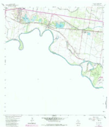
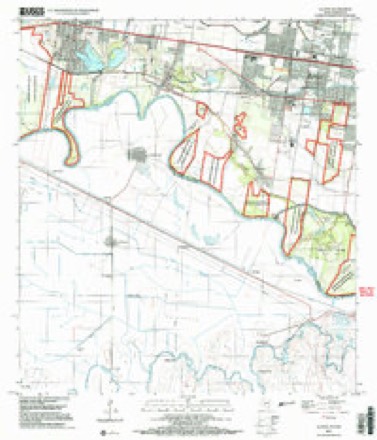
10 topographic sheets cover this place, the earliest surveyed in 1949 and the latest in 2002. It stands in the Sullivan City census division. It lies in ZIP code area 78576. The Survey maps it on the La Joya quadrangle. 6,460 people lived here at the 2020 count. It stands 145 feet above sea level.
Population over time
2 figuresPenitas grew from 4,403 to 6,460 between 2010 and 2020. These are the recorded population figures Wikidata holds for this place, reached through the Geographic Names Information System number this page is keyed on rather than by name, so they belong to this place and not to another of the same name. Most are census counts, but not all are: an early figure may be a founding or settlement estimate, and an estimate published within five years of a census is left out. The change column is computed, and is left blank where more than 20 years separate a figure from the one before it, because a gap that long is not a change between two counts.
| Year | People | Change |
|---|---|---|
| 2010 | 4,403 | |
| 2020 | 6,460 | +2,057 (+47%) |
Topographic sheets covering this place
8 surveys from 10 printed sheetsMatched by testing this settlement's coordinate against the published boundary of every sheet in the United States Geological Survey's historical collection. Each opens the scanned sheet at the Survey.
- 1949 USGS Mc Allen quadrangle1:250000
- 1954 USGS McAllen quadrangle1:250000
- 1957 USGS Mc Allen quadrangle1:250000, 2 printings
- 1962 USGS McAllen quadrangle1:250000
- 1963 USGS La Joya quadrangle1:24000, 2 printings
- 1983 USGS Mc Allen quadrangle1:250000
- 1992 USGS Mc Allen quadrangle1:100000
- 2002 USGS La Joya quadrangle1:24000
Fires near this place
383 since 1993Regional context, not property-specific evidence. The federal wildfire occurrence database lists 383 fires within 5 miles of Penitas between 1993 and 2020, burning about 5,151 acres in total. 2 started naturally. 78 were recorded as arson. Distance is straight-line from the map coordinates, so a fire counted here may appear on a neighbouring settlement's page as well.
| Reported cause | Fires |
|---|---|
| Debris and open burning | 148 |
| Missing data/not specified/undetermined | 136 |
| Arson/incendiarism | 78 |
| Equipment and vehicle use | 9 |
| Railroad operations and maintenance | 3 |
| Natural | 2 |
| Other causes | 2 |
| Smoking | 2 |
| Misuse of fire by a minor | 1 |
| Recreation and ceremony | 1 |
| Power generation/transmission/distribution | 1 |
The most recent of them, most recent first, with the day each was reported and the service that recorded it.
| Date | Cause | Size | Reported by | Name on the report |
|---|---|---|---|---|
| 6 September 2009 | Missing data/not specified/undetermined | under an acre | Lower Rio Grande Valley National Wildlife Refuge | DOVE |
| 30 September 2010 | Missing data/not specified/undetermined | 5.5 acres | Lower Rio Grande Valley National Wildlife Refuge | ABRAM LEVEE |
| 30 September 2010 | Missing data/not specified/undetermined | under an acre | South Texas Refuge Complex | 1427 |
| 28 September 2005 | Debris and open burning | under an acre | South Texas Refuge Complex | DOFFING |
| 11 September 2004 | Debris and open burning | 1.0 acres | South Texas Refuge Complex | 1 1/2 MILE |
| 9 August 2004 | Debris and open burning | under an acre | Lower Rio Grande Valley National Wildlife Refuge | GARZA |
| 5 August 2004 | Smoking | under an acre | Laguna Atascosa National Wildlife Refuge | SORGHUM |
| 5 August 2004 | Arson/incendiarism | under an acre | South Texas Refuge Complex | DOFFING 3 |
Settlements close enough to share some of these fires:
Mines and quarries near this place
10 of 13 shownRegional context, not property-specific evidence. The federal mineral resources record lists 13 workings within 5 miles of Penitas: 12 producers, 1 unknown. 12 still produce. What was taken out: Stone, Crushed/Broken, Sand and Gravel, Construction, Stone, Crushed/Broken, Sand and Gravel, Construction. Distance is straight-line from the map coordinates, so a quarry counted here may appear on a neighbouring settlement's page as well.
| Where | Site | Commodity | Status | Recorded |
|---|---|---|---|---|
| Beck Pit & Plant | Stone, Crushed/Broken, Sand and Gravel, Construction | Producer | ||
| Crow Pit & Plant | Sand and Gravel, Construction | Producer | ||
| Garcia Pit | Sand and Gravel, Construction | Producer | ||
| No. 1 Pit & Plant | Sand and Gravel, Construction | Producer | ||
| Sullivan City | Sand and Gravel, Construction | Unknown | ||
| Beck Quarry | Stone, Crushed/Broken | Producer | Caliche | |
| Bell Pit | Stone, Crushed/Broken | Producer | ||
| Frost Pit | Stone, Crushed/Broken | Producer | ||
| Hawkins Pit | Stone, Crushed/Broken | Producer | ||
| J-2 Pit | Stone, Crushed/Broken | Producer |
Storms near this place
13 since 2003Regional context, not property-specific evidence. The National Weather Service names Penitas in 13 storm reports between 2003 and 2025: 4 thunderstorm wind, 4 hail, 2 flood, 1 tornado. The reports record 11 injuries. Each account below is quoted exactly as the forecast office filed it, from the NOAA Storm Events Database, and each date opens the federal record of that event.
| When | Event | Place named | Harm | What the report says |
|---|---|---|---|---|
| April 2003 | Tornado (F1) | Penitas | 11 hurt, $1,500,000 | Damage report and survey determined that an F1 tornado touched down in Penitas at the intersection of Seven Mile Road and Tom Gill Road. Thirty-seven mobile homes and other structures sustained damage or were destroyed. Several larger trailers were pushed from their foundations and overturned. |
| July 2010 | Flood | Penitas | $6,400,000 | Incredible rainfall estimated to be more than 50 inches in around 10 days' time between June 30th and July 9th across the front range and peaks of the Sierra Madre Oriental in Coahuila Province, Mexico, ultimately flowed through the entire Lower Rio Grande basin for much of the summer of 2010. ||The rare and extreme event rapidly produced major flooding along the river in southwest Hidalgo County, the result of planned dam releases from Falcon International Reservoir. River flooding likely continued spreading southeast into the area that begins the improved levee system of the Lower Rio Grande Valley Flood Control Project, south of Penitas and extending to Anzalduas Diversion Dam where the system of floodways (spillways) begins. While the levees protected most property behind them, a number of structures built inside the levees suffered significant and costly water damage, from Penitas to south of Granjeno.||The structures included the popular river front Chimney Park RV Resort, which had more than 3 feet of water cover half of the land and property; Pepe's on the River Bar and Grill and the Riverside Club, favorite haunts for Winter Texans and local residents alike which provide river views but unfortunately were covered by feet of mud after the flood waters subsided. A sugar grower reported $450 thousand in losses of 300 acres of crop on land south of Mission. Dryland/irrigated dryland crops such as cotton, corn, and sorghum may have suffered some loss but values were unknown as of this writing; an estimate of $500 thousand will be used until additional data arrive. ||Property damage likely exceeded $5 million in these areas alone. |
| April 2023 | Hail | Penitas | $250,000 | Multiple reports of golf ball (1.75) to baseball (2.75) size hail falling across the Peitas area. Several pictures showed hail sizes up to baseballs, with a few pictures showing hail damaged car windshields. One picture in particular showed hail going through the rear windshield of a vehicle with the hailstone intact in the backseat. That same car also had it's right driver's side taillight broken by the large hail. Several other reports of broken windshields or dents to cars were reported in and around Peitas. |
| April 2023 | Thunderstorm Wind | Penitas | $40,000 | A member of the public shared pictures with an NWS employee of significant damage to a mobile home trailer. The pictures show the mobile home destroyed with only one wall still standing. Timing estimated by radar. |
| May 2020 | Thunderstorm Wind | Penitas | $15,000 | Multiple power lines, poles, and trees were reported down with some blocking roads across Hidalgo county as the thunderstorm moved eastward across the county. |
| April 2015 | Flash Flood | Penitas | $10,000 | An estimated 4 to 6 inches of rain fell within a few hours. Poor drainage areas, particularly around the colonias of Alton along and near State Road 107, were hardest hit; several homes had standing water, up to 2 feet in depth, inside them. A foot of water was reported at the Penitas Shopping Plaza as well. |
| March 2025 | Thunderstorm Wind | Penitas | - | Several trees were reported down and power outages in the town of Penitas. |
| May 2024 | Hail | Penitas | - | Quarter size hail was reported near the intersection of Tom Gil and 3 Mile Line Road. |
| April 2023 | Hail | Penitas | - | A member of the public shared pictures of hail up to 2 inches falling in the Peitas area north of HWY 83. |
| April 2023 | Hail | Penitas | - | Member of the public shared pictures of golf ball (1.75) hail in and around the Peitas area. |
| April 2023 | Thunderstorm Wind | Penitas | - | Video from the public shows the metal roof of a carport peeled back near the intersection of Mile 3 Road and Tom Gill Road. Time estimated by radar. |
| August 2022 | Funnel Cloud | Penitas | - | A strong storm developed in southern Hidalgo County and sagged to the southwest the evening of August 11th. At 7:08PM CDT, a member of the public began a Facebook Live that showed a funnel cloud dropping out of the storm. Radar analysis showed some mid-level rotation with the storm to corroborate the video and its timing. It dissipated by the end of the 2 minutes video, so around 7:10PM CDT. |
| August 2010 | Flood | Penitas | - | River flooding continued into the first third of August across the initial section of the Lower Rio Grande Valley Flood Control Project, which includes improved levees between Penitas and the Anzalduas Diversion Dam southwest of Granjeno. While the levees protected most property behind them, a number of structures built inside the levees suffered significant and costly water damage, from Penitas to south of Granjeno.||The structures included the popular river front Chimney Park RV Resort, which had more than 3 feet of water cover half of the land and property; Pepe's on the River Bar and Grill and the Riverside Club, favorite haunts for Winter Texans and local residents alike which provide river views but unfortunately were covered by feet of mud after the flood waters subsided in August. Some crop may have been destroyed by the flood, but damage was unknown as of this writing in this area. Property damage may have exceeded [$5] million in these areas alone. Note: Damage estimates for this portion of the flood area are listed in the July report. |
Nearest settlements
The eight closest, with where each one stands in the county. Distances are straight-line, computed from the Geographic Names Information System coordinates.
| Map | Place | Distance | Sheets |
|---|---|---|---|
| Nuevo Penitas Colonia | 0.8 miles | 10 | |
| Colonia Martinez | 0.8 miles | 10 | |
| Colonia Camargo | 0.9 miles | 10 | |
| El Rio Colonia | 1.0 miles | 10 | |
| King Ranch Colonia Number 2 | 1.0 miles | 10 | |
| King Ranch Colonia Number 1 | 1.1 miles | 10 | |
| Carlos Acres Colonia | 1.6 miles | 10 | |
| Chihuahua | 1.7 miles | 10 |
Elsewhere
Matched on this settlement's Geographic Names Information System number rather than its name, so it cannot be a different place of the same name in another state.
| Wikipedia article on Penitas | An encyclopaedic summary. Its text is share-alike, so it is linked here rather than copied. |
| Wikidata item Q973771 | The structured record the population and elevation above come from. Public domain (CC0). |
Provenance
This settlement is recorded in the Geographic Names Information System as feature 1388195. The sheet list is computed by point-in-boundary test against the United States Geological Survey's historical topographic inventory. Both are works of the United States government and carry no copyright under 17 U.S.C. 105.
Wildfire. Short, Karen C. 2022. Spatial wildfire occurrence data for the United States, 1992-2020 [FPA_FOD_20221014]. 6th Edition. Fort Collins, CO: Forest Service Research Data Archive. https://doi.org/10.2737/RDS-2013-0009.6 Collected with United States Government funding and usable without additional permissions or fees.
Mines and quarries. USGS Mineral Resources Data System (MRDS) https://mrdata.usgs.gov/mrds/ A work of the United States government, no copyright under 17 U.S.C. 105.
Storms. NOAA National Centers for Environmental Information, Storm Events Database https://www.ncei.noaa.gov/stormevents/ A work of the United States government, no copyright under 17 U.S.C. 105. Narratives are quoted verbatim from the National Weather Service report and are not edited or summarised.