 Block
BlockPenwell, Texas
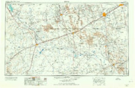
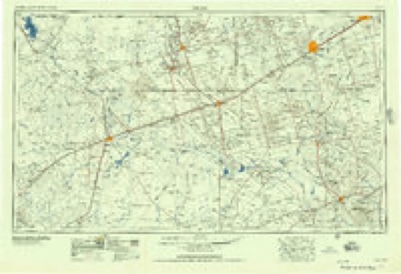
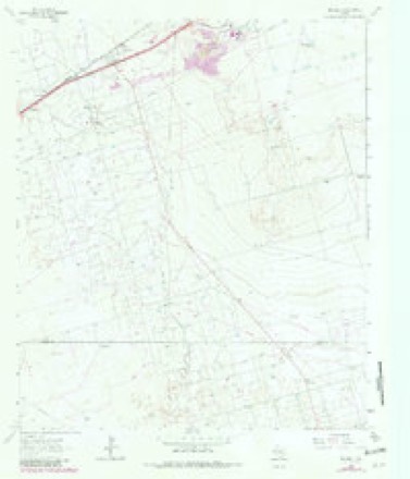
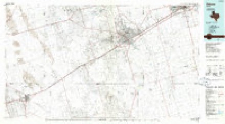
8 topographic sheets cover this place, the earliest surveyed in 1954 and the latest in 1986. It stands in the West Odessa-Goldsmith census division. It lies in ZIP code area 79759. The Survey maps it on the Penwell quadrangle. It stands 2,936 feet above sea level.
Topographic sheets covering this place
4 surveys from 8 printed sheetsMatched by testing this settlement's coordinate against the published boundary of every sheet in the United States Geological Survey's historical collection. Each opens the scanned sheet at the Survey.
- 1954 USGS Pecos quadrangle1:250000, 3 printings
- 1957 USGS Pecos quadrangle1:250000
- 1964 USGS Penwell quadrangle1:24000, 2 printings
- 1986 USGS Odessa quadrangle1:100000, 2 printings
Fires near this place
1 since 2017Regional context, not property-specific evidence. The federal wildfire occurrence database lists 1 fire within 5 miles of Penwell in 2017, burning about 1 acre in total. None started naturally. None was recorded as arson. Distance is straight-line from the map coordinates, so a fire counted here may appear on a neighbouring settlement's page as well.
| Reported cause | Fires |
|---|---|
| Power generation/transmission/distribution | 1 |
The most recent of them, most recent first, with the day each was reported and the service that recorded it.
| Date | Cause | Size | Reported by | Name on the report |
|---|---|---|---|---|
| 15 June 2017 | Power generation/transmission/distribution | 1.0 acres | Texas A & M Forest Service | LEGACY FIRE |
Settlements close enough to share some of these fires:
Mines and quarries near this place
6 within 5 milesRegional context, not property-specific evidence. The federal mineral resources record lists 6 workings within 5 miles of Penwell: 5 producers, 1 past producer. 5 still produce. What was taken out: Stone, Crushed/Broken, Limestone, General, Limestone, General, Stone, Crushed/Broken. Distance is straight-line from the map coordinates, so a quarry counted here may appear on a neighbouring settlement's page as well.
| Where | Site | Commodity | Status | Recorded |
|---|---|---|---|---|
| Moss Quarry | Limestone, General, Stone, Crushed/Broken | Producer | Limestone | |
| Cap Rock Pit | Stone, Crushed/Broken, Limestone, General | Producer | ||
| Odessa Quarry | Limestone, General | Producer | Limestone | |
| Permian Sand and Gravel Operation | Stone, Crushed/Broken | Past Producer | ||
| Strain Brothers Limestone Operation | Stone, Crushed/Broken | Producer | ||
| Weaver-Cunningham Pit | Stone, Crushed/Broken | Producer |
Storms near this place
19 since 1993Regional context, not property-specific evidence. The National Weather Service names Penwell in 19 storm reports between 1993 and 2025: 11 hail, 5 thunderstorm wind, 2 flash flood, 1 flood. No death or injury is recorded in these reports. Each account below is quoted exactly as the forecast office filed it, from the NOAA Storm Events Database, and each date opens the federal record of that event.
| When | Event | Place named | Harm | What the report says |
|---|---|---|---|---|
| June 2003 | Thunderstorm Wind | Penwell | $105,000 | A trained weather spotter measured a 61 MPH severe thunderstorm wind gust with a home weather station near Penwell. These winds were responsible for overturning a tractor trailer on Interstate 20 at mile marker 102. The storm then propagated southeast toward the Pleasant Farms vicinity. Several weakly constructed homes were heavily damaged in Pleasant Farms. Winds associated with the storm were likely higher than indicated across the southeast portions of the county, where most of the damage was concentrated. Due to the light construction of the damaged structures, the sole measured wind gust is referenced here instead of a damage based estimate. |
| July 1997 | Thunderstorm Wind | Penwell | $60,000 | A pulse microburst destroyed 5 trailer homes in a rural development in southwestern Ector County. Three other units received major damage. Most of the trailers were not tied down. Winds in the local area was blowing from SE to NW; the same direction as the storm movement. Since there was minimal damage to some more-substantial structures in the area, wind speeds were only estimated at 60-70 mph. In areas farther east it became evident that there was a downburst pattern, as winds were from the south or southwest. |
| June 2004 | Hail | Penwell | $5,000 | Law enforcement officials reported a swath of large hail along Interstate 20 from the city of Monahans in Ward County, northeast to mile marker 92 in southwest Ector County. Hail up to the size of golfballs was reported in the vicinity of Monahans. Quarter size hail was observed northeast of Monahans along the interstate in extreme northwest Crane County and in southwest Ector County. |
| May 2025 | Hail | Penwell | - | A report of quarter-size hail was received from mPING. |
| June 2003 | Thunderstorm Wind | Penwell | - | A few strong to severe thunderstorms developed over the western Permian Basin and Upper Trans Pecos region of West Texas during the afternoon and evening of the 23rd. One of these storms resulted in severe wind gusts in Ector County. |
| June 2003 | Hail | Penwell | - | Several reports of large hail to the size of golfballs was reported from Penwell to Pleasant Farms. |
| March 2002 | Flood | Penwell | - | Minor street flooding was reported in Penwell by a trained spotter. |
| May 2002 | Flash Flood | Penwell | - | Water was one foot deep at the intersection of Farm to Market Road 1601 and Interstate-20. |
| May 2002 | Flash Flood | Penwell | - | Two inches of rainfall in a short time span produced water as much as 15 inches deep on roadways in the community of Penwell. |
| May 2001 | Thunderstorm Wind | Penwell | - | The cooperative observer reported strong winds as a result of a collapsing thunderstorm. |
| May 1995 | Hail | Penwell | - | An HP supercell that caused wind damage and dropped large hail in southeastern New Mexico turned right and crossed the border into Winkler County, Texas. A rotating wall cloud was reported by SKYWARN spotters, then a brief tornado occurred five minutes later. Spotters reported the hail in Kermit as the storm continued to move southeast. Weather observer recorded hail in surface observations from the Winkler County Airport near Wink. The storm continued to track southeastward through parts of the next three counties, dropping large hail and another brief tornado. |
| May 1995 | Hail | Penwell | - | An HP supercell that caused wind damage and dropped large hail in southeastern New Mexico turned right and crossed the border into Winkler County, Texas. A rotating wall cloud was reported by SKYWARN spotters, then a brief tornado occurred five minutes later. Spotters reported the hail in Kermit as the storm continued to move southeast. Weather observer recorded hail in surface observations from the Winkler County Airport near Wink. The storm continued to track southeastward through parts of the next three counties, dropping large hail and another brief tornado. |
| May 2023 | Hail | Penwell | - | no account filed |
| May 2019 | Hail | Penwell | - | no account filed |
| March 2002 | Hail | Penwell | - | no account filed |
| May 2002 | Hail | Penwell | - | no account filed |
| May 2002 | Thunderstorm Wind | Penwell | - | no account filed |
| August 2002 | Hail | Penwell | - | no account filed |
| April 1993 | Hail | Penwell | - | no account filed |
Nearest settlements
The eight closest, with where each one stands in the county. Distances are straight-line, computed from the Geographic Names Information System coordinates.
| Map | Place | Distance | Sheets |
|---|---|---|---|
| Badger | 1.4 miles | 8 | |
| Judkins | 2.7 miles | 8 | |
| Douro | 3.8 miles | 9 | |
| Metz | 4.3 miles | 8 | |
| West Odessa | 8.6 miles | 10 | |
| Arcade | 8.9 miles | 10 | |
| Pleasant Farms | 12.4 miles | 8 | |
| Odessa | 13.9 miles | 9 |
Elsewhere
Matched on this settlement's Geographic Names Information System number rather than its name, so it cannot be a different place of the same name in another state.
| Wikipedia article on Penwell | An encyclopaedic summary. Its text is share-alike, so it is linked here rather than copied. |
| Wikidata item Q7165366 | The structured record the population and elevation above come from. Public domain (CC0). |
Provenance
This settlement is recorded in the Geographic Names Information System as feature 1343836. The sheet list is computed by point-in-boundary test against the United States Geological Survey's historical topographic inventory. Both are works of the United States government and carry no copyright under 17 U.S.C. 105.
Wildfire. Short, Karen C. 2022. Spatial wildfire occurrence data for the United States, 1992-2020 [FPA_FOD_20221014]. 6th Edition. Fort Collins, CO: Forest Service Research Data Archive. https://doi.org/10.2737/RDS-2013-0009.6 Collected with United States Government funding and usable without additional permissions or fees.
Mines and quarries. USGS Mineral Resources Data System (MRDS) https://mrdata.usgs.gov/mrds/ A work of the United States government, no copyright under 17 U.S.C. 105.
Storms. NOAA National Centers for Environmental Information, Storm Events Database https://www.ncei.noaa.gov/stormevents/ A work of the United States government, no copyright under 17 U.S.C. 105. Narratives are quoted verbatim from the National Weather Service report and are not edited or summarised.