 Block
BlockPresidio, Texas
13 topographic sheets cover this place, the earliest surveyed in 1896 and the latest in 1993. It stands in the Presidio census division. It lies in ZIP code area 79845. It lies near Arroyo Mimbroso. The Survey maps it on the Presidio East quadrangle. 3,264 people lived here at the 2020 count. It stands 2,582 feet above sea level.
On record in Presidio
Buildings and businesses the archive holds for this place. Each opens its own page, with the source record it came from.
On the National Register 1 record
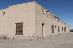 Fort Leatonlisted 1973
Population over time
2 figuresPresidio fell from 4,426 to 3,264 between 2010 and 2020. These are the recorded population figures Wikidata holds for this place, reached through the Geographic Names Information System number this page is keyed on rather than by name, so they belong to this place and not to another of the same name. Most are census counts, but not all are: an early figure may be a founding or settlement estimate, and an estimate published within five years of a census is left out. The change column is computed, and is left blank where more than 20 years separate a figure from the one before it, because a gap that long is not a change between two counts.
| Year | People | Change |
|---|---|---|
| 2010 | 4,426 | |
| 2020 | 3,264 | -1,162 (-26%) |
Topographic sheets covering this place
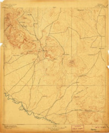
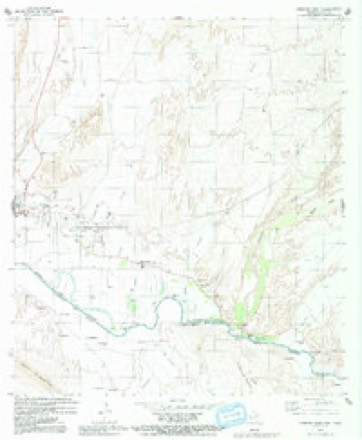
6 surveys from 13 printed sheetsMatched by testing this settlement's coordinate against the published boundary of every sheet in the United States Geological Survey's historical collection. Each opens the scanned sheet at the Survey.
- 1896 USGS Shafter quadrangle1:125000, 5 printings
- 1959 USGS Presidio quadrangle1:250000, 2 printings
- 1965 USGS Presidio quadrangle1:250000
- 1979 USGS Presidio East quadrangle1:24000, 2 printings
- 1985 USGS Presidio quadrangle1:100000
- 1993 USGS Presidio quadrangle1:100000, 2 printings
Fires near this place
11 since 2006Regional context, not property-specific evidence. The federal wildfire occurrence database lists 11 fires within 5 miles of Presidio between 2006 and 2019, burning about 632 acres in total. None started naturally. None was recorded as arson. Distance is straight-line from the map coordinates, so a fire counted here may appear on a neighbouring settlement's page as well.
| Reported cause | Fires |
|---|---|
| Smoking | 7 |
| Debris and open burning | 4 |
The most recent of them, most recent first, with the day each was reported and the service that recorded it.
| Date | Cause | Size | Reported by | Name on the report |
|---|---|---|---|---|
| 8 April 2014 | Smoking | under an acre | Texas A & M Forest Service | VILLAREAL BRUSH FIRE |
| 10 March 2013 | Smoking | 6.0 acres | Texas A & M Forest Service | PRIETOS RANCH BRUSH FIRE |
| 10 March 2006 | Debris and open burning | 5.0 acres | Texas A & M Forest Service | not named |
| 22 February 2019 | Debris and open burning | 600 acres | Texas A & M Forest Service | ALAMITO CREEK |
| 21 February 2013 | Smoking | 2.0 acres | Texas A & M Forest Service | ANDY'S RANCH BRUSH FIRE |
| 18 February 2013 | Smoking | 2.0 acres | Texas A & M Forest Service | CHIANATI RANCH |
| 22 November 2013 | Smoking | under an acre | Texas A & M Forest Service | CIBOLO CREEK RANCH FIRE |
| 9 January 2006 | Debris and open burning | 10 acres | Texas A & M Forest Service | not named |
Settlements close enough to share some of these fires:
Mines and quarries near this place
4 within 5 milesRegional context, not property-specific evidence. The federal mineral resources record lists 4 workings within 5 miles of Presidio: 2 occurrences, 1 producer, 1 unknown. 1 still produces. What was taken out: Stone, Crushed/Broken, Lead, Zinc, Zinc. Distance is straight-line from the map coordinates, so a quarry counted here may appear on a neighbouring settlement's page as well.
| Where | Site | Commodity | Status | Recorded |
|---|---|---|---|---|
| Dos Marias | Zinc | Unknown | ||
| Marias Mine | Lead, Zinc | Producer | ||
| Unidentified Quarry | Stone, Crushed/Broken | Occurrence | Sedimentary | |
| Unidentified Quarry | Stone, Crushed/Broken | Occurrence |
Storms near this place
39 since 1996Regional context, not property-specific evidence. The National Weather Service names Presidio in 39 storm reports between 1996 and 2025: 15 thunderstorm wind, 13 hail, 9 flash flood, 1 flood. No death or injury is recorded in these reports. Each account below is quoted exactly as the forecast office filed it, from the NOAA Storm Events Database, and each date opens the federal record of that event.
| When | Event | Place named | Harm | What the report says |
|---|---|---|---|---|
| September 2008 | Flash Flood | Presidio | $1,000,000 | On September 9, the levees near Redford, TX failed. This resulted in water covering the entire city of Redford. A high water rescue was reported near Alamito Creek.||Heavy rain made matters worse by September 14. Flash flooding was occurring in the city of Presidio and border patrol closed the International Bridge on September 16. The Mexican side of the bridge was covered in water and levels continue to rise. Water also topped the levees near Presidio Golf Course on the 16th and 17th. Border patrol reported that nearly 15 feet of water was located in the fields near the golf course, with 3 to 4 feet of water covering the golf course itself.||The International Boundary and Water Commission reported cracks in the levees near the golf course on September 17 and water was beginning to approach Presidio High School. |
| July 1996 | Thunderstorm Wind | Presidio | $1,000,000 | no account filed |
| July 2002 | Thunderstorm Wind | Presidio | $200,000 | A severe thunderstorm produced damaging outflow winds in Presidio. A warehouse was destroyed and four homes lost roofs. Small hail collected up to 6 inches deep in some locations around town. Slightly larger hail occurred approximately 30 minutes later, around 615 PM CDT, as the main core of the severe thunderstorm moved over the community. |
| June 2002 | Flash Flood | Presidio | $100,000 | The Texas Department of Transportation reported flash flooding resulting in high water in homes and businesses...as well as street flooding in the city of Presidio. |
| April 2004 | Hail | Presidio | $20,000 | no account filed |
| July 1997 | Thunderstorm Wind | Presidio | $10,000 | A thunderstorm with only light to moderate rain had damaging downbursting winds that blew over two carport tops and a utility pole. |
| June 1997 | Thunderstorm Wind | Presidio | $8,000 | Strong winds damaged a new double-wide mobile home. |
| June 1997 | Hail | Presidio | $7,000 | Hail larger than golfball damaged a new pickup truck parked near the trailer that was damaged by the wind. |
| May 2004 | Lightning | Presidio | $5,000 | Lightning struck an insulator on a power pole near Presidio in the southern part of Presidio County. Damage caused by the lightning strike resulted in an eleven-hour power outage in the cities of Presidio, Shafter, and Redford. Electrical power was finally restored to area residents during the mid morning of Sunday the 16th. |
| October 2025 | Hail | Presidio | - | Presidio County Sheriff's Office relayed a report of quarter-size hail at the Port of Entry in Presidio. The total time of occurrence is partially estimated from radar. |
| September 2020 | Thunderstorm Wind | Presidio | - | A thunderstorm moved across Presidio County and produced a 67 mph wind gust at the AWOS site near the town of Presidio. |
| July 2019 | Thunderstorm Wind | Presidio | - | A thunderstorm moved across Presidio County and produced a 59 mph wind gust five miles north of the town of Presidio. |
| August 2015 | Thunderstorm Wind | Presidio | - | A storm moved across Presidio County and produced a 64 mph wind gust north of Presidio as recorded by the local AWOS site. |
| September 2015 | Thunderstorm Wind | Presidio | - | A thunderstorm moved across Presidio County and produced a 59 mph wind gust north of the City of Presidio as recorded by the local AWOS. |
| July 2007 | Thunderstorm Wind | Presidio | - | No damage was reported. |
| May 2005 | Hail | Presidio | - | Penny size hail was reported along Farm to Market Road 170 just northwest of Presidio. |
| July 2005 | Flash Flood | Presidio | - | Heavy rainfall with embedded thunderstorms persisted over Presidio county. Storms caused Farm to Market Road 170 to flood and subsequently be closed by the Texas Department of Transportation due to the high water. |
| May 2004 | Thunderstorm Wind | Presidio | - | Several strong to severe thunderstorms affected the area from the Guadalupe Mountains south through the Big Bend on the afternoon and evening of the 15th. The public reported severe thunderstorm winds in Presidio. |
| November 2004 | Flash Flood | Presidio | - | The U.S. Border Patrol reported flash flooding along several creeks in Presidio. Flood waters from the swollen creeks were reported to inundate several city streets. |
| June 2002 | Flash Flood | Presidio | - | The Texas Department of Transportation reported 1.5 feet of water flooding FM170. |
| June 2002 | Hail | Presidio | - | Hail up to nickel size covered the ground in Presidio. |
| July 2002 | Flash Flood | Presidio | - | Rainfall amounts of approximately 2.5 inches in less than one hour resulted in road flooding and minor flooding of a few homes in Presidio. |
| September 2002 | Flood | Presidio | - | Minor street flooding was reported in the city. |
| June 1997 | Flash Flood | Presidio | - | Heavy rains east of the Rio Grande filled local arroyos that sent flood waters across State Highway 170 upstream from Presidio. Department of Transportation employees worked through the night to clear sand and other debris from the highway. |
| May 1997 | Hail | Presidio | - | A northeasterly upslope flow into the mountains of northern Chihuahua formed storms in the mountainous terrain. These storms were advected over the top of a frontal boundary and crossed the Rio Grande near Presidio where the hail fell. The storm appeared to continue with very strong intensity over open country while riding on the frontal boundary. The storm weakened as it approached the city of Marfa, where it skimmed the city to the south. |
| August 2023 | Thunderstorm Wind | Presidio | - | no account filed |
| May 2012 | Hail | Presidio | - | no account filed |
| May 2011 | Hail | Presidio | - | no account filed |
| May 2009 | Hail | Presidio | - | no account filed |
| March 2007 | Hail | Presidio | - | no account filed |
| June 2007 | Hail | Presidio | - | no account filed |
| June 2007 | Flash Flood | Presidio | - | no account filed |
| May 2007 | Hail | Presidio | - | no account filed |
| June 2004 | Thunderstorm Wind | Presidio | - | no account filed |
| July 2002 | Hail | Presidio | - | no account filed |
| September 2002 | Thunderstorm Wind | Presidio | - | no account filed |
| September 2002 | Thunderstorm Wind | Presidio | - | no account filed |
| May 1996 | Thunderstorm Wind | Presidio | - | no account filed |
| August 1996 | Flash Flood | Presidio | - | no account filed |
Nearest settlements
The eight closest, with where each one stands in the county. Distances are straight-line, computed from the Geographic Names Information System coordinates.
| Map | Place | Distance | Sheets |
|---|---|---|---|
| Fort Leaton (historical) | 2.9 miles | 13 | |
| La Junta | 3.1 miles | 12 | |
| Loma Pelona | 4.0 miles | 13 | |
| Haciendito | 5.8 miles | 12 | |
| Las Pampas Colonia | 8.4 miles | 12 | |
| Ochoa | 10.0 miles | 11 | |
| Redford | 12.3 miles | 11 | |
| Polvo | 12.8 miles | 11 |
Elsewhere
Matched on this settlement's Geographic Names Information System number rather than its name, so it cannot be a different place of the same name in another state.
| Wikipedia article on Presidio | An encyclopaedic summary. Its text is share-alike, so it is linked here rather than copied. |
| Wikidata item Q970777 | The structured record the population and elevation above come from. Public domain (CC0). |
Provenance
This settlement is recorded in the Geographic Names Information System as feature 1344545. The sheet list is computed by point-in-boundary test against the United States Geological Survey's historical topographic inventory. Both are works of the United States government and carry no copyright under 17 U.S.C. 105.
Wildfire. Short, Karen C. 2022. Spatial wildfire occurrence data for the United States, 1992-2020 [FPA_FOD_20221014]. 6th Edition. Fort Collins, CO: Forest Service Research Data Archive. https://doi.org/10.2737/RDS-2013-0009.6 Collected with United States Government funding and usable without additional permissions or fees.
Mines and quarries. USGS Mineral Resources Data System (MRDS) https://mrdata.usgs.gov/mrds/ A work of the United States government, no copyright under 17 U.S.C. 105.
Storms. NOAA National Centers for Environmental Information, Storm Events Database https://www.ncei.noaa.gov/stormevents/ A work of the United States government, no copyright under 17 U.S.C. 105. Narratives are quoted verbatim from the National Weather Service report and are not edited or summarised.