 Block
BlockRaymondville, Texas
9 topographic sheets cover this place, the earliest surveyed in 1953 and the latest in 1992. It stands in the Raymondville census division. It lies in ZIP code area 78580. The Survey maps it on the Raymondville quadrangle. 10,236 people lived here at the 2020 count. It stands 30 feet above sea level.
Research this city
On record in Raymondville
Buildings and businesses the archive holds for this place. Each opens its own page, with the source record it came from.
On the National Register 1 record
 Willacy County Courthouselisted 2017
Population over time
2 figuresRaymondville fell from 11,284 to 10,236 between 2010 and 2020. These are the recorded population figures Wikidata holds for this place, reached through the Geographic Names Information System number this page is keyed on rather than by name, so they belong to this place and not to another of the same name. Most are census counts, but not all are: an early figure may be a founding or settlement estimate, and an estimate published within five years of a census is left out. The change column is computed, and is left blank where more than 20 years separate a figure from the one before it, because a gap that long is not a change between two counts.
| Year | People | Change |
|---|---|---|
| 2010 | 11,284 | |
| 2020 | 10,236 | -1,048 (-9%) |
Topographic sheets covering this place
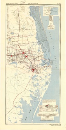
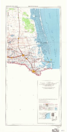
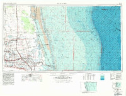
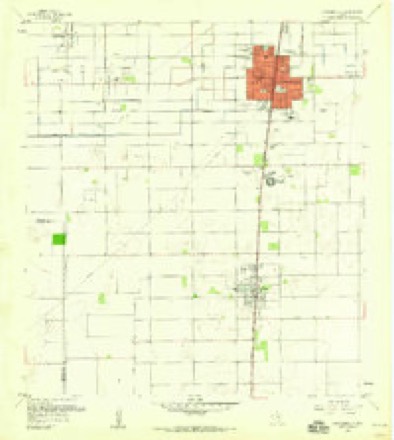
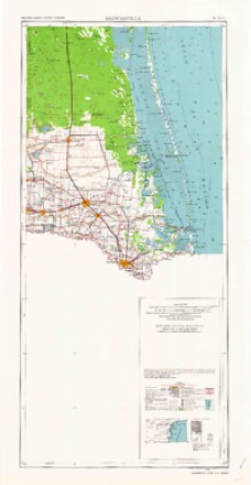
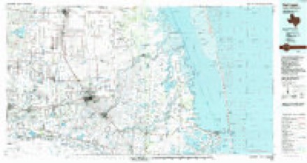
6 surveys from 9 printed sheetsMatched by testing this settlement's coordinate against the published boundary of every sheet in the United States Geological Survey's historical collection. Each opens the scanned sheet at the Survey.
- 1953 USGS Brownsville quadrangle1:250000
- 1956 USGS Brownsville quadrangle1:250000, 2 printings
- 1956 USGS Port Isabel quadrangle1:250000
- 1956 USGS Raymondville quadrangle1:24000, 3 printings
- 1962 USGS Brownsville quadrangle1:250000
- 1992 USGS Harlingen quadrangle1:100000
Fires near this place
60 since 2002Regional context, not property-specific evidence. The federal wildfire occurrence database lists 60 fires within 5 miles of Raymondville between 2002 and 2020, burning about 1,813 acres in total. None started naturally. 4 were recorded as arson. Distance is straight-line from the map coordinates, so a fire counted here may appear on a neighbouring settlement's page as well.
| Reported cause | Fires |
|---|---|
| Missing data/not specified/undetermined | 36 |
| Debris and open burning | 13 |
| Power generation/transmission/distribution | 4 |
| Arson/incendiarism | 4 |
| Equipment and vehicle use | 2 |
| Smoking | 1 |
The most recent of them, most recent first, with the day each was reported and the service that recorded it.
| Date | Cause | Size | Reported by | Name on the report |
|---|---|---|---|---|
| 13 September 2011 | Missing data/not specified/undetermined | 25 acres | Texas A & M Forest Service | BRUSH/GRASS MIXTURE FIRE |
| 1 September 2011 | Missing data/not specified/undetermined | 30 acres | Texas A & M Forest Service | BRUSH GRASS MIXTURE |
| 7 August 2011 | Debris and open burning | 1.0 acres | Texas A & M Forest Service | GRASS FIRE |
| 5 August 2011 | Debris and open burning | 10 acres | Texas A & M Forest Service | GRASS FIRE |
| 29 August 2009 | Debris and open burning | 10 acres | Texas A & M Forest Service | GRASS FIRE |
| 25 August 2011 | Missing data/not specified/undetermined | 12 acres | Texas A & M Forest Service | GRASS FIRE |
| 10 August 2011 | Equipment and vehicle use | 10 acres | Texas A & M Forest Service | NATURAL VEGITATION |
| 6 July 2011 | Debris and open burning | 1.0 acres | Texas A & M Forest Service | TRASH FIRE |
Settlements close enough to share some of these fires:
Storms near this place
44 since 1999Regional context, not property-specific evidence. The National Weather Service names Raymondville in 44 storm reports between 1999 and 2024: 14 thunderstorm wind, 11 hail, 7 flash flood, 5 tornado. No death or injury is recorded in these reports. Each account below is quoted exactly as the forecast office filed it, from the NOAA Storm Events Database, and each date opens the federal record of that event.
| When | Event | Place named | Harm | What the report says |
|---|---|---|---|---|
| May 2009 | Thunderstorm Wind | Raymondville | $50,000 | A microburst from a cluster of thunderstorms moving through Raymondville toward Lyford rolled a new but unsecured mobile home just west of Raymondville. Nearby, several fences were blown down, and the door to an industrial building was blown in. Farther south, at about the same time, an amateur radio operator reported |estimated wind gusts of 50 mph or higher occurred just north of Lyford. |
| August 2005 | Tornado (F0) | Raymondville | $50,000 | no account filed |
| April 2023 | Thunderstorm Wind | Raymondville | $40,000 | Pictures from the Raymondville area of Willacy County showed damage from a line from south of HWY 186 and S 1st Street to a quarter mile north of the Raymondville Country Club along S 7th Street. Some of the pictures included a part of a wood roof peeled back from a porch on W Gem Street and some gate and metal roof damage to a garage along S 7th Street. There was also a video shared from the Holiday Inn Express near the intersection of US-77/I-69E and HWY 186 looking to the southwest showing a large gust front blowing through Raymondville in the areas mentioned above. A closer inspection of the video shows some debris lofted into the air and was used a guide for the estimated 70 mph wind gusts. The time is based on the video and radar. |
| August 2019 | Thunderstorm Wind | Raymondville | $25,000 | One roof was blown off a residence in Raymondville, and there were several calls to dispatch of trees and power poles down between Raymondville and Lyford. |
| October 2015 | Heavy Rain | Raymondville | $10,000 | An estimated 2 to 4 inches of rain fell across Raymondville leading to nuisance and urban flooding that would later reach into a few businesses in town. |
| June 2011 | Heavy Rain | Raymondville | $10,000 | Slow moving thunderstorms, containing more than an hour of torrential rains, dumped between 3 and 6 inches in central Willacy County during the early and mid afternoon of June 22nd. In Raymondville, up to a foot of standing water was observed by storm spotters and the county Emergency Manager; several roads were temporarily closed due to the urban/poor drainage flooding. No water reached structures. Observed rainfall ranged from just under 3 inches on the west side of Raymondville to 6.10 inches 6 miles east of Raymondville (San Perlita). Other minor flooding was reported in Sebastian (just north of the Cameron/Willacy County line), with backyards turning to low water lakes and streets with more than a foot of water in them.||The flooding in Sebastian intensified on the 23rd, reaching into properties as poor drainage structure in town (pipe structure) could not handle the heavy rains and flooding reached into the ground floor of a number of structures in town. |
| May 2011 | Hail | Raymondville | $5,000 | A friend of an NWS employee reported Golfball size hail in Raymondville, some which caused dents and dings to several vehicles parked outside, as the first of two hailstorms scooted through Willacy County during the mid afternoon of May 15th, 2011. |
| June 2011 | Lightning | Raymondville | $5,000 | Frequent cloud to ground lightning, particularly on the 22nd, caught a 400 barrel oil container on fire in Willacy County, and effects of another strike injured a woman attempting to enter her vehicle, all occurring around 3 PM CDT. The container fire was put out by the torrential rains; the woman was admitted to Valley Baptist Medical Center for observation. |
| May 2010 | Thunderstorm Wind | Raymondville | $3,000 | Trees and large limbs were blown down on various streets in Raymondville. Time and duration are estimated by radar, based on core of estimated winds between 50 and 52 knots a few thousand feet above the surface. |
| May 2015 | Thunderstorm Wind | Raymondville | $2,000 | Willacy County EM reported a telephone pole blown down at 100 East Sunset Avenue in Raymondville and at the intersection of FM 1762 and Business 77 in Raymondville. Peak winds were estimated to be 45 mph. |
| May 1999 | Thunderstorm Wind | Raymondville | $2,000 | Trees down. |
| November 2013 | Flash Flood | Raymondville | $1,000 | Slow moving thunderstorms dropped over three inches of rain over the Raymondville area in the matter of a few hours, with a nearby COOP site reporting 3.2 inches. This rainfall caused water to rise rapidly in downton Raymondville. The Willacy County emergency manager reported several inches of water entering the Raymondville City Hall building. |
| July 2008 | Heavy Rain | Raymondville | $1,000 | A number of roads in typically poor drainage locations of Raymondville sustained minor flooding, when persistent bands of torrential rains moved through the western half of Willacy County during the morning and early afternoon of July 7th. In general, rainfall between 2 and 3 inches fell during this time period, near the end of a weeklong welcome drenching that that dropped between 5 and 7 inches, perhaps higher in a few spots, across the more populated areas of the Lower Rio Grande Valley, stretching north and northwest toward the King Ranch (Kenedy County) and northeast Hidalgo County.| |Street flooding seeped into the the Raymondville City Hall, soaking some carpeting and forcing crews to sandbag the doorways. Other streets were blocked by Law Enforcement to prevent vehicles from pushing floodwaters into stores in poor drainage areas of downtown. As of this writing, no significant damage was reported.||The rains ended by mid afternoon on the 7th, and minor street flooding subsided. |
| June 2017 | Thunderstorm Wind | Raymondville | $500 | Large tree reported down via social media. Time estimated based on radar. |
| March 2024 | Hail | Raymondville | - | There were several videos and pictures sent to the local news media of nickel size hail. |
| April 2021 | Hail | Raymondville | - | Law enforcement reported dime-sized hail in the city of Raymondville as thunderstorms moved through the area. Time frame is estimated. |
| April 2021 | Hail | Raymondville | - | The Willacy County Sheriff's Department reported hail up to the size of nickels in Raymondville as storms moved through the area. Time frame is estimated. |
| July 2018 | Tornado (EF0) | Raymondville | - | The Emergency Management Coordinator from Willacy County, Texas, reported a small tornado briefly touched down between Raymondville and San Perlita. There was no structural damage, but patches of sugar cane were blown down based on photo evidence, and a short video confirmed the brief touch down. |
| May 2015 | Thunderstorm Wind | Raymondville | - | Willacy County Sheriffs Office reported estimated wind gusts of 60 mph at their location. |
| May 2015 | Heavy Rain | Raymondville | - | Willacy County EM reported that in Raymondville, Hidalgo Street from 4th Street to 10th Street had water across from curb to curb and that the city was closing the road. |
| May 2013 | Heavy Rain | Raymondville | - | Around 2.5 inches of rain fell in less than two hours just southwest of Raymondville, leaving ponded water in streets and fields and some nuisance urban flooding behind. The event, which occurred very early on a Saturday morning, had little impact with few people out. |
| December 2012 | Thunderstorm Wind | Raymondville | - | The public reported that a barn was destroyed 5 miles west of Raymondville. The barn also crushed a car. Winds were estimated at 70 to 80 mph. |
| December 2012 | Thunderstorm Wind | Raymondville | - | Raymondville Police Department reported that the Precinct 1 garage west of Raymondville on Highway 186 sustained heavy damage from straight line thunderstorm winds. The garage doors were blown down and a section of hurricane fencing near the garage was also blown down. |
| December 2012 | Thunderstorm Wind | Raymondville | - | Raymondville Police Department reported estimated 60 mph winds when the storm came through. |
| April 2012 | Hail | Raymondville | - | Willacy County emergency manager reported penny to golf ball size hail across Raymondville. |
| April 2012 | Tornado (EF0) | Raymondville | - | Tornado reported near Wal-Mart in Raymondville. Tornado touched down briefly. No damage reported. |
| May 2012 | Hail | Raymondville | - | Public reported nickel size hail near Raymondville, about 2 miles east of Highway 77. |
| May 2012 | Hail | Raymondville | - | Nickel sized hail was reported at the intersection of 1st St. and Tampico Ave., also on the north side of town, at 434 PM CDT, by the public. Report was relayed to the NWS by a local weather broadcaster. |
| May 2012 | Thunderstorm Wind | Raymondville | - | Emergency manager reported winds from 50 to 60 mph in Raymondville. |
| June 2010 | Tornado (EF0) | Raymondville | - | Texas Military Forces reported a small, brief touch down near Highway 77 north of Raymondville. No damage was reported as of this writing. |
| May 2009 | Hail | Raymondville | - | A Raymondville Volunteer Fire Department employee reported penny size hail fell in the city of Raymondville during a thunderstorm that moved through Willacy County. The Willacy County Emergency Manager also reported penny size hail had fallen in the city of Raymondville during this thunderstorm. |
| May 2007 | Flash Flood | Raymondville | - | Texas DPS reported water covering U.S. Highway 77 in Raymondville. |
| May 2007 | Flash Flood | Raymondville | - | Strong thunderstorms produced from 5-7 inches of rain over southwest and western Willacy County. The rains resulted in the closure of Farm to Market Road 1015 south of Highway 186. |
| August 2007 | Flash Flood | Raymondville | - | Willacy county emergency manager reported 4 inches of floodwater on FM186 and 10th street in downtown Raymondville. |
| July 2007 | Flash Flood | Raymondville | - | Four to five inches of rain flooded much of the city of Raymondville. Road 186 closed from 3rd to 10th Streets. |
| July 2007 | Flash Flood | Raymondville | - | Flooding on Business Hwy 77 1/4 mile north of FM 490 and at the intersection of FM490 and 1834. |
| May 2002 | Thunderstorm Wind | Raymondville | - | Storm spotter estimated 70 mph wind gust lifted trampoline into the air against the house and fence blown over |
| September 2002 | Flash Flood | Raymondville | - | Intense thunderstorms produced flash flooding of homes and city streets in Raymondville. Portions of Highway 186 near Raymondville were also closed due to floodwaters. |
| October 2002 | Thunderstorm Wind | Raymondville | - | Thunderstorm winds produced damage to several mobile home awnings and roofs in the Gulf View RV Park in Raymondville. A few small trees were uprooted while larger trees had limbs severed. A storm survey found evidence of winds to 75 mph. |
| October 2002 | Flood | Raymondville | - | Street flooding due to strong thunderstorms was reported by the Raymondville Police Department. |
| September 2001 | Tornado (F0) | Raymondville | - | A weak tornado was reported by the Willacy County Sheriff's Department at the intersection of FM 490 and FM 1425, or about four miles southwest of Raymondville. |
| April 2003 | Hail | Raymondville | - | no account filed |
| March 2000 | Hail | Raymondville | - | no account filed |
| March 2000 | Hail | Raymondville | - | no account filed |
Nearest settlements
The eight closest, with where each one stands in the county. Distances are straight-line, computed from the Geographic Names Information System coordinates.
| Map | Place | Distance | Sheets |
|---|---|---|---|
| Colonia los Angeles | 1.0 miles | 9 | |
| Los Angeles | 1.0 miles | 9 | |
| Benitez Colonia | 1.8 miles | 13 | |
| Ranchette Estates Colonia | 2.1 miles | 9 | |
| Ranchette Estates | 2.2 miles | 9 | |
| Lisa Colonia | 2.2 miles | 13 | |
| Willacy Acres Colonia | 2.6 miles | 13 | |
| Raymondville Tract Number 1 Colonia | 2.8 miles | 9 |
Elsewhere
Matched on this settlement's Geographic Names Information System number rather than its name, so it cannot be a different place of the same name in another state.
| Wikipedia article on Raymondville | An encyclopaedic summary. Its text is share-alike, so it is linked here rather than copied. |
| Wikidata item Q979250 | The structured record the population and elevation above come from. Public domain (CC0). |
Provenance
This settlement is recorded in the Geographic Names Information System as feature 1377181. The sheet list is computed by point-in-boundary test against the United States Geological Survey's historical topographic inventory. Both are works of the United States government and carry no copyright under 17 U.S.C. 105.
Wildfire. Short, Karen C. 2022. Spatial wildfire occurrence data for the United States, 1992-2020 [FPA_FOD_20221014]. 6th Edition. Fort Collins, CO: Forest Service Research Data Archive. https://doi.org/10.2737/RDS-2013-0009.6 Collected with United States Government funding and usable without additional permissions or fees.
Storms. NOAA National Centers for Environmental Information, Storm Events Database https://www.ncei.noaa.gov/stormevents/ A work of the United States government, no copyright under 17 U.S.C. 105. Narratives are quoted verbatim from the National Weather Service report and are not edited or summarised.