 Block
BlockRound Rock, Texas
19 topographic sheets cover this place, the earliest surveyed in 1893 and the latest in 1987. It stands in the Round Rock-Georgetown census division. It lies in ZIP code area 78664. It stands on Onion Branch. The Survey maps it on the Round Rock quadrangle. 119,468 people lived here at the 2020 count. It stands 735 feet above sea level.
Research this city
On record in Round Rock
Buildings and businesses the archive holds for this place. Each opens its own page, with the source record it came from.
On the National Register 3 records
 Capt. Nelson Merrell Houselisted 1970
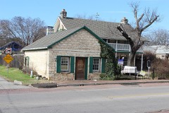 Round Rock Post Office and William M. Owen Houselisted 1983
- Round Rock Commercial Historic Districtlisted 1983
Population over time
3 figuresRound Rock grew from 628 to 119,468 between 1880 and 2020. These are the recorded population figures Wikidata holds for this place, reached through the Geographic Names Information System number this page is keyed on rather than by name, so they belong to this place and not to another of the same name. Most are census counts, but not all are: an early figure may be a founding or settlement estimate, and an estimate published within five years of a census is left out. The change column is computed, and is left blank where more than 20 years separate a figure from the one before it, because a gap that long is not a change between two counts.
| Year | People | Change |
|---|---|---|
| 1880 | 628 | |
| 2010 | 99,887 | |
| 2020 | 119,468 | +19,581 (+20%) |
Topographic sheets covering this place
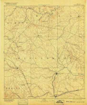
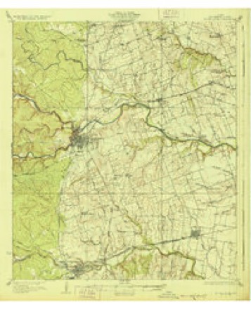
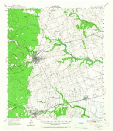
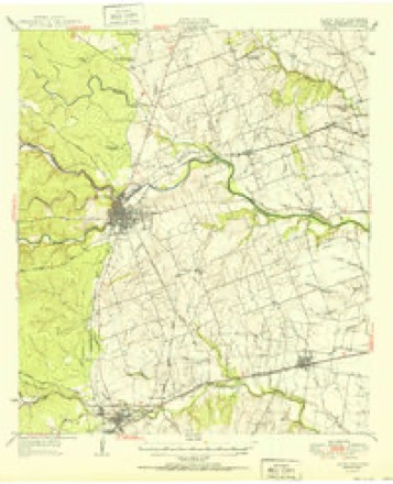
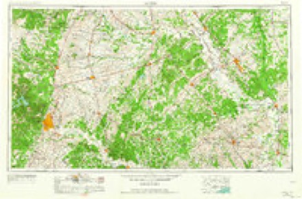
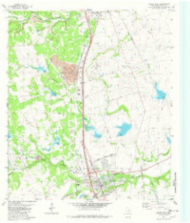
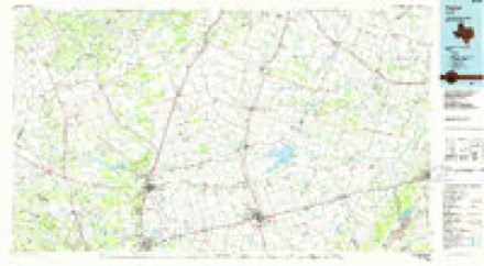
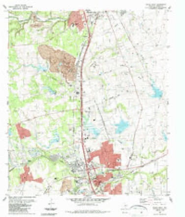
8 surveys from 19 printed sheetsMatched by testing this settlement's coordinate against the published boundary of every sheet in the United States Geological Survey's historical collection. Each opens the scanned sheet at the Survey.
- 1893 USGS Georgetown quadrangle1:125000, 5 printings
- 1928 USGS Round Rock quadrangle1:62500, 2 printings
- 1949 USGS Round Rock quadrangle1:62500, 2 printings
- 1951 USGS Round Rock quadrangle1:62500
- 1954 USGS Austin quadrangle1:250000, 4 printings
- 1982 USGS Round Rock quadrangle1:24000
- 1985 USGS Taylor quadrangle1:100000, 2 printings
- 1987 USGS Round Rock quadrangle1:24000, 2 printings
Fires near this place
106 since 2005Regional context, not property-specific evidence. The federal wildfire occurrence database lists 106 fires within 5 miles of Round Rock between 2005 and 2017, burning about 724 acres in total. 3 started naturally. 4 were recorded as arson. Distance is straight-line from the map coordinates, so a fire counted here may appear on a neighbouring settlement's page as well.
| Reported cause | Fires |
|---|---|
| Missing data/not specified/undetermined | 75 |
| Debris and open burning | 10 |
| Equipment and vehicle use | 4 |
| Arson/incendiarism | 4 |
| Misuse of fire by a minor | 4 |
| Power generation/transmission/distribution | 3 |
| Natural | 3 |
| Smoking | 2 |
| Recreation and ceremony | 1 |
The most recent of them, most recent first, with the day each was reported and the service that recorded it.
| Date | Cause | Size | Reported by | Name on the report |
|---|---|---|---|---|
| 3 September 2008 | Missing data/not specified/undetermined | 1.0 acres | Texas A & M Forest Service | not named |
| 9 August 2011 | Missing data/not specified/undetermined | 1.0 acres | Texas A & M Forest Service | 3300 BLOCK SH 130 |
| 7 August 2009 | Missing data/not specified/undetermined | 2.0 acres | Texas A & M Forest Service | 1535 GULFWAY |
| 4 August 2011 | Missing data/not specified/undetermined | under an acre | Texas A & M Forest Service | SH 130 AT FM 971 |
| 31 August 2015 | Missing data/not specified/undetermined | under an acre | Texas A & M Forest Service | 1498 N IH 35 |
| 31 August 2012 | Missing data/not specified/undetermined | 1.0 acres | Texas A & M Forest Service | HEATHERWILDE COMMAND |
| 28 August 2011 | Power generation/transmission/distribution | 1.0 acres | Texas A & M Forest Service | MCNEIL COMMAND |
| 28 August 2009 | Missing data/not specified/undetermined | under an acre | Texas A & M Forest Service | 09-0228027 |
Settlements close enough to share some of these fires:
Mines and quarries near this place
4 within 5 milesRegional context, not property-specific evidence. The federal mineral resources record lists 4 workings within 5 miles of Round Rock: 4 producers. All of them still produce. What was taken out: Calcium, Limestone, General, Stone, Crushed/Broken, Stone, Crushed/Broken. Distance is straight-line from the map coordinates, so a quarry counted here may appear on a neighbouring settlement's page as well.
| Where | Site | Commodity | Status | Recorded |
|---|---|---|---|---|
| Dedear Quarry | Limestone, General, Stone, Crushed/Broken | Producer | Limestone | |
| Texas Ind Limestone Quarry | Stone, Crushed/Broken | Producer | ||
| Dedear Quarry | Calcium | Producer | ||
| Mc Neil Plant & Quarry | Calcium | Producer |
Storms near this place
60 of 94 shownRegional context, not property-specific evidence. The National Weather Service names Round Rock in 94 storm reports between 1994 and 2026: 61 hail, 18 thunderstorm wind, 8 flash flood, 3 tornado. No death or injury is recorded in these reports. Each account below is quoted exactly as the forecast office filed it, from the NOAA Storm Events Database, and each date opens the federal record of that event.
| When | Event | Place named | Harm | What the report says |
|---|---|---|---|---|
| September 2023 | Hail | Round Rock | $300,000,000 | A thunderstorm produced four inch diameter hail in Round Rock. This storm was part of a complex that caused 700 million dollars in hail damage in Texas. The damage in Austin, Georgetown, and Round Rock was the most impactful from this system and totaled upwards of 600 million dollars in damage across Williamson and Travis counties. Thus 300 million dollars of damage is being listed on this Williamson County entry. An article from the Austin American Statesman tells that Round Rock school district estimated losses of 70 million in damages to 62 facilities. |
| October 2013 | Flash Flood | Round Rock | $1,100,000 | Across Round Rock and the northern sections of Williamson County, heavy rain fell much of the night with areas reporting up to 10 inches of rain. At the peak of the flooding there were 23 areas closed due to high water. Several homes along Brushy Creek were evacuated. Houses were damaged over the eastern portions along the Highway 79 corridor including Forest Creek, Hutto, and the County Road 123 area. Voluntary evacuations were called for in eastern Round Rock and Hutto. 88 homes were evacuated. Several swift water rescues were performed including 8 vehicle rescues. Overall 19 homes were affected by flooding rains in Williamson County with overall damages hit 1.1 million dollars in uninsured losses to public infrastructure. |
| May 2001 | Hail | Round Rock | $200,000 | no account filed |
| October 2001 | Thunderstorm Wind | Round Rock | $100,000 | Damage was reported to roofs of homes in Round Rock from severe thunderstorm winds. |
| May 2007 | Thunderstorm Wind | Round Rock | $50,000 | Winds from a severe thunderstorm damaged roofs of five homes in a small subdivision just east of Round Rock. |
| April 2008 | Lightning | Old Round Rock | $30,000 | Lightning struck a house and caused considerable damage. |
| July 1998 | Tornado (F1) | Round Rock | $30,000 | no account filed |
| September 2000 | Thunderstorm Wind | Round Rock | $20,000 | Severe thunderstorm winds toppled over several trees. |
| April 2000 | Thunderstorm Wind | Round Rock | $15,000 | The public reported trees blown down by severe thunderstorm winds. |
| October 1996 | Hail | Round Rock | $15,000 | no account filed |
| August 2009 | Thunderstorm Wind | Round Rock | $10,000 | Thunderstorm wind gusts, estimated at 60 mph, knocked down trees. One tree landed on a car and others tore down power lines. |
| June 2007 | Flash Flood | Round Rock | $10,000 | Storms produced general accumulations of 2 to 3 inches over southern Williamson county, with up to 5 inches in the Round Rock area. Water was reported to be over Parmer Road near Kings Village. FM620 was also closed due to high water in the Round Rock area. |
| May 1994 | Thunderstorm Wind | Round Rock | $5,000 | no account filed |
| September 2023 | Thunderstorm Wind | Round Rock | $2,000 | A thunderstorm produced wind gusts estimated at 70 mph that knocked down a large tree off Chisholm Valley Dr. in Round Rock. |
| May 2022 | Thunderstorm Wind | Round Rock | $2,000 | A thunderstorm produced wind gusts estimated at 65 mph that downed a tree approximately eight inches in diameter near the intersection of Emerald Hill Dr. and Curtis Dr. in Round Rock. |
| May 2017 | Thunderstorm Wind | Old Round Rock | $1,000 | A thunderstorm produced wind gusts estimated at 75 mph that snapped a large tree in half in Round Rock. |
| July 2012 | Thunderstorm Wind | Old Round Rock | $200 | A thunderstorm produced wind gusts estimated at 45 mph that broke 2-3 inch diameter branches off several trees. |
| April 2026 | Hail | Round Rock | - | A thunderstorm produced nickel size hail in Brushy Creek. |
| April 2025 | Hail | Old Round Rock | - | A thunderstorm produced penny size hail in Round Rock. |
| April 2025 | Hail | Old Round Rock | - | A thunderstorm produced quarter size hail on the northeast side of Round Rock. |
| April 2023 | Hail | Round Rock | - | A thunderstorm produced quarter size hail in Round Rock. |
| April 2023 | Hail | Round Rock | - | A thunderstorm produced ping pong ball size at the intersection of I-35 and Hwy 45 in Round Rock. |
| April 2023 | Hail | Round Rock | - | A thunderstorm produced quarter size hail in Round Rock. |
| April 2023 | Hail | Old Round Rock | - | A thunderstorm produced penny size hail east of Round Rock. |
| September 2023 | Hail | Round Rock | - | A thunderstorm produced baseball size hail in Round Rock. |
| September 2023 | Hail | Round Rock | - | A thunderstorm produced 3.5 inch diameter hail in Round Rock. The hail dropped over a car dealership and broke windows and windshields. |
| September 2023 | Hail | Old Round Rock | - | A thunderstorm produced golf ball size hail at the intersection of E. Bowman Dr. and Sunrise Rd. in Round Rock. |
| September 2023 | Hail | Round Rock | - | A thunderstorm produced golf ball size hail in Round Rock. |
| September 2023 | Hail | Round Rock | - | A thunderstorm produced golf ball size hail in Round Rock. |
| September 2023 | Hail | Old Round Rock | - | A thunderstorm produced three inch diameter hail near the intersection of TX 45 and I-35 in Round Rock. |
| September 2023 | Hail | Round Rock | - | A thunderstorm produced quarter size hail at the intersection of FM 620 and O'Connor Dr. in Brushy Creek. |
| September 2023 | Hail | Round Rock | - | A thunderstorm produced three inch diameter hail on Heather Dr. in Round Rock. |
| September 2023 | Hail | Round Rock | - | A thunderstorm produced 2.25 inch diameter hail in Brushy Creek. |
| September 2023 | Hail | Round Rock | - | A thunderstorm produced 3.5 inch diameter hail in Round Rock. |
| September 2023 | Hail | Round Rock | - | A thunderstorm produced pea to golf ball size hail near the intersection of Sam Bass Rd. and Old Settlers Blvd. in Round Rock. |
| September 2023 | Hail | Round Rock | - | A thunderstorm produced quarter size hail at the intersection of FM 1431 and I-35 in Round Rock. |
| September 2023 | Hail | Round Rock | - | A thunderstorm produced quarter size hail in Brushy Creek. |
| September 2023 | Hail | Round Rock | - | A thunderstorm produced quarter size hail in Round Rock. |
| September 2023 | Hail | Round Rock | - | A thunderstorm produced golf ball size hail in Round Rock. |
| September 2023 | Hail | Old Round Rock | - | A thunderstorm produced hail up to the size of ping pong balls in Round Rock. |
| September 2023 | Hail | Round Rock | - | A thunderstorm produced two inch diameter hail at the intersection of CR 172 and TX 45 in Round Rock. |
| September 2023 | Hail | Round Rock | - | A thunderstorm produced 3.75 inch diameter hail in Round Rock. |
| March 2022 | Tornado (EF2) | Round Rock | - | The Round Rock - Granger tornado was a long-lived tornado that started approximately 1.25 miles southwest of the I-35/Hwy 45 interchange. The tornado tracked to that interchange moving into Williamson County and then moved northeastward across the county and into Bell County approximately 0.8 miles east of CR 352. Touchdown was found near the Silverstone subdivision where some shingles were torn off roofs and fences blown down. This was rated weak EF0 damage. The tornado quickly strengthened to EF1 as it continued to cross a residential area and business park where a section of roof was lifted off a warehouse building and several empty semi-trailers were tipped over. Several trees were snapped and air conditioning units were blown off the roofs of several buildings. The tornado crossed the I-35/Hwy 45 intersection and entered a large retail shopping center where roof and window damage was observed on several businesses. Still an EF1, the tornado crossed Dell Way and entered the Windy Terrace and Greenlawn Place neighborhoods. Widespread tree and roof damage was observed to multiple homes, a few lost their entire roof indicating the tornado had strengthened briefly to EF2. The tornado likely weakened a bit before regaining EF2 strength as it moved northeast and crossed Gattis School Rd. where substantial roof damage was seen on some homes near the intersection of Gattis School Rd. and windy Park Dr. The Clay Madsen Recreation Center and the adjacent playing fields sustained damage as well. The storm crossed A.W.Grimes Blvd. and entered the South Creek neighborhood where tree and roof damage was once again observed across many streets until it exited the neighborhood at Brushy Creek. Before crossing Hwy 79 the tornado made a slight right turn and started to parallel the south side of Hwy 79 and moved through the parking lot of the Kalahari Resort where multiple vehicles were damaged, trees blown down, and some windows of the resort were broken from flying debris. The tornado was likely at high end EF1 strength when it followed Brushy Creek into the Forest Bluff neighborhood off Red Bud Ln. Trees were blown down along the creek and several homes sustained roof damage where large sections of roof were blown off the house. The tornado crossed Red Bud Ln. and damaged a few businesses at the Red Bud Ln. and CR123 intersection. Shortly after crossing Hwy 79 east of Red Bud Ln., the tornado produced EF1 damage to an industrial park complex to numerous metal warehouse buildings. The tornado then weakened and continued to the northeast for nearly 5 miles producing minor EF0 damage to residential roofs, trees, and signs. Just east of FM1660, several homes under construction with only visible studs collapsed. As the tornado approached Chandler Rd. near the intersection with CR 101, the intensity of the tornado increased again with EF1 damage observed to a large metal building system with sections of the roof peeled away. Additional EF1 damage was observed to a stable on a property near the San Gabriel River with substantial tree damage as well. As the tornado neared CR337, EF2 damage was observed to a home on piers as the roof, most exterior walls, and some interior walls failed and were moved away from the property. As the tornado crossed Hwy 95 and CR345 EF1 damage was found on more homes and metal system buildings. Significant EF2 damage occurred to a home near the intersection of CR347 and CR346. The tornado then produced EF1 damage to trees, power poles, and a few structures as it crossed CR348, FM971, CR352, and CR357 before exiting Williamson County and entering Bell County. The maximum width of the tornado and its damage path was roughly 500 yards with maximum winds at 135 mph, the high end of EF2. Most of the 29-mile-long track however was at EF1 strength. There were reports of a total of 16 injuries, most of which were minor. There were no reported fatalities with this tornado. |
| March 2022 | Thunderstorm Wind | Old Round Rock | - | A thunderstorm produced wind gusts estimated at 65 mph that damaged the Chili's Restaurant at the intersection of I-35 and SH 45 in Round Rock. |
| April 2021 | Hail | Round Rock | - | A thunderstorm produced golf ball size hail at O'Connor Dr. and FM 620 in Round Rock. |
| April 2021 | Hail | Round Rock | - | A thunderstorm produced golf ball size hail in Round Rock. |
| April 2021 | Hail | Round Rock | - | A thunderstorm produced two inch diameter hail in Round Rock. |
| June 2020 | Flood | Old Round Rock | - | Thunderstorms produced heavy rain that caused minor flooding in Round Rock. Report was from mPING. |
| May 2019 | Thunderstorm Wind | Round Rock | - | A thunderstorm produced wind gusts estimated at 60 mph. Pictures on Twitter showed large trees limbs broken off a tree. |
| May 2017 | Hail | Old Round Rock | - | A thunderstorm produced quarter size hail near I-35 and Hwy 45 in Round Rock. |
| May 2017 | Hail | Old Round Rock | - | A thunderstorm produced quarter size hail near I-35 and Hwy 45 in Round Rock. |
| April 2017 | Thunderstorm Wind | Round Rock | - | A thunderstorm produced wind gusts estimated at 60 mph that snapped large tree limbs along Hairy Man Rd. in Round Rock. |
| April 2016 | Thunderstorm Wind | Old Round Rock | - | A thunderstorm produced wind gusts estimated at 60 mph that knocked down multiple large trees. |
| May 2015 | Heavy Rain | Round Rock | - | In Round Rock TX on Sunday afternoon 4:40 PM, May 17 , a 38 year old male drowned in Brushy Creek near Chisholm Trail. His 4 year old daughter had left a gathering at a park and wondered in the creek area and tried to cross a small dam. When the father tried to go after her, they both fell into the swollen creek. The daughter was thrown to safety, the father drowned. Although the creek was not in flood at the time, it was much higher and the current stronger due to recent rains. |
| May 2015 | Thunderstorm Wind | Round Rock | - | A thunderstorm produced wind gusts estimated at 70 mph that knocked down a tree on Wood Glen Rd. at FM 3406. |
| February 2013 | Hail | Old Round Rock | - | A thunderstorm produced penny size hail that nearly covered the ground near the 2300 block of Greenlawn Blvd. in Round Rock. |
| April 2012 | Hail | Old Round Rock | - | A thunderstorm produced quarter size hail for nearly two minutes. |
| May 2012 | Hail | Old Round Rock | - | A thunderstorm produced nickel size hail that caused traffic problems on I35. |
| July 2012 | Thunderstorm Wind | Old Round Rock | - | A thunderstorm produced wind gusts estimated at 52 kts. |
| July 2012 | Flash Flood | Old Round Rock | - | Thunderstorms produced heavy rain that caused flash flooding prompting precautionary evacuations and high water rescues in Round Rock near Brushy Creek. |
Nearest settlements
The eight closest, with where each one stands in the county. Distances are straight-line, computed from the Geographic Names Information System coordinates.
| Map | Place | Distance | Sheets |
|---|---|---|---|
| Old Round Rock (historical) | 0.5 miles | 19 | |
| Brushy Creek | 3.2 miles | 19 | |
| Turkey Hollow | 3.8 miles | 17 | |
| Jollyville | 6.8 miles | 23 | |
| Pond Springs | 6.9 miles | 23 | |
| Hutto | 7.4 miles | 19 | |
| Cedar Park | 7.5 miles | 17 | |
| Anderson Mill | 7.7 miles | 23 |
Elsewhere
Matched on this settlement's Geographic Names Information System number rather than its name, so it cannot be a different place of the same name in another state.
| Wikipedia article on Round Rock | An encyclopaedic summary. Its text is share-alike, so it is linked here rather than copied. |
| Wikidata item Q128334 | The structured record the population and elevation above come from. Public domain (CC0). |
Provenance
This settlement is recorded in the Geographic Names Information System as feature 1366966. The sheet list is computed by point-in-boundary test against the United States Geological Survey's historical topographic inventory. Both are works of the United States government and carry no copyright under 17 U.S.C. 105.
Wildfire. Short, Karen C. 2022. Spatial wildfire occurrence data for the United States, 1992-2020 [FPA_FOD_20221014]. 6th Edition. Fort Collins, CO: Forest Service Research Data Archive. https://doi.org/10.2737/RDS-2013-0009.6 Collected with United States Government funding and usable without additional permissions or fees.
Mines and quarries. USGS Mineral Resources Data System (MRDS) https://mrdata.usgs.gov/mrds/ A work of the United States government, no copyright under 17 U.S.C. 105.
Storms. NOAA National Centers for Environmental Information, Storm Events Database https://www.ncei.noaa.gov/stormevents/ A work of the United States government, no copyright under 17 U.S.C. 105. Narratives are quoted verbatim from the National Weather Service report and are not edited or summarised.