 Block
BlockSan Benito, Texas
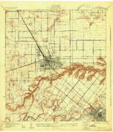
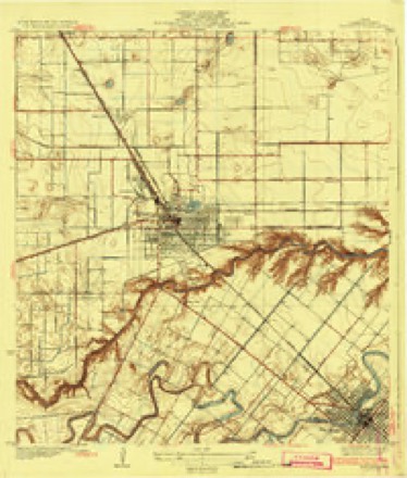
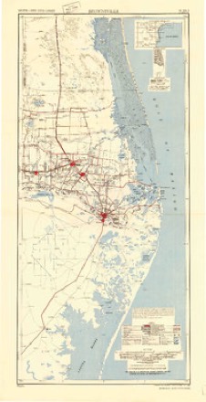
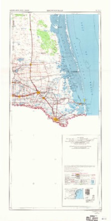
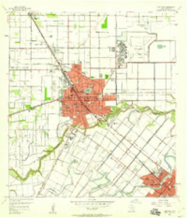
13 topographic sheets cover this place, the earliest surveyed in 1929 and the latest in 1992. It stands in the Harlingen-San Benito census division. It lies in ZIP code area 78586. The Survey maps it on the Harlingen quadrangle. 24,861 people lived here at the 2020 count. It stands 36 feet above sea level.
On record in San Benito
Buildings and businesses the archive holds for this place. Each opens its own page, with the source record it came from.
On the National Register 1 record
- Palmvillelisted 2021
Surveyed buildings and structures 2 records
- James L. Landrum House, South side of U.S. Highway 281 (Military Highway), approximately 850 feet east of FM 2520, San Benitofederal building survey, 25 photographs
- San Benito Irrigation System, San Benitofederal building survey, 1 photograph
Population over time
2 figuresSan Benito grew from 24,250 to 24,861 between 2010 and 2020. These are the recorded population figures Wikidata holds for this place, reached through the Geographic Names Information System number this page is keyed on rather than by name, so they belong to this place and not to another of the same name. Most are census counts, but not all are: an early figure may be a founding or settlement estimate, and an estimate published within five years of a census is left out. The change column is computed, and is left blank where more than 20 years separate a figure from the one before it, because a gap that long is not a change between two counts.
| Year | People | Change |
|---|---|---|
| 2010 | 24,250 | |
| 2020 | 24,861 | +611 (+3%) |
Topographic sheets covering this place
8 surveys from 13 printed sheetsMatched by testing this settlement's coordinate against the published boundary of every sheet in the United States Geological Survey's historical collection. Each opens the scanned sheet at the Survey.
- 1929 USGS Harlingen quadrangle1:24000
- 1932 USGS Harlingen quadrangle1:31680, 3 printings
- 1953 USGS Brownsville quadrangle1:250000
- 1956 USGS Brownsville quadrangle1:250000, 2 printings
- 1956 USGS Harlingen quadrangle1:24000, 3 printings
- 1956 USGS Port Isabel quadrangle1:250000
- 1962 USGS Brownsville quadrangle1:250000
- 1992 USGS Harlingen quadrangle1:100000
Fires near this place
46 since 1993Regional context, not property-specific evidence. The federal wildfire occurrence database lists 46 fires within 5 miles of San Benito between 1993 and 2019, burning about 465 acres in total. 1 started naturally. 4 were recorded as arson. Distance is straight-line from the map coordinates, so a fire counted here may appear on a neighbouring settlement's page as well.
| Reported cause | Fires |
|---|---|
| Missing data/not specified/undetermined | 23 |
| Debris and open burning | 12 |
| Arson/incendiarism | 4 |
| Equipment and vehicle use | 3 |
| Natural | 1 |
| Railroad operations and maintenance | 1 |
| Smoking | 1 |
| Power generation/transmission/distribution | 1 |
The most recent of them, most recent first, with the day each was reported and the service that recorded it.
| Date | Cause | Size | Reported by | Name on the report |
|---|---|---|---|---|
| 14 July 2017 | Missing data/not specified/undetermined | 25 acres | Texas A & M Forest Service | GRASS FIRE MUTUAL AID |
| 1 July 2005 | Debris and open burning | 3.0 acres | South Texas Refuge Complex | LINK |
| 9 June 2019 | Missing data/not specified/undetermined | 10 acres | Lower Rio Grande Valley National Wildlife Refuge | RANCHITO |
| 30 May 2018 | Missing data/not specified/undetermined | 2.0 acres | Texas A & M Forest Service | 83 COMMAND |
| 15 May 2000 | Railroad operations and maintenance | under an acre | Lower Rio Grande Valley National Wildlife Refuge | DAWN |
| 8 April 2006 | Missing data/not specified/undetermined | 40 acres | Texas A & M Forest Service | not named |
| 6 April 2005 | Debris and open burning | 5.0 acres | Lower Rio Grande Valley National Wildlife Refuge | GOAT |
| 5 April 2017 | Missing data/not specified/undetermined | 40 acres | Texas A & M Forest Service | GRASS FIRE |
Settlements close enough to share some of these fires:
Storms near this place
19 since 1998Regional context, not property-specific evidence. The National Weather Service names San Benito in 19 storm reports between 1998 and 2024: 6 flash flood, 6 thunderstorm wind, 3 hail, 3 flood. No death or injury is recorded in these reports. Each account below is quoted exactly as the forecast office filed it, from the NOAA Storm Events Database, and each date opens the federal record of that event.
| When | Event | Place named | Harm | What the report says |
|---|---|---|---|---|
| May 2004 | Flash Flood | San Benito | $2,000,000 | Slow-moving thunderstorms with torrential rainfall developed over central and eastern Cameron county. In fact, the previous daily rainfall record was shattered when 4.56 inches of rain was reported at the Brownsville-South Padre Island Airport. This amount paled in comparison to the rain that was experienced along an axis extending from central and western sections of Brownsville north and northwest through Lost Fresnos, Olmito, Rancho Viejo and up through San Benito. Locations within this axis experienced anywhere from 5 to 9 inches of rainfall over a period of appoximately 3-4 hours.The area of heaviest rain occurred in western Brownsville where numerous homes experienced flooding. Approximately 170 homes in central and western Brownsville received at least minor flooding, as did many of the city's resacas. Flooding of homes and businesses was also reported in Los Fresnos, and in homes between Los Fresnos and San Benito. An estimated 200-250 homes were affected by flooding, and the standing water resulted in many road closures across the county, especially in the Brownsville area. |
| September 2024 | Flash Flood | San Benito | $10,000 | San Benito PD reported various levels of flooding across town. The following reports were received: One foot of flowing water down Brooks Avenue at around 445 PM CDT; additional flooding on Franklin Road, Woodford Street, and Bowie Street. Water reportedly entered homes on Bowie Street with one rescue required; water was reportedly at least knee deep in some locations (2 to 3 feet). |
| April 2015 | Thunderstorm Wind | San Benito | $5,000 | San Benito Police Department reported trees blown down onto South Sam Houston, downed utility wires at the intersection of South Dick Dowling and Rowsen and on Zillock Road, and a trampoline blown into a house that caused winds to break on San Jacinto Drive. |
| December 2006 | Thunderstorm Wind | San Benito | $5,000 | Local broadcast media relayed report of wind damage to gas station roof at the intersection of U.S. Business Highway 77 and Williams road. Damage was also done to a nearby warehouse. General public had indentified a possible funnel cloud in the area at the time of the report. A survey completed by a NWS employee revealed damage consistent with that produced by straight-line winds. |
| May 2012 | Thunderstorm Wind | San Benito | $3,000 | A strong thunderstorm raced through central and eastern Cameron County, and briefly intensified. Winds estimated at 55 mph blue a poorly anchored roof from one mobile home at the Tropical Trail MHP along U.S. 77 (business) near Oscar Williams Road. A few mesquite limbs were also torn from one or two trees near the home; other structures were unharmed. |
| June 2023 | Thunderstorm Wind | San Benito | $1,000 | Public relayed via social media that a RV jack was bent, and the trailer was pushed back about 2 feet due to thunderstorm winds. Time approximated by radar. |
| June 2023 | Thunderstorm Wind | San Benito | - | An NWS employee reported several large tree limbs down near the intersection of S Travis Street and W Landrum Street in San Benito. Timing based on radar. |
| June 2023 | Hail | San Benito | - | Member of the public shared a picture of quarter size hail in the San Benito area. Timing based report given by the public and radar. |
| August 2022 | Flood | San Benito | - | Torrential rainfall, with local estimates of 2 or more inches per hour for two hours, produced street flooding from San Benito through La Tina Ranch, including along city and rural roads, with 1 to 2 feet of water on roads where the heaviest rainfall fell. There were no reports of flooding of structures in these areas, and flood receded quickly after the slow moving band ended. |
| May 2021 | Flood | San Benito | - | Social media report received of water rising up to the doorsteps of homes in San Benito near the intersection of Oscar Williams Road and I69E. Depth of water unknown, but likely 2 feet or less. |
| June 2011 | Heavy Rain | San Benito | - | Slow moving thunderstorms, containing more than an hour of torrential rains, dumped between 3 and 5 inches in western Cameron County during the early and mid afternoon of June 22nd. Numerous instances of nuisance urban flooding were reported, much in the typical poor drainage locations that see flooding with any locally heavy rainfall.||Across the Lower Valley, nuisance flooding of roads, ditches, and even some properties occurred each afternoon. On the 22nd, locally high water was reported in La Feria, Palm Valley/Harlingen, and San Benito. An estimated 5 inches of rain flooded the Mariposa subdivision near La Feria an area which often has poor drainage issues and suffered greatly after Hurricane Dolly. The water rose to around 2 feet in neighborhood roads, closing them but not reaching into structures. On the west side of Harlingen, CoCoRaHS observers reported between 4 and 5.27 inches of rain. |
| May 2007 | Flash Flood | San Benito | - | Texas General Land Office reported flash flooding of U.S. Highway 77 and its frontage road in San Benito. |
| May 2007 | Flash Flood | San Benito | - | Flash flooding was reported in San Benito on Business Highway 77 and Farm to Market Road 510. |
| July 2007 | Flash Flood | San Benito | - | Minor street flooding was reported by law enforcment in San Benito. |
| November 2002 | Flash Flood | San Benito | - | Heavy rains and saturated soil conditions led to severe flooding of the Green Valley Acres housing area in San Benito. Homes and streets were flooded, prompting Cameron County officials to evacuate around 500 residents. Flood waters persisted over the area for several days after the initial flash flooding. |
| October 2002 | Flood | San Benito | - | Street flooding was reported in San Benito by an off-duty NWS employee. |
| September 2002 | Thunderstorm Wind | San Benito | - | Several power poles were downed by strong thunderstorm winds, resulting in loss of power for residents in San Benito. |
| May 2007 | Hail | San Benito | - | no account filed |
| February 1998 | Hail | San Benito | - | no account filed |
Nearest settlements
The eight closest, with where each one stands in the county. Distances are straight-line, computed from the Geographic Names Information System coordinates.
| Map | Place | Distance | Sheets |
|---|---|---|---|
| East Stenger Street Colonia | 1.4 miles | 15 | |
| Yost Road Colonia | 1.4 miles | 13 | |
| Leal Colonia | 1.4 miles | 13 | |
| Pennsylvania Avenue Colonia | 1.4 miles | 13 | |
| South Ratliff Street Colonia | 1.5 miles | 13 | |
| El Camino Angosto Colonia | 1.5 miles | 13 | |
| El Camino Angosto | 1.6 miles | 13 | |
| Expressway 83-77 Colonia | 1.6 miles | 15 |
Elsewhere
Matched on this settlement's Geographic Names Information System number rather than its name, so it cannot be a different place of the same name in another state.
| Wikipedia article on San Benito | An encyclopaedic summary. Its text is share-alike, so it is linked here rather than copied. |
| Wikidata item Q981827 | The structured record the population and elevation above come from. Public domain (CC0). |
Provenance
This settlement is recorded in the Geographic Names Information System as feature 1375956. The sheet list is computed by point-in-boundary test against the United States Geological Survey's historical topographic inventory. Both are works of the United States government and carry no copyright under 17 U.S.C. 105.
Wildfire. Short, Karen C. 2022. Spatial wildfire occurrence data for the United States, 1992-2020 [FPA_FOD_20221014]. 6th Edition. Fort Collins, CO: Forest Service Research Data Archive. https://doi.org/10.2737/RDS-2013-0009.6 Collected with United States Government funding and usable without additional permissions or fees.
Storms. NOAA National Centers for Environmental Information, Storm Events Database https://www.ncei.noaa.gov/stormevents/ A work of the United States government, no copyright under 17 U.S.C. 105. Narratives are quoted verbatim from the National Weather Service report and are not edited or summarised.