 Block
BlockSanta Rosa, Texas
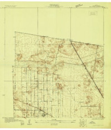
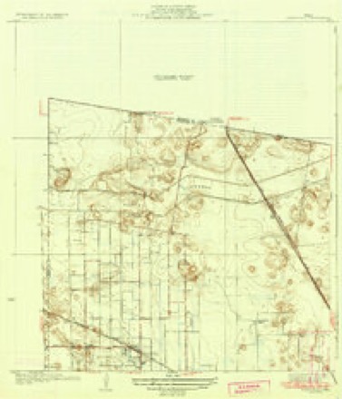
13 topographic sheets cover this place, the earliest surveyed in 1929 and the latest in 1992. It stands in the Harlingen-San Benito census division. It lies in ZIP code area 78593. The Survey maps it on the Santa Rosa quadrangle. 2,450 people lived here at the 2020 count. It stands 49 feet above sea level.
Population over time
2 figuresSanta Rosa fell from 2,873 to 2,450 between 2010 and 2020. These are the recorded population figures Wikidata holds for this place, reached through the Geographic Names Information System number this page is keyed on rather than by name, so they belong to this place and not to another of the same name. Most are census counts, but not all are: an early figure may be a founding or settlement estimate, and an estimate published within five years of a census is left out. The change column is computed, and is left blank where more than 20 years separate a figure from the one before it, because a gap that long is not a change between two counts.
| Year | People | Change |
|---|---|---|
| 2010 | 2,873 | |
| 2020 | 2,450 | -423 (-15%) |
Topographic sheets covering this place
8 surveys from 13 printed sheetsMatched by testing this settlement's coordinate against the published boundary of every sheet in the United States Geological Survey's historical collection. Each opens the scanned sheet at the Survey.
- 1929 USGS Santa Rosa quadrangle1:24000
- 1933 USGS Santa Rosa quadrangle1:31680, 3 printings
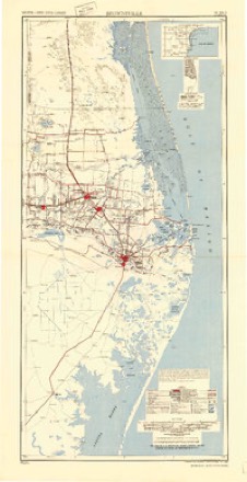
- 1953 USGS Brownsville quadrangle1:250000
- 1956 USGS Brownsville quadrangle1:250000, 2 printings
- 1956 USGS Port Isabel quadrangle1:250000
- 1956 USGS Santa Rosa quadrangle1:24000, 3 printings
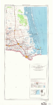
- 1962 USGS Brownsville quadrangle1:250000
- 1992 USGS Harlingen quadrangle1:100000
Photographs
1 photograph, 1939Taken for the Office of War Information and the Farm Security Administration, who photographed the country between 1935 and 1944. Works of United States government photographers, with no known restriction on use. Each opens its catalogue record.
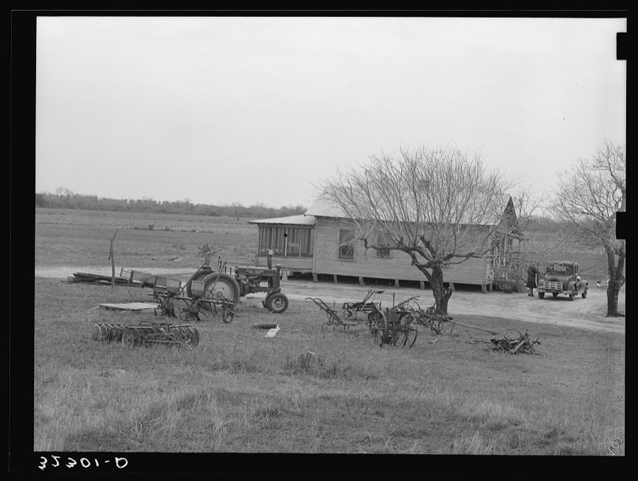
Lee, Russell, 1939. Library of Congress
Fires near this place
47 since 1993Regional context, not property-specific evidence. The federal wildfire occurrence database lists 47 fires within 5 miles of Santa Rosa between 1993 and 2018, burning about 1,361 acres in total. None started naturally. 13 were recorded as arson. Distance is straight-line from the map coordinates, so a fire counted here may appear on a neighbouring settlement's page as well.
| Reported cause | Fires |
|---|---|
| Debris and open burning | 24 |
| Arson/incendiarism | 13 |
| Missing data/not specified/undetermined | 8 |
| Equipment and vehicle use | 1 |
| Fireworks | 1 |
The most recent of them, most recent first, with the day each was reported and the service that recorded it.
| Date | Cause | Size | Reported by | Name on the report |
|---|---|---|---|---|
| 13 September 2018 | Debris and open burning | under an acre | Texas A & M Forest Service | WILCOX COMMAND |
| 3 August 1993 | Debris and open burning | 10 acres | Lower Rio Grande Valley National Wildlife Refuge | TIOCANO2 |
| 26 August 2018 | Debris and open burning | under an acre | Texas A & M Forest Service | WILCOX COMMAND |
| 22 August 2004 | Debris and open burning | 41 acres | Lower Rio Grande Valley National Wildlife Refuge | RANCHITO |
| 20 August 2008 | Debris and open burning | under an acre | Lower Rio Grande Valley National Wildlife Refuge | OTHA 2 |
| 19 August 2004 | Debris and open burning | 1.2 acres | South Texas Refuge Complex | UNDER |
| 10 August 2015 | Missing data/not specified/undetermined | 52 acres | Lower Rio Grande Valley National Wildlife Refuge | RATLIFF |
| 23 July 1997 | Arson/incendiarism | 1.0 acres | Lower Rio Grande Valley National Wildlife Refuge | NSUGAR |
Settlements close enough to share some of these fires:
Storms near this place
18 since 1998Regional context, not property-specific evidence. The National Weather Service names Santa Rosa in 18 storm reports between 1998 and 2025: 5 thunderstorm wind, 4 flash flood, 3 hail, 3 flood. No death or injury is recorded in these reports. Each account below is quoted exactly as the forecast office filed it, from the NOAA Storm Events Database, and each date opens the federal record of that event.
| When | Event | Place named | Harm | What the report says |
|---|---|---|---|---|
| June 2018 | Flash Flood | Santa Rosa | $35,000,000 | Multiple cells and clusters of thunderstorms during the pre-dawn hours into the morning commute on June 20th dropped measured and estimated rainfall between 5 and more than 8 inches in western Cameron County, which caused widespread flooding between La Feria, Harlingen, San Benito, and other locations. The flooding produced locally 2 to 4 feet of water depth, with Santa Rosa through La Feria particularly hard hit. Interstate 2 frontage road was closed from Harlingen to McAllen due to the intense rainfall, which fell at an estimated rate of 2 to 3 inches per hour in a few spots for 2 to 3 hours - and on top of prior rainfall earlier in the week.||Detailed damage for this particular event was not known, though total damage through multiple agencies along with standard doubling for uninsured properties, as well as significant damage to drainage canals, suggested event totals in Cameron County were over $60 million. For this particular event, which included some of the highest rainfall rates, damage was estimated at around $35 million. There were an unknown number of properties and vehicles damaged in this particular flood, though the numbers are likely above 1,000 for each case. ||Full details will be available within 12 to 18 months of the event. |
| June 2019 | Flash Flood | Santa Rosa | $30,000,000 | Measured and estimated rainfall between 8 and 15.2 inches that fell predominantly from early evening June 24th through a bit after midnight on June 25th produced widespread flash flooding across northwestern Cameron County. Hardest hit locations were the west side of Harlingen through La Feria, north to Santa Rosa, and back east to near Combes. ||In the tri-county area (western Willacy, northwestern Cameron, and southeastern Hidalgo), 1188 homes were considered destroyed or with major damage, with an additional 182 homes with minor damage. Hundreds of streets flooded, including 30 Texas-managed highways. This included the frontage roads of Interstate 2 and Interstate 69E (with up to four feet of water in Cameron County). ||More than 100 persons were evacuated to higher ground when dozens of homes were threatened by 2 to 4 feet of water in each county. In northwestern Cameron County, total neighborhoods were inundated with 1 to 3 feet of water in northwest Harlingen, Santa Rosa (where some reports noted 4 feet of water depth), and Combes. | |Individual Assistance costs for the affected area in the three counties was estimated at $27.6 million as of early August 2019; Public Assistance values were unknown but likely to add to the damage, which will be estimated at $75 million in all three counties. Daily rainfall records were set in the flood area, including 6.29 inches in Harlingen, more than four inches above the prior calendar day record (2.23 inches in 1926). The total was also a new daily record for the month (5.89 on June 20, 2018); records date back to 1912 at the site.||Despite the flooding and damage, much which occurred in the dark, there were no know deaths of injuries directly attributed to the flood. |
| July 2020 | Flash Flood | Santa Rosa | $13,270,000 | Afternoon and early evening rains of 2 to 3 inches fell across the IH-2 corridor of Cameron County, from La Feria to east of Harlingen, and saturated soils ahead of the torrential rains that were to come later in the evening as the southern and eastern eyewall pulled copious tropical moisture into northern Cameron County after sunset. Estimated rainfall of 4 to 6+ inches by mid evening began to produce known flash flooding in La Feria and Harlingen, with two water rescues conducted in La Feria just after 10 PM CST. Despite lighter rains, flash flooding would continue due to poor drainage situations, especially in the La Feria/Santa Rosa area. A broad south to north feeder band added another 2 to 4+ inches of rainfall to the storm totals during the pre-dawn hours, and light rains would continue to around noon in western Cameron County before ending. Note: Estimated flood-related public assistance property damage is provided in this episode. However, the total damage would also include another 3 to 5 inches that would fall in an unrelated tropical band of torrential rain during the evening of July 27th.||Flooding would decimate the cotton (lint) crop and other unharvested dryland crops to an estimated value of $27.1 million. Public assistance property damage as of this writing from flooding rainfall was estimated to be at $3.3 million. Additional public and individual assistance dollar damages, as well as insured damages, from flood waters was calculated using NCEI's total dollar damage estimate (divided among the affected counties by local storm data experts). Total property damage from flood waters for Cameron County was $9.968 million. |
| July 2010 | Flood | Santa Rosa | $100,000 | Incredible rainfall estimated to be more than 50 inches in around 10 days' time between June 30th and July 9th across the front range and peaks of the Sierra Madre Oriental in Coahuila Province, Mexico, ultimately flowed through the entire Lower Rio Grande basin for much of the summer of 2010. ||Nearly a month of dam releases from Falcon International Reservoir at 60,000 cfs ultimately required water to be diverted at Anzalduas Dam (southwest of Granjeno) into Mexico and the U.S. Floodway system, which includes the North Floodway which curves east across northwest Cameron County just south of Sebastian. ||These floodways, protected by a robust system of levees and gates, protected communities outside of the levees by containing up to 50%, or 4 to 8 to feet, of fast flowing water, within them. In Cameron County, there were no reports of structural damage as the North Floodway tracks in largely uninhabited country. However, several paved and unpaved roads were flooded inside the levees, including the Federal Highway 77 (Expressway) frontage road (the Expressway was well above the water level), County Road 506, and FM 1425 (along the Cameron/Hidalgo County line) ||Crops may have been destroyed by the flood along North Floodways, but damage in northwest Cameron County was unknown as of this writing. Infrastructure damage to roads and low water bridges may have exceeded [$x] thousand in northwestern Cameron County. |
| May 2008 | Thunderstorm Wind | Santa Rosa | $50,000 | The same severe thunderstorm that rolled a number of trailer homes, ripped a roof off of an industrial building, and blew down hundreds of trees and limbs in central Hidalgo County continued to maintain strength while racing into northwest Cameron County. Wind gusts estimated near 80 mph damaged homes in Santa Rosa, and flipped two vehicles along Farm to Market Road 506, including a pickup truck on a driveway near the intersection of Orphanage and Louisiana. A number of power lines were also down in the area. |
| April 2019 | Thunderstorm Wind | Santa Rosa | $10,000 | The squall line that originally developed in Starr and Zapata County weakened a bit over western and central Hidalgo County, still producing wind gusts up to 53 mph. The central part of the line re-intensified over eastern Hidalgo County, and as it reached Cameron County began producing several reports of wind damage. Along a 10 mile stretch from near Santa Rosa to San Benito, the following damage reports were received:|*Power lines down on the southeast side of Santa Rosa (820 AM CST)|*Tree blocking a road in West Harlingen (830 AM CST)|*Tree down on car with damage to vehicle on Diaz St. in San Benito (830 AM CST). ||Reports were received from Public and Law Enforcement. |
| March 2025 | Thunderstorm Wind | Santa Rosa | $8,000 | The Cameron County Office of Emergency Management reported a small shed blown down by strong thunderstorms winds in Santa Rosa. |
| May 2010 | Thunderstorm Wind | Santa Rosa | $5,000 | Winds within and ahead of the squall line increased to severe levels as they swept across Cameron County. Racing from from west northwest to east southeast across the County, the winds, both measured and estimated at 60 mph, knocked down hundreds of different sized tree limbs and caused power outages from Santa Rosa through Harlingen and San Benito. The ASOS (KHRL) at the Valley International Airport recorded a 60 mph gusts, and the public estimated a 60 mph gust moments later in San Benito. |
| June 2009 | Thunderstorm Wind | Santa Rosa | $1,000 | The public reported strong winds occurred during thunderstorms and blew down trees just south of Sebastian in extreme northern Cameron County. |
| April 2023 | Hail | Santa Rosa | - | Several reports of quarter to half dollar sized hail in northwestern Cameron County from 5 miles west of Harlingen to near Santa Rosa and La Feria. |
| April 2023 | Hail | Santa Rosa | - | A member of the public reported quarter (1.0) sized hail in the Santa Rosa area. |
| June 2019 | Flood | Santa Rosa | - | Slow drainage of torrential rains of 6 to 15 inches in just six hours during the evening of June 24th through just after midnight on June 25th maintained widespread flooding of 1 to as much as 3 feet of water depth across many neighborhoods and roads in the eastern portion of the Rio Grande Valley. Hundreds of roads remained closed or impassible, and hundreds to more than a thousand homes continued to have some water in them for several (mainly fair weather days) following the causative event. Water did not recede completely in some neighborhoods until up to 2 weeks following the rains, much due to the interconnected drainage system which was unable to handle the rainfall rate, which was a 1 in 500 probability event occurring in locations only built to sustain 1 in 5 or 1 in 10 probability events. ||Please note: Damage listed here is shown as *zero*. Estimated total damage for this event is listed in the flash flood entries for these locations. |
| April 2013 | Heavy Rain | Santa Rosa | - | Community Collaborative Rain, Hail, and Snow Network (CoCoRaHS), spotters, cooperative observers, and Automated Surface Observing Systems recorded between 2 and 3.5 inches of torrential rain in less than an hour, generally on a line from Santa Rosa to east of Cameron Park. The torrents included much of Brownsville, Los Fresnos, and Harlingen. At Brownsville (2.65 inches) and Harlingen/Valley Airport (2.37 inches), new daily records were set. The heavy rainfall flooded previously parched farm and ranch fields with over a foot of water in some spots, particularly north of Los Fresnos, where the most rain (over 3 inches) fell. Brief nuisance urban flooding was noted in Harlingen, portions of Brownsville, and Los Fresnos. |
| August 2010 | Flood | Santa Rosa | - | High and fast flowing waters continued through the North Floodway in extreme northwest Cameron County well into August, as water continued to flow through the Anzalduas (Hidalgo County) Diversion Dam into the Lower Rio Grande Flood Control Project (floodways/levee system).||These floodways, protected by a robust system of levees and gates, protected communities outside of the levees by containing up to 50%, or 4 to 8 to feet, of fast flowing water, within them. In Cameron County, there were no reports of structural damage as the North Floodway tracks in largely uninhabited country. However, several paved and unpaved roads were flooded inside the levees, including the Federal Highway 77 (Expressway) frontage road (the Expressway was well above the water level), County Road 506, and FM 1425 (along the Cameron/Hidalgo County line).||The North Floodway finally drained to mud toward the end of the month. The end date of the high water is a best estimate. ||Crops may have been destroyed by the flood along North Floodways, but damage in northwest Cameron County was unknown as of this writing. Infrastructure damage to roads and low water bridges may have exceeded [$x] thousand in northwestern Cameron County. Note: The dollar damage estimate is listed with the July report. |
| June 2009 | Heavy Rain | Santa Rosa | - | Clusters of thunderstorms dumped heavy rainfall across western Cameron County during the mid to late afternoon on June 1st. Measured rainfall between 2 and more than 4 inches fell at several locations, including 2.03 inches in Palm Valley and 2.33 inches near Harlingen. An unconfirmed report of nearly 4 1/2 inches was reported by local media near Santa Rosa, and 4 to 5 inches of standing water were reported along Harrison and Tyler in downtown Harlingen. |
| May 2007 | Flash Flood | Santa Rosa | - | Texas Department of Transportation reported flash flooding of Farm to Market Road 506 and Farm to Market Road 107 in Santa Rosa with one and a half feet of water covering the roads. |
| September 2001 | Tornado (F0) | Santa Rosa | - | Several weak landspout-type tornadoes formed along the leading of a stationary front. The tornadoes were weak, small, and short-lived, with none lasting more than five minutes. This tornado resulted in a tree falling on a home. |
| February 1998 | Hail | Santa Rosa | - | no account filed |
Nearest settlements
The eight closest, with where each one stands in the county. Distances are straight-line, computed from the Geographic Names Information System coordinates.
| Map | Place | Distance | Sheets |
|---|---|---|---|
| Santa Rosa Number 5 Colonia | 0.2 miles | 13 | |
| Santa Rosa Number 12 Colonia | 0.5 miles | 13 | |
| El Nogal Colonia | 0.5 miles | 13 | |
| Santa Rosa Number 9 Colonia | 0.5 miles | 13 | |
| Santa Rosa Number 14 Colonia | 0.7 miles | 13 | |
| Tierra Bonita Colonia | 0.8 miles | 13 | |
| Grande Acres Colonia | 0.9 miles | 13 | |
| Grand Acres | 0.9 miles | 13 |
Elsewhere
Matched on this settlement's Geographic Names Information System number rather than its name, so it cannot be a different place of the same name in another state.
| Wikipedia article on Santa Rosa | An encyclopaedic summary. Its text is share-alike, so it is linked here rather than copied. |
| Wikidata item Q981969 | The structured record the population and elevation above come from. Public domain (CC0). |
Provenance
This settlement is recorded in the Geographic Names Information System as feature 1346669. The sheet list is computed by point-in-boundary test against the United States Geological Survey's historical topographic inventory. Both are works of the United States government and carry no copyright under 17 U.S.C. 105.
Wildfire. Short, Karen C. 2022. Spatial wildfire occurrence data for the United States, 1992-2020 [FPA_FOD_20221014]. 6th Edition. Fort Collins, CO: Forest Service Research Data Archive. https://doi.org/10.2737/RDS-2013-0009.6 Collected with United States Government funding and usable without additional permissions or fees.
Storms. NOAA National Centers for Environmental Information, Storm Events Database https://www.ncei.noaa.gov/stormevents/ A work of the United States government, no copyright under 17 U.S.C. 105. Narratives are quoted verbatim from the National Weather Service report and are not edited or summarised.