 Block
BlockSeagraves, Texas
6 topographic sheets cover this place, the earliest surveyed in 1954 and the latest in 1992. It stands in the Seagraves census division. It lies in ZIP code area 79359. The Survey maps it on the Seagraves quadrangle. 2,153 people lived here at the 2020 count. It stands 3,353 feet above sea level.
Population over time
3 figuresSeagraves fell from 2,334 to 2,153 between 2000 and 2020. These are the recorded population figures Wikidata holds for this place, reached through the Geographic Names Information System number this page is keyed on rather than by name, so they belong to this place and not to another of the same name. Most are census counts, but not all are: an early figure may be a founding or settlement estimate, and an estimate published within five years of a census is left out. The change column is computed, and is left blank where more than 20 years separate a figure from the one before it, because a gap that long is not a change between two counts.
| Year | People | Change |
|---|---|---|
| 2000 | 2,334 | |
| 2010 | 2,417 | +83 (+4%) |
| 2020 | 2,153 | -264 (-11%) |
Topographic sheets covering this place
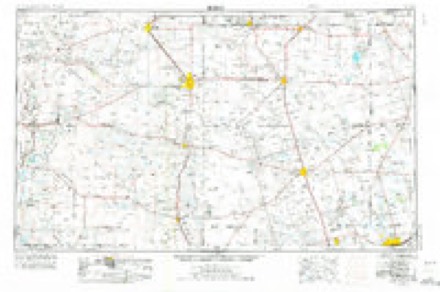
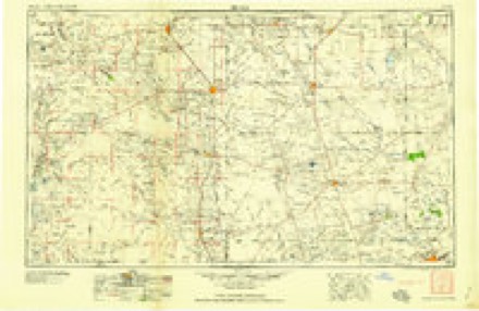
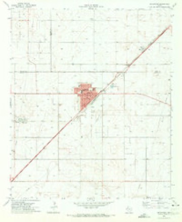
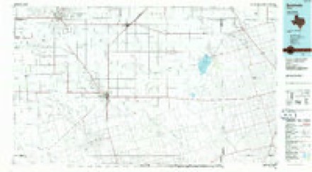
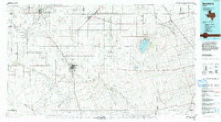
5 surveys from 6 printed sheetsMatched by testing this settlement's coordinate against the published boundary of every sheet in the United States Geological Survey's historical collection. Each opens the scanned sheet at the Survey.
- 1954 USGS Hobbs quadrangle1:250000, 2 printings
- 1958 USGS Hobbs quadrangle1:250000
- 1970 USGS Seagraves quadrangle1:24000
- 1985 USGS Seminole quadrangle1:100000
- 1992 USGS Seminole quadrangle1:100000
Fires near this place
2 since 2007Regional context, not property-specific evidence. The federal wildfire occurrence database lists 2 fires within 5 miles of Seagraves between 2007 and 2010, burning about 115 acres in total. None started naturally. None was recorded as arson. Distance is straight-line from the map coordinates, so a fire counted here may appear on a neighbouring settlement's page as well.
| Reported cause | Fires |
|---|---|
| Smoking | 1 |
| Debris and open burning | 1 |
The most recent of them, most recent first, with the day each was reported and the service that recorded it.
| Date | Cause | Size | Reported by | Name on the report |
|---|---|---|---|---|
| 18 February 2007 | Debris and open burning | 40 acres | Texas A & M Forest Service | not named |
| 29 December 2010 | Smoking | 75 acres | Texas A & M Forest Service | GRASS FIRE |
Mines and quarries near this place
1 within 5 milesRegional context, not property-specific evidence. The federal mineral resources record lists 1 working within 5 miles of Seagraves: 1 producer. All of them still produce. What was taken out: Sodium. Distance is straight-line from the map coordinates, so a quarry counted here may appear on a neighbouring settlement's page as well.
| Where | Site | Commodity | Status | Recorded |
|---|---|---|---|---|
| Seagraves Plant | Sodium | Producer |
Storms near this place
60 of 87 shownRegional context, not property-specific evidence. The National Weather Service names Seagraves in 87 storm reports between 1995 and 2025: 33 thunderstorm wind, 27 flash flood, 26 hail, 1 heavy rain. No death or injury is recorded in these reports. Each account below is quoted exactly as the forecast office filed it, from the NOAA Storm Events Database, and each date opens the federal record of that event.
| When | Event | Place named | Harm | What the report says |
|---|---|---|---|---|
| May 1997 | Hail | Seagraves | $2,500,000 | Baseball size hail and larger smashed the windshield of a Police cruiser and shattered windows in several homes. Power was knocked out around town as well. Autos and roofs of houses were smashed by the large hail and accounted for much of the damage total. A local insurance agent said the damage was the worst in 20 years in Seagraves.Storms that were moving eastward into the Seagraves area had been a multicell cluster, but just before arriving at Seagraves one cell developed briefly into an HP Supercell. |
| September 1998 | Thunderstorm Wind | Seagraves | $700,000 | An isolated severe thunderstorm rapidly intensified as it moved to the south into Northern Gaines County just east of Seagraves. Doppler radar showed this storm to have VILs in excess of 50 kg/m2 for several volume scans as it entered the county. VILs and low-level reflectivity decreased significantly during and shortly after the time severe weather was reported. The MAF evening sounding suggested the potential for hybrid microbursts, with wind gusts over 75 knots possible.A trailer house and barn one mile east of the city limits were demolished, and the roofs off three hangars at the municipal airport farther east of town were partly or totally removed. Other structures from eastern city limits to a couple miles east of the city limits incurred similar damage. The most costly damage was to the cotton crops, which were days away from being harvested. Winds estimated at or above 80 mph levelled these crops with pea-sized and smaller hail. A 17,000 pound tractor was also moved over 100 feet and 23 center-pivot irrigation systems were at least overturned. |
| July 2018 | Thunderstorm Wind | Seagraves | $500,000 | A thunderstorm moved across Gaines County and produced wind damage about three miles southwest of Seagraves. Several power lines were blown down due to thunderstorm winds at County Road 226 and US 385. The cost of damage is a very rough estimate. |
| April 2006 | Thunderstorm Wind | Seagraves | $500,000 | Severe thunderstorm winds blew through Seagraves in northern Gaines County taking down a cell phone tower and blowing a tree onto a house. Several reports of damage were received by police in Seagraves according to the local newspaper. A Texas Tech Mesonet site one mile southwest of Seagraves recorded wind gusts of 74 and 75 mph during the time damage was reported to have occurred. |
| April 2000 | Hail | Seagraves | $500,000 | Small cluster of storms crossed into Texas from Eastern New Mexico with the southern-most cell developing into a low-topped supercell. Hail was described as very hard. |
| May 2016 | Thunderstorm Wind | Seagraves | $250,000 | A thunderstorm moved across Gaines County and produced wind damage east of Seagraves. Several irrigation pivots were overturned. The cost of damage is a very rough estimate. |
| May 1995 | Hail | Seagraves | $100,000 | Reported by the Seagraves Fire Department. Numerous vehicles damaged by golf ball-size hail. |
| October 2023 | Flash Flood | Seagraves | $50,000 | Multiple cars were stranded in flood waters on North State Highway 385 and East State Highway 83. Property cost damage is an estimation. |
| May 2018 | Thunderstorm Wind | Seagraves | $28,000 | A thunderstorm moved across Gaines County and produced a downburst in Seagraves. A 74 mph wind gust was recorded by the West Texas Mesonet. Roof damage occurred in the town of Seagraves. The cost of damage is a very rough estimate. |
| June 2007 | Thunderstorm Wind | Seagraves | $20,000 | The West Texas Mesonet site one mile southwest of Seagraves (KSGV) recorded a wind gust of 76 mph. Trees and power lines were downed, roofs were damaged and horse trailers were flipped over. A tree limb went through a company vehicle. |
| September 2004 | Flash Flood | Seagraves | $15,000 | Flash flooding inundated Texas Highway 214 near the Gaines/Yoakam County line. At 14:55 CST a car was washed off of the highway just south of the county line by flowing flood waters. Local emergency officials closed the highway after the driver of the vehicle was brought to safety and it was not re-opened until the water receded after midnight CST. |
| June 2008 | Thunderstorm Wind | Seagraves | $10,000 | Telephone poles were downed by severe thunderstorm winds at the intersection of U.S. Highway 385 and Texas State Highway 83 in Seagraves. |
| May 2008 | Hail | Seagraves | $10,000 | no account filed |
| June 2015 | Thunderstorm Wind | Seagraves | $8,000 | A thunderstorm that moved across Gaines County knocked down power lines and trees throughout the city of Seagraves. Additional power lines were down 3 miles south of Seagraves on FM 1429. |
| August 2018 | Flash Flood | Seagraves | $6,000 | Heavy rain fell across Gaines County and produced flash flooding in Seagraves. Cars were flooded out at the intersection of US 385 and TX 83. The cost of damage is a very rough estimate. |
| May 2015 | Flash Flood | Seagraves | $6,000 | Heavy rain fell across Gaines County and produced flash flooding in Seagraves. There was flooding at Highway 385/83 and stranded vehicles at McAdoo Curve. Water was covering all four lanes of traffic. The cost of damage is a very rough estimate. |
| May 1997 | Thunderstorm Wind | Seagraves | $6,000 | Roof blown off a structure 1-2 miles east of State Highway 214 on State Highway 83. Strong outflow winds in a slightly bowing multicell complex. |
| May 2024 | Thunderstorm Wind | Seagraves | $5,000 | A photo shows a carport destroyed. Time is estimated from radar. Wind speeds and property damage costs are an estimation. |
| October 2018 | Flash Flood | Seagraves | $5,000 | Heavy rain fell across Gaines County and produced flash flooding near Seagraves. The Seagraves Fire Department performed high water rescues at the intersection of State Highway 83 and US Highway 62, one mile north of Seagraves. The cost of damage is a very rough estimate. |
| August 2016 | Flash Flood | Seagraves | $5,000 | Heavy rain fell across Gaines County and produced flash flooding north of Seminole. Six to twelve inches of water was running over Highway 62/385 ten to twelve miles north of Seminole. Motorists were stuck in high water. The cost of damage is a very rough estimate. |
| June 2015 | Flash Flood | Seagraves | $5,000 | Heavy rain fell across Gaines County and produced flash flooding on Highway 385 between Seminole and Seagraves. The flooding was reported on Highway 385 between County Roads 103 and 124. Other reports were received that indicate numerous county roads northwest of Seminole were flooded and impassable. Seminole and Seagraves fire departments were pulling cars out of ditches. The cost of damage is a very rough estimate. |
| June 1995 | Thunderstorm Wind | Seagraves | $5,000 | Power lines were blown down in Seagraves. Both reports came from the sheriff's office. |
| June 2019 | Flash Flood | Seagraves | $4,000 | Heavy rain fell across Gaines County and produced flash flooding in Seagraves. There were stranded cars at the intersection of US 385/83. The cost of damage is a very rough estimate. |
| May 2016 | Thunderstorm Wind | Seagraves | $3,000 | A thunderstorm moved across Gaines County and produced a 65 mph wind gust at the Seagraves Mesonet site. A storm survey was conducted and there were trees uprooted and a tin building was ripped apart. The cost of damage is a very rough estimate. |
| July 2017 | Flash Flood | Seagraves | $2,000 | Heavy rain moved across Gaines County and produced flash flooding about ten miles north of Seminole. There was water over Highway 385/62 near McAdoo Curve. A couple of stalled vehicles were reported. The cost of damage is a very rough estimate. |
| May 2015 | Flash Flood | Seagraves | $1,000 | Heavy rain fell in Gaines County and produced flash flooding in Seagraves. Roads were reported to be closed. The cost of damage is a very rough estimate. |
| May 2015 | Flash Flood | Seagraves | $1,000 | Heavy rain moved across Gaines County and produced flash flooding in Seagraves. Several roads were closed in Seagraves. The cost of damage is a very rough estimate. |
| September 1998 | Thunderstorm Wind | Seagraves | $1,000 | After pounding the areas east of Seagraves, this storm caused additional structural damage to power poles a half hour later. Many people in Loop were consequently without power for several hours. |
| May 2021 | Flash Flood | Seagraves | $500 | Heavy rain fell across Gaines County and produced flash flooding. There was one to two feet of flowing water across US Highway 62. |
| June 2015 | Flash Flood | Seagraves | $200 | Spotter reported water 12-18 inches deep over four lanes on Highway 385 southwest of Seagraves. |
| June 2015 | Flash Flood | Seagraves | $200 | Trained Spotter reported closed roads due to flooding in the City of Seagraves. |
| June 2025 | Thunderstorm Wind | Seagraves | - | The West Texas Mesonet station 15 Seagraves 1SW recorded a 58 mph wind gust. |
| April 2025 | Hail | Seagraves | - | A media partner reported nickel to quarter-sized hail between Seagraves and Seminole in Gaines County, TX, along US Highway 62. Time is estimated from radar. |
| June 2025 | Thunderstorm Wind | Seagraves | - | The West Texas Mesonet station 15 Seagraves 1SW measured a 69 mph wind gust, along with numerous other severe gusts associated with a strong outflow boundary. |
| May 2024 | Hail | Seagraves | - | Two-inch diameter hail on US Highway 62. |
| June 2023 | Flash Flood | Seagraves | - | Water was reported over Highway 385 5 miles south of Seagraves. FM 1249 south of Seagraves is temporarily closed due to flooding. |
| May 2022 | Thunderstorm Wind | Seagraves | - | A thunderstorm produced a 61 mph wind gust at the Seagraves Mesonet site. |
| August 2022 | Thunderstorm Wind | Seagraves | - | A thunderstorm produced a 58 mph wind gust at the Seagraves Mesonet site. |
| May 2021 | Thunderstorm Wind | Seagraves | - | A thunderstorm produced a 61 mph wind gust at the Seagraves Mesonet site. |
| July 2018 | Thunderstorm Wind | Seagraves | - | A thunderstorm moved across Gaines County and produced a 71 mph wind gust one mile southwest of Seagraves. |
| June 2018 | Thunderstorm Wind | Seagraves | - | A thunderstorm moved across Gaines County and produced a 67 mph wind gust near Seagraves. |
| May 2016 | Thunderstorm Wind | Seagraves | - | A thunderstorm moved across Gaines County and produced a 61 mph wind gust south of Seagraves. |
| June 2015 | Thunderstorm Wind | Seagraves | - | A thunderstorm moved across Gaines County and produced a wind gust of 74 mph measured at mesonet 1 SW of Seagraves. |
| April 2015 | Flash Flood | Seagraves | - | Road closure due to flash flooding at Highway 385 and State Highway 83. |
| April 2015 | Flash Flood | Seagraves | - | Heavy rain cause flash flooding which lead to a road closure at the intersection of State Highway 83 and US Highway 385 in Seagraves. |
| May 2015 | Heavy Rain | Seagraves | - | Heavy rain fell near Seagraves and the Texas Tech Mesonet reported 3.96 inches of rain in one hour. |
| June 2014 | Thunderstorm Wind | Seagraves | - | A thunderstorm moved across Gaines County and produced a 62 mph wind gust near Seagraves. No damage was reported. |
| June 2013 | Thunderstorm Wind | Seagraves | - | A thunderstorm moved over Gaines County and produced a 60 mph wind gust one mile southwest of Seagraves. |
| June 2013 | Thunderstorm Wind | Seagraves | - | A thunderstorm moved over Gaines County and produced a 58 mph wind gust one mile southwest of Seagraves. |
| May 2012 | Flash Flood | Seagraves | - | A thunderstorm with heavy rain moved across Gaines County and produced significant street flooding in Seagraves. No information about the flooding was given, so the cost of damage is assumed to be zero. |
| July 2010 | Flash Flood | Seagraves | - | The Gaines County Emergency Manager reported water running over US Highway 83 about 5 miles east of Seagraves. The depth of the water was not reported. |
| June 2008 | Flash Flood | Seagraves | - | Texas State Highway 83 just west of Seagraves was blocked off due to high water covering the roadway. |
| June 2008 | Flash Flood | Seagraves | - | Several roadways in and around Seagraves were under water and deemeed impassible by TXDOT. |
| June 2008 | Hail | Seagraves | - | Penny to quarter sized hail was reported south of Seagraves. |
| September 2008 | Flash Flood | Seagraves | - | Local law enforcement reported multiple stranded vehicles along Hwy 385N near Seagraves and Seminole due to high water flowing across roadways. |
| August 2008 | Flash Flood | Seagraves | - | Texas State Highway 83 and U.S. Highway 385 in Seagraves were closed due to two feet of flowing water. Farm to Market Road 303 south of Loop was also closed due to high water flowing across the road. |
| September 2007 | Flash Flood | Seagraves | - | Six to eight inches of water flowed across the intersection of Texas State Highway 83 and U.S. Highway 385. |
| September 2006 | Hail | Seagraves | - | Half-dollar to ping pong ball sized hail fell from 1.5 to 4.5 miles East Southeast of Seagraves. The hail began at 730 pm CST and lasted 25 minutes. Considerable crop damage was done by the hail. Six to eight sections of cotton and peanuts were damaged with the combined cost at roughly 2 million dollars. The report was relayed by the Weather Forecast Office in Lubbock. |
| August 2006 | Flash Flood | Seagraves | - | The Gaines County Sheriff's Office reported flash flooding at the intersection of U.S. Highway 385 and Texas Highway 83 near Seagraves. The intersection was closed due to the flooding and to a traffic accident. Other reports of flash flooding included areas of U.S. Highway 385 between Seminole and Seagraves with as much as two to four feet of water running over the highway. |
| June 2005 | Hail | Seagraves | - | Local emergency management officials reported quarter size hail along U.S. Highway 385 south of Seagraves. |
Nearest settlements
The eight closest, with where each one stands in the county. Distances are straight-line, computed from the Geographic Names Information System coordinates.
| Map | Place | Distance | Sheets |
|---|---|---|---|
| Loop | 8.1 miles | 6 | |
| Ashmore | 15.3 miles | 7 | |
| Seminole | 16.1 miles | 6 | |
| Fairview | 17.1 miles | 6 | |
| White City | 17.7 miles | 6 | |
| Paynes Corner | 19.4 miles | 6 | |
| Higginbotham | 22.8 miles | 6 | |
| State Line | 30.5 miles | 6 |
Elsewhere
Matched on this settlement's Geographic Names Information System number rather than its name, so it cannot be a different place of the same name in another state.
| Wikipedia article on Seagraves | An encyclopaedic summary. Its text is share-alike, so it is linked here rather than copied. |
| Wikidata item Q973885 | The structured record the population and elevation above come from. Public domain (CC0). |
Provenance
This settlement is recorded in the Geographic Names Information System as feature 1346845. The sheet list is computed by point-in-boundary test against the United States Geological Survey's historical topographic inventory. Both are works of the United States government and carry no copyright under 17 U.S.C. 105.
Wildfire. Short, Karen C. 2022. Spatial wildfire occurrence data for the United States, 1992-2020 [FPA_FOD_20221014]. 6th Edition. Fort Collins, CO: Forest Service Research Data Archive. https://doi.org/10.2737/RDS-2013-0009.6 Collected with United States Government funding and usable without additional permissions or fees.
Mines and quarries. USGS Mineral Resources Data System (MRDS) https://mrdata.usgs.gov/mrds/ A work of the United States government, no copyright under 17 U.S.C. 105.
Storms. NOAA National Centers for Environmental Information, Storm Events Database https://www.ncei.noaa.gov/stormevents/ A work of the United States government, no copyright under 17 U.S.C. 105. Narratives are quoted verbatim from the National Weather Service report and are not edited or summarised.