 Block
BlockSebastian, Texas
13 topographic sheets cover this place, the earliest surveyed in 1929 and the latest in 1992. It stands in the Sebastian census division. It lies in ZIP code area 78594. The Survey maps it on the Santa Rosa quadrangle. 1,684 people lived here at the 2020 count. It stands 39 feet above sea level.
Population over time
2 figuresSebastian fell from 1,917 to 1,684 between 2010 and 2020. These are the recorded population figures Wikidata holds for this place, reached through the Geographic Names Information System number this page is keyed on rather than by name, so they belong to this place and not to another of the same name. Most are census counts, but not all are: an early figure may be a founding or settlement estimate, and an estimate published within five years of a census is left out. The change column is computed, and is left blank where more than 20 years separate a figure from the one before it, because a gap that long is not a change between two counts.
| Year | People | Change |
|---|---|---|
| 2010 | 1,917 | |
| 2020 | 1,684 | -233 (-12%) |
Topographic sheets covering this place
8 surveys from 13 printed sheetsMatched by testing this settlement's coordinate against the published boundary of every sheet in the United States Geological Survey's historical collection. Each opens the scanned sheet at the Survey.
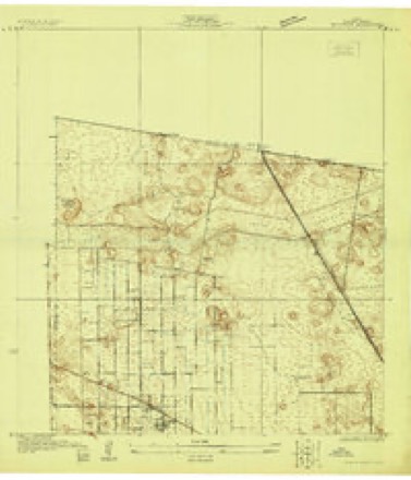
- 1929 USGS Santa Rosa quadrangle1:24000
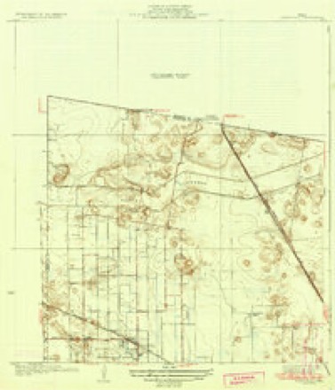
- 1933 USGS Santa Rosa quadrangle1:31680, 3 printings
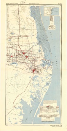
- 1953 USGS Brownsville quadrangle1:250000
- 1956 USGS Brownsville quadrangle1:250000, 2 printings
- 1956 USGS Port Isabel quadrangle1:250000
- 1956 USGS Santa Rosa quadrangle1:24000, 3 printings
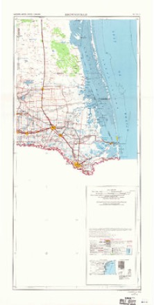
- 1962 USGS Brownsville quadrangle1:250000
- 1992 USGS Harlingen quadrangle1:100000
Fires near this place
40 since 2004Regional context, not property-specific evidence. The federal wildfire occurrence database lists 40 fires within 5 miles of Sebastian between 2004 and 2020, burning about 211 acres in total. None started naturally. None was recorded as arson. Distance is straight-line from the map coordinates, so a fire counted here may appear on a neighbouring settlement's page as well.
| Reported cause | Fires |
|---|---|
| Debris and open burning | 18 |
| Missing data/not specified/undetermined | 18 |
| Power generation/transmission/distribution | 3 |
| Equipment and vehicle use | 1 |
The most recent of them, most recent first, with the day each was reported and the service that recorded it.
| Date | Cause | Size | Reported by | Name on the report |
|---|---|---|---|---|
| 7 September 2019 | Debris and open burning | under an acre | Texas A & M Forest Service | GRASS FIRE |
| 27 August 2018 | Missing data/not specified/undetermined | under an acre | Texas A & M Forest Service | GRASS FIRE |
| 22 August 2004 | Debris and open burning | 41 acres | Lower Rio Grande Valley National Wildlife Refuge | RANCHITO |
| 19 August 2004 | Debris and open burning | 1.2 acres | South Texas Refuge Complex | UNDER |
| 16 August 2019 | Missing data/not specified/undetermined | under an acre | Texas A & M Forest Service | LARGE FRONTAGE GRASS FIRE |
| 10 August 2019 | Equipment and vehicle use | under an acre | Texas A & M Forest Service | FRONTAGE FIRE |
| 6 July 2011 | Debris and open burning | 1.0 acres | Texas A & M Forest Service | TRASH FIRE |
| 26 July 2011 | Debris and open burning | 1.0 acres | Texas A & M Forest Service | GRASS FIRE |
Settlements close enough to share some of these fires:
Storms near this place
19 since 1998Regional context, not property-specific evidence. The National Weather Service names Sebastian in 19 storm reports between 1998 and 2025: 7 flood, 5 flash flood, 4 hail, 1 thunderstorm wind. The reports record 2 deaths. Each account below is quoted exactly as the forecast office filed it, from the NOAA Storm Events Database, and each date opens the federal record of that event.
| When | Event | Place named | Harm | What the report says |
|---|---|---|---|---|
| March 2025 | Lightning | Sebastian | 2 killed, $20,000 | The Cameron County Office of Emergency Management reported a trailer home struck by lightning with the entire building consumed by the flames after the pre-dawn strike. Two residents inside were killed by the ensuing fire. |
| October 2015 | Flood | Sebastian | $2,500,000 | Hazardous, high water on roadways, in homes, and across cropland continued across nearly all of eastern Willacy County. |
| October 2015 | Flash Flood | Sebastian | $2,500,000 | The heavy rainfall on October 24th led to much of eastern Willacy County being under several feet of water. Water rescues were underway prior to the heaviest rains and continued through the afternoon. Though homes are few and far between (mainly farm houses or workers homes), the majority likely had water inside them by late in the day. Hazardous, high water was found across nearly all of the County east of the expressway (and the larger communities). |
| June 2018 | Flash Flood | Sebastian | $1,500,000 | The same clusters of thunderstorms that dropped between 12 and an estimated 18 inches in the Weslaco/Mercedes area early on June 20th dropped an estimated 5 to 10 inches on central through northeastern Willacy County (primary population areas), including a number of farm fields (agricultural damage unknown). Final damage totals from initial emergency management surveys of public damage were nearly three-quarter of a million dollars, with standard doubling estimating the value at just over $1.5 million. |
| July 2010 | Flood | Sebastian | $50,000 | Incredible rainfall estimated to be more than 50 inches in around 10 days' time between June 30th and July 9th across the front range and peaks of the Sierra Madre Oriental in Coahuila Province, Mexico, ultimately flowed through the entire Lower Rio Grande basin for much of the summer of 2010. ||Nearly a month of dam releases from Falcon International Reservoir at 60,000 cfs ultimately required water to be diverted at Anzalduas Dam (southwest of Granjeno) into Mexico and the U.S. Floodway system, which includes the North Floodway which curves east across southeastern Willacy County between Sebastian and Santa Monica. ||These floodways, protected by a robust system of levees and gates, protected communities outside of the levees by containing up to 50%, or 4 to 8 to feet, of fast flowing water, within them. In Willacy County, there were no reports of structural damage. However, FM 507 and FM 1420, as well as several paved and unpaved county roads, were closed at low water crossings inside the levee. On July 17th, a leaky levee valve required pumping water away from homes just east of FM 1420 immediately north of the Levee Road near Santa Monica. ||Crops may have been destroyed by the flood along North Floodway, but damage in the Willacy County portion was unknown as of this writing. Infrastructure damage to roads and low water bridges may have exceeded [$x] thousand in southeastern Willacy County. |
| October 2015 | Flash Flood | Sebastian | $25,000 | Heavy rainfall raised water levels once again across eastern Wiallcy County. High water of 1 to 3 feet covered many streets and surrounded more than a dozen buildings, especially in the San Perlita area. |
| October 2015 | Flood | Sebastian | $25,000 | Hazardous high water conditions continued through the end of the month for eastern Willacy County, where high water remained on roadways, across agricultural fields, and in and around residences and businesses. |
| July 2008 | Flash Flood | Sebastian | $14,250 | A little after noon on the 23rd, the first torrents of blinding rains from a flare-up of convection in the southern and western eyewall of Huricane Dolly began heading into southeastern Willacy County. These torrents, falling on top of already heavy rainfall earlier that morning, likely began producing high water levels, likely 3 feet or more, starting near Porfirio. Soon after the eyewall intensification, Dolly's center made landfall along the Cameron/Willacy County line, then very slowly edged west through central and southern Willacy County through the rest of the afternoon and evening, reaching the Hidalgo County line at around 9 PM CDT. ||Throughout the afternoon, blinding, torrential rains persisted over south central and eventually southwestern portions of the county, within the inner core of convection immediately west of the center of circulation. Flash flooding of increasingly high water - as high as 5 feet in some places - spread west into Raymondville, Lyford, Sebastian, and La Sara. Parts of Raymondville and Lyford were under differening levels of water during the afternoon and into the evening.||Measured and estimated rainfall totals in the flash flood areas of Willacy County from Dolly ranged from 12 to 18 inches, though there was one unconfirmed report of more than 20 inches along the Cameron/Willacy County line north of Rio Hondo. Dozens of homes likely sustained some level of inundation, and farmland was inundated across the flood zone as well. High water and general flooding would continue for another day or two, except much longer in backed up drainage areas.||Property damage data are based on reported, insured values from the FEMA National Flood Insurance Program. Actual values are likely significantly greater, due to the number of residences and businesses that flooded and were uninsured. Crop damage data is also estimated, and will be adjusted as more accurate data are received. Please note that damage values have been split between the flash flood period, and the more general flood event which followed. |
| July 2008 | Flood | Sebastian | $14,250 | The combination of 14 to 18 inches of rain, poor drainage issues, and the overarching fact that the flat, saturated landscape of the Lower Rio Grande River Delta drains very slowly, maintained widespread flood conditions well after the rains ended during the early morning of the 24th. Numerous roads and neighborhoods, particularly across southern Willacy County, remained flooded right through the weekend which followed Dolly's passage. In some areas, where ground drainage mechanisms were exceptionally poor, the flooding persisted into August. ||Some of these areas included neighborhoods in Raymondville, Lyford, La Sara, and Porfirio.||Property damage data are based on reported, insured values from the FEMA National Flood Insurance Program. Actual values are likely significantly greater, due to the number of residences and businesses that flooded and were uninsured. Crop damage data is also estimated, and will be adjusted as more accurate data are received. Please note that damage values have been split between the general flood event listed here, and the flash flood period which preceded it. |
| August 2008 | Tornado (EF0) | Sebastian | $2,000 | Emergency management officials reported a brief touchdown of a small tornado in western Willacy County, likely between Sebastian and Lyford. The tornado produced some damage, but details were not known. |
| April 2023 | Hail | Sebastian | - | Several reports from social media of ping pong ball to hen egg, or two inch, hail just south of the Lyford area to the Cameron/Willacy County line. |
| April 2023 | Hail | Sebastian | - | Multiple reports of 0.5 to 2.0 hail in the Sebastian area. |
| July 2020 | Flash Flood | Sebastian | - | A second round of rainfall dropped an estimated 2 to 3 inches of rain in about two hours on southwest Willacy County, from just west of Lyford/Sebastian to the Cameron County line to the south and the Hidalgo County line to the west. The additional rainfall exacerbated ongoing flooding in this area, leaving pockets of 1 to 3 feet of water in roads (Farm-to-Market and County) and ditches. Public assistance property damage is listed in the episode for Hurricane Hanna, as it was the trigger event for the continuation of the flooding. Crop damage (Cotton, other dryland crops) due to the heavy rain is listed in the episode for Hurricane Hanna. |
| July 2020 | Flood | Sebastian | - | High standing water due to a total of 7 to 10 inches of rainfall that fell directly from Hurricane/Tropical Storm Hanna from late on July 25th through early afternoon on July 26th continued to close roads and stand in neighborhoods, fields, and ditches through the end of July. An additional 2 to 3 inches fell during the late afternoon and early evening of July 27th from an unrelated tropical rain band, leaving total rainfall of 10 to 15 inches in the area.||A combination of the heavy rain with known drainage capacity issues in the form of pumps, pipes, and retention kept water levels ranging from one to three feet deep on several Farm-to-Market and County Roads in the southwest corner of Willacy County from near Sebastian to north of Lyford to the eastern Hidalgo County line. Fields saw similar water levels, and low lying neighborhoods had high water near homes, with spot-built farm homes seeing some water inside. ||Note: Public Assistance (which includes damage to roads and bridges) and Crop damage is listed on the Flash Flood event in southwestern Willacy County for brevity. Individual assistance and insured damage reported through the National Flood Insurance Program was estimated to be around $6 million for Willacy County. This information is also included in the flash flood entry, as mentioned above. |
| August 2020 | Flood | Sebastian | - | Emergency management continued to report road closures across portions of western Willacy County due to ongoing flooding from rainfall from Hurricane Hanna, along with additional rainfall at the end of July and then the rainfall on August 1st. Road closures from standing water were reported through the afternoon of August 6th, with gradual improvement over the course of the first week of August as no additional significant rainfall fell. Note: Estimated flood damage from this event is included in the Hanna episode as part of July 2020 Storm Data. |
| May 2012 | Hail | Sebastian | - | After an initial report of baseball to softball sized hail in Sebastian, visual evidence from an NWS storm survey indicated no discernible hail impact in Sebastian. Estimated size was penny sized based on conversations with affected residents. the hail lasted up to 10 minutes. |
| August 2010 | Flood | Sebastian | - | High and fast flowing waters continued through the North Floodway in extreme southeastern Willacy County well into August, as water continued to flow through the Anzalduas (Hidalgo County) Diversion Dam into the Lower Rio Grande Flood Control Project (floodways/levee system).||These floodways, protected by a robust system of levees and gates, protected communities outside of the levees by containing up to 50%, or 4 to 8 to feet, of fast flowing water, within them. ||The North Floodway finally drained to mud toward the end of the month. The end date of the high water is a best estimate. In Willacy County, there were no reports of structural damage. However, FM 507 and FM 1420, as well as several paved and unpaved county roads, were closed at low water crossings inside the levee. Earlier in July, a leaky levee valve required pumping water away from homes just east of FM 1420 immediately north of the Levee Road near Santa Monica. ||Crops may have been destroyed by the flood along North Floodway, but damage in the Willacy County portion was unknown as of this writing. Infrastructure damage to roads and low water bridges may have exceeded [$x] thousand in southeastern Willacy County. Note: The dollar damage for this portion of the flood is included with the July report. |
| September 2002 | Thunderstorm Wind | Sebastian | - | Strong thunderstorm winds downed trees and damaged power lines, resulting in loss of power to residents. |
| February 1998 | Hail | Sebastian | - | no account filed |
Nearest settlements
The eight closest, with where each one stands in the county. Distances are straight-line, computed from the Geographic Names Information System coordinates.
| Map | Place | Distance | Sheets |
|---|---|---|---|
| S and C Colonia | 1.5 miles | 13 | |
| Hugh Terry Colonia | 2.2 miles | 13 | |
| Zapata Ranch | 2.3 miles | 13 | |
| Zapata Ranch Colonia | 2.3 miles | 13 | |
| Lyford South Colonia | 3.9 miles | 9 | |
| Lyford | 4.8 miles | 9 | |
| Bausell and Ellis Colonia | 6.2 miles | 9 | |
| Los Coyotes | 6.9 miles | 9 |
Elsewhere
Matched on this settlement's Geographic Names Information System number rather than its name, so it cannot be a different place of the same name in another state.
| Wikipedia article on Sebastian | An encyclopaedic summary. Its text is share-alike, so it is linked here rather than copied. |
| Wikidata item Q981211 | The structured record the population and elevation above come from. Public domain (CC0). |
Provenance
This settlement is recorded in the Geographic Names Information System as feature 1346856. The sheet list is computed by point-in-boundary test against the United States Geological Survey's historical topographic inventory. Both are works of the United States government and carry no copyright under 17 U.S.C. 105.
Wildfire. Short, Karen C. 2022. Spatial wildfire occurrence data for the United States, 1992-2020 [FPA_FOD_20221014]. 6th Edition. Fort Collins, CO: Forest Service Research Data Archive. https://doi.org/10.2737/RDS-2013-0009.6 Collected with United States Government funding and usable without additional permissions or fees.
Storms. NOAA National Centers for Environmental Information, Storm Events Database https://www.ncei.noaa.gov/stormevents/ A work of the United States government, no copyright under 17 U.S.C. 105. Narratives are quoted verbatim from the National Weather Service report and are not edited or summarised.