 Block
BlockSeguin, Texas
16 topographic sheets cover this place, the earliest surveyed in 1911 and the latest in 1985. It stands in the Seguin census division. It lies in ZIP code area 78155. It stands on Walnut Branch. The Survey maps it on the Seguin quadrangle. 29,433 people lived here at the 2020 count. It stands 522 feet above sea level.
Research this city
On record in Seguin
Buildings and businesses the archive holds for this place. Each opens its own page, with the source record it came from.
On the National Register 12 of 13 shown
 Erskine House No. 1listed 1970
 Hall, Robert, Houselisted 1979
 Hardscramblelisted 2011
 King-Woods Farmsteadlisted 2018
 Los Nogaleslisted 1972
 Park Hotellisted 1980
 Saffold Damlisted 1979
 Sebastopollisted 1970
 Seguin Commercial Historic Districtlisted 1983
 Seguin Commercial Historic District (Boundary Increase)listed 2003
 Sweet Home Vocational and Agricultural High Schoollisted 1998
 Edward and Texanna Tewes Houselisted 1997
Population over time
2 figuresSeguin grew from 25,175 to 29,433 between 2010 and 2020. These are the recorded population figures Wikidata holds for this place, reached through the Geographic Names Information System number this page is keyed on rather than by name, so they belong to this place and not to another of the same name. Most are census counts, but not all are: an early figure may be a founding or settlement estimate, and an estimate published within five years of a census is left out. The change column is computed, and is left blank where more than 20 years separate a figure from the one before it, because a gap that long is not a change between two counts.
| Year | People | Change |
|---|---|---|
| 2010 | 25,175 | |
| 2020 | 29,433 | +4,258 (+17%) |
Topographic sheets covering this place
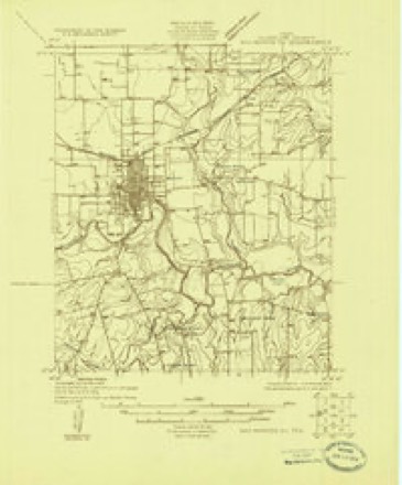
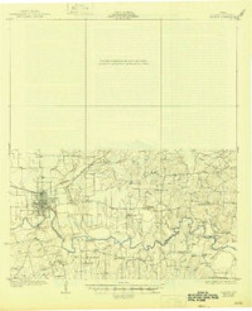
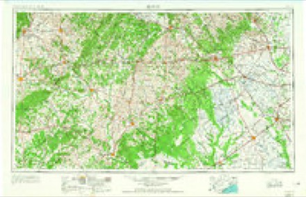
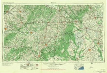
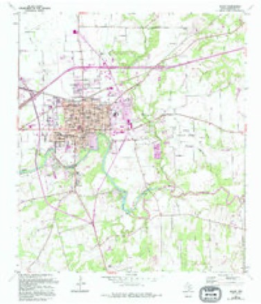
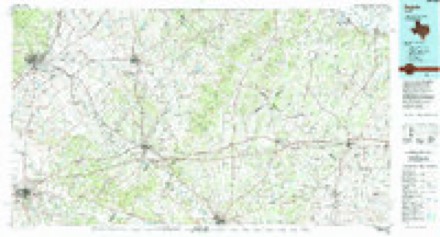
8 surveys from 16 printed sheetsMatched by testing this settlement's coordinate against the published boundary of every sheet in the United States Geological Survey's historical collection. Each opens the scanned sheet at the Survey.
- 1911 USGS San Marcos quadrangle1:125000, 2 printings
- 1919 USGS San Marcos quadrangle1:125000
- 1924 USGS San Marcos 3-c quadrangle1:48000
- 1930 USGS Seguin quadrangle1:62500, 2 printings
- 1953 USGS Seguin quadrangle1:250000, 4 printings
- 1958 USGS Seguin quadrangle1:250000
- 1964 USGS Seguin quadrangle1:24000, 3 printings
- 1985 USGS Seguin quadrangle1:100000, 2 printings


Fires near this place
116 since 2005Regional context, not property-specific evidence. The federal wildfire occurrence database lists 116 fires within 5 miles of Seguin between 2005 and 2020, burning about 772 acres in total. 1 started naturally. 3 were recorded as arson. Distance is straight-line from the map coordinates, so a fire counted here may appear on a neighbouring settlement's page as well.
| Reported cause | Fires |
|---|---|
| Missing data/not specified/undetermined | 59 |
| Debris and open burning | 24 |
| Equipment and vehicle use | 19 |
| Smoking | 3 |
| Arson/incendiarism | 3 |
| Power generation/transmission/distribution | 2 |
| Recreation and ceremony | 2 |
| Railroad operations and maintenance | 2 |
| Misuse of fire by a minor | 1 |
| Natural | 1 |
The most recent of them, most recent first, with the day each was reported and the service that recorded it.
| Date | Cause | Size | Reported by | Name on the report |
|---|---|---|---|---|
| 7 September 2013 | Missing data/not specified/undetermined | 1.0 acres | Texas A & M Forest Service | I10 EAST |
| 6 September 2015 | Smoking | under an acre | Texas A & M Forest Service | SEGUIN MANOR FIRE |
| 5 September 2013 | Missing data/not specified/undetermined | 1.0 acres | Texas A & M Forest Service | IH10 EAST 1 |
| 5 September 2013 | Missing data/not specified/undetermined | 1.0 acres | Texas A & M Forest Service | IH10 EAST 2 |
| 4 September 2013 | Equipment and vehicle use | 9.0 acres | Texas A & M Forest Service | ALAMO CONCRETE FIRE |
| 4 September 2013 | Missing data/not specified/undetermined | 1.0 acres | Texas A & M Forest Service | IH10EAST |
| 3 September 2013 | Equipment and vehicle use | 2.0 acres | Texas A & M Forest Service | IH10 AND 130 |
| 26 September 2015 | Recreation and ceremony | under an acre | Texas A & M Forest Service | SKATE PARK FIRE |
Settlements close enough to share some of these fires:
Mines and quarries near this place
1 within 5 milesRegional context, not property-specific evidence. The federal mineral resources record lists 1 working within 5 miles of Seguin: 1 producer. All of them still produce. What was taken out: Clay. Distance is straight-line from the map coordinates, so a quarry counted here may appear on a neighbouring settlement's page as well.
| Where | Site | Commodity | Status | Recorded |
|---|---|---|---|---|
| Mcqueeney Pit | Clay | Producer | Sedimentary |
Storms near this place
48 since 1994Regional context, not property-specific evidence. The National Weather Service names Seguin in 48 storm reports between 1994 and 2025: 18 hail, 18 thunderstorm wind, 7 flash flood, 4 tornado. The reports record 1 death. Each account below is quoted exactly as the forecast office filed it, from the NOAA Storm Events Database, and each date opens the federal record of that event.
| When | Event | Place named | Harm | What the report says |
|---|---|---|---|---|
| March 2007 | Flash Flood | Seguin | 1 killed | Thunderstorms across the northern half of Guadalupe County produced general 2 inch rainfall with up to 6 inches near Kingsbury. Flash flooding closed FM20 and FM621, among many other area roads through the early morning hours. Three men and a woman were attempting to drive through a low area on Laubach Road around 0120 am CST on Laubach Road that was experiencing flash flooding from nearby Geronimo Creek. Their car stalled and the three men attempted to push the car to safety while the woman steered. Unfamiliar with this area, and in the dark, they became confused and moved the car the wrong direction, causing it to be swept into Geronimo Creek. The men escaped the flash flooding safely but the young woman was swept downstream and drowned. |
| March 1994 | Hail | Seguin | $5,000,000 | The thunderstorms moved eastward from Bexar County into Comal and Guadalupe Counties shortly after 0100 CST, producing damaging wind at New Braunfels and large hail at Schertz and Cibolo. They reached the city of Seguin just before 0200 CST. The Guadalupe County Sheriff reported 0.50- to 1-inch hail at Seguin near 0150 CST. Damaging winds occurred at the same time, uprooting several trees and knocking down numerous large tree limbs. This thunderstorm system caused extensive property damage and cut off electric service to 11,000 homes. Eleven power lines that had been built to withstand over 100 mph winds were twisted and toppled by the storm. Damage was the most severe from the New Braunfels and Schertz area eastward to Staples. Twenty-one residences in Schertz, Cibolo, and Marion were damaged, with four mobile homes destroyed and four with major damage. Winds were estimated at 50 to 60 mph, with golf ball-size hail. One woman at a flea market on the Interstate 35 portion of Schertz was hit by flying debris and was taken to a hospital. Damage in the Schertz-Cibolo region was estimated at well over $2 million. Barns and storage areas were blown over or damaged. Other damage was mainly to roofs and windows of houses and to windows of automobiles. |
| March 1994 | Thunderstorm Wind | Seguin | $5,000,000 | The thunderstorms moved eastward from Bexar County into Comal and Guadalupe Counties shortly after 0100 CST, producing damaging wind at New Braunfels and large hail at Schertz and Cibolo. They reached the city of Seguin just before 0200 CST. The Guadalupe County Sheriff reported 0.50- to 1-inch hail at Seguin near 0150 CST. Damaging winds occurred at the same time, uprooting several trees and knocking down numerous large tree limbs. This thunderstorm system caused extensive property damage and cut off electric service to 11,000 homes. Eleven power lines that had been built to withstand over 100 mph winds were twisted and toppled by the storm. Damage was the most severe from the New Braunfels and Schertz area eastward to Staples. Twenty-one residences in Schertz, Cibolo, and Marion were damaged, with four mobile homes destroyed and four with major damage. Winds were estimated at 50 to 60 mph, with golf ball-size hail. One woman at a flea market on the Interstate 35 portion of Schertz was hit by flying debris and was taken to a hospital. Damage in the Schertz-Cibolo region was estimated at well over $2 million. Barns and storage areas were blown over or damaged. Other damage was mainly to roofs and windows of houses and to windows of automobiles. |
| May 1994 | Thunderstorm Wind | Seguin | $500,000 | Damaging winds were reported in and around the city of Seguin for more than an hour. The winds toppled over trees and power lines, leaving over 50 percent of the city without power. Several cars were damaged when trees and tree limbs were blown onto them. |
| March 2000 | Hail | Seguin | $100,000 | Widespread damage was reported to windows and roofs of homes and to cars and vegetation by a combination of a strong downburst and large hail that struck the north side of Seguin. Power lines were also blown down. The initial reports were received from Amateur Radio Operators. Storm damage was later assessed during an NWS Storm Survey. |
| March 2000 | Thunderstorm Wind | Seguin | $80,000 | no account filed |
| July 2007 | Tornado (EF2) | Seguin | $50,000 | At approximately 4:25 am CST a tornado estimated to be an EF-2 touched down about 9 miles south of Seguin and 1/4 mile southeast of CR411. The tornado moved northward along SH123 for nearly 1 mile before turning slightly to the north northwest and crossing CR410. It damaged three outbuildings, a residence and a store, but no one was injured. The tornado ranged in width from 50 yards up to 150 yards. The total track length was approximately 2 miles. |
| June 2019 | Thunderstorm Wind | Seguin | $30,000 | The Guadalupe Valley Electric Cooperative reported multiple power outages as a result of trees and tree limbs being knocked down on power lines during a severe thunderstorm. |
| May 1999 | Thunderstorm Wind | Seguin | $30,000 | Amateur Radio Spotters reported that severe thunderstorm winds had blown over trees just east of Seguin. |
| May 2011 | Thunderstorm Wind | Seguin | $20,000 | A thunderstorm produced wind gusts estimated at 45 knots which caused some roof damage in Seguin. |
| May 1997 | Thunderstorm Wind | Seguin | $20,000 | Severe winds blew a plane over on its top at the Seguin airport. |
| March 2000 | Tornado (F0) | Seguin | $15,000 | A small and short-lived tornado struck near a building along SH46 just north of I-10. The tornado destroyed two large trees. |
| May 2025 | Thunderstorm Wind | Seguin | $10,000 | A thunderstorm produced wind gusts estimated at 70 mph that snapped a large tree at its trunk and knocked down power lines in northern Seguin. |
| June 2019 | Thunderstorm Wind | Seguin | $10,000 | A thunderstorm produced wind gusts estimated at 75 mph that damaged a middle school roof in Seguin. |
| May 2025 | Thunderstorm Wind | Seguin | $2,000 | A thunderstorm produced wind gusts estimated at 60 mph that blew down a fence in Seguin. |
| August 2023 | Thunderstorm Wind | Seguin | $2,000 | A thunderstorm from the remnants of Tropical Storm Harold produced wind gusts estimated at 60 mph that damaged a roof in Seguin. |
| June 2021 | Thunderstorm Wind | Seguin | $2,000 | A thunderstorm produced wind gusts estimated at 60 mph that damaged a tree and roof in neighborhood around Lake Placid west of Seguin. |
| June 2019 | Thunderstorm Wind | Seguin | $2,000 | A thunderstorm produced wind gusts estimated at 70 mph that knocked down a tree across Turtle Ln. along Lake Placid on the west side of Seguin. |
| May 2020 | Thunderstorm Wind | Seguin | $1,000 | A thunderstorm produced wind gusts estimated at 80 mph that snapped a large tree at its base. There was a picture of the tree on social media. |
| May 2025 | Hail | Seguin | - | A thunderstorm produced quarter size hail in Seguin. |
| November 2025 | Hail | Seguin | - | A thunderstorm produced quarter size hail in Seguin. There were pictures of the hail on social media. |
| April 2024 | Hail | Seguin | - | A thunderstorm produced half dollar size hail in Seguin near Hwy 46. |
| April 2024 | Thunderstorm Wind | Seguin | - | A thunderstorm produced wind gusts estimated at 70 mph that blew off siding and shingles from several houses in the Meadows neighborhood in Seguin. |
| April 2023 | Hail | Seguin | - | A thunderstorm produced half dollar size hail in Seguin. |
| October 2021 | Flash Flood | Seguin | - | Thunderstorms produced heavy rain that led to flash flooding. There were multiple vehicle rescues across Guadalupe County, multiple roads were flooded, and many creeks were going out of their banks. Up to 7.53 inches of rain fell near Seguin. |
| June 2015 | Flash Flood | Seguin | - | Thunderstorms produced heavy rain that caused flash flooding closing a number of roads around Seguin including Kimbrough Rd. at FM466, FM2438 at AltHwy90 and I-10, and other sections of FM477 and FM466. |
| September 2010 | Flash Flood | Seguin | - | Heavy rain from Tropical Storm Hermine produced flash flooding which closed several roads across Seguin and western Guadalupe County. |
| February 2008 | Hail | Seguin | - | An off duty NWS employee reported penny size hail. |
| March 2007 | Flash Flood | Seguin | - | Parts of northern Guadalupe County received up to 3 inches of rain in less than 3 hours, closing numerous roads due to flash flooding. FM1977 was reported to be closed due to flooding from the San Marcos River. The FM775 bridge was also closed at Cibolo Creek. |
| July 2007 | Flood | Seguin | - | The Guadalupe River at Seguin crested at 24.75 ft on 07/20 at 1755cst, where flood stage is 19 ft. |
| May 2007 | Flash Flood | Seguin | - | Scattered showers and thunderstorms produced general 1 to 3 inch rain amounts over Caldwell and Guadalupe Counties. Highest rain amounts in Guadalupe County were 4 inches near Kingsbury. Many rural roads were closed, including FM20 and SH123. |
| July 2007 | Flash Flood | Seguin | - | Between 2 and 4 inches of rain fell in southern Guadalupe County and southeastern Bexar County, closing many rural roads due to flash flooding. Among those closed in Guadalupe County were SH123 and FM539. |
| July 2005 | Thunderstorm Wind | Seguin | - | Thunderstorms forming along the northern Texas Hill Country in the late afternoon moved into Guadalupe County in the late evening. The storms blew down power lines east of Seguin. |
| August 2004 | Thunderstorm Wind | Seguin | - | Downburst winds blew down trees and tree limbs that knocked out power lines in Seguin. |
| February 1998 | Tornado (F0) | Seguin | - | A brief tornado was spotted by Department of Public Safety trooper near the Wilson County line. |
| May 2021 | Hail | Seguin | - | no account filed |
| March 2016 | Hail | Seguin | - | no account filed |
| March 2009 | Hail | Seguin | - | no account filed |
| April 2007 | Hail | Seguin | - | no account filed |
| May 2007 | Hail | Seguin | - | no account filed |
| June 2007 | Thunderstorm Wind | Seguin | - | no account filed |
| February 2000 | Hail | Seguin | - | no account filed |
| March 2000 | Hail | Seguin | - | no account filed |
| March 2000 | Hail | Seguin | - | no account filed |
| January 1999 | Tornado (F0) | Seguin | - | no account filed |
| March 1999 | Hail | Seguin | - | no account filed |
| February 1998 | Hail | Seguin | - | no account filed |
| April 1996 | Hail | Seguin | - | no account filed |
Nearest settlements
The eight closest, with where each one stands in the county. Distances are straight-line, computed from the Geographic Names Information System coordinates.
| Map | Place | Distance | Sheets |
|---|---|---|---|
| Zipp | 2.8 miles | 14 | |
| Morrison Falls | 3.0 miles | 14 | |
| Nolte | 3.5 miles | 14 | |
| McQueeney | 4.0 miles | 14 | |
| Lauback | 4.3 miles | 15 | |
| Muehlsville | 4.4 miles | 14 | |
| Dugger | 4.6 miles | 16 | |
| Hilda Siding | 5.8 miles | 14 |
Elsewhere
Matched on this settlement's Geographic Names Information System number rather than its name, so it cannot be a different place of the same name in another state.
| Wikipedia article on Seguin | An encyclopaedic summary. Its text is share-alike, so it is linked here rather than copied. |
| Wikidata item Q975549 | The structured record the population and elevation above come from. Public domain (CC0). |
Provenance
This settlement is recorded in the Geographic Names Information System as feature 1346881. The sheet list is computed by point-in-boundary test against the United States Geological Survey's historical topographic inventory. Both are works of the United States government and carry no copyright under 17 U.S.C. 105.
Wildfire. Short, Karen C. 2022. Spatial wildfire occurrence data for the United States, 1992-2020 [FPA_FOD_20221014]. 6th Edition. Fort Collins, CO: Forest Service Research Data Archive. https://doi.org/10.2737/RDS-2013-0009.6 Collected with United States Government funding and usable without additional permissions or fees.
Mines and quarries. USGS Mineral Resources Data System (MRDS) https://mrdata.usgs.gov/mrds/ A work of the United States government, no copyright under 17 U.S.C. 105.
Storms. NOAA National Centers for Environmental Information, Storm Events Database https://www.ncei.noaa.gov/stormevents/ A work of the United States government, no copyright under 17 U.S.C. 105. Narratives are quoted verbatim from the National Weather Service report and are not edited or summarised.