 Block
BlockSnyder, Texas
10 topographic sheets cover this place, the earliest surveyed in 1952 and the latest in 1985. It stands in the Snyder census division. It lies in ZIP code area 79549. It stands on South Fork Deep Creek. The Survey maps it on the Snyder quadrangle. 11,438 people lived here at the 2020 count. It stands 2,320 feet above sea level.
Research this city
Population over time
2 figuresSnyder grew from 11,202 to 11,438 between 2010 and 2020. These are the recorded population figures Wikidata holds for this place, reached through the Geographic Names Information System number this page is keyed on rather than by name, so they belong to this place and not to another of the same name. Most are census counts, but not all are: an early figure may be a founding or settlement estimate, and an estimate published within five years of a census is left out. The change column is computed, and is left blank where more than 20 years separate a figure from the one before it, because a gap that long is not a change between two counts.
| Year | People | Change |
|---|---|---|
| 2010 | 11,202 | |
| 2020 | 11,438 | +236 (+2%) |
Topographic sheets covering this place
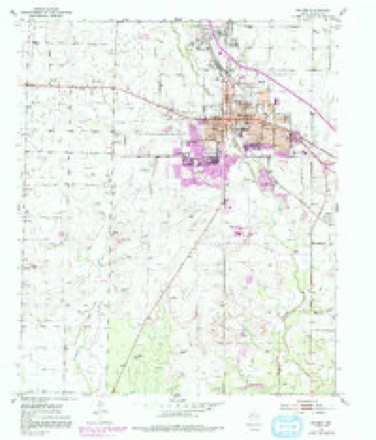
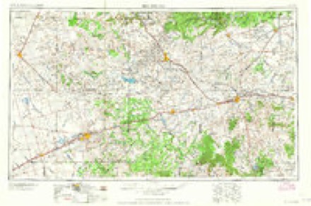
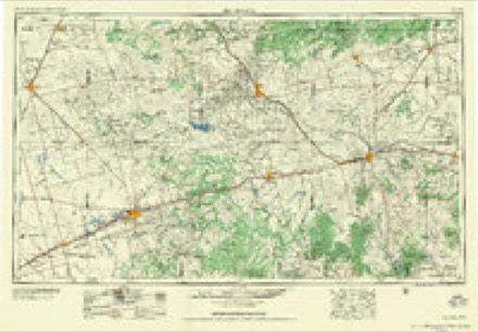
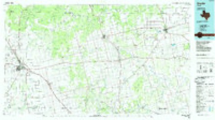
4 surveys from 10 printed sheetsMatched by testing this settlement's coordinate against the published boundary of every sheet in the United States Geological Survey's historical collection. Each opens the scanned sheet at the Survey.
- 1952 USGS Snyder quadrangle1:24000, 3 printings
- 1954 USGS Big Spring quadrangle1:250000, 4 printings
- 1958 USGS Big Spring quadrangle1:250000
- 1985 USGS Snyder quadrangle1:100000, 2 printings
Fires near this place
234 since 2006Regional context, not property-specific evidence. The federal wildfire occurrence database lists 234 fires within 5 miles of Snyder between 2006 and 2018, burning about 31,455 acres in total. 8 started naturally. 1 was recorded as arson. Distance is straight-line from the map coordinates, so a fire counted here may appear on a neighbouring settlement's page as well.
| Reported cause | Fires |
|---|---|
| Missing data/not specified/undetermined | 115 |
| Equipment and vehicle use | 39 |
| Power generation/transmission/distribution | 29 |
| Debris and open burning | 26 |
| Natural | 8 |
| Smoking | 7 |
| Recreation and ceremony | 4 |
| Misuse of fire by a minor | 4 |
| Railroad operations and maintenance | 1 |
| Arson/incendiarism | 1 |
The most recent of them, most recent first, with the day each was reported and the service that recorded it.
| Date | Cause | Size | Reported by | Name on the report |
|---|---|---|---|---|
| 8 September 2014 | Power generation/transmission/distribution | under an acre | Texas A & M Forest Service | RODRIGUEZ |
| 6 September 2009 | Smoking | under an acre | Texas A & M Forest Service | S C GOLF COURSE |
| 4 September 2017 | Equipment and vehicle use | 1.0 acres | Texas A & M Forest Service | HWY 208 AND KELLER AVENUE |
| 30 September 2009 | Equipment and vehicle use | under an acre | Texas A & M Forest Service | CR 132 |
| 3 September 2014 | Missing data/not specified/undetermined | under an acre | Texas A & M Forest Service | 19TH ST & AVE Q |
| 3 September 2009 | Missing data/not specified/undetermined | under an acre | Texas A & M Forest Service | 1509 39TH |
| 21 September 2017 | Recreation and ceremony | 1.0 acres | Texas A & M Forest Service | 1209 13TH ST |
| 17 September 2017 | Debris and open burning | 1.0 acres | Texas A & M Forest Service | SOUTH HWY 208 AND BRICKPLANT ROAD |
Settlements close enough to share some of these fires:
Mines and quarries near this place
1 within 5 milesRegional context, not property-specific evidence. The federal mineral resources record lists 1 working within 5 miles of Snyder: 1 producer. All of them still produce. What was taken out: Clay. Distance is straight-line from the map coordinates, so a quarry counted here may appear on a neighbouring settlement's page as well.
| Where | Site | Commodity | Status | Recorded |
|---|---|---|---|---|
| Southwestern Brick Inc | Clay | Producer |
Storms near this place
60 of 196 shownRegional context, not property-specific evidence. The National Weather Service names Snyder in 196 storm reports between 1993 and 2025: 87 hail, 71 thunderstorm wind, 34 flash flood, 3 heavy rain. The reports record 6 injuries. Each account below is quoted exactly as the forecast office filed it, from the NOAA Storm Events Database, and each date opens the federal record of that event.
| When | Event | Place named | Harm | What the report says |
|---|---|---|---|---|
| May 2021 | Hail | Snyder | 6 hurt, $500,000 | A thunderstorm produced three inch hail in Snyder. There were multiple reports of golf ball to softball sized hail in Snyder. There was a photo of hail up to 3.5 inches. There were numerous broken windows, busted solar panels, severely damaged roofs and vehicles, and damage to trees. Six injuries were reported. The cost of damage is a very rough estimate. |
| May 2006 | Hail | Snyder | $15,000,000 | Lime to baseball sized hail fell across Snyder for at least 15 minutes. The hail was blown sideways at times by 60 to 70 mph winds. This resulted in numerous broken windows in both buildings and vehicles, as well as damaged siding, roofs, and window air conditioning units. A damage survey was performed the following day by the National Weather Service. The most significant damage was found in an area bounded by A, E, 30th, and 37th Streets. In this area, an apartment complex sustained damage to 110 windows and numerous cars parked in its parking lot. Also in this area was a car dealership that sustained major damage to at least 140 cars. Over a million dollars in damage was estimated to have been done just to county owned buildings and vehicles, with an additional quarter of a million dollars in damage to city owned buildings and vehicles. Ten to eighteen vehicles used by the Snyder Police Department were damaged. Three of these were removed from service because of the damage sustained. Hail scouring was evident on many roads throughout Snyder. |
| June 1999 | Hail | Snyder | $4,000,000 | Hail fell from the southern end of a multicell cluster moving east across Scurry County. Numerous cars and roofs were damaged from 24th Street to 44th Street. |
| June 2008 | Thunderstorm Wind | Snyder | $500,000 | Very strong thunderstorm winds impacted the city of Snyder. The West Texas Mesonet site recorded a peak gust of 82 mph. Widespread damage occurred across the city. At least 50 power poles were downed by these high winds. A residental and commercial carport were blown over. In addition, several commercial and residental roofs received substantial damage. In one instance, the roof from a downtown business was tossed into an adjacent bank parking lot, causing damage to the front of a bank. I another case, portions of an irregular shaped roof were blow onto cars in a nearby lot. |
| June 2004 | Thunderstorm Wind | Snyder | $140,000 | no account filed |
| August 2023 | Thunderstorm Wind | Snyder | $100,000 | A large swath of damage with numerous powerline poles down resulted in overnight power outages for the city of Snyder and much of the surrounding area. The time of damage is based on radar analysis. Wind speed is estimated to be approximately 100 mph. Property damage cost is an estimation. |
| June 2003 | Thunderstorm Wind | Snyder | $60,000 | A severe thunderstorm wind gust was measured by the West Texas Mesonet site near Snyder. Several warehouse-type structures received considerable damage. |
| October 1993 | Thunderstorm Wind | Snyder | $50,000 | A tornado was reported near Union by the Scurry County Sheriff's Office at 2120 CST. Also, power poles were twisted off, and power lines and fences were knocked down in northeast Snyder. |
| April 1993 | Thunderstorm Wind | Snyder | $50,000 | As the Borden County storm moved across Scurry County, downburst winds downed trees and power lines in Snyder. Roof and window damage was inflicted on several homes, according to spotters and the Snyder Police Department. |
| May 1993 | Thunderstorm Wind | Snyder | $50,000 | Downburst winds gusting to 72 miles an hour destroyed a barn and a house trailer just west of Snyder. In Ira, the wind damaged a carport. Power lines were also reported down across the county. |
| July 2004 | Flash Flood | Snyder | $30,000 | A cold front approached the northern Permian Basin of west Texas during the afternoon of the 24th. The front interacted with a tropical airmass over the region and resulted in scattered thunderstorm development. Very heavy rainfall over Snyder caused flash flooding in city streets. Fire department officials reported minor flooding that began shortly after 13:30 CST. Conditions then rapidly deteriorated with high water rescues of stranded motorists conducted by 14:00 CST.The flash flood event in Snyder on the afternoon of Saturday, July 24th kicked off an extensive flash flooding episode across west Texas and southeastern New Mexico. Widespread heavy rainfall erupted over the region during the early morning hours Sunday, July 25th as the cold front swept south. |
| May 2015 | Thunderstorm Wind | Snyder | $20,000 | A thunderstorm moved across Scurry County and produced three severe wind gusts from 225 am to 235 am CDT as measured by the Snyder Mesonet. An SPC forecaster reported major roof damage at a motel in Snyder. The cost of damage is a very rough estimate. |
| May 2015 | Thunderstorm Wind | Snyder | $20,000 | A thunderstorm moved across Scurry County and produced seven severe wind gusts beginning at 345 am and ending at 425 am CDT as indicated by the Snyder mesonet. The highest gust reported was 67 mph. A SPC forecaster reported major roof damage at a motel in Snyder. The cost of damage is a very rough estimate. |
| August 2005 | Flash Flood | Snyder | $20,000 | The Snyder Police department reported widespread flooding of streets in Snyder and on rural roads around Snyder. Several cars had floated off roads into bar ditches. One high water rescue was performed by local officials in Snyder. |
| February 2001 | Thunderstorm Wind | Snyder | $20,000 | High winds produced by a severe thunderstorm resulted in the roof blowing off a 30' X 70'' commercial building and then landing on two parked cars in an adjacent parking lot. |
| June 2020 | Thunderstorm Wind | Snyder | $17,000 | A thunderstorm moved across Scurry County and produced a 72 mph wind gust at the mesonet site near Snyder. A 100 foot radio tower in Snyder was blown over due to the winds. The cost of damage is a very rough estimate. |
| March 2004 | Flash Flood | Snyder | $15,000 | Numerous roads were inudated by high water in the city of Snyder. In addition, Deep Creek flooded in the city. As a result, several vehicles stalled in high water. The Snyder Fire Department conducted several high water rescues. No injuries were reported. |
| July 2002 | Flash Flood | Snyder | $15,000 | Flooding was reported along Highway 84. This resulted in two car accidents. However, no injuries were reported. |
| July 2023 | Thunderstorm Wind | Snyder | $10,000 | Emergency Manager was dispatched for an empty 18-wheeler blown over on Hwy 84 and Hwy 180. Estimated wind speeds were 60 mph. Property damage cost is an estimation. |
| June 2014 | Thunderstorm Wind | Snyder | $10,000 | A thunderstorm moved across Scurry County and produced wind damage near Snyder. An 18 wheeler was blown over on US Highway 84. The cost of damage is a rough estimate. |
| April 2007 | Flash Flood | Snyder | $10,000 | The Snyder Daily News reported two motorists stranded by high water. One motorist was stuck under the College Avenue bridge. The other motorists location was not disclosed. |
| June 2006 | Thunderstorm Wind | Snyder | $10,000 | The Automated Weather Observing System at Winston Field Airport outside of Snyder (KSNK) recorded a wind gust of 75 mph. Shortly thereafter, the public reported 70 mph winds near the Scurry/Kent County line. The severe wind snapped six inch diameter trees seven feet off the ground, and downed two utility poles. |
| November 2004 | Flash Flood | Snyder | $10,000 | Storm spotters and local law enforcement officials reported flash flooding in Snyder. At 18:10 CST high water was reported flowing through the intersection of College Avenue and 37th Street at a depth of two feet, and at least one vehicle was stalled. Several city streets were closed and barricaded by local officials due to high water by 19:00 CST. Flood waters slowly receded in the city streets through the late evening. |
| August 2003 | Thunderstorm Wind | Snyder | $10,000 | Severe thunderstorm winds uprooted trees and blew down power lines in Snyder. |
| April 1999 | Thunderstorm Wind | Snyder | $10,000 | Outflow winds from a bowing part of the line took down 10 utility poles along State Highway 208. The poles took down lines of another company and one vehicle sustains light damage from falling debris. |
| July 1998 | Thunderstorm Wind | Snyder | $10,000 | Winds from a downbursting thunderstorm took a large metal roof off a barn and also ripped the roof off a mobile home. |
| May 1997 | Thunderstorm Wind | Snyder | $10,000 | Strong winds knocked down utility poles in Snyder. An outflow boundary moving eastward across the South Plains and northern Permian Basin exploded into a line of severe storms as the boundary moved into rich moisture. The line that affected Snyder developed rapidly as it moved into Scurry County from Borden County. |
| June 2004 | Hail | Snyder | $10,000 | no account filed |
| July 2002 | Flash Flood | Snyder | $8,000 | The local newspaper reported that local officials were called to aide a motorist when their car stalled in rapidly rising water between 21st and 22nd Streets in Snyder. No injuries were reported. |
| June 1998 | Thunderstorm Wind | Snyder | $5,000 | Thunderstorm outflow winds damaged three new pickup truck beds and destroyed a bed topper. Also a goat shed had much of its metal stripped off. |
| June 1997 | Thunderstorm Wind | Snyder | $5,000 | Farther north downbursting winds knocked down utility lines in Snyder. |
| May 1995 | Thunderstorm Wind | Snyder | $5,000 | no account filed |
| May 2014 | Flash Flood | Snyder | $3,000 | Heavy rain moved across Scurry County and produced flash flooding in Snyder. Low-lying areas were flooded with six to eight inches of water covering the roads. The cost of damage is a very rough estimate. |
| June 1998 | Thunderstorm Wind | Snyder | $3,000 | Part of a mobile home roof was peeled up by thunderstorm winds. Later in the evening rainfall damaged the contents inside. |
| June 1997 | Flash Flood | Snyder | $3,000 | Heavy morning rains caused widespread street flooding in the city of Snyder. A city park had flooding that caused a large whirlpool as the water flowed into a drainage grate. Flooding rose into three units of an apartment complex. |
| September 2021 | Thunderstorm Wind | Snyder | $2,000 | A thunderstorm moved across Scurry County and produced wind damage. There were downed power lines and tree limbs. The cost of damage is a very rough estimate. |
| May 2013 | Thunderstorm Wind | Snyder | $1,500 | A thunderstorm moved over Scurry County and produced a 70 to 80 mph wind gust five miles east southeast of Snyder. A metal awning for an RV was blown over a stable across a cattle pen along US 180. The cost of damage is a rough estimate. |
| July 2020 | Flash Flood | Snyder | $1,000 | Heavy rain produced flash flooding in Scurry County. A car was stranded in a low water crossing. About one inch of rain fell in less than an hour. The cost of damage is a very rough estimate. |
| April 2016 | Hail | Snyder | $1,000 | A thunderstorm moved across Scurry County and produced one inch hail about ten miles northeast of Snyder. The hail left dents on a vehicle and horse trailer. There were numerous leaves off of the trees. The cost of damage is a very rough estimate. |
| September 2014 | Flash Flood | Snyder | $1,000 | Heavy rain moved across Scurry County and produced flash flooding in Snyder. Roads in Snyder were barricaded due to the high water. The cost of damage is a very rough estimate. |
| March 2000 | Thunderstorm Wind | Snyder | $1,000 | A large store window was blown out by thunderstorm outflow winds. |
| June 1998 | Thunderstorm Wind | Snyder | $1,000 | Power lines and a tree were knocked down by the same storm as it moved to the east. |
| June 1999 | Thunderstorm Wind | Snyder | $1,000 | no account filed |
| August 2020 | Thunderstorm Wind | Snyder | $800 | A thunderstorm moved across Scurry County and produced wind damage near Snyder. A barn door was blown in and the wind speed was estimated to be around 60 mph. The cost of damage is a very rough estimate. |
| July 2015 | Flash Flood | Snyder | $500 | Heavy rain from thunderstorms moving across Scurry County resulted in flash flooding in the city of Snyder. Hwy 180 was closed between Ave M and Ave Q with two feet of water over the road. The cost of damage is a very rough estimate. |
| March 1993 | Hail | Snyder | $500 | Golfball-size hail fell from a thunderstorm in northern Scurry County. No significant damage resulted. |
| June 1998 | Thunderstorm Wind | Snyder | $400 | Trees were knocked down in southwestern Snyder. |
| July 2015 | Flash Flood | Snyder | $300 | Thunderstorms producing heavy rainfall moved across Scurry County in the morning hours and caused flash flooding in the city of Snyder. Emergency management reported that 28th street was flooded by Deep Creek and was barricaded off. The cost of damage is a very rough estimate. |
| October 2015 | Flash Flood | Snyder | $300 | Heavy rain fell across Scurry County and produced flash flooding. The Snyder Fire Department reported that a few roads were barricaded due to high water. |
| June 2025 | Thunderstorm Wind | Snyder | - | The West Texas Mesonet station 37 Snyder 3E measured a 58 mph wind gust. |
| April 2025 | Thunderstorm Wind | Snyder | - | A maximum wind gust of 80 MPH was observed at the West Texas Mesonet site, 3E Snyder, and it was associated with a microburst. |
| July 2025 | Thunderstorm Wind | Snyder | - | The West Texas Mesonet station 3 miles east of Snyder measured a 67 mph wind gust. |
| October 2025 | Flash Flood | Snyder | - | Flash Flooding was reported on multiple roadways in Snyder, including at 19th and 17th Streets, Ave. O, 25th and 26th Streets, and near the water plant. The total time of occurrence is partially estimated by radar. No damage was reported. |
| October 2025 | Flash Flood | Snyder | - | Flash Flooding was reported on multiple roadways in Snyder by the fire department. The total time of occurrence is partially estimated by radar. No damage was reported. |
| February 2023 | Thunderstorm Wind | Snyder | - | Mesonet Station Snyder 3E. |
| October 2023 | Flash Flood | Snyder | - | Scurry County Emergency Manager reports Deep Creek out of its banks in Snyder leading to road closures. This flooding is a result of heavy rainfall received from last night. |
| October 2023 | Flash Flood | Snyder | - | Report received from mPING of flash flooding. |
| May 2022 | Thunderstorm Wind | Snyder | - | A thunderstorm produced a 62 mph wind gust at the Mesonet site near Snyder. |
| May 2022 | Heavy Rain | Snyder | - | Heavy rain occurred in Scurry County. The West Texas Mesonet measured 3.34 inches of rainfall. The duration of this rainfall is unknown. |
| May 2022 | Heavy Rain | Snyder | - | Heavy rainfall occurred in Scurry County. The West Texas Mesonet measured 4.11 inches of rainfall. The duration of this rainfall is unknown. |
Nearest settlements
The eight closest, with where each one stands in the county. Distances are straight-line, computed from the Geographic Names Information System coordinates.
Elsewhere
Matched on this settlement's Geographic Names Information System number rather than its name, so it cannot be a different place of the same name in another state.
| Wikipedia article on Snyder | An encyclopaedic summary. Its text is share-alike, so it is linked here rather than copied. |
| Wikidata item Q979796 | The structured record the population and elevation above come from. Public domain (CC0). |
Provenance
This settlement is recorded in the Geographic Names Information System as feature 1347340. The sheet list is computed by point-in-boundary test against the United States Geological Survey's historical topographic inventory. Both are works of the United States government and carry no copyright under 17 U.S.C. 105.
Wildfire. Short, Karen C. 2022. Spatial wildfire occurrence data for the United States, 1992-2020 [FPA_FOD_20221014]. 6th Edition. Fort Collins, CO: Forest Service Research Data Archive. https://doi.org/10.2737/RDS-2013-0009.6 Collected with United States Government funding and usable without additional permissions or fees.
Mines and quarries. USGS Mineral Resources Data System (MRDS) https://mrdata.usgs.gov/mrds/ A work of the United States government, no copyright under 17 U.S.C. 105.
Storms. NOAA National Centers for Environmental Information, Storm Events Database https://www.ncei.noaa.gov/stormevents/ A work of the United States government, no copyright under 17 U.S.C. 105. Narratives are quoted verbatim from the National Weather Service report and are not edited or summarised.