 Block
BlockSouth Plains, Texas
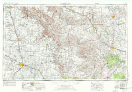
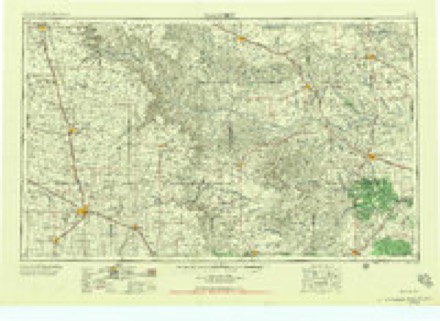
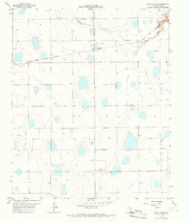
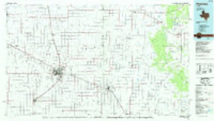
7 topographic sheets cover this place, the earliest surveyed in 1954 and the latest in 1985. It stands in the Lockney census division. It lies in ZIP code area 79258. The Survey maps it on the South Plains quadrangle. It stands 3,215 feet above sea level.
Topographic sheets covering this place
4 surveys from 7 printed sheetsMatched by testing this settlement's coordinate against the published boundary of every sheet in the United States Geological Survey's historical collection. Each opens the scanned sheet at the Survey.
- 1954 USGS Plainview quadrangle1:250000, 3 printings
- 1958 USGS Plainview quadrangle1:250000
- 1966 USGS South Plains quadrangle1:24000
- 1985 USGS Plainview quadrangle1:100000, 2 printings
Fires near this place
10 since 2006Regional context, not property-specific evidence. The federal wildfire occurrence database lists 10 fires within 5 miles of South Plains between 2006 and 2020, burning about 2,491 acres in total. 3 started naturally. None was recorded as arson. Distance is straight-line from the map coordinates, so a fire counted here may appear on a neighbouring settlement's page as well.
| Reported cause | Fires |
|---|---|
| Missing data/not specified/undetermined | 5 |
| Natural | 3 |
| Debris and open burning | 1 |
| Equipment and vehicle use | 1 |
The most recent of them, most recent first, with the day each was reported and the service that recorded it.
| Date | Cause | Size | Reported by | Name on the report |
|---|---|---|---|---|
| 13 September 2011 | Equipment and vehicle use | 800 acres | Texas A & M Forest Service | ASSIST FLOYD |
| 25 August 2015 | Natural | 160 acres | Texas A & M Forest Service | SOUTH PLAINS GRASS FIRE |
| 20 May 2006 | Natural | 200 acres | Texas A & M Forest Service | not named |
| 20 May 2006 | Natural | 220 acres | Texas A & M Forest Service | not named |
| 13 May 2020 | Debris and open burning | 1.0 acres | Texas A & M Forest Service | 20009 |
| 17 March 2016 | Missing data/not specified/undetermined | 60 acres | Texas A & M Forest Service | GRASS FIRE |
| 28 December 2016 | Missing data/not specified/undetermined | 700 acres | Texas A & M Forest Service | GRASS FIRE |
| 27 November 2016 | Missing data/not specified/undetermined | 10 acres | Texas A & M Forest Service | GRASS FIRE |
Settlements close enough to share some of these fires:
Storms near this place
37 since 1994Regional context, not property-specific evidence. The National Weather Service names South Plains in 37 storm reports between 1994 and 2025: 18 hail, 10 tornado, 7 thunderstorm wind, 1 flash flood. No death or injury is recorded in these reports. Each account below is quoted exactly as the forecast office filed it, from the NOAA Storm Events Database, and each date opens the federal record of that event.
| When | Event | Place named | Harm | What the report says |
|---|---|---|---|---|
| June 1994 | Thunderstorm Wind | South Plains | $50,000 | no account filed |
| April 2009 | Tornado (EF1) | South Plains | $25,000 | Numerous storm chasers documented a long-lived tornado in northeastern Floyd County during the 17:00 CST hour of the 29th. The tornado initially developed at 17:11 CST northwest of Cedar Hill, and quickly evolved from its initial appearance as a thin rope to a fat cone-shaped vortex. The tornado tracked east-southeastward across Farm to Market Road 97 just west of Cedar Hill, where it downed four utility poles as it crossed that highway. At least a couple of the wooden poles were snapped just above ground level. The tornado continued east-southeastward as a satellite tornado developed north of the main tornado. Both tornadoes remained over open range land and no damages were reported. Video and photographs provided by several storm chasers suggest that the visible condensation funnel disappeared at 17:21 CST, but then reformed briefly as a thin rope-shaped vortex at 17:23 CST before the tornado dissipated. |
| June 1995 | Tornado (F0) | South Plains | $20,000 | no account filed |
| June 2014 | Hail | South Plains | $12,000 | A supercell produced a swath of golf ball to baseball size hail from near South Plains to Cedar Hill. A few storm spotters received broken windshields and dented body panels from the hail. |
| April 2015 | Hail | South Plains | $10,000 | Fire department officials and storm spotters estimated hail to hen egg size. Damage was reported to storm spotter vehicles, some of which lost windshields. |
| April 2010 | Hail | South Plains | $10,000 | A motorist reported that penny to quarter size hail damaged her vehicle along Texas Highway 207 just south of South Plains. |
| March 2007 | Tornado (EF0) | South Plains | $10,000 | Area residents and an off-duty National Weather Service employee observed a tornado that intermittently touched down just north of South Plains. The tornado caused light roof damage to an abandoned farm house, but otherwise remained over open farm land. |
| June 1997 | Thunderstorm Wind | South Plains | $3,000 | no account filed |
| March 2013 | Thunderstorm Wind | South Plains | $1,000 | Law enforcement reported power lines down along Highway 207. |
| April 2010 | Hail | South Plains | $1,000 | Multiple reports of very large hail up to the size of baseballs were received along Farm to Market Road 1065 east of South Plains at 18:21 CST. Several car windsheilds were reportedly broken by the hail. |
| March 2013 | Hail | South Plains | $250 | A citizen reported hen egg size hail east of Cedar Hill which broke the windshield of a car. |
| April 2025 | Thunderstorm Wind | South Plains | - | A Texas Tech University West Texas mesonet site near South Plains measured a wind gust of 59 mph at 2108 CST. |
| April 2025 | Hail | South Plains | - | Numerous photographs on social media as well as public reports depicted a swath of extremely large hail from near South Plains to east-central Floyd County. The largest hail size measured was 5.20 inches in diameter confirmed with a measurement from a caliper. No damage was reported. |
| July 2023 | Thunderstorm Wind | South Plains | - | A Texas Tech University West Texas mesonet site near South Plains measured severe wind gusts from 2231 CST through 2235 CST. A peak wind gust of 73 mph was measured at 2231 CST. |
| June 2022 | Thunderstorm Wind | South Plains | - | A Texas Tech University West Texas mesonet site near South Plains measured severe wind gusts from 0714 CST through 0716 CST. A peak wind gust of 62 mph was measured at 0715 CST. |
| March 2019 | Thunderstorm Wind | South Plains | - | Measured by a Texas Tech University West Texas mesonet. |
| May 2018 | Hail | South Plains | - | No damage information was available. |
| May 2018 | Hail | South Plains | - | Reports between ping pong and golf ball size hail were received around the intersection of Farm to Market Road 97 and Texas Highway 207 as well as near Cedar Hill. |
| April 2016 | Flood | South Plains | - | Water of one to two feet was covering a segment of Texas State Highway 207. |
| May 2013 | Tornado (EF0) | South Plains | - | Following a brief landspout tornado earlier, Floydada Fire Department personnel observed a second brief landspout tornado about two miles south of Cedar Hill. |
| April 2009 | Tornado (EF0) | South Plains | - | Storm chasers documented a satellite tornado which accompanied a cone-shaped and long-lived tornado near Cedar Hill in northeastern Floyd County around 19:20 CST. The small satellite tornado remained in open range land southeast of Farm to Market Road 97 and resulted in no damages. |
| April 2009 | Tornado (EF0) | South Plains | - | A thin rope-shaped tornado was witnessed by several storm chasers just north of South Plains and immediately west of Texas Highway 207. This tornado was initially documented as the development phase of the long-lived Cedar Hill tornado, but subsequent photographic evidence suggest it was indeed a seperate event. The brief tornado caused no damage and remained over open fields. |
| April 2009 | Tornado (EF0) | South Plains | - | An off-duty National Weather Service meteorologist witnessed a brief tornado in extreme northeastern Floyd County shortly before 16:15 CST. The tornado occurred as a developing supercell thunderstorm interacted with a pre-existing outflow boundary. No damages were reported. |
| April 2009 | Hail | South Plains | - | Local fire department officials reported large hail that ranged in size between quarters and golfballs near Farm to Market Road 1065 in far northeastern Floyd County. The supercell thunderstorm that produced the hail produced a tornado minutes before the hail was observed. |
| March 2007 | Hail | South Plains | - | |A storm chaser following the storm reported that golfball size hail was on the ground in South Plains. Event time is estimated based on radar. |
| August 2006 | Hail | South Plains | - | Local agricultural officials reported that large hail up to the size of nickels resulted in damage to cotton crops near South Plains. |
| May 2005 | Tornado (F0) | South Plains | - | F0 tornado in South Plains.A multi-vortex tornado associated with the previous circulation. This tornado was much weaker in comparison to the primary and stronger tornadic circulation mentioned earlier. This tornado was reported approximately one-half mile south of FM 689 and 7 miles east of State Highway 207. |
| May 2005 | Tornado (F2) | South Plains | - | F2 Tornado South Plains.Several power poles were snapped in half or blown over. The telephone poles surveyed were blown over in a variety of patterns, south to north direction, southwest to northeast direction, and a west to east direction. In addition, several center pivots were either blown over or twisted and two vehicles were flipped over in a field from a south to north direction. The Tornado produced the most damage shortly before and after crossing State Highway 207.This tornado was the parent or main tornado involved in what is known as a multi-vortex tornado. At times, this tornado was greater than one-half mile in width. Large tornadoes sometimes undergo a process where the flow inside the tornado becomes disrupted, but does not dissipate. The result is a turbulent circulation, or vortex, where smaller and typically weaker tornadoes develop and rotate around the parent or much broader circulation. The following South Plains tornado was one of these smaller and weaker tornadoes associated with this multi-vortex tornado. |
| June 2003 | Hail | South Plains | - | The Floyd County Sheriff's Office reported golfball size hail. |
| July 2011 | Flash Flood | South Plains | - | no account filed |
| May 2005 | Hail | South Plains | - | no account filed |
| May 2005 | Hail | South Plains | - | no account filed |
| June 2004 | Hail | South Plains | - | no account filed |
| June 2003 | Hail | South Plains | - | no account filed |
| June 1999 | Hail | South Plains | - | no account filed |
| May 1995 | Hail | South Plains | - | no account filed |
| June 1995 | Tornado (F0) | South Plains | - | no account filed |
Nearest settlements
The eight closest, with where each one stands in the county. Distances are straight-line, computed from the Geographic Names Information System coordinates.
| Map | Place | Distance | Sheets |
|---|---|---|---|
| Sterley | 4.8 miles | 7 | |
| Johnfarris | 5.2 miles | 7 | |
| Lone Star | 6.6 miles | 7 | |
| Cedar Hill | 7.9 miles | 7 | |
| Lockney | 9.8 miles | 7 | |
| Cereal | 11.3 miles | 7 | |
| Providence | 11.4 miles | 7 | |
| Crume Gin | 11.6 miles | 7 |
Elsewhere
Matched on this settlement's Geographic Names Information System number rather than its name, so it cannot be a different place of the same name in another state.
| Wikipedia article on South Plains | An encyclopaedic summary. Its text is share-alike, so it is linked here rather than copied. |
| Wikidata item Q7568227 | The structured record the population and elevation above come from. Public domain (CC0). |
Provenance
This settlement is recorded in the Geographic Names Information System as feature 1368739. The sheet list is computed by point-in-boundary test against the United States Geological Survey's historical topographic inventory. Both are works of the United States government and carry no copyright under 17 U.S.C. 105.
Wildfire. Short, Karen C. 2022. Spatial wildfire occurrence data for the United States, 1992-2020 [FPA_FOD_20221014]. 6th Edition. Fort Collins, CO: Forest Service Research Data Archive. https://doi.org/10.2737/RDS-2013-0009.6 Collected with United States Government funding and usable without additional permissions or fees.
Storms. NOAA National Centers for Environmental Information, Storm Events Database https://www.ncei.noaa.gov/stormevents/ A work of the United States government, no copyright under 17 U.S.C. 105. Narratives are quoted verbatim from the National Weather Service report and are not edited or summarised.