 Block
BlockSouthland, Texas
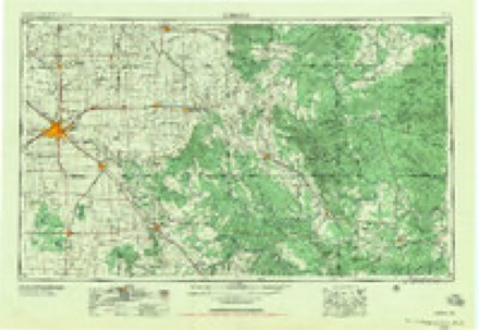
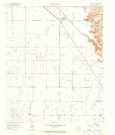
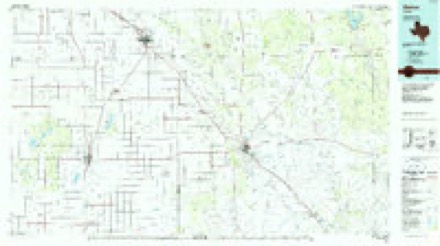
7 topographic sheets cover this place, the earliest surveyed in 1954 and the latest in 1986. It stands in the Post West census division. It lies in ZIP code area 79364. The Survey maps it on the Southland quadrangle.
Topographic sheets covering this place
3 surveys from 7 printed sheetsMatched by testing this settlement's coordinate against the published boundary of every sheet in the United States Geological Survey's historical collection. Each opens the scanned sheet at the Survey.
- 1954 USGS Lubbock quadrangle1:250000, 4 printings
- 1965 USGS Southland quadrangle1:24000
- 1986 USGS Slaton quadrangle1:100000, 2 printings
Fires near this place
25 since 2006Regional context, not property-specific evidence. The federal wildfire occurrence database lists 25 fires within 5 miles of Southland between 2006 and 2016, burning about 504 acres in total. 1 started naturally. None was recorded as arson. Distance is straight-line from the map coordinates, so a fire counted here may appear on a neighbouring settlement's page as well.
| Reported cause | Fires |
|---|---|
| Missing data/not specified/undetermined | 10 |
| Equipment and vehicle use | 6 |
| Smoking | 3 |
| Power generation/transmission/distribution | 3 |
| Railroad operations and maintenance | 1 |
| Debris and open burning | 1 |
| Natural | 1 |
The most recent of them, most recent first, with the day each was reported and the service that recorded it.
| Date | Cause | Size | Reported by | Name on the report |
|---|---|---|---|---|
| 16 August 2011 | Smoking | under an acre | Texas A & M Forest Service | GRASS FIRE |
| 11 August 2011 | Missing data/not specified/undetermined | under an acre | Texas A & M Forest Service | GRASS FIRE |
| 6 July 2013 | Missing data/not specified/undetermined | under an acre | Texas A & M Forest Service | SOUTHLAND |
| 4 July 2012 | Equipment and vehicle use | under an acre | Texas A & M Forest Service | CR HH |
| 11 July 2016 | Power generation/transmission/distribution | 45 acres | Texas A & M Forest Service | WILDLAND FIRE |
| 6 April 2006 | Missing data/not specified/undetermined | 160 acres | Texas A & M Forest Service | not named |
| 5 April 2006 | Equipment and vehicle use | 160 acres | Texas A & M Forest Service | not named |
| 30 April 2006 | Missing data/not specified/undetermined | 1.0 acres | Texas A & M Forest Service | not named |
Settlements close enough to share some of these fires:
Mines and quarries near this place
1 within 5 milesRegional context, not property-specific evidence. The federal mineral resources record lists 1 working within 5 miles of Southland: 1 producer. All of them still produce. What was taken out: Sand and Gravel, Construction. Distance is straight-line from the map coordinates, so a quarry counted here may appear on a neighbouring settlement's page as well.
| Where | Site | Commodity | Status | Recorded |
|---|---|---|---|---|
| A-Rock Pit & Plant | Sand and Gravel, Construction | Producer |
Storms near this place
27 since 1994Regional context, not property-specific evidence. The National Weather Service names Southland in 27 storm reports between 1994 and 2023: 11 hail, 8 thunderstorm wind, 4 flash flood, 3 flood. No death or injury is recorded in these reports. Each account below is quoted exactly as the forecast office filed it, from the NOAA Storm Events Database, and each date opens the federal record of that event.
| When | Event | Place named | Harm | What the report says |
|---|---|---|---|---|
| July 2010 | Flash Flood | Southland | $1,500,000 | The Garza County Sheriff's Office initially reported impacts from flash flooding shortly after 05:00 CST. At 05:03 CST, high water reportedly began to threaten a home in Southland and water was beginning to rapidly flow through many Post city streets. By 05:53 CST, reports indicated that a playa lake at the Post city pool had flooded and was overflowing with rapidly flowing water spilling over U.S. Highway 84 at a depth that was over the guard rails. By 06:02 CST, emergency officials reported widespread flooding of structures in Post, and that sewer was backing up into many homes and businesses. A door-to-door search was conducted to remove residents from flooded structures. The Lubbock Avalanche-Journal interviewed a woman who's car stalled in flood waters on her way to work. The woman then managed to walk to her place of business, a Post nursing home, where ankle-deep water filled the facility. ||The failure of the Lake Stuart dam in eastern Lynn County resulted in a flood wave that travelled down the Double Mountain Fork of the Brazos River. Flash flooding along the river washed out a number of county roads in southwestern Garza County.|Farther downstream, flash flooding along the Double Mountain Fork upstream of Lake Alan Henry washed away support beams for two small oil lines. As a result, 165 barrels of crude oil spilled into the river and threatened Lake Alan Henry. ||Despite these significant public impacts, no serious injuries were reported. State and county officials estimated the total economic loss in the county at $1.7 million. For the purposes of this report, these damages are differientiated here by flash flood and flood at $1.5 million and $200,000 respectively. |
| May 2015 | Flood | Southland | $250,000 | no account filed |
| September 2008 | Flash Flood | Southland | $80,000 | The Garza County Sheriff's Office reported that persistent heavy rainfall resulted in rapidly flowing water over portions of U.S. Highway 84 between Post and Southland. Authorities conducted high water rescues when at least eight vehicles were swept off of the highway. No injuries were reported. In addition, a number of other roadways across Garza County were reportedly flooded. |
| May 2015 | Thunderstorm Wind | Southland | $25,000 | An electric cooperative official reported nine power poles downed by strong winds approximately six miles south of Southland. |
| July 2010 | Heavy Rain | Southland | $15,000 | Scattered showers and thunderstorms initially began to produce rainfall around midday on the 1st. This activity gradually evolved toward heavy tropical downpours, especially during the evening hours of the 3rd through the morning hours of the 4th.||Although no heavy rains were occurring at the time, wet pavement from earlier heavy rains contributed to the hydroplaning of a vehicle on U.S. Highway 84 near Post around 23:30 CST. The vehicle reportedly came to rest 60 feet off of the highway in a canyon area along the Caprock escarpment. No significant injuries were reported.||The Texas Tech University West Texas Mesonet measured storm rainfall totals that included: 9.78 inches at Post, 9.08 inches at Graham, and 5.88 inches at Lake Alan Henry. Local newspapers reported unofficial amounts between 10.00 and 12.00 inches in western Garza County. |
| April 2012 | Flood | Southland | $500 | Slow-moving thunderstorms this night flooded a portion of Highway 84 near Southland to such an extent that tractor trailers were unable to proceed. |
| June 2023 | Hail | Southland | - | Law enforcement in Garza County reported golf ball size hail southeast of Southland. |
| June 2023 | Flash Flood | Southland | - | Thunderstorms that became anchored over Lynn County bringing extensive flash flooding slowly moved into central and northern Garza County spreading intense rain rates along with it. Widespread flash flooding was reported throughout central and northern Garza County. Additionally, a tractor trailer rolled over on US Highway 84 near Farm to Market Road 399 also causing a multiple vehicle wreck. |
| June 2020 | Thunderstorm Wind | Southland | - | A swath of wind damage was observed from just south of Southland along US Highway 84 into Post. Several transmission power poles were downed within this swath. The Garza County Sheriff's Office relayed numerous reports of wind damage in and around Post including outbuilding flattened, carports lifted, roofs damage, and a tractor trailer flipped over. The Texas Tech University West Texas mesonet site one mile northeast of Post reported a peak wind gust of 73 mph at 2120 CST. Severe winds were observed from 2110 through 2130 CST. |
| March 2012 | Thunderstorm Wind | Southland | - | A NWS co-op observer in Southland estimated straight line winds of 60 mph. No damage was reported. |
| April 2012 | Hail | Southland | - | A trained spotter reported golfball size hail in Southland. No damage was reported. |
| September 2012 | Thunderstorm Wind | Southland | - | A NWS COOP observer estimated 65 mph winds associated with a nearly stationary rotating thunderstorm ahead of a squall line. As the squall line's outflow interacted with the rotating updraft, tight low-level rotation ensued for a short period of time before the outflow undercut the storm. |
| April 2010 | Hail | Southland | - | Hail that ranged in size from peas to quarters was reported in Southland just after 21:00 CST. |
| August 2010 | Thunderstorm Wind | Southland | - | A National Weather Service cooperative observer estimated thunderstorm winds in excess of 60 mph in Southland. The winds were reportedly accompanied by a wall of dust. No damages were reported. |
| July 2008 | Thunderstorm Wind | Southland | - | A National Weather Service cooperative observer estimated thunderstorm wind gusts up to 60 mph in Southland. No damages were reported. |
| June 2007 | Thunderstorm Wind | Southland | - | A cluster of thunderstorms developed over western Garza County during the afternoon hours of the 9th and produced locally severe winds. The Texas Tech University West Texas Mesonet site near Graham recorded a 67 mph wind gust at 17:25 CST. National Weather Service cooperative observers additionally reported 60 mph in Southland. No damage was reported. |
| September 2004 | Flash Flood | Southland | - | Flooding was reported in and around Southland. |
| June 2003 | Hail | Southland | - | The public reported two inch diameter hail. |
| May 1994 | Thunderstorm Wind | Southland | - | The Terry County Sheriff's Office reported several Farm-to-Market roads closed due to flooding. In Garza County, the Southland cooperative observer measured a thunderstorm wind gust of 53 knots (61 mph). |
| July 2015 | Flood | Southland | - | no account filed |
| November 2011 | Hail | Southland | - | no account filed |
| October 2004 | Hail | Southland | - | no account filed |
| April 2003 | Hail | Southland | - | no account filed |
| May 2001 | Hail | Southland | - | no account filed |
| February 2000 | Hail | Southland | - | no account filed |
| April 1997 | Hail | Southland | - | no account filed |
| June 1995 | Hail | Southland | - | no account filed |
Nearest settlements
The eight closest, with where each one stands in the county. Distances are straight-line, computed from the Geographic Names Information System coordinates.
| Map | Place | Distance | Sheets |
|---|---|---|---|
| Hackberry | 5.2 miles | 7 | |
| Buenos | 5.5 miles | 7 | |
| Pleasant Valley | 6.7 miles | 7 | |
| Close City | 10.9 miles | 7 | |
| Post | 14.9 miles | 7 | |
| Graham | 15.2 miles | 7 | |
| Verbena | 19.7 miles | 7 | |
| Augustus | 20.8 miles | 7 |
Provenance
This settlement is recorded in the Geographic Names Information System as feature 1368839. The sheet list is computed by point-in-boundary test against the United States Geological Survey's historical topographic inventory. Both are works of the United States government and carry no copyright under 17 U.S.C. 105.
Wildfire. Short, Karen C. 2022. Spatial wildfire occurrence data for the United States, 1992-2020 [FPA_FOD_20221014]. 6th Edition. Fort Collins, CO: Forest Service Research Data Archive. https://doi.org/10.2737/RDS-2013-0009.6 Collected with United States Government funding and usable without additional permissions or fees.
Mines and quarries. USGS Mineral Resources Data System (MRDS) https://mrdata.usgs.gov/mrds/ A work of the United States government, no copyright under 17 U.S.C. 105.
Storms. NOAA National Centers for Environmental Information, Storm Events Database https://www.ncei.noaa.gov/stormevents/ A work of the United States government, no copyright under 17 U.S.C. 105. Narratives are quoted verbatim from the National Weather Service report and are not edited or summarised.