 Block
BlockSpearman, Texas
7 topographic sheets cover this place, the earliest surveyed in 1954 and the latest in 1986. It stands in the Spearman census division. It lies in ZIP code area 79081. The Survey maps it on the Spearman quadrangle. 3,171 people lived here at the 2020 count. It stands 3,104 feet above sea level.
Research this city
On record in Spearman
Buildings and businesses the archive holds for this place. Each opens its own page, with the source record it came from.
On the National Register 1 record
 Hansford County Courthouselisted 2019
Population over time
2 figuresSpearman fell from 3,368 to 3,171 between 2010 and 2020. These are the recorded population figures Wikidata holds for this place, reached through the Geographic Names Information System number this page is keyed on rather than by name, so they belong to this place and not to another of the same name. Most are census counts, but not all are: an early figure may be a founding or settlement estimate, and an estimate published within five years of a census is left out. The change column is computed, and is left blank where more than 20 years separate a figure from the one before it, because a gap that long is not a change between two counts.
| Year | People | Change |
|---|---|---|
| 2010 | 3,368 | |
| 2020 | 3,171 | -197 (-6%) |
Topographic sheets covering this place
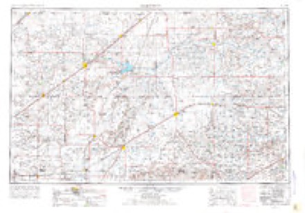
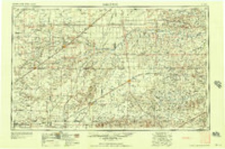
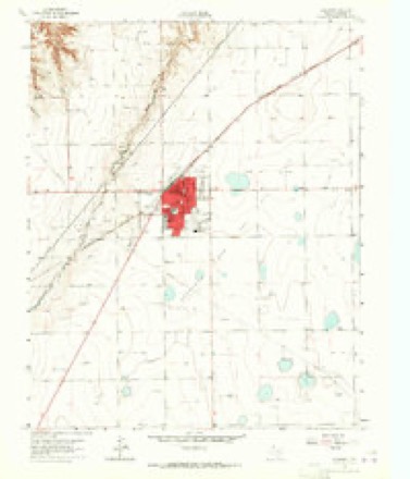
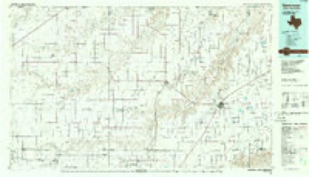
4 surveys from 7 printed sheetsMatched by testing this settlement's coordinate against the published boundary of every sheet in the United States Geological Survey's historical collection. Each opens the scanned sheet at the Survey.
- 1954 USGS Perryton quadrangle1:250000, 3 printings
- 1958 USGS Perryton quadrangle1:250000
- 1962 USGS Spearman quadrangle1:24000, 2 printings
- 1986 USGS Spearman quadrangle1:100000
Fires near this place
24 since 2006Regional context, not property-specific evidence. The federal wildfire occurrence database lists 24 fires within 5 miles of Spearman between 2006 and 2016, burning about 112 acres in total. 2 started naturally. 1 was recorded as arson. Distance is straight-line from the map coordinates, so a fire counted here may appear on a neighbouring settlement's page as well.
| Reported cause | Fires |
|---|---|
| Missing data/not specified/undetermined | 12 |
| Equipment and vehicle use | 8 |
| Natural | 2 |
| Debris and open burning | 1 |
| Arson/incendiarism | 1 |
The most recent of them, most recent first, with the day each was reported and the service that recorded it.
| Date | Cause | Size | Reported by | Name on the report |
|---|---|---|---|---|
| 26 September 2011 | Arson/incendiarism | under an acre | Texas A & M Forest Service | CLAUDE SHEETS PLACE |
| 11 September 2011 | Missing data/not specified/undetermined | 20 acres | Texas A & M Forest Service | 2 MILES WEST SPEARMAN FIRE |
| 20 July 2013 | Natural | 1.0 acres | Texas A & M Forest Service | CR 28 1 WEST FIRE |
| 1 July 2011 | Missing data/not specified/undetermined | under an acre | Texas A & M Forest Service | SPEARMAN FEEDERS |
| 30 June 2011 | Equipment and vehicle use | 2.0 acres | Texas A & M Forest Service | 3 M EAST HWY 15 |
| 30 June 2008 | Equipment and vehicle use | 2.0 acres | Texas A & M Forest Service | not named |
| 29 June 2016 | Missing data/not specified/undetermined | 1.0 acres | Texas A & M Forest Service | BAR DITCH |
| 23 June 2011 | Equipment and vehicle use | 4.0 acres | Texas A & M Forest Service | HWY 207 BY FIVE STAR |
Settlements close enough to share some of these fires:
Storms near this place
60 of 203 shownRegional context, not property-specific evidence. The National Weather Service names Spearman in 203 storm reports between 1993 and 2025: 109 hail, 66 thunderstorm wind, 19 tornado, 5 flash flood. The reports record 2 injuries. Each account below is quoted exactly as the forecast office filed it, from the NOAA Storm Events Database, and each date opens the federal record of that event.
| When | Event | Place named | Harm | What the report says |
|---|---|---|---|---|
| April 2001 | Tornado (F2) | Spearman | 2 hurt, $750,000 | An official storm damage survey was made on the tornado path length and width. The tornado destroyed several grain bins and a grain elevator to Agco facility. Extensive damage also occurred at a local farm...including the home...barns and equipment. Several power poles also were blown down. |
| June 2003 | Tornado (F0) | Spearman | $600,000 | A damage survey was made on this tornado. Minor damage occurred on a farm home with major damage to several grain elevators and to buildings and other structures on the premises. No injuries were reported from the tornado. |
| June 2003 | Thunderstorm Wind | Spearman | $550,000 | A damage assessment was made on this event in which it was determined that a combination of straight-line winds and a tornado...which occurred almost simultaneously...resulted in considerable damage across the southern half of Hansford county. There was moderate damage to barns...outbuildings...and farm equipment along with damage to fences...large trees...and irrigation sprinklers. The evidence suggests that most of the significant damage was the result of the straight-line downburst winds rather than from the tornado. No injuries were reported from the straight-line downburst winds. |
| June 2003 | Thunderstorm Wind | Spearman | $100,000 | Numerous power poles were reported broken. |
| June 2025 | Tornado (EF2) | Spearman | $95,000 | This tornado developed south of W 13th Avenue to the southeast of Spearman, producing its first signs of damage once it crossed CR Y just east of CR 27. EF-1 damage occurred in the area including two small pinyon trees being uprooted with others having branches snapped, as well as metal barns having lost several side and|roofing panels. The tornado continued tracking to the south-southeast, pulling roofing and siding off multiple metal barns near CR AA and CR 28. The strongest damage occurred when it crossed CR 28 to the southeast, snapping several wooden power|poles. This is where the tornado achieved peak intensity and earned the EF-2 rating. In the later stages of its life, the tornado flipped single sections of irrigation pivots just north of FM 281, and again as it crossed into far northeast Hutchinson county before eventually lifting. Along the western edge of the track, there were several instances of damage due to strong winds associated with the rear flank downdraft of the supercell. This included snapped wooden power lines and flipped irrigation pivots. The maximum estimated winds were 115mph. The total track length was around 9.5 miles. |
| April 2001 | Thunderstorm Wind | Spearman | $90,000 | High winds did considerable damage to a home...barn...and sheds on a local farm. |
| August 2020 | Thunderstorm Wind | Spearman | $61,000 | Two miles of power poles blown down on County Road 28 around 1/2 mile south of county road 759. |
| May 2024 | Tornado (EF1) | Spearman | $50,000 | This tornado occurred on the northeast side of Spearman. It initially touched down near Brandt Street and Kenneth Avenue(FM 759 760). Here it snapped some tree branches, lifted some carports and caused minor fence damage. It then traveled north along County Road 25, where it snapped a few power poles and this is where it was given its highest rating. As it neared Highway 15, it collapsed an empty grain silo and caused some minor shingle damage to a few roofs along County Road 25. The tornado|turned east, crossing Highway 15 and caused additional minor roof damage and snapped branches to hardwood trees. It finally lifted just to the east of Highway 15. The maximum estimated wind speed was 98mph. |
| June 2025 | Thunderstorm Wind | Spearman | $40,000 | The outer extent of the EF2 tornado that occurred southeast of Spearman also produced wind damage. This was likely caused by very strong winds associated with the rear flank downdraft of the supercell rather than the tornado itself. About two power poles were broken and a few others were leaning from the strong winds. An irrigation pivot was also turned over. |
| June 2012 | Thunderstorm Wind | Spearman | $30,000 | The Emergency Management Office reported that there was metal debris from a cotton gin that was strewn about. Also, one corn field was completely stripped and destroyed from the thunderstorm wind gusts. There were no reports of injuries or fatalities. |
| August 2020 | Thunderstorm Wind | Spearman | $27,000 | Received a report of 15 power poles blown down or snapped on County Road X just west of Highway 207. |
| August 2024 | Thunderstorm Wind | Spearman | $25,000 | Four power poles were snapped by thunderstorms, likely a microburst, along Farm to Market Road 51 near the Adobe Walls Gin. These were all laying towards the road. |
| June 1999 | Tornado (F0) | Spearman | $25,000 | The tornado lifted a roof off of a house. The tornado track was estimated. |
| August 2020 | Thunderstorm Wind | Spearman | $23,000 | Received a report of 13 power poles blown down or snapped on County Road Y just east of 760. |
| May 2024 | Tornado (EF0) | Spearman | $15,000 | This tornado touched down to the west of County Road 24 where it snapped the top branches and trunk of a couple of hardwood trees. It then traveled south, crossing County Road 24 and lifting the roof off of a building at the Storage Depot. It continued south and caused minor damage to a nearby shed. The tornado lifted before it reached Highway 207. The maximum estimated wind speed was 85mph. |
| June 2000 | Thunderstorm Wind | Spearman | $15,000 | Sheriff's Office reported street signs blown down. |
| May 2024 | Tornado (EF0) | Spearman | $10,000 | A small, weak tornado moved east across the Spearman High school football field and into open country. There are multiple videos showing the small tornado crossing Cotter Drive before dissipating. The tornado damaged one small shed and pushed a utility trailer onto its side but didn't damage power lines along the road which supports an EF0 rating. The maximum estimated wind speed was 80mph. |
| May 2024 | Thunderstorm Wind | Spearman | $10,000 | A large tree was blown down onto a brick fence which also suffered damage from the collision. |
| June 2025 | Hail | Spearman | $7,000 | no account filed |
| May 2010 | Tornado (EF0) | Spearman | $6,000 | The tornado began about four miles west of Spearman Texas at 1929 CST and lifted about four miles northwest of Spearman Texas at 1942 CST. Minor damage to some structures was reported on a farmstead and also large trees were knocked down. The tornado path length and path width were estimated. |
| April 2025 | Hail | Spearman | $3,000 | no account filed |
| April 2025 | Hail | Spearman | $3,000 | no account filed |
| June 2025 | Hail | Spearman | $3,000 | no account filed |
| August 2009 | Hail | Spearman | $1,000 | The large hail produced a dent in a vehicle the size of a grapefruit. |
| May 2025 | Thunderstorm Wind | Spearman | - | Multiple wind gusts in excess of 58 mph occurred between 1934CDT and 2114CDT. Peak wind gusts of 67 mph occurred at 1939CDT under decaying thunderstorms. |
| May 2025 | Thunderstorm Wind | Spearman | - | The AWOS station located one mile north-northwest of Spearman measured a 61mph wind gust from showers and thunderstorms in the area. |
| June 2025 | Thunderstorm Wind | Spearman | - | Wind gusts over 60mph occurred for two minutes. |
| June 2025 | Tornado (EFU) | Spearman | - | This tornado was documented by storm spotter picture. No damage is known to have occurred from this tornado. |
| September 2025 | Thunderstorm Wind | Spearman | - | This wind gust was most likely caused by virga showers as winds gusted from the west-southwest with the only near by thunderstorm located to the northeast. |
| May 2024 | Hail | Spearman | - | Hail of quarter size fell around Spearman, including some hail that was slightly larger than quarter size. This fell at the Lowes Market along Highway 207. |
| April 2022 | Hail | Spearman | - | Several reports came in from a storm chasers and trained spotters for hail between 0.75 and 2 in diameter. |
| May 2022 | Thunderstorm Wind | Spearman | - | West Texas mesonet site Palo Duro Reservoir | 1 NW. Heat burst suspected with temperature | increase of 10 degrees and dew point | temperature decrease of 13 degrees in a 5 | minute period. |
| August 2022 | Thunderstorm Wind | Spearman | - | Damage reported of downed trees on Kenneth AVE, along with a roof blown off of a shed, and a nearby baseball field dugout cover was blown over. |
| June 2022 | Thunderstorm Wind | Spearman | - | Grain bins destroyed in Spearman. |
| June 2022 | Thunderstorm Wind | Spearman | - | Peak gust occurred at 04212CDT. |
| April 2020 | Hail | Spearman | - | Nickel size hail was reported 1 mile west-southwest of Spearman. |
| April 2020 | Hail | Spearman | - | Penny size hail was reported 1 mile southwest of Spearman. |
| April 2020 | Hail | Spearman | - | Pea to penny size hail covered the ground. |
| June 2020 | Hail | Spearman | - | Ping pong ball hail was reported at the intersection of State Highway 15 and County Road 28 about 5 miles northeast of Spearman. |
| June 2020 | Thunderstorm Wind | Spearman | - | This gust was measured at the West Texas Mesonet station 1 mile northwest of Palo Duro Reservoir. |
| July 2020 | Thunderstorm Wind | Spearman | - | The West Texas Mesonet station 1mile northwest of Palo Duro Reservoir measured gusts in the 59 to 63 MPH range during this time period. The highest gust of 63 MPH occurred at 19:41. |
| June 2020 | Hail | Spearman | - | Quarter size hail fell in Spearman. |
| August 2020 | Thunderstorm Wind | Spearman | - | Gust of 58 mph measure one minute before this 67 mph gust. |
| August 2020 | Thunderstorm Wind | Spearman | - | Reports from local police of several downed power lines a few miles west of Spearman around the 15/207 area and a few miles north of Gruver on HWY 136. Additionally, several downed tree branches as well as loose objects, such as trampolines, had been displaced in town. |
| June 2019 | Hail | Spearman | - | Half dollar hail occurred at County Road CC and 26. |
| May 2019 | Hail | Spearman | - | Pictures from social media show at least golf ball sized hail, possibly larger, that fell in the Spearman area this morning. Hail lasted for 20 minutes with a gradual decrease in size over time. |
| May 2019 | Thunderstorm Wind | Spearman | - | Late report of multiple center pivot sprinklers overturned by thunderstorm winds. Time estimated from radar. |
| May 2019 | Tornado (EFU) | Spearman | - | NWS damage survey information found that a tornado touchdown first occurred about 11 miles SSW of Spearman at 0336 pm CDT and lifted at 0349 pm CDT approximately 8 miles SSW of Spearman. The tornado crossed the Hansford County line around 342 pm CDT. The tornado was rated EF-unknown, with track and times based on eyewitness accounts and video. |
| May 2019 | Flash Flood | Spearman | - | Late report of water over roadway requiring rescue of 1 motorist along Highway 15 west of Spearman. Other completely flooded roadways include County Road U and Highway 760 west and northwest of Spearman. |
| May 2019 | Thunderstorm Wind | Spearman | - | Late report of thunderstorm wind gust with squall line of 70 to 80 mph. |
| March 2018 | Tornado (EF0) | Spearman | - | Land spout tornado reported with multiple photos. Was on ground for about 5 minutes. |
| June 2018 | Thunderstorm Wind | Spearman | - | Lake Palo Duro school net site. |
| June 2018 | Thunderstorm Wind | Spearman | - | Late report of measured 58 mph thunderstorm wind gust. |
| May 2018 | Flood | Spearman | - | Water standing over roadways and streets. Bar ditches overflowing. Intersections flooded with water 6 to 8 inches deep. |
| May 2018 | Hail | Spearman | - | Spotter is at highway 15 and FM 2387 just west of Spearman. |
| May 2018 | Hail | Spearman | - | Report received by spotter network. |
| May 2018 | Thunderstorm Wind | Spearman | - | Storm chaser reports a downed power line along Highway 15 northeast of Spearman. |
| May 2017 | Hail | Spearman | - | Deputy at Palo Duro lake - reported quarter size hail at 939pm. |
| May 2017 | Hail | Spearman | - | Law enforcement reported golf ball size hail. |
| May 2017 | Thunderstorm Wind | Spearman | - | Measured gust of 60 MPH. |
Nearest settlements
The eight closest, with where each one stands in the county. Distances are straight-line, computed from the Geographic Names Information System coordinates.
Elsewhere
Matched on this settlement's Geographic Names Information System number rather than its name, so it cannot be a different place of the same name in another state.
| Wikipedia article on Spearman | An encyclopaedic summary. Its text is share-alike, so it is linked here rather than copied. |
| Wikidata item Q649075 | The structured record the population and elevation above come from. Public domain (CC0). |
Provenance
This settlement is recorded in the Geographic Names Information System as feature 1368880. The sheet list is computed by point-in-boundary test against the United States Geological Survey's historical topographic inventory. Both are works of the United States government and carry no copyright under 17 U.S.C. 105.
Wildfire. Short, Karen C. 2022. Spatial wildfire occurrence data for the United States, 1992-2020 [FPA_FOD_20221014]. 6th Edition. Fort Collins, CO: Forest Service Research Data Archive. https://doi.org/10.2737/RDS-2013-0009.6 Collected with United States Government funding and usable without additional permissions or fees.
Storms. NOAA National Centers for Environmental Information, Storm Events Database https://www.ncei.noaa.gov/stormevents/ A work of the United States government, no copyright under 17 U.S.C. 105. Narratives are quoted verbatim from the National Weather Service report and are not edited or summarised.