 Block
BlockStiles, Texas
7 topographic sheets cover this place, the earliest surveyed in 1928 and the latest in 1986. It stands in the Big Lake census division. It lies in ZIP code area 76932. The Survey maps it on the Stiles quadrangle. 4 people lived here at the 2000 count. It stands 2,549 feet above sea level.
On record in Stiles
Buildings and businesses the archive holds for this place. Each opens its own page, with the source record it came from.
On the National Register 1 record
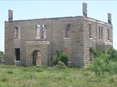 Old Reagan County Courthouselisted 1978
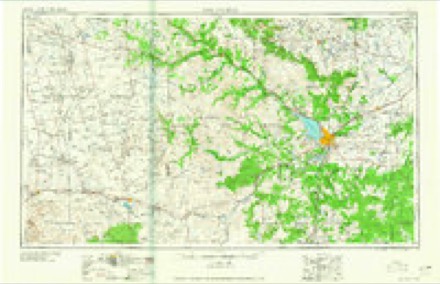
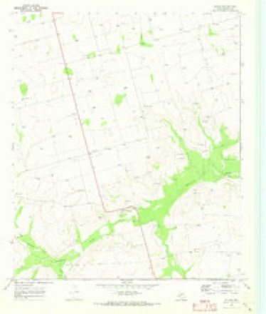
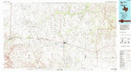
Topographic sheets covering this place
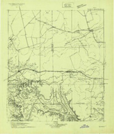
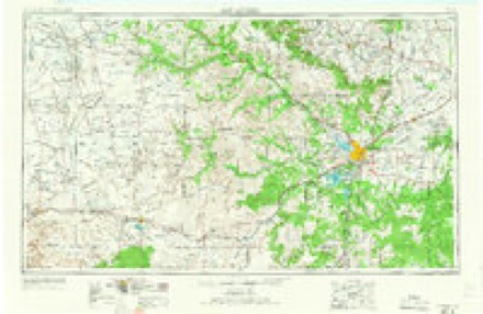
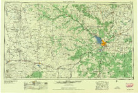
6 surveys from 7 printed sheetsMatched by testing this settlement's coordinate against the published boundary of every sheet in the United States Geological Survey's historical collection. Each opens the scanned sheet at the Survey.
- 1928 USGS Rankin quadrangle1:125000
- 1954 USGS San Angelo quadrangle1:250000, 2 printings
- 1958 USGS San Angelo quadrangle1:250000
- 1965 USGS San Angelo quadrangle1:250000
- 1970 USGS Stiles quadrangle1:24000
- 1986 USGS Big Lake quadrangle1:100000
Fires near this place
4 since 2006Regional context, not property-specific evidence. The federal wildfire occurrence database lists 4 fires within 5 miles of Stiles between 2006 and 2019, burning about 591 acres in total. 1 started naturally. None was recorded as arson. Distance is straight-line from the map coordinates, so a fire counted here may appear on a neighbouring settlement's page as well.
| Reported cause | Fires |
|---|---|
| Missing data/not specified/undetermined | 3 |
| Natural | 1 |
The most recent of them, most recent first, with the day each was reported and the service that recorded it.
| Date | Cause | Size | Reported by | Name on the report |
|---|---|---|---|---|
| 20 March 2006 | Missing data/not specified/undetermined | 1.0 acres | Texas A & M Forest Service | not named |
| 30 November 2019 | Missing data/not specified/undetermined | 75 acres | Texas A & M Forest Service | JAMESON RANCH |
| 7 January 2006 | Missing data/not specified/undetermined | 500 acres | Texas A & M Forest Service | not named |
| 27 January 2006 | Natural | 15 acres | Texas A & M Forest Service | not named |
Storms near this place
60 of 67 shownRegional context, not property-specific evidence. The National Weather Service names Stiles in 67 storm reports between 1994 and 2026: 39 hail, 15 thunderstorm wind, 10 flash flood, 3 tornado. The reports record 5 injuries. Each account below is quoted exactly as the forecast office filed it, from the NOAA Storm Events Database, and each date opens the federal record of that event.
| When | Event | Place named | Harm | What the report says |
|---|---|---|---|---|
| March 2000 | Tornado (F2) | Stiles | 5 hurt, $200,000 | The tornado knocked a small house off its foundation by about 15 yards with the house pivoting 90 degrees as well. One infant suffered a slight head injury from falling furniture. The tornado continued travelling north-northeast through rural areas, but struck and destroyed a mobile home, injuring two men, one seriously. Lighter damage was scattered along the rest of its path, including utility poles down, parts of roofs damaged, fences and barns damaged, etc. The tornado crossed into Glasscock County at 31.65N/101.50W. |
| November 2004 | Flash Flood | Stiles | $300,000 | Flash flooding along the usually dry Indian Creek in northeastern Reagan County caused high water to rush over portions of Farm to Market Road 2600. Fire department personnel aided several motorists in the area that were stranded by flowing water. Receding flood waters during the late afternoon hours revealed extensive damage to portions of the roadway. |
| March 2004 | Tornado (F0) | Stiles | $20,000 | Results from a National Weather Service storm survey indicated that a brief tornado resulted in five downed power poles in open range land across northeast Reagan County. A witness reported seeing a funnel in the immediate vicinity, and a rural resident that lives near the damaged poles heard a "loud roar". |
| March 2005 | Thunderstorm Wind | Stiles | $1,000 | A rural resident north of Stiles reported 60 MPH gusts from a severe thunderstorm that blew open and slightly damaged the door on a large barn. |
| August 2004 | Thunderstorm Wind | Stiles | $500 | The North Reagan County Fire Department reported severe thunderstorm winds that produced minor damage around the fire station. A large wooden swing and jungle gym unit was blown over by the winds. |
| April 2026 | Thunderstorm Wind | Stiles | - | The West Texas Mesonet station 5 SW Saint Lawrence measured a severe thunderstorm wind gust of 75 mph. |
| May 2024 | Hail | Stiles | - | Public photo shared of half-dollar-size hail. |
| May 2024 | Hail | Stiles | - | Large piles of small hail along the side of the road, some hail may be larger. |
| June 2023 | Hail | Stiles | - | COOP observer at Cope Ranch measured 2-inch hail. |
| May 2023 | Hail | Stiles | - | Report from mPing. |
| May 2016 | Thunderstorm Wind | Stiles | - | A thunderstorm produced a reported wind gust of 50 to 60 mph. |
| May 2015 | Thunderstorm Wind | Stiles | - | A thunderstorm moved across Reagan County and produced a 63 mph wind gust as recorded by the mesonet five miles southwest of St. Lawrence. |
| May 2014 | Thunderstorm Wind | Stiles | - | A thunderstorm moved over Reagan County and produced a 73 mph wind gust five miles southwest of St. Lawrence. No damage was reported. |
| June 2013 | Thunderstorm Wind | Stiles | - | A thunderstorm moved over Reagan County and produced a 68 mph wind gust five miles southwest of St. Lawrence. |
| April 2012 | Hail | Stiles | - | A storm moved over Reagan County and produced golfball sized hail and wind speeds over 60 mph nine miles southeast of Stiles. |
| May 2010 | Hail | Stiles | - | Several windows on a home were broken by the hail, but no known specifics were given with regards to replacement costs. |
| May 2010 | Tornado (EF0) | Stiles | - | A brief tornado developed near a residence, doing minor damage. The time of the tornado's formation was estimated from radar and the storm report from the owner of the home. At approximately 17:35 pm CST, the tornado blew an old telephone antenna a couple hundred yards away. It then blew a stack of wooden pallets 15 to 20 yards away. In addition, several 5 inch limbs were broken off of trees. The tornado lasted less than 2 minutes. |
| September 2010 | Thunderstorm Wind | Stiles | - | A trained spotter reported his flag was partially torn by the wind gust. A 6 foot long tree branch was also found broken near State Highway 137. |
| May 2007 | Thunderstorm Wind | Stiles | - | A 62 mph wind gust was reported from the Reagon and Glasscock County line. No damage was reported. |
| June 2007 | Hail | Stiles | - | Quarter to half dollar sized hail fell in rural North Central Reagan County. |
| June 2007 | Hail | Stiles | - | Ping pong ball sized hail fell on Texas State Highway 137, one mile west of Farm to Market Road 33. |
| June 2007 | Hail | Stiles | - | Lemon sized hail fell at the North Reagon Fire Station. |
| May 2007 | Hail | Stiles | - | Deputy Sheriff reported penny sized hail at the North Reagan Fire Station from noon to 12:40pm. |
| March 2006 | Hail | Stiles | - | Quarter to half dollar size hail covered the ground at Cope Ranch in rural Reagan county. |
| April 2006 | Hail | Stiles | - | Quarter size hail fell at the intersection of Texas Highway 137 and Farm to Market Road 1357. |
| February 2005 | Hail | Stiles | - | A rural resident in northern Reagan County reported penny size hail that covered the ground just north of the Farm to Market Road 1357 and Texas Route 137 intersection. |
| August 2005 | Flash Flood | Stiles | - | The Texas Department of Public Safety reported that water was flowing over most roads in northern Reagan county. |
| October 2005 | Flash Flood | Stiles | - | The Reagan County Sheriff's Office reported one foot of water running over Texas Highway 137 between Stiles and Farm to Market Road 33. |
| March 2004 | Hail | Stiles | - | Nickel to quarter size hail covered the ground. |
| August 2004 | Hail | Stiles | - | A complex of severe multicell convection back built into the southeastern Permian Basin from the west-central Texas area near San Angelo along and north of a stalled frontal boundary. This was first of several waves to affect the west Texas Permian Basin and the Trans Pecos region during an extensive severe weather episode. Pea to quarter size hail was first reported at the Cope Ranch in rural northeastern Reagan County. |
| August 2004 | Flash Flood | Stiles | - | Flash flooding across northern Reagan County resulted in high water that flowed over the intersection of State Highway 137 and Morton Drive. A National Weather Service cooperative observer reported 1.8 inches of rainfall in the immediate area. |
| October 2004 | Hail | Stiles | - | Residents at a ranch headquarters in northeastern Reagan County reported penny size hail that covered the ground. |
| October 2004 | Flash Flood | Stiles | - | A local newspaper reported that Reagan County officials closed portions of Farm to Market Road 2600 in northeastern Reagan County due to flash flooding. Event time is estimated based on radar data. |
| August 2003 | Flash Flood | Stiles | - | The public reported high water flowing over Highway 137 in extreme northern Reagan County. |
| June 2003 | Thunderstorm Wind | Stiles | - | A trained storm spotter estimated severe thunderstorm winds of at least 80 MPH. The winds broke tree limbs up to eight inches in diameter. |
| June 2003 | Flash Flood | Stiles | - | Spotters reported high water running across Farm to Market Road 2401 in the northwest corner of Reagan County. |
| June 2003 | Hail | Stiles | - | Reported on Farm to Market Road 1357. |
| April 2002 | Hail | Stiles | - | Reported by a storm spotter near the county line on Highway 33. |
| July 2002 | Thunderstorm Wind | Stiles | - | Thunderstorm winds blew down a large flag pole and a few large limbs off trees. |
| August 2002 | Thunderstorm Wind | Stiles | - | Severe wind gusts were measured by a trained spotter along Highway 349. |
| October 2002 | Thunderstorm Wind | Stiles | - | Large tree limbs were blown down by severe thunderstorm wind gusts. |
| April 2000 | Hail | Stiles | - | Reported along RR 33 in the old Stiles community area. |
| June 1997 | Flash Flood | Stiles | - | Water was running across Ranch Road 33 in the central portions of the county. |
| June 1997 | Flash Flood | Stiles | - | Water was running across State Highway 137, but not enough to close the roadway. |
| October 1994 | Hail | Stiles | - | The Reagan County Sheriff's Office reported golfball-size hail 5 miles north of Stiles. |
| November 2024 | Thunderstorm Wind | Stiles | - | no account filed |
| May 2021 | Hail | Stiles | - | no account filed |
| March 2017 | Hail | Stiles | - | no account filed |
| March 2017 | Hail | Stiles | - | no account filed |
| April 2016 | Hail | Stiles | - | no account filed |
| May 2015 | Hail | Stiles | - | no account filed |
| May 2015 | Hail | Stiles | - | no account filed |
| May 2014 | Hail | Stiles | - | no account filed |
| August 2011 | Thunderstorm Wind | Stiles | - | no account filed |
| May 2010 | Hail | Stiles | - | no account filed |
| April 2009 | Hail | Stiles | - | no account filed |
| April 2009 | Hail | Stiles | - | no account filed |
| May 2009 | Hail | Stiles | - | no account filed |
| May 2009 | Hail | Stiles | - | no account filed |
| May 2007 | Hail | Stiles | - | no account filed |
Nearest settlements
The eight closest, with where each one stands in the county. Distances are straight-line, computed from the Geographic Names Information System coordinates.
| Map | Place | Distance | Sheets |
|---|---|---|---|
| Four Corner Windmill | 8.1 miles | 7 | |
| Crossroads | 11.1 miles | 7 | |
| Best | 12.9 miles | 7 | |
| Santa Rita (historical) | 13.5 miles | 7 | |
| Texon | 14.2 miles | 7 | |
| Big Lake | 15.9 miles | 8 | |
| Witco | 20.9 miles | 8 |
Elsewhere
Matched on this settlement's Geographic Names Information System number rather than its name, so it cannot be a different place of the same name in another state.
| Wikipedia article on Stiles | An encyclopaedic summary. Its text is share-alike, so it is linked here rather than copied. |
| Wikidata item Q7616957 | The structured record the population and elevation above come from. Public domain (CC0). |
Provenance
This settlement is recorded in the Geographic Names Information System as feature 1380609. The sheet list is computed by point-in-boundary test against the United States Geological Survey's historical topographic inventory. Both are works of the United States government and carry no copyright under 17 U.S.C. 105.
Wildfire. Short, Karen C. 2022. Spatial wildfire occurrence data for the United States, 1992-2020 [FPA_FOD_20221014]. 6th Edition. Fort Collins, CO: Forest Service Research Data Archive. https://doi.org/10.2737/RDS-2013-0009.6 Collected with United States Government funding and usable without additional permissions or fees.
Storms. NOAA National Centers for Environmental Information, Storm Events Database https://www.ncei.noaa.gov/stormevents/ A work of the United States government, no copyright under 17 U.S.C. 105. Narratives are quoted verbatim from the National Weather Service report and are not edited or summarised.