 Block
BlockTarzan, Texas
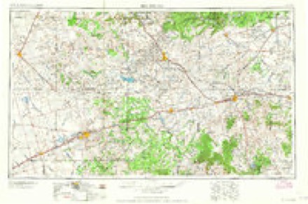
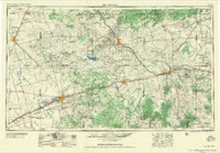
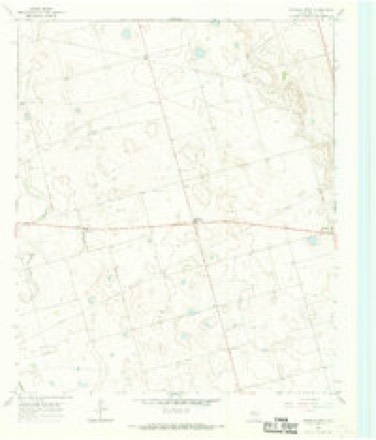
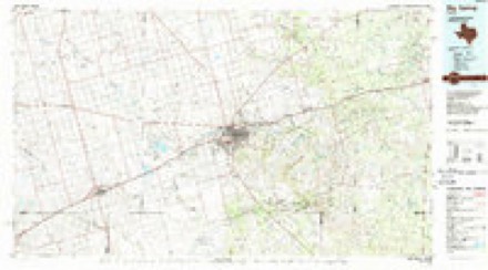
8 topographic sheets cover this place, the earliest surveyed in 1954 and the latest in 1986. It stands in the Tarzan-Lenorah census division. It lies in ZIP code area 79783. The Survey maps it on the Lenorah West quadrangle. It stands 2,822 feet above sea level.
Topographic sheets covering this place
4 surveys from 8 printed sheetsMatched by testing this settlement's coordinate against the published boundary of every sheet in the United States Geological Survey's historical collection. Each opens the scanned sheet at the Survey.
- 1954 USGS Big Spring quadrangle1:250000, 4 printings
- 1958 USGS Big Spring quadrangle1:250000
- 1966 USGS Lenorah West quadrangle1:24000
- 1986 USGS Big Spring quadrangle1:100000, 2 printings
Fires near this place
7 since 2008Regional context, not property-specific evidence. The federal wildfire occurrence database lists 7 fires within 5 miles of Tarzan between 2008 and 2009, burning about 34 acres in total. None started naturally. None was recorded as arson. Distance is straight-line from the map coordinates, so a fire counted here may appear on a neighbouring settlement's page as well.
| Reported cause | Fires |
|---|---|
| Equipment and vehicle use | 3 |
| Missing data/not specified/undetermined | 3 |
| Debris and open burning | 1 |
The most recent of them, most recent first, with the day each was reported and the service that recorded it.
| Date | Cause | Size | Reported by | Name on the report |
|---|---|---|---|---|
| 12 July 2008 | Equipment and vehicle use | under an acre | Texas A & M Forest Service | not named |
| 27 June 2008 | Missing data/not specified/undetermined | 5.0 acres | Texas A & M Forest Service | not named |
| 26 June 2008 | Missing data/not specified/undetermined | 25 acres | Texas A & M Forest Service | not named |
| 18 May 2008 | Missing data/not specified/undetermined | under an acre | Texas A & M Forest Service | not named |
| 3 April 2008 | Equipment and vehicle use | 2.0 acres | Texas A & M Forest Service | not named |
| 4 March 2008 | Debris and open burning | 1.0 acres | Texas A & M Forest Service | not named |
| 20 January 2009 | Equipment and vehicle use | under an acre | Texas A & M Forest Service | TARZAN BAR DITCH |
Settlements close enough to share some of these fires:
Storms near this place
60 of 83 shownRegional context, not property-specific evidence. The National Weather Service names Tarzan in 83 storm reports between 1994 and 2025: 37 hail, 30 thunderstorm wind, 10 flash flood, 5 tornado. No death or injury is recorded in these reports. Each account below is quoted exactly as the forecast office filed it, from the NOAA Storm Events Database, and each date opens the federal record of that event.
| When | Event | Place named | Harm | What the report says |
|---|---|---|---|---|
| September 2003 | Thunderstorm Wind | Tarzan | $120,000 | The storm which produced the tornado quickly evolved from a classic supercell structure to a high precipition supercell as the occlusion process occured. This transition resulted in a broad swath of very strong and damaging southwest to west winds which crossed Highway 349. The most intense damage occurred along the stretch of Highway 349 from the intersection with 176 to about 6 miles south of that intersection. This damage correlated with a strong low level divergent pattern in radar velocity products, indicative of an intense downburst in the forward flank downdraft of the storm. These winds blew down numerous power poles (up to twenty-five) from the intersection of Highways 349 and 176, south to ten miles south of that intersection. One metal light pole, which was snapped at the base, was rated to withstand 80 MPH winds. |
| September 2025 | Flash Flood | Tarzan | $60,000 | A report was received from the public of flash flooding with cars stranded on State Hwy 176 east of Grady. Pictures of the flooding were shared on social media. The time of occurrence is partially estimated by radar. The cost of damages is also estimated. |
| June 2013 | Thunderstorm Wind | Tarzan | $45,000 | A thunderstorm moved over Martin County and produced strong winds ten miles northeast of Tarzan on a farm. Two old wooden barns were destroyed, and a 20 by 20 foot portable metal building was overturned. There was an estimate of about ten power poles down, and large tree limbs were broke. The cost of damage is a rough estimate. |
| April 2009 | Tornado (EF1) | Tarzan | $40,000 | This tornado first did damage to 7 power poles about 4.5 miles southwest of Tarzan; this was confirmed by contacting the utility company in the area the following day. The estimated time of damage according to radar at this location was around 2020 CST. At 2032 CST, the tornado then tracked east northeastward and impacted a COOP observer's farm about 3 miles southeast of Tarzan, TX damaging multiple pieces of farm equipment, storage tanks and removing 3 roofs from multiple structures. It then continued on its same path snapping 3 power poles about a mile west of Lenorah, TX. The estimated time of damage according to radar was sometime around 2036 CST. This was the last known location of the tornado, although another tornado redeveloped with the same supercell about 20 minutes later. Please see the attached images. |
| March 2000 | Thunderstorm Wind | Tarzan | $40,000 | Thunderstorm outflow winds damaged farm equipment. |
| June 2021 | Thunderstorm Wind | Tarzan | $3,000 | A thunderstorm moved across Martin County and produced wind damage in Tarzan. There was roof damage to a metal outbuilding. The time was estimated by radar. The cost of damage is a very rough estimate. |
| June 1998 | Thunderstorm Wind | Tarzan | $1,000 | Just as occurred in SW Dawson County, a long duration of wind occurred from this storm as it developed southward into Martin County. Many tree limbs were broken off and a small shed was damaged. A total of 2.25" of rain was recorded here. |
| March 2020 | Flash Flood | Tarzan | $500 | Heavy rain fell across Martin County and produced flash flooding. There was a lane closure on SH 349 due to high water in the passing lane. The cost of damage is a very rough estimate. |
| September 2014 | Flash Flood | Tarzan | $300 | Heavy rain fell across Martin County and produced flash flooding near Tarzan. State Highway 176 was reported to be under water. The cost of damage is a very rough estimate. |
| June 2025 | Hail | Tarzan | - | An off duty NWS employee reported hen egg-size hail. The time of occurrence is estimated by radar. |
| June 2025 | Thunderstorm Wind | Tarzan | - | The West Texas Mesonet station 84 2WNW Tarzan/Martin County recorded a 67 mph wind gust. |
| October 2025 | Thunderstorm Wind | Tarzan | - | The West Texas Mesonet station 84 2WNW Tarzan/Martin County measured a 63mph wind gust. |
| November 2025 | Thunderstorm Wind | Tarzan | - | The West Texas Mesonet Station 84 2WNW Tarzan/Martin County measured a 61 mph wind gust associated with strong thunderstorm outflow. |
| February 2022 | Thunderstorm Wind | Tarzan | - | A thunderstorm moved across Martin County and produced a 60 mph wind gust near Tarzan. |
| June 2021 | Thunderstorm Wind | Tarzan | - | A thunderstorm moved across Martin County and produced a 69 mph wind gust at the mesonet site near Tarzan. |
| June 2021 | Thunderstorm Wind | Tarzan | - | A thunderstorm moved across Martin County and produced a 62 mph wind gust at the Tarzan mesonet site. |
| June 2020 | Thunderstorm Wind | Tarzan | - | A thunderstorm moved across Martin County and produced a 61 mph wind gust at the mesonet site near Tarzan. |
| June 2017 | Thunderstorm Wind | Tarzan | - | A thunderstorm moved across Martin County and produced a 69 mph wind gust at the mesonet site near Tarzan. |
| July 2016 | Thunderstorm Wind | Tarzan | - | A thunderstorm moved across Martin County and produced a 60 mph wind gust near Tarzan. |
| July 2016 | Thunderstorm Wind | Tarzan | - | A thunderstorm moved across Martin County and produced a 58 mph wind gust near Tarzan. |
| July 2016 | Thunderstorm Wind | Tarzan | - | A thunderstorm moved across Martin County and produced a 61 mph wind gust near Tarzan. |
| July 2016 | Thunderstorm Wind | Tarzan | - | A thunderstorm moved across Martin County and produced a 60 mph wind gust near Tarzan. |
| May 2015 | Thunderstorm Wind | Tarzan | - | A thunderstorm moved across Martin County, and the public estimated a 50 to 60 mph wind gust between 415 and 430 pm CDT. No damage was reported. |
| June 2013 | Flash Flood | Tarzan | - | Heavy rain moved over Martin County and produced flash flooding eight miles northeast of Tarzan. Two feet of water was reported over a low water crossing. The cost of damage is assumed to be zero since no damage was reported. |
| September 2012 | Thunderstorm Wind | Tarzan | - | A thunderstorm moved over Martin County and produced a 50 to 60 mph wind gust in northeast Martin County. |
| September 2012 | Thunderstorm Wind | Tarzan | - | A thunderstorm moved over Martin County and produced a 60 mph wind gust thirteen miles northwest of Tarzan. |
| August 2010 | Flash Flood | Tarzan | - | At 2005 CST, a spotter first reported 6 to 8 inches of flowing water over portions of SH 137, just north of SH 176, in Martin County. Water was also running over FM 846 east of SH 137. About an hour later, TXDOT closed SH 176 in Martin County from near the Martin County line east to the Howard County line. Several motorists were stranded in high water along the highway. |
| April 2009 | Funnel Cloud | Tarzan | - | A large funnel cloud was reported by a trained spotter around 2045 CST about 5 miles SSE of Tarzan. It is possible that the funnel was actually a tornado considering the damage to the power poles done upstream. |
| May 2008 | Thunderstorm Wind | Tarzan | - | Winds up to 60 mph were estimated by a trained storm spotter. No damage was reported. |
| June 2008 | Hail | Tarzan | - | A trained spotter reported quarter sized hail ten miles north of Midand along Texas State Highway 349. |
| March 2007 | Flash Flood | Tarzan | - | Six inches of water was flowing acros Texas Highway 176, one and a half miles east of that highway's intersection with Texas Route 349. |
| May 2007 | Flash Flood | Tarzan | - | Farm to Market Road 846 just off State Highway 137 and Farm to Market Road 1212 at State Highway 176 were under water and impassable due to heavy rainfall. |
| June 2007 | Hail | Tarzan | - | Golfball sized hail fell on Farm to Market Road 1212, five to seven miles south of its intersection with Texas Highway 176. |
| June 2007 | Hail | Tarzan | - | Quarter sized hail fell three to five miles east of the intersection of Texas Highways 349 and 176. |
| June 2007 | Hail | Tarzan | - | Quarter to lime sized hail was falling at and just south of the intersection of Farm to Market Road 1212 and Texas Highway 176. |
| June 2007 | Thunderstorm Wind | Tarzan | - | The wind gust was reported by a motorist on Texas State Highway 349. No damage was reported. |
| June 2007 | Thunderstorm Wind | Tarzan | - | Three to five miles east of the intersection of Texas Highways 349 and 176, 50 to 60 mph wind gusts were estimated. No damage was reported. |
| May 2007 | Flash Flood | Tarzan | - | The Martin County Sheriff's Office advised against traveling anywhere in the county north of Texas Highway 176 as most of the roads were underwater. |
| May 2006 | Hail | Tarzan | - | Softball size hail fell at the intersection of Texas Highway 349 and Martin County Road D2651. |
| April 2006 | Hail | Tarzan | - | Pea to quarter size hail accumulated to a depth of three to four inches north of Tarzan and Lenorah. |
| April 2006 | Hail | Tarzan | - | Quarter to golfball size hail fell in a swath from northwest of Tarzan to Lenorah. An hour and a half later, an off-duty NWS employee came across drifts of penny to nickel size hail in this same area. |
| May 2006 | Tornado (F0) | Tarzan | - | Just east of Texas Highway 349, nine miles southwest of Patricia, an anticyclonic tornado developed in view of chasers and spotters. Based on the location of the tornado in relation to the supercell, indications are that this tornado developed on the south flank of the rear flank downdraft. |
| May 2006 | Tornado (F2) | Tarzan | - | A tornado developed in Martin County in open fields north of County Road D4800 and east of County Road D2651. Based on spotter reports, the tornado was visible at 8:02 pm CDT just south of CR D4800 and west of Farm to Market Road 829 (FM 829), south-southeast of Patricia. According to spotter reports, it took on a stove-pipe like shape and continued to move to the east-southeast along FM 829. A few minutes later, the tornado pulled an oil pump jack and well head from the ground. The pump jack was estimated to weigh about 35,000 pounds by an oil company representative. The well head was anchored in the ground by an additional 35,000 pounds of weight from pipe below the ground. Southward along FM 829, four power poles were snapped four to five feet above ground and an additional six poles farther south were blown over to the east due to rear flank downdraft winds. Another couple of minutes later, an oil heater treater weighing approximately 12,000 pounds was blown over. The damage survey team classified the damage that occurred between 8:02pm CDT and 8:07pm CDT, when the oil heater treater was blown over, as F2 intensity damage. After blowing over the oil heater, the tornado became rain-wrapped and crossed County Road 4600, just west of County Road D3401. Five power poles were knocked down on County Road D3401. Based on information received from both spotters and chasers, the tornado dissipated at 8:14pm CDT, just west of Texas Highway 137. During the remainder of the tornado's path, it remained mainly over open country. The damage survey team calculated the width of the tornado to be 130 yards near the end of its life. However, the track was estimated to be between 200 and 300 yards during earlier stages of its life. The path length was calculated to be just over six miles long. |
| May 2004 | Hail | Tarzan | - | A motorist traveling on State Route 176 in eastern Martin County reported grapefruit size hail just west of the Martin/Howard County line. No reports of damage were received. |
| August 2004 | Flash Flood | Tarzan | - | The Martin County Sheriff's Office reported flood waters flowing over State Highway 349 in northwest Martin County and Farm to Market Road 829 near Grady. |
| December 2004 | Thunderstorm Wind | Tarzan | - | A local farmer reported thunderstorm wind gusts up to 60 MPH between Tarzan and Lenorah along State Highway 176. |
| September 2003 | Tornado (F0) | Tarzan | - | As the supercell storm moved from eastern Andrews County into western Martin County a local television meteorologist who was in the field storm spotting, and a WFO Midland staff meteorologist who was looking north from the office, observed a tornado. The tornado was located in rural areas of southwest Martin County, approximately three miles west of Highway 349 and eight miles south-southwest of the intersection of Highways 349 and 176. |
| April 2003 | Hail | Tarzan | - | An off duty NWS meteorologist reported golfball hail stones sporadically falling on Highway 349 three miles north of the Martin/Midland County line. These hail stones were ejected some distance from the parent supercell thunderstorm, which was centered about twelve miles to the northeast. |
| April 2003 | Thunderstorm Wind | Tarzan | - | A storm chaser reported golfball size hail blown horizontally by severe thunderstorm winds. The chaser's portable anemometer recorded a peak gust of 72 MPH. |
| April 2003 | Hail | Tarzan | - | A spotter reported nickel size hail ten miles south of the intersection of Highways 349 and 176. |
| April 2003 | Hail | Tarzan | - | A spotter reported penny size hail on Highway 349 eight miles north of the intersection with Highway 176. |
| June 2003 | Hail | Tarzan | - | Reported by a trained storm spotter at the intersection of Farm to Market Road 1212 and State Route 176, then south along 1212. |
| September 2003 | Hail | Tarzan | - | As the evening's third supercell storm propagated south-southeast out of Dawson County and into northern Martin County, large hail up to the size of golfballs covered Highway 349. The Texas Department of Transportation temporarily closed a section of the highway due to drifted hail. |
| September 2003 | Hail | Tarzan | - | Large hailstones ranging in size from dimes to quarters covered the ground and stripped the leaves from trees at a rural residence on the Andrews/Martin County line just off of Highway 176. |
| September 2003 | Hail | Tarzan | - | Hail to the size of golfballs accumulated three feet deep on Highway 349. The Texas Department of Transportation in Martin County was called out for the second time this night to close parts of that highway due to hail. Parts of Highway 349 remained closed due to high hail drifts for at least nine hours. |
| June 2002 | Thunderstorm Wind | Tarzan | - | Thunderstorm winds broke large limbs out of mesquite trees and blew them across Highway 176. |
| March 2000 | Flash Flood | Tarzan | - | State Highway 176 was flooded with two feet of water over the roadway. |
| May 1999 | Tornado (F0) | Tarzan | - | The cell that had produced the tornado in Ector County, dissipated, but its associated cluster began to favor one cell and by the time the cluster was in Eastern Andrews County it was forming into an HP supercell. Just after crossing into Martin County the storm produced a very brief tornado. The storm had a huge slot of rain that had wrapped around the mesocyclone. The spotter who saw the tornado was in heavy rain to the southeast of the spinup point. Video showed the condensation funnel to the ground, but rotation looked fairly weak. The unfavorable environment quickly destroyed the tornado within about one minute. |
| May 1995 | Hail | Tarzan | - | A farmer reported a tornado that damaged eight trees, as well as a metal grain bin and four sections of an irrigation system. Quarter-size hail accompanied this storm. |
| May 2024 | Thunderstorm Wind | Tarzan | - | no account filed |
Nearest settlements
The eight closest, with where each one stands in the county. Distances are straight-line, computed from the Geographic Names Information System coordinates.
Elsewhere
Matched on this settlement's Geographic Names Information System number rather than its name, so it cannot be a different place of the same name in another state.
| Wikipedia article on Tarzan | An encyclopaedic summary. Its text is share-alike, so it is linked here rather than copied. |
| Wikidata item Q7687004 | The structured record the population and elevation above come from. Public domain (CC0). |
Provenance
This settlement is recorded in the Geographic Names Information System as feature 1348260. The sheet list is computed by point-in-boundary test against the United States Geological Survey's historical topographic inventory. Both are works of the United States government and carry no copyright under 17 U.S.C. 105.
Wildfire. Short, Karen C. 2022. Spatial wildfire occurrence data for the United States, 1992-2020 [FPA_FOD_20221014]. 6th Edition. Fort Collins, CO: Forest Service Research Data Archive. https://doi.org/10.2737/RDS-2013-0009.6 Collected with United States Government funding and usable without additional permissions or fees.
Storms. NOAA National Centers for Environmental Information, Storm Events Database https://www.ncei.noaa.gov/stormevents/ A work of the United States government, no copyright under 17 U.S.C. 105. Narratives are quoted verbatim from the National Weather Service report and are not edited or summarised.