 Block
BlockTemple, Texas
15 topographic sheets cover this place, the earliest surveyed in 1892 and the latest in 1985. It stands in the Temple census division. It lies in ZIP code area 76501. The Survey maps it on the Temple quadrangle. 82,073 people lived here at the 2020 count. It stands 715 feet above sea level.
On record in Temple
Buildings and businesses the archive holds for this place. Each opens its own page, with the source record it came from.
On the National Register 6 records
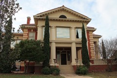 Barclay-Bryan Houselisted 1984
 Kyle Hotellisted 1993
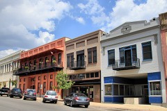 Temple Commercial Historic Districtlisted 2005
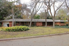 Wilson, Ralph, Sr., and Sunny, Houselisted 1998
- Ferguson Houselisted 1978
- Missouri, Kansas and Texas (MK&T-Katy) Railway Passenger Depotlisted 2022
Surveyed buildings and structures 1 record
- Bone Crossing Bridge, Spanning Cowhouse Creek at County Route 137, Gatesvillefederal building survey
Population over time
3 figuresTemple grew from 54,986 to 82,073 between 2000 and 2020. These are the recorded population figures Wikidata holds for this place, reached through the Geographic Names Information System number this page is keyed on rather than by name, so they belong to this place and not to another of the same name. Most are census counts, but not all are: an early figure may be a founding or settlement estimate, and an estimate published within five years of a census is left out. The change column is computed, and is left blank where more than 20 years separate a figure from the one before it, because a gap that long is not a change between two counts.
| Year | People | Change |
|---|---|---|
| 2000 | 54,986 | |
| 2010 | 66,102 | +11,116 (+20%) |
| 2020 | 82,073 | +15,971 (+24%) |
Topographic sheets covering this place
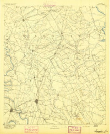
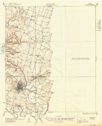
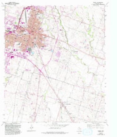
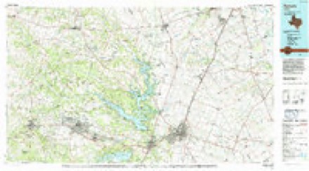
6 surveys from 15 printed sheetsMatched by testing this settlement's coordinate against the published boundary of every sheet in the United States Geological Survey's historical collection. Each opens the scanned sheet at the Survey.
- 1892 USGS Temple quadrangle1:125000, 6 printings
- 1931 USGS Belton quadrangle1:62500
- 1954 USGS Waco quadrangle1:250000, 2 printings
- 1955 USGS Waco quadrangle1:250000
- 1965 USGS Temple quadrangle1:24000, 3 printings
- 1985 USGS Temple quadrangle1:100000, 2 printings
Fires near this place
36 since 2006Regional context, not property-specific evidence. The federal wildfire occurrence database lists 36 fires within 5 miles of Temple between 2006 and 2020, burning about 438 acres in total. None started naturally. 1 was recorded as arson. Distance is straight-line from the map coordinates, so a fire counted here may appear on a neighbouring settlement's page as well.
| Reported cause | Fires |
|---|---|
| Missing data/not specified/undetermined | 19 |
| Equipment and vehicle use | 7 |
| Debris and open burning | 5 |
| Smoking | 2 |
| Railroad operations and maintenance | 1 |
| Recreation and ceremony | 1 |
| Arson/incendiarism | 1 |
The most recent of them, most recent first, with the day each was reported and the service that recorded it.
| Date | Cause | Size | Reported by | Name on the report |
|---|---|---|---|---|
| 6 September 2011 | Equipment and vehicle use | 50 acres | Texas A & M Forest Service | BERGER RD FIRE |
| 11 August 2020 | Missing data/not specified/undetermined | 5.0 acres | Texas A & M Forest Service | CENTRAL POINTE |
| 5 July 2009 | Missing data/not specified/undetermined | 25 acres | Texas A & M Forest Service | 4400 HOPIE TR |
| 4 July 2020 | Missing data/not specified/undetermined | 1.0 acres | Texas A & M Forest Service | AMBER DAVIS DR |
| 27 July 2009 | Equipment and vehicle use | 20 acres | Texas A & M Forest Service | OLD HWY 95 & FM 93 |
| 15 July 2018 | Missing data/not specified/undetermined | 15 acres | Texas A & M Forest Service | AIRPORT |
| 19 June 2014 | Missing data/not specified/undetermined | 3.0 acres | Texas A & M Forest Service | GRASS FIRE |
| 10 June 2009 | Smoking | under an acre | Texas A & M Forest Service | 1701 BOB WHITE ROAD |
Settlements close enough to share some of these fires:
Mines and quarries near this place
4 within 5 milesRegional context, not property-specific evidence. The federal mineral resources record lists 4 workings within 5 miles of Temple: 2 past producers, 1 producer, 1 unknown. 1 still produces. What was taken out: Sand and Gravel, Construction, Silica. Distance is straight-line from the map coordinates, so a quarry counted here may appear on a neighbouring settlement's page as well.
| Where | Site | Commodity | Status | Recorded |
|---|---|---|---|---|
| Tex-Rock | Silica | Unknown | ||
| Shallow Ford Pit | Sand and Gravel, Construction | Producer | ||
| Unknown | Sand and Gravel, Construction | Past Producer | ||
| Unknown | Sand and Gravel, Construction | Past Producer |
Storms near this place
60 of 110 shownRegional context, not property-specific evidence. The National Weather Service names Temple in 110 storm reports between 1994 and 2025: 39 hail, 36 thunderstorm wind, 27 flash flood, 3 lightning. The reports record 1 injury. Each account below is quoted exactly as the forecast office filed it, from the NOAA Storm Events Database, and each date opens the federal record of that event.
| When | Event | Place named | Harm | What the report says |
|---|---|---|---|---|
| June 1995 | Thunderstorm Wind | Temple | 1 hurt, $325,000 | Widespread wind damage was reported from Temple to Belton, with several outbuildings thrown onto Interstate 35. A tree fell onto a house injuring a woman. Several homes and businesses were partially unroofed. |
| April 1996 | Hail | Temple | $200,000,000 | no account filed |
| June 1995 | Hail | Temple | $300,000 | Hail damage occurred at the Tranum Auto Dealership with damage to nearly every car on the lot. |
| April 2008 | Thunderstorm Wind | Temple | $75,000 | The roofs were torn off of several structures at the intersection of Calhoun and 13th Streets. |
| May 2005 | Thunderstorm Wind | Temple | $75,000 | Significant damage to homes reported, including roofs blown off. Trees and fences were blown down, as well as dozens of power lines in the city's northern historic district. |
| June 1995 | Thunderstorm Wind | Temple | $75,000 | A roof was blown off a construction company. |
| September 2020 | Lightning | Temple | $60,000 | A couple died in an early morning house fire that fire investigators determined was started by lightning. |
| April 2006 | Thunderstorm Wind | Temple | $60,000 | At least two mobile homes in Moffat were pushed more than three feet off of their foundations. A garage was destroyed and debris covered a nearby road. Several other structures including outbuildings were damaged or destroyed. The Moffat Fire Chief estimated winds in excess of 70 MPH. |
| December 2006 | Lightning | Temple | $60,000 | Lightning started a fire at an apartment complex, causing smoke and fire damage in four units upstairs, and smoke and water damage in the four units below. At least ten to twelve people were displaced by the fire. |
| November 2024 | Thunderstorm Wind | Temple | $50,000 | Fire Department reported roof damage and sheet metal removed from buildings in north Temple. In the same area, the public reported damage to a hotel along I-35. Pictures show part of the facade was torn off the front of the building. |
| February 2013 | Thunderstorm Wind | Temple | $50,000 | Strong thunderstorm winds impacted the Western Hills area of Temple where several large trees were uprooted, fences were knocked over, and at least one street sign was bent over. Much of the tree damage was reported along West Adams Ave, Apache Dr, and Blackfoot Drive. One tree fell on a home in the Whispering Oaks subdivision. The awning and part of the roof of 4 units at the Brentwood Apartments on West Adams Avenue was peeled off. A few large satellite dishes were knocked over on Moody Lane. Business signs at the Quick Shop & Go on Olaf and the New Hope Community Church on Apache Drive were damaged. |
| March 1997 | Thunderstorm Wind | Temple | $50,000 | no account filed |
| June 2005 | Thunderstorm Wind | Temple | $40,000 | Roofing torn off portions of an apartment complex. Several of the apartments suffered water damage. A fence was also destroyed. |
| March 1997 | Tornado (F1) | Temple | $40,000 | no account filed |
| May 2010 | Thunderstorm Wind | Temple | $30,000 | Numerous tree limbs were blown down across the city of Temple. |
| April 2022 | Hail | Temple | $25,000 | A trained spotter reported golf ball sized hail about 3 miles east of Temple, TX. |
| April 2022 | Hail | Temple | $25,000 | Amateur radio reported golf ball sized hail about 3 miles southeast of Temple, TX. |
| August 2002 | Thunderstorm Wind | Temple | $25,000 | High winds blew a tree down on a 1929 Mercedes. |
| August 1998 | Lightning | Temple | $25,000 | Lightning started a fire at an apartment complex. |
| November 2024 | Thunderstorm Wind | Temple | $20,000 | A social media picture indicated a missing roof and other exterior damage on a building in Temple. The time of the occurrence was estimated by radar. |
| April 2016 | Hail | Temple | $20,000 | Amateur radio operators reported golf ball sized hail to the northwest of Temple. |
| May 2008 | Heavy Rain | Temple | $20,000 | A roof collapsed into a bedroom from the weight of the rainwater. No injuries were reported. |
| May 2011 | Thunderstorm Wind | Temple | $15,000 | Thunderstorm winds blew a tree onto a house and blew a tree over a road in Temple. |
| September 2011 | Thunderstorm Wind | Temple | $15,000 | Several trees were blown down and power flashes were also seen in Temple. Thunderstorm wind speeds were estimated to be near 65 MPH. |
| October 2005 | Thunderstorm Wind | Temple | $15,000 | Roof damage occurred to two buildings. One of the roofs blew onto nearby power lines. Several power lines were also blown down. Trees were reported down in nearby Belton. |
| May 2024 | Hail | Temple | $10,000 | Broadcast media relayed a photo of 2 inch hail in south Temple. |
| April 2024 | Flash Flood | Temple | $10,000 | Fire and rescue reported at least four roads in Temple inundated. There was also a report of one vehicle water rescue. |
| April 2023 | Hail | Temple | $10,000 | Quarter to golf ball sized hail was reported near I-35 and Loop 363 in Temple. |
| April 2006 | Thunderstorm Wind | Temple | $10,000 | A roof of a barn and a garden shed were blown away. |
| August 1998 | Thunderstorm Wind | Temple | $10,000 | High winds damaged a house roof and blew out windows. |
| May 2024 | Hail | Temple | $7,000 | Trained spotter reported hail up to golf ball size in Temple. |
| October 2015 | Flash Flood | Temple | $5,000 | Numerous streets and underpasses flooded, as well as a few homes 2 miles W of Temple. |
| March 2014 | Thunderstorm Wind | Temple | $5,000 | Sixty mph winds were estimated at Scott and White Hospital in Temple. |
| May 2013 | Hail | Temple | $5,000 | Golf ball sized hail was reported on the northeast side of Temple. |
| June 2012 | Thunderstorm Wind | Temple | $5,000 | Several trees and tree limbs were knocked down in Temple by strong thunderstorm winds. Many of the fallen trees and limbs blocked several roads. Temple Fire Station #4 sustained minor roof damage; part of the metal awning of the roof was peeled off. |
| April 2010 | Thunderstorm Wind | Temple | $5,000 | A 72 MPH wind gust was measured just north of Temple. |
| May 2007 | Flash Flood | Temple | $4,000 | A high-water rescue was reported. |
| April 2020 | Thunderstorm Wind | Temple | $3,000 | Uprooted trees were reported in Temple. |
| October 2006 | Thunderstorm Wind | Temple | $3,000 | Street lights were damaged on the south edge of Temple. |
| May 2024 | Thunderstorm Wind | Temple | $2,000 | Large trees were uprooted and split at the Chapel Hill Apartments in southwest Temple. |
| October 2015 | Flash Flood | Temple | $2,000 | Water was reported over both sides of I-35 at MM 306 with cars stalling just south of Troy. |
| November 2024 | Flash Flood | Temple | $1,000 | A few mPING reports of street flooding and road closures were reported in Temple. |
| November 2004 | Thunderstorm Wind | Temple | $1,000 | A bus stop building in Bartlett was blown down. |
| April 1997 | Thunderstorm Wind | Temple | $1,000 | A road sign was blown down by high winds. |
| August 2025 | Thunderstorm Wind | Temple | - | A social media photo indicated a large tree branch snapped in the north part of Temple. |
| August 2025 | Thunderstorm Wind | Temple | - | A social media report indicated that several large tree branches were blown down near the Baylor hospital on South 31st Street in Temple. |
| May 2024 | Flash Flood | Temple | - | Broadcast media reported several flooded roadways in Temple. |
| May 2024 | Flood | Temple | - | Report from mPING: River/Creek overflowing; Cropland/Yard/Basement Flooding. |
| April 2023 | Flash Flood | Temple | - | A public report indicated vehicles stranded from flash flooding. |
| April 2023 | Flash Flood | Temple | - | A public report indicated that vehicles became stranded due to flash flooding about 2 miles north northeast of Temple. |
| October 2022 | Thunderstorm Wind | Temple | - | A trained spotter reported several 4-inch diameter tree limbs blown down in Temple, TX. |
| May 2021 | Hail | Temple | - | Quarter sized hail was reported in Temple. |
| April 2018 | Hail | Temple | - | Broadcast media reported quarter-sized hail in the city of Temple, TX. |
| May 2017 | Hail | Temple | - | Amateur radio reported quarter-sized hail on the north side of Temple, TX. |
| June 2016 | Flash Flood | Temple | - | BELL County Emergency Management reported that a few water rescues were ongoing in the city of Temple, TX. |
| May 2015 | Thunderstorm Wind | Temple | - | The AWOS in Temple measured a wind gust to 63 mph. |
| August 2014 | Hail | Temple | - | A trained spotter reported penny to nickel sized hail in Temple. |
| October 2014 | Thunderstorm Wind | Temple | - | Amateur radio reported 2 foot diameter trees blown down on Canyon Creek and Marlin Rd. |
| March 2014 | Hail | Temple | - | Quarter sized hail was reported at Scott and White Hospital in Temple. |
| May 2014 | Hail | Temple | - | Quarter sized hail was reported near Temple. |
Nearest settlements
The eight closest, with where each one stands in the county. Distances are straight-line, computed from the Geographic Names Information System coordinates.
Elsewhere
Matched on this settlement's Geographic Names Information System number rather than its name, so it cannot be a different place of the same name in another state.
| Wikipedia article on Temple | An encyclopaedic summary. Its text is share-alike, so it is linked here rather than copied. |
| Wikidata item Q427075 | The structured record the population and elevation above come from. Public domain (CC0). |
Provenance
This settlement is recorded in the Geographic Names Information System as feature 1369696. The sheet list is computed by point-in-boundary test against the United States Geological Survey's historical topographic inventory. Both are works of the United States government and carry no copyright under 17 U.S.C. 105.
Wildfire. Short, Karen C. 2022. Spatial wildfire occurrence data for the United States, 1992-2020 [FPA_FOD_20221014]. 6th Edition. Fort Collins, CO: Forest Service Research Data Archive. https://doi.org/10.2737/RDS-2013-0009.6 Collected with United States Government funding and usable without additional permissions or fees.
Mines and quarries. USGS Mineral Resources Data System (MRDS) https://mrdata.usgs.gov/mrds/ A work of the United States government, no copyright under 17 U.S.C. 105.
Storms. NOAA National Centers for Environmental Information, Storm Events Database https://www.ncei.noaa.gov/stormevents/ A work of the United States government, no copyright under 17 U.S.C. 105. Narratives are quoted verbatim from the National Weather Service report and are not edited or summarised.