 Block
BlockZapata, Texas
10 topographic sheets cover this place, the earliest surveyed in 1949 and the latest in 1985. It stands in the Zapata census division. It lies in ZIP code area 78076. It lies near Arroyo Valeriano. The Survey maps it on the Zapata quadrangle. 5,383 people lived here at the 2020 count. It stands 394 feet above sea level.
Research this city
Population over time
2 figuresZapata grew from 5,089 to 5,383 between 2010 and 2020. These are the recorded population figures Wikidata holds for this place, reached through the Geographic Names Information System number this page is keyed on rather than by name, so they belong to this place and not to another of the same name. Most are census counts, but not all are: an early figure may be a founding or settlement estimate, and an estimate published within five years of a census is left out. The change column is computed, and is left blank where more than 20 years separate a figure from the one before it, because a gap that long is not a change between two counts.
| Year | People | Change |
|---|---|---|
| 2010 | 5,089 | |
| 2020 | 5,383 | +294 (+6%) |
Topographic sheets covering this place
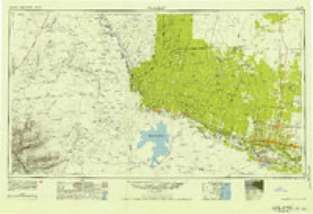
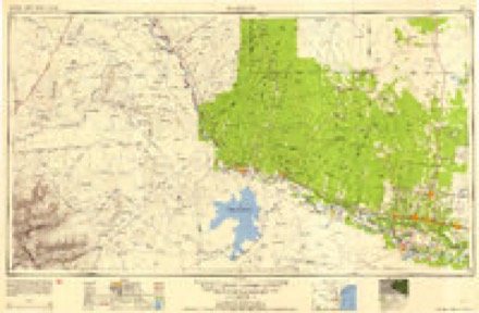
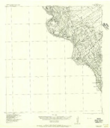
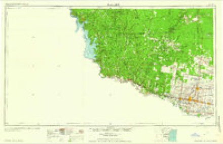
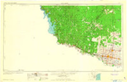
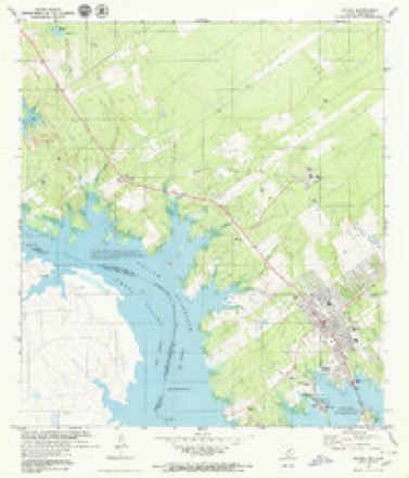
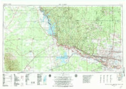
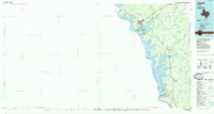
8 surveys from 10 printed sheetsMatched by testing this settlement's coordinate against the published boundary of every sheet in the United States Geological Survey's historical collection. Each opens the scanned sheet at the Survey.
- 1949 USGS Mc Allen quadrangle1:250000
- 1954 USGS McAllen quadrangle1:250000
- 1956 USGS Zapata quadrangle1:62500
- 1957 USGS Mc Allen quadrangle1:250000, 2 printings
- 1962 USGS McAllen quadrangle1:250000
- 1979 USGS Zapata quadrangle1:24000
- 1983 USGS Mc Allen quadrangle1:250000
- 1985 USGS Zapata quadrangle1:100000, 2 printings
Fires near this place
107 since 2005Regional context, not property-specific evidence. The federal wildfire occurrence database lists 107 fires within 5 miles of Zapata between 2005 and 2019, burning about 647 acres in total. 1 started naturally. None was recorded as arson. Distance is straight-line from the map coordinates, so a fire counted here may appear on a neighbouring settlement's page as well.
| Reported cause | Fires |
|---|---|
| Missing data/not specified/undetermined | 68 |
| Equipment and vehicle use | 16 |
| Misuse of fire by a minor | 8 |
| Debris and open burning | 8 |
| Power generation/transmission/distribution | 6 |
| Natural | 1 |
The most recent of them, most recent first, with the day each was reported and the service that recorded it.
| Date | Cause | Size | Reported by | Name on the report |
|---|---|---|---|---|
| 6 August 2009 | Missing data/not specified/undetermined | 1.0 acres | Texas A & M Forest Service | MEDINA/GRASS FIRE |
| 5 August 2016 | Equipment and vehicle use | 10 acres | Texas A & M Forest Service | GRASS FIRE |
| 3 August 2015 | Power generation/transmission/distribution | 1.0 acres | Texas A & M Forest Service | GRASS FIRE ACROSS LIBRARY |
| 3 August 2015 | Power generation/transmission/distribution | 1.0 acres | Texas A & M Forest Service | LINCOLN AND 10TH STREET |
| 3 August 2009 | Missing data/not specified/undetermined | 1.0 acres | Texas A & M Forest Service | MEDINA/GRASS FIRE |
| 23 August 2009 | Missing data/not specified/undetermined | 2.0 acres | Texas A & M Forest Service | SANTA MARIA GRASS FIRE |
| 19 August 2019 | Missing data/not specified/undetermined | 1.0 acres | Texas A & M Forest Service | PENA LN. VACANT LOT GRASS FIRE |
| 19 August 2015 | Power generation/transmission/distribution | 1.0 acres | Texas A & M Forest Service | ZAPATA CO WATER WORKS |
Settlements close enough to share some of these fires:
Storms near this place
60 of 61 shownRegional context, not property-specific evidence. The National Weather Service names Zapata in 61 storm reports between 1993 and 2022: 20 hail, 19 thunderstorm wind, 9 flash flood, 6 heavy rain. No death or injury is recorded in these reports. Each account below is quoted exactly as the forecast office filed it, from the NOAA Storm Events Database, and each date opens the federal record of that event.
| When | Event | Place named | Harm | What the report says |
|---|---|---|---|---|
| April 1993 | Hail | Zapata | $500,000 | Hail up baseball-size was reported in Zapata. Over 200 claims have been filed for damage to homes and cars. The hail penetrated metal awnings and damaged cactus plants in the area. |
| May 2022 | Flash Flood | Zapata | $300,000 | Video on social media shows several feet of fast moving water near Medina Street - a flood-prone area known as Medina Addition - with two SUVs that had been swept off the road and into a ditch. Video later shows the vehicles getting dragged out of the ditch by a tow truck. Based on the during and after videos, it is estimated that 3 to 4 feet of fast flowing water was moving across the road at the height of the flash flooding. Additional video shows people having to abandon homes during the height of the flooding and the water coming up to their waists, which supports the 3 to 4 foot estimates of fast moving water. A report of 8 of rain came in from just northwest of Zapata from this storm. The local newspaper in Zapata County later reported that at least 15 homes were affected with many of them losing their furniture, clothing, and household items. |
| May 2006 | Thunderstorm Wind | Zapata | $100,000 | Damaging winds associated with a severe thunderstorm completely blew a roof off of a medical clinic in Zapata. The winds also destroyed a mobile home and damaged canopies at a gas station. |
| May 2004 | Lightning | Zapata | $75,000 | A home burned to the ground after being struck by lightning. |
| May 2004 | Thunderstorm Wind | Zapata | $50,000 | A mobile home roof was reported to be blown off and a second mobile home suffered substantial damage. Branches were also twisted off several trees in the adjacent area. |
| May 2004 | Flash Flood | Zapata | $50,000 | Thunderstorms with very heavy rain produced flooding of streets in Zapata. Two cars were reported stranded in high water. |
| May 2002 | Tornado (F0) | Zapata | $25,000 | A brief tornado was reported by law enforcement officials in the city of Zapata. Several roofs were damaged with numerous reports of power outages. |
| March 2007 | Thunderstorm Wind | Zapata | $15,000 | Roof of a house was blown off onto electrical power lines in the community of Siesta Shores. |
| September 2003 | Flash Flood | Zapata | $15,000 | Heavy rains led to flash flooding of U.S. Highway 83 near Zapata, with arroyos adjacent to the roadway running full. Substantial flooding of roadways was also reported in the City of Zapata. |
| April 2007 | Thunderstorm Wind | Zapata | $10,000 | Laredo media reported roof damage to hardware store in Zapata. |
| April 2004 | Hail | Zapata | $10,000 | Chief of Zapata Police reported broken windshields on vehicles 2 miles east of State Highway 83 on FM road 2687. |
| August 1995 | Thunderstorm Wind | Zapata | $10,000 | Power lines were down and trees were damaged. |
| August 2016 | Lightning | Zapata | $7,500 | The Zapata County Emergency Manager also reported three lightning strikes to power poles in the Medina Addition, Siesta Shores, and in Falcon and a lightning strike to a gas tank in Aguilares. |
| August 2008 | Flash Flood | Zapata | $5,000 | Developing thunderstorms that initially affected Starr County during the late afternoon of the 22nd gradually spread north, generally along Federal Highway 83, helping to develop other torrential rains into western Zapata County. The Zapata fire department reported widespread flooding in the town of Zapata, ongoing at 730 PM CDT. There was likely additional road flooding along portions of Federal Highway 83 between the Falcon Dam area and Zapata, where some of the heavier rains developed, into the mid evening. |
| May 1995 | Thunderstorm Wind | Zapata | $5,000 | Trees and power lines down. |
| May 1997 | Thunderstorm Wind | Zapata | $5,000 | no account filed |
| May 2015 | Flash Flood | Zapata | $2,000 | Zapata County Sheriffs Office reported reported that a family on the north side of Zapata was evacuated due to water entering the home. |
| April 2009 | Hail | Zapata | $2,000 | Hail fell for more than 15 minutes near Zapata County during the mid evening. The Zapata County Emergency Management Coordinator received a report of quarter size hail in the Las Palmas subdivision, about 4 miles northeast of the City of Zapata. The Manager of the Zapata County Airport noted quarter size hail as well, which cause indentations in some vehicles' hoods. Some larger stones of unknown size were embedded with the quarter sized hail field. |
| June 2003 | Thunderstorm Wind | Zapata | $2,000 | Emergency management official reported minor damage to homes from thunderstorm winds. |
| September 1996 | Thunderstorm Wind | Zapata | $2,000 | no account filed |
| May 2015 | Thunderstorm Wind | Zapata | $1,000 | Zapata County Sheriffs Office reported a trampoline blown on top of power lines in Zapata. 40 mph gust reported at Zapata County Airport (Medina), approximately 6 miles north of the damage location. Event wind speed estimated based on proximity and no other corroborating damage. |
| April 2010 | Flash Flood | Zapata | $1,000 | The Chief of Police in the City of Zapata reported one and one half feet of water was flowing on Alamo St. and State Highway 16. The arroyo at Highway 16 and Carla Street overflowed its banks, with one and one half feet of water flowing over the road there as well. Heavy creek and arroyo flooding was also reported at the Manuel Medina Addition colonia, south of Zapata County Airport. |
| May 2022 | Flood | Zapata | - | Law enforcement reported minor street flooding due to very heavy rain near the Medina Subdivision near Zapata County High School. |
| May 2020 | Flood | Zapata | - | Minor flooding was reported in the Medina addition with arroyo overflowing on Guerrero Ave. between 4th and 7th St. up with up to 2 feet of flowing water depth. Time estimated via radar. |
| June 2020 | Flood | Zapata | - | As some isolated thunderstorms merged in northwestern Zapata County and slowly moved south-southwest, heavy rainfall caused some minor flooding. An Emergency Manager called to report ongoing minor street flooding with at least 1 foot of water depth at the intersection of Highway 16 and Alamo Street at 7:11 PM CDT. |
| May 2017 | Flash Flood | Zapata | - | Zapata County Sheriff's Office reported the Medina addition arroyo was flooded with water and there was flooding in the city of Zapata. Radar estimated 3 to 4 inches of rainfall. |
| May 2017 | Hail | Zapata | - | Public reported via social media quarter size hail in the city of Zapata. |
| April 2016 | Hail | Zapata | - | Zapata County Sheriff's Office relayed several reports of nickel to quarter sized hail falling across the city of Zapata. |
| March 2015 | Heavy Rain | Zapata | - | Zapata County EM reported 2.75 inches of rainfall. |
| May 2015 | Heavy Rain | Zapata | - | Zapata County Sheriffs Office reported flooding of the arroyos near the Medina Addition in Zapata, along with a foot of water on roadways. |
| May 2015 | Flash Flood | Zapata | - | Zapata County Sheriffs Office reported knee high water over the roads in the Medina addition and between Miraflores and Highway 83 in Zapata due to swollen arroyos. |
| November 2014 | Hail | Zapata | - | Zapata County EM reported hail to around ping pong ball size. |
| November 2014 | Thunderstorm Wind | Zapata | - | Zapata County EM reported several older houses had roofs partially removed, several metal buildings and trailers had roofs totally removed, a chain link fence was blow down, numerous trees and power lines were blown down through the city, and a large object blew off a construction site at the courthouse and damaged nearby objects. Wind speeds were estimated to be 65 to 70 mph. |
| February 2013 | Hail | Zapata | - | Trained Skywarn spotter reported golf ball size hail at the Zapata County Airport. |
| April 2012 | Hail | Zapata | - | Quarter sized hail reported by trained storm spotter in Zapata. |
| May 2012 | Heavy Rain | Zapata | - | Heavy rainfall of unknown amount caused minor flooding in the Medina Addition section of the City of Zapata. |
| September 2008 | Heavy Rain | Zapata | - | Torrential rains from two intense thunderstorms dropped an estimated 4 or more inches in north central Zapata County, generally in rural areas along and north of State Highway 16, bounded by Bustamente and Escobas on the east. As of this writing, no reports of flooding have been received. |
| May 2008 | Hail | Zapata | - | The public reported hail up to 1.75 inches was observed falling approximately 6 miles southeast of Zapata along US highway 83, as the supercell thunderstorm began edging toward Starr County. |
| April 2007 | Thunderstorm Wind | Zapata | - | A newspaper employee in Zapata reported trees with diameter of one foot toppled by estimated 60 mph wind. |
| March 2007 | Thunderstorm Wind | Zapata | - | Small trees reported down in the community of Siesta Shores. |
| May 2006 | Hail | Zapata | - | Large hail was reported at the Fandango Gas Plant. |
| May 2006 | Hail | Zapata | - | Large hail was reported by the Sheriff's Office in Zapata. |
| July 2005 | Tornado (F0) | Zapata | - | Short-lived tornado was relayed by Zapata County Sheriff's Office. Tornado occurred over open ranch land. No damage reported. |
| June 2003 | Thunderstorm Wind | Zapata | - | Emergency management coordinator reported wind damage from very strong thunderstorms. The coordinator reported medium sized trees uprooted, sheet metal blown off roofs, and the covering of a little league bleacher destroyed. |
| May 2002 | Hail | Zapata | - | .88 inch hail reported by law enforcement officials |
| May 2001 | Hail | Zapata | - | Dime size hail was reported by the public along Highway 2687. |
| June 2001 | Flash Flood | Zapata | - | The Zapata County Sheriff reported that U.S. Highway 83 was flooded from the city of Zapata to San Ygnacio, and along State Highway 16 from the city of Zapata to Bustamante. |
| June 2001 | Thunderstorm Wind | Zapata | - | Numerous shingles were blown off a home. |
| July 2000 | Thunderstorm Wind | Zapata | - | The roof was torn off of a school that was under construction. |
| June 1995 | Thunderstorm Wind | Zapata | - | Large tree limbs broken. |
| July 1994 | Thunderstorm Wind | Zapata | - | The Zapata Fire Department reported very heavy rain, dime-sized hail, and winds estimated at 50 to 60 miles an hour. |
| July 1994 | Hail | Zapata | - | The Zapata Fire Department reported very heavy rain, dime-sized hail, and winds estimated at 50 to 60 miles an hour. |
| April 1993 | Hail | Zapata | - | The Department of Public Safety reported golf ball-size hail in Zapata. |
| March 2007 | Hail | Zapata | - | no account filed |
| May 2005 | Hail | Zapata | - | no account filed |
| April 2003 | Hail | Zapata | - | no account filed |
| June 2001 | Thunderstorm Wind | Zapata | - | no account filed |
| February 1998 | Hail | Zapata | - | no account filed |
| September 1996 | Hail | Zapata | - | no account filed |
| August 1996 | Heavy Rain | Zapata | - | no account filed |
Nearest settlements
The eight closest, with where each one stands in the county. Distances are straight-line, computed from the Geographic Names Information System coordinates.
| Map | Place | Distance | Sheets |
|---|---|---|---|
| A F Pierce Colonia | 0.3 miles | 10 | |
| Guzman Colonia | 0.4 miles | 10 | |
| Flores Addition Colonia | 0.6 miles | 10 | |
| Ranchito San Jose Colonia | 1.0 miles | 10 | |
| Buena Vista Colonia | 1.1 miles | 10 | |
| Medina | 1.1 miles | 10 | |
| Manuel Medina Addition Colonia | 1.2 miles | 10 | |
| Falcon Estates Colonia | 1.2 miles | 10 |
Elsewhere
Matched on this settlement's Geographic Names Information System number rather than its name, so it cannot be a different place of the same name in another state.
| Wikipedia article on Zapata | An encyclopaedic summary. Its text is share-alike, so it is linked here rather than copied. |
| Wikidata item Q967558 | The structured record the population and elevation above come from. Public domain (CC0). |
Provenance
This settlement is recorded in the Geographic Names Information System as feature 1350720. The sheet list is computed by point-in-boundary test against the United States Geological Survey's historical topographic inventory. Both are works of the United States government and carry no copyright under 17 U.S.C. 105.
Wildfire. Short, Karen C. 2022. Spatial wildfire occurrence data for the United States, 1992-2020 [FPA_FOD_20221014]. 6th Edition. Fort Collins, CO: Forest Service Research Data Archive. https://doi.org/10.2737/RDS-2013-0009.6 Collected with United States Government funding and usable without additional permissions or fees.
Storms. NOAA National Centers for Environmental Information, Storm Events Database https://www.ncei.noaa.gov/stormevents/ A work of the United States government, no copyright under 17 U.S.C. 105. Narratives are quoted verbatim from the National Weather Service report and are not edited or summarised.