 Block
BlockFrom the record
One of 6 National Register listings published here for Lampasas County · listed in 2004 · category: District.
Sources: the case file at the National Archives · the National Register database, National Park Service
Listed on the National Register of Historic Places in 2004.
One of 6 National Register listings published here for Lampasas County · listed in 2004 · category: District.
Sources: the case file at the National Archives · the National Register database, National Park Service
Regional context, not property-specific evidence. The federal wildfire occurrence database lists 32 fires within 5 miles of Lampasas Downtown Historic District between 2006 and 2020, burning about 694 acres in total. None started naturally. 2 were recorded as arson. Distance is straight-line from the map coordinates, so a fire counted here may appear on a neighbouring settlement's page as well.
| Reported cause | Fires |
|---|---|
| Debris and open burning | 15 |
| Missing data/not specified/undetermined | 11 |
| Equipment and vehicle use | 4 |
| Arson/incendiarism | 2 |
The most recent of them, most recent first, with the day each was reported and the service that recorded it.
| Date | Cause | Size | Reported by | Name on the report |
|---|---|---|---|---|
| 29 September 2010 | Debris and open burning | 10 acres | Texas A & M Forest Service | HIGHWAY 281 NORTH |
| 28 September 2010 | Debris and open burning | 5.0 acres | Texas A & M Forest Service | LOMETA FIRE |
| 28 September 2006 | Missing data/not specified/undetermined | 30 acres | Texas A & M Forest Service | not named |
| 9 August 2020 | Missing data/not specified/undetermined | 10 acres | Texas A & M Forest Service | 4383 N HWY 281 |
| 8 August 2011 | Missing data/not specified/undetermined | 100 acres | Texas A & M Forest Service | HWY 963 (11-0090) |
| 3 August 2011 | Arson/incendiarism | 25 acres | Texas A & M Forest Service | KEMPNER FIRE |
| 3 August 2008 | Missing data/not specified/undetermined | 100 acres | Texas A & M Forest Service | STIFFEMIRE |
| 19 August 2020 | Missing data/not specified/undetermined | 200 acres | Texas A & M Forest Service | 800 CR 1715 |
Regional context, not property-specific evidence. The federal mineral resources record lists 10 workings within 5 miles of Lampasas Downtown Historic District: 9 producers, 1 past producer. 9 still produce. What was taken out: Stone, Crushed/Broken, Stone, Crushed/Broken, Sand and Gravel, Construction, Sand and Gravel, Construction, Silica. Distance is straight-line from the map coordinates, so a quarry counted here may appear on a neighbouring settlement's page as well.
| Where | Site | Commodity | Status | Recorded |
|---|---|---|---|---|
| Milwhite Quarry | Silica | Past Producer | Tripoli | |
| Road Material Pit | Sand and Gravel, Construction, Stone, Crushed/Broken | Producer | Sedimentary | |
| Lampasas Pit | Sand and Gravel, Construction | Producer | ||
| Lampasas Quarry | Sand and Gravel, Construction | Producer | Sedimentary | |
| Road Material Pit | Stone, Crushed/Broken, Sand and Gravel, Construction | Producer | Sedimentary | |
| Road Material Pit | Stone, Crushed/Broken, Sand and Gravel, Construction | Producer | Sedimentary | |
| Road Material Pit | Stone, Crushed/Broken | Producer | Caliche | |
| Road Material Pit | Stone, Crushed/Broken | Producer | Sedimentary | |
| Road Material Pit | Stone, Crushed/Broken | Producer | Caliche | |
| Road Material Pit | Stone, Crushed/Broken | Producer | Caliche |
Regional context, not property-specific evidence. The National Weather Service names Lampasas, the town this property stands in, in 73 storm reports between 1993 and 2024: 32 hail, 24 thunderstorm wind, 12 flash flood, 2 tornado. No death or injury is recorded in these reports. Each account below is quoted exactly as the forecast office filed it, from the NOAA Storm Events Database, and each date opens the federal record of that event.
| When | Event | Place named | Harm | What the report says |
|---|---|---|---|---|
| April 2016 | Flood | Lampasas | $300,000 | Late newspaper reports indicated emergency personnel rescued nine people for high water after several residences were flooded by rain and heavy rain over the past few days. Approximately nine people were pulled from the flood waters. Water forced at least five additional persons to be displaced due to the flood. |
| May 2007 | Flash Flood | Lampasas | $300,000 | Flooding was reported along Highways 183 and 190 near the city. Water was as high as four feet on Highway 183. Evacuations were required near Mesquite Creek. Numerous low water crossings were barricaded. About twenty apartments and several homes were damaged by high water and deemed unihabitable. Many of the residents lost most of their possessions. In addition, the School Creek Bridge was washed away, with the road closed indefinitely. |
| March 2010 | Thunderstorm Wind | Lampasas | $175,000 | A building on Highway 190 E, east of Lampasas, was heavily damaged by high winds. The building suffered partial roof loss and partially collapsed walls. Seven units at a nearby storage facility were also damaged by 2x6 timbers and debris from the building. Timbers were also driven into a nearby double-wide mobile home, and a window was broken out at the residence. Some timbers were sticking up out of the ground around the residence. One 50-60' tall elm tree near the home was snapped in half and fell on a car. Only minor dents were sustained to the car. Also nearby, a fireworks stand was destroyed. |
| March 2010 | Thunderstorm Wind | Lampasas | $75,000 | A 60 foot tall oak tree was uprooted and crashed into a residence on 4th street in Lampasas. The house was significantly damaged. Also in Lampasas, the roof was blown off a portable building at the Lampasas Middle School. |
| May 2008 | Thunderstorm Wind | Lampasas | $75,000 | Trees were blown over and uprooted and roofs and fences were damaged. |
| April 2016 | Hail | Lampasas | $50,000 | Golf ball sized hail fell in the city of Lampasas. |
| March 2007 | Flash Flood | Lampasas | $50,000 | Numerous roads including Highway 190 was closed with water over it. A swift water rescue was required when a woman and two toddlers were trapped with waist-high water in the house. Severals cars and trucks were stranded and the occupants needed rescuing. |
| June 2015 | Heavy Rain | Lampasas | $30,000 | Rain slick roads contributed to the crash of a school bus at U.S. Highway 281 and U.S. Highway 190 in Lampasas. No one was injured. |
| May 2014 | Thunderstorm Wind | Lampasas | $30,000 | A roof was blown off a house to the east of Lampasas. Trees were also uprooted and power lines were knocked down. |
| June 2004 | Thunderstorm Wind | Lampasas | $30,000 | There was heavy damage to Builders Mart and a brick wall was blown down onto a late model vehicle. Trees were blown down on CR 2001 on the west side of Lampasas and near Adamsville. |
| June 2009 | Thunderstorm Wind | Lampasas | $25,000 | A manufactured home on CR 3430 suffered significant damage from straightline winds. Part of the metal roof was peeled back and removed, but the ceiling beams were still in tact. The inside was exposed and damaged by incoming rain. |
| March 2004 | Thunderstorm Wind | Lampasas | $25,000 | A Taco Bell sign was destroyed, the sheet metal roof of a funeral home was peeled back, a plate glass window was blown out, and numerous trees were uprooted. The weathernet site has a wind gust to 58 miles an hour. |
| August 2007 | Thunderstorm Wind | Lampasas | $20,000 | Tree and minor roof damage was reported. Time estimated. |
| June 2019 | Thunderstorm Wind | Lampasas | $10,000 | A county official reported a tree being blown onto a house and multiple power lines down in the eastern part of the city of Lampasas, TX. |
| April 2016 | Thunderstorm Wind | Lampasas | $10,000 | Lampasas Sheriff's Department reported numerous trees and power lines down, causing several road blocks and power outages in the city. |
| June 2009 | Hail | Lampasas | $10,000 | Baseball size hail fell along Highway 281 4 miles north of Lampasas. |
| June 2009 | Hail | Lampasas | $10,000 | Baseball size hail fell 3 miles east of Lampasas. |
| May 2008 | Hail | Lampasas | $10,000 | Golfball-size hail was reported at the sheriff's office. |
| April 2018 | Hail | Lampasas | $5,000 | A social media picture indicated golf-ball sized hail off the north end of the runway at Lampasas Airport. |
| July 2008 | Lightning | Lampasas | $5,000 | Lightning struck an oak tree in a driveway, busting some of the concrete and exposing steel rebar. |
| May 2007 | Flash Flood | Lampasas | $5,000 | Cars were stranded in high water downtown. |
| April 2006 | Hail | Lampasas | $5,000 | Golf ball-size hail reported in town. |
| May 2006 | Hail | Lampasas | $5,000 | no account filed |
| January 2020 | Hail | Lampasas | $3,000 | no account filed |
| February 2009 | Thunderstorm Wind | Lampasas | $2,000 | Large limbs were knocked down and trees were uprooted in the city of Lampasas. |
| June 2009 | Flash Flood | Lampasas | $2,000 | Roads throughout the city of Lampasas were being barricaded. |
| November 2000 | Thunderstorm Wind | Lampasas | $2,000 | The roof of a barn was blown off and trees were blown down by high thunderstorm winds. |
| April 1997 | Thunderstorm Wind | Lampasas | $2,000 | Power lines were blown down by high winds. |
| April 1997 | Thunderstorm Wind | Lampasas | $2,000 | Power lines were blown down by high winds. |
| May 2005 | Thunderstorm Wind | Lampasas | $1,000 | Power lines knocked down. |
| April 1998 | Thunderstorm Wind | Lampasas | $1,000 | Powerlines were damaged by high winds. |
| May 2024 | Hail | Lampasas | - | Trained spotter reported nickel hail in Lampasas. |
| April 2023 | Hail | Lampasas | - | Amateur radio reported quarter sized hail on the east side of Lampasas, TX. |
| November 2022 | Hail | Lampasas | - | Quarter to half-dollar sized hail was reported in Lampasas. |
| March 2018 | Hail | Lampasas | - | A trained spotter reported quarter-sized hail approximately one mile south of the city of Lampasas, TX along Highway 281. |
| May 2017 | Thunderstorm Wind | Lampasas | - | Lampasas PD reported several trees down in the city of Lampasas, TX. |
| April 2014 | Hail | Lampasas | - | Broadcast media reported quarter sized hail in Lampasas. |
| January 2010 | Flash Flood | Lampasas | - | Roads were barricaded around Sulphur Creek due to a rapid rise in water. |
| October 2009 | Thunderstorm Wind | Lampasas | - | A 60 mph wind gust was estimated 12 miles east of Lampasas. |
| May 2008 | Thunderstorm Wind | Lampasas | - | A 70 MPH wind gust was measured by amateur radio operators. |
| June 2007 | Flash Flood | Lampasas | - | Several county and secondary roads flooded. |
| March 2007 | Flash Flood | Lampasas | - | Continued flooding and barricading of a few secondary roads. |
| June 2005 | Hail | Lampasas | - | Golf ball size hail reported just west of Lampasas. |
| July 2005 | Flash Flood | Lampasas | - | Several roads flooded and closed off in and around Lampasas. Cars were stranded in the flood waters. |
| June 2004 | Flash Flood | Lampasas | - | Roads were closed between highwat 190 and Highway 281. More flooding was reported south of Highwat 190 and west of Lampasas. |
| November 2004 | Flash Flood | Lampasas | - | Little Lucy Creek was flooding. High water was over east FM 581 and County Road 3500. Numerous county roads and low water crossings around Lampasas were flooded. |
| March 2002 | Thunderstorm Wind | Lampasas | - | A wind gust to 69 miles an hour occurred at the Lampasas High School. |
| February 2000 | Tornado (F0) | Lampasas | - | A brief tornado occurred at the Flying L Ranch, but no damaged was reported. |
| May 2000 | Thunderstorm Wind | Lampasas | - | Large trees were blown down by high thunderstorm wind. |
| May 1993 | Hail | Lampasas | - | Quarter-size hail was reported the northern part of the County, by a TV-Weather Watcher. |
| October 1993 | Tornado (F0) | Lampasas | - | The Department of Public Safety reported a tornado in the northern part of the County. |
| May 2021 | Hail | Lampasas | - | no account filed |
| March 2014 | Hail | Lampasas | - | no account filed |
| May 2007 | Hail | Lampasas | - | no account filed |
| May 2006 | Hail | Lampasas | - | no account filed |
| April 2006 | Hail | Lampasas | - | no account filed |
| April 2006 | Hail | Lampasas | - | no account filed |
| April 2006 | Thunderstorm Wind | Lampasas | - | no account filed |
| May 2002 | Hail | Lampasas | - | no account filed |
| March 2000 | Hail | Lampasas | - | no account filed |
No historic map-sheet match is published for this property yet. That does not mean no map exists. This record needs a coordinate-quality review before it can be joined to a sheet boundary. Browse the county's mapped places while that work is pending.
Other National Register properties close enough to walk or drive between, ordered by distance from this one. Both positions come from the same geocoding pass that matched these properties to their map sheets.
| Photograph | Property | Distance | Listed |
|---|---|---|---|
 | Phillips and Trosper Buildings | 0.1 miles | 1987 |
 | Markward Homestead | 1.3 miles | 2016 |
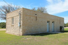 | Lampasas Colored School | 5.2 miles | 2002 |
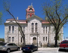 | Lampasas County Courthouse | 7.3 miles | 1971 |
| National Archives record | The nomination case file for reference 03001540 in Record Group 79. |
| Lampasas County | All 6 listed properties in this county. |