| May 2010 | Flash Flood | Midland | 1 killed, 1 hurt, $175,000 | At 13:46 pm CST, local law enforcement reported that a car had been swept into the Scharbauer Draw near Jackson Street and Scharbauer Drive. When emergency officials arrived on the scene, they were unable to locate the car. Later that evening, a wrecker service was removing the reemerged car from the water when they found the body of a female driver inside. Numerous cars were submerged throughout Midland, and several high water rescues were executed. The police received over 92 submerged vehicle reports, although some may have been repeats. The monetary damage for this event was estimated based on the number of vehicles observed under water. |
| July 2017 | Lightning | Midland | 1 killed | A thunderstorm with frequent lightning developed across Midland County and moved across the City of Midland. A 43 year old man was struck by lightning at the 300 block of Maple Avenue and was later declared dead at the hospital. |
| April 2009 | Hail | Midland | 1 hurt, $161,200,000 | Numerous roofs throughout Midland, TX were damaged during this event. A local newspaper clipping with a quote from a major roofing company estimated 40 to 50 percent of the homes in Midland needed to be re-roofed. The average cost to replace a shingled roof is anywhere from $8-$10K. This resulted in an estimated $160 million in roof damage. In addition to homes being damaged, multiple vehicles also received damage from the hail. According to local dent repair shops and car dealers across the area, an estimated 800 vehicles had to be repaired resulting in $1.2 million in damage. A Midland woman was also struck in the stomach by a hail stone, after it broke through her dining room window. Her injuries were only minor and did not require medical attention. |
| April 1999 | Hail | Midland | $8,000,000 | no account filed |
| April 1999 | Thunderstorm Wind | Midland | $3,000,000 | no account filed |
| September 1995 | Hail | Midland | $2,500,000 | A classic supercell thunderstorm moved into northwestern Andrews County after dropping large hail and causing strong winds in Southeast New Mexico. Winds up to 70 mph and golf ball-size hail were reported as the storm moved southeast across parts of the Permian Basin. The storm tracked across Andrews County where power lines were downed southwest of Andrews. The storm moved through the northeast corner of Ector County then into northwestern Midland County making a beeline for Midland. Golf ball-size hail was reported in the western parts of Midland damaging roofs and autos. Just south of Interstate 20 windows were broken at houses as the storm passed through that area. |
| September 2012 | Flash Flood | Midland | $1,500,000 | Heavy rain developed and moved over Midland County and produced widespread flooding in the City of Midland. There were numerous reports of stalled vehicles and about 120 water rescues among Midland and Odessa. Some vehicles were reported to be fully submerged. The cost of damage for the flooding in Midland is estimated to be around one and a half million dollars which is a very rough estimate. There were no injuries reported. |
| May 1994 | Thunderstorm Wind | Midland | $500,000 | no account filed |
| May 1994 | Hail | Midland | $500,000 | no account filed |
| April 1993 | Hail | Midland | $500,000 | no account filed |
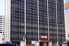
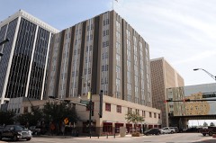
| June 2009 | Thunderstorm Wind | Midland | $450,000 | Damage was done to a 24 story building near downtown Midland, TX. Large wood panels, each weighing between 200 to 300 pounds 4'x4'x1', were torn off the outside of the structure near the 6th and 7th floors. This has required the building to be re-engineered, with the removal of an additional 150 panels from the structure. The time of this report was estimated. |
| July 2002 | Thunderstorm Wind | Midland | $250,000 | no account filed |
| September 2024 | Flash Flood | Midland | $200,000 | The fire department reports that 41 high-water rescues were conducted around Midland over the course of the afternoon. The property damage cost is an estimation. |
| June 2021 | Flash Flood | Midland | $200,000 | Heavy rain resulted in flash flooding in Midland. First responders performed 20 water rescues in Midland between 6/26 and 6/28 across multiple flash flood events. The cost of damage is a very rough estimate. |
| October 2004 | Heavy Rain | Midland | $200,000 | According to local newspaper accounts, very heavy rainfall associated with a complex of strong thunderstorms late on the 5th and early on the 6th caused damage to structures in Midland. Several business and homes suffered minor roof damage when water accumulated on flat-roof surfaces. Water entered the structures through the compromised roofs and caused significant interior damage. One local resident interviewed in the newspaper reported damage to both her home and place of employment. |
| July 2025 | Flash Flood | Midland | $175,000 | Emergency management reported 21 vehicles stalled in high water due to flash flooding across various portions of Midland, TX. The time of occurrence is estimated by radar. The total cost of damages is also estimated. |
| June 2014 | Thunderstorm Wind | Midland | $170,000 | A thunderstorm moved across Midland County and produced wind damage in Midland. Eleven travel trailers were blown over in northwest Midland. The cost of damage is a very rough estimate. |
| August 2002 | Thunderstorm Wind | Midland | $150,000 | A damaging microburst occured in the northern portions of the city of Midland. High winds up to 70 MPH resulted in numerous large trees being blown down...damage to fences...and business signs. The most significant damage was centered near the intersection of Loop 250 and Garfield Street... however... windows were broken by the high winds as far west as Midkiff Street. Power lines were also blown down...resulting in power outages. One power line landed on a vehicle. No injuries were reported. |
| August 2007 | Flash Flood | Midland | $125,000 | Law enforcement and fire department officals responded to 25 high water rescues, as several vehicles were submerged or washed off the road throughout the city of Midland. These events took place at the intersections of Illinois and Stonybrook, Texas State Highway 191 and Loop 250, and Midland Drive and Wall Street. |
| June 2025 | Flash Flood | Midland | $100,000 | Five vehicles were reported stalled in high water due to flash flooding across various locations in Midland. The duration of these incidents is an estimation. The property damage cost is an estimation. |
| July 2016 | Thunderstorm Wind | Midland | $100,000 | A thunderstorm moved across Midland County and produced a microburst in the City of Midland. The American Red Cross Permian Basin performed a preliminary damage assessment. In addition to damage to a number of businesses along Wall Street; the American Red Cross found 28 homes that had damage from the microburst. The wind speed is an estimate and the cost of damage is a very rough estimate. |
| August 2005 | Flash Flood | Midland | $100,000 | The public reported flash flooding in the city of Midland, along the Loop 250 service road. An off-duty National Weather Service meteorologist reported that a car was stranded in high water at the intersection of Bluebird and Midkiff Streets in Midland. Flooding was reported by the sheriff's office on Wadley Avenue, Loop 250, Texas Highway 191, A Street, Cuthbert, Andrews Highway, and I Street. Many cars were submerged, leaving their occupants stranded. Nineteen high water rescues were reported by the Midland Fire Department. The broadcast media reported two to three feet of water flowing across the intersection of Garfield and Golf Course Road, where eight additional rescues were conducted by media personnel and the public. Several streets around Midland were barricaded including County Road 1150 between Texas Highways 158 and 307. |
| June 2004 | Flash Flood | Midland | $100,000 | Flooding of city streets was widespread across the city of Midland as a severe thunderstorm tracked across the area. Between two and four feet of water rushed down Midland and Wadley Drives. At least four vehicles were submerged. Cars were also stranded in high water near the intersection of Briarwood and Oriole in the northwestern parts of the city. Portions of Illinois Street, Midkiff, and U.S. Highway 80 were also inundated by flood waters. A total of fifty-three high water rescues were conducted by the Midland Fire Department during the storm. A one year-old child was abandoned in the car seat of a stranded vehicle and had to be rescued by fire officials. Despite the magnitude of the flooding, no injuries were reported thanks to the work of local emergency workers. |
| September 2004 | Flash Flood | Midland | $100,000 | Storm spotters, law enforcement officials, and the local media reported several instances of flash flooding across Midland. At 10:00 CST Texas Department of Public Safety troopers and Midland Fire Department personnel rescued a woman and three children from a vehicle submerged in three feet of water near the intersection of West Industrial Avenue and South Midland Drive.Shortly before 10:30 CST rescue crews assisted stranded motorists on Illinois Avenue and at the intersection of Midkiff Road and Wadley Avenue. At 11:00 CST an elderly driver was rescued from a vehicle submerged in six feet of flowing water near Midland College. Flood waters reportedly covered the trunk and hood of the sports utility vehicle and entered the cab. Fire crews anchored a safety line across Wadley Avenue to reach the distressed motorist. In addition, over a foot of water covered the Loop 250 access road between Thomason and State Highway 191 near Grandecom Stadium. Over two feet of water covered the Interstate 20 access road at the intersection of Farm to Market Road 1130. Two traffic accidents on Interstate 20 in Midland were indirectly related to the wet weather when cars lost control on the wet pavement. One such accident resulted in an injured motorist. No injuries or fatalities resulted from the flash flooding. |
| August 2002 | Lightning | Midland | $100,000 | Lightning struck building 11 at the Polo Park Apartment complex in north Midland. The building was fully engulfed in flames within thirty minutes. All residents were evacuated and no injuries were reported. |
| September 2002 | Thunderstorm Wind | Midland | $100,000 | Damaging thunderstorm winds were reported from the city of Midland to Greenwood. A total of nineteen power poles were blown down by the winds. The hardest hit areas were near Greenwood, where a NWS damage survey indicated that several weakly constructed homes received minor roof damage, along with one business. In addition, windows were blown out of seven vehicles in a church parking lot. No injuries were reported. |
| September 2018 | Flash Flood | Midland | $80,000 | Heavy rain fell across Midland County and produced flash flooding in the City of Midland. There were numerous road closures and stalled vehicles reported throughout the City of Midland. The cost of damage is a very rough estimate. |
| May 2003 | Thunderstorm Wind | Midland | $80,000 | Many reports of severe and damaging winds were received across the northwest part of Midland after a downburst was observed visually and on radar by meteorologists on duty at WFO Midland. Estimates in the city of Midland indicate 70 to 80 MPH winds. Damage reports which were received included barns destoryed and power poles blown down. |
| June 2008 | Thunderstorm Wind | Midland | $70,000 | On Tuesday morning, the National Weather Service in Midland conducted a damage survey of areas within the city of Midland affected by a heat burst. The damage survey focused on locations at and around the intersection of Loop 250 and Midland Drive, in northwest portions of the city of Midland. Between Briarwood and Navarro Avenues along Midland Drive, 13 power poles were damaged to varying degees. A 62 mph wind was reported at Midland Airpark on the 11:25 pm CDT observation. However, damage to wooden poles along Midland Drive was indicative of winds in the 80 to 100 mph range. |
| June 2021 | Flash Flood | Midland | $50,000 | Heavy rain resulted in flash flooding near Midland. There was water up to the doors of houses and stranded SUVs at Cotton Flat Road just south of I-20. The cost of damage is a very rough estimate. |
| August 2018 | Flash Flood | Midland | $50,000 | Heavy rain moved across Midland County and produced flash flooding in the City of Midland. Lots of streets in Midland were reported to be flooded with numerous stalled vehicles. Some of the flooded streets included Wadley, Garfield, and by the Midland Park Mall. The cost of damage is a very rough estimate. |
| June 2017 | Thunderstorm Wind | Midland | $50,000 | A thunderstorm moved across Midland County and produced wind damage in the City of Midland. The damage includes a tree that fell on top of some vehicles at an apartment complex, a tree fell on top of some power lines, a trampoline was blown into some powerlines, the foul pole at the local baseball stadium was damaged, and a power pole was blown down on top of a house. The cost of damage is a very rough estimate. |
| May 2006 | Thunderstorm Wind | Midland | $50,000 | Thunderstorm winds blew down at least nine power poles near the intersection of Farm to Market Roads 1788 and 3503. They also blew out the windows in a house north of Greenwood. |
| November 2004 | Flash Flood | Midland | $50,000 | Numerous reports of flash flooding along streets in Midland were received during the afternoon hours. Initial reports indicated that high water flowing over Carver and Scharbauer Streets prompted officials to deploy barricade. By 14:00 CST at least one vehicle was reported to be stalled in high water on an Interstate 20 access road. At 14:15 CST the local broadcast media reported up to eight inches of water flowing through Old Lamesa Road and Florida Street. The Texas Department of Public Safety additionally reported that several traffic accidents were indirectly related to the flooding and wet conditions, when several vehicles hydroplaned off of Interstate 20 and came to rest in the ditch. No injuries were reported. |
| June 1998 | Hail | Midland | $50,000 | The initial storm of this event developed along the dry line, near the Ector/Crane County line. The storm developed rapidly and was a single cell storm for much of its life. The storm intensified as it moved into the western part of Midland where golfball size hail fell briefly damaging vehicles and a few roofs. |
| May 1994 | Thunderstorm Wind | Midland | $50,000 | no account filed |
| August 2006 | Thunderstorm Wind | Midland | $43,000 | Severe thunderstorm wind gusts downed trees around the intersection of Louisiana and Midkiff. These tree trunks were reportedly 12-16 inches in diameter. One tree landed on a car. A 300 pound tent structure that was bolted to the ground was blown off its foundation. A few blocks away a storage shed was blown into a cinder block fence. The top portion of the fence was destroyed and the shed blew about 200 yards. A wooden fence also was blown down about a block away. In addition, tree branches were blown down, including two and a half to three inch diameter elm branches and one and a half inch pecan and cottonwood branches. A thrift store just off Business 20 in southeastern Midland (just less than a mile from previous reports) also was damaged by the thunderstorm winds. According to news reports, an estimated 15,000 pounds of roof was blown off the structure and into an empty yard just north of the building. Accompanying rain ruined many items in the store after the roof was blown off. Several days of rain following this event made more items unsalvageable as tarps covering the damaged portion of the roof became waterlogged. |
| June 2025 | Thunderstorm Wind | Midland | $40,000 | Midland County Emergency Manager reports approximately 17 power poles down near SCR 1200 and WCR 125 and along Rankin Highway south of WCR 140. This is all in the Cotton Flat area due to multiple microbursts in the area. Time is estimated from radar. Wind speeds were estimated to have been approximately 80 MPH. The property damage cost is an estimation. |
| June 2025 | Flash Flood | Midland | $40,000 | Emergency manager reported two vehicles stalled in high water due to street flooding in southeast Midland. The duration of the flooding is an estimation. The property damage cost is also an estimation. |
| August 2005 | Flash Flood | Midland | $40,000 | The broadcast media reported that Midland county road 1150 was barricaded between Farm to Market Road 307 and Texas Highway 158 because of flash flooding. Also, water was entering a home on Texas Highway 349 and Midland County Road 1379 south of Midland. Three feet of water was running across Texas Highway 349, 15 miles south of Midland. Law enforcement officials reported flash flooding on Midland County Road 1160 between Farm to Market Road 1213 and Midland County Road 300. The public reported Farm to Market Road 1379 was flooded from Texas Highway 158 south of Spraberry. |
| May 2024 | Thunderstorm Wind | Midland | $35,000 | Report of damage to a DK Gas Station canopy at Midland Dr. and Andrews Highway. Time is estimated from radar. Wind speed and property damage cost are estimations. |
| May 2019 | Flash Flood | Midland | $30,000 | Heavy rain moved across Midland County and produced flash flooding in the City of Midland. Midland County Sheriff reported numerous stalled vehicles due to flooding across the City of Midland. The cost of damage is a very rough estimate. |
| October 2013 | Flash Flood | Midland | $30,000 | Heavy rain moved across Midland County and produced flash flooding in Midland. Some cars were reported to be flooded and there was flooding reported in some homes. The cost of damage is a very rough estimate since the number of cars and homes affected is unknown and the extent of the damage is unknown. |
| May 1997 | Hail | Midland | $30,000 | no account filed |
| July 2009 | Flash Flood | Midland | $25,000 | There were numerous reports of flooding from multiple sources, but most were confirmed by the media. At 515 AM CST, the Midland Police Department reported a few stalled vehicles across the city limits. Three minutes later, a high water rescue was reported at the intersection of Lee and Maple. At 635 AM CST, the media reported flash flooding along the Scharbauer Draw in residential areas. The police department then reported two more cars were submerged in the city of Midland, at 717 AM CST. One foot of flowing water was present near the intersection of Golf Course and Garfield. Finally, at 1001 AM CST, the media still continued to report areas of high water across Midland. |
| June 2004 | Flash Flood | Midland | $25,000 | The thunderstorm that produced flooding rainfall over Odessa continued moving east across northwest Midland County. Frontage roads along Business Interstate 20 flooded near the Midland and Ector County line. In the city of Midland, over four feet of water ran down Midland and Wadley Drives and resulted in several stalled out vehicles. Over a foot of water covered several roads near the fairgrounds on the east side of the city. No injuries were reported. |
| June 2003 | Hail | Midland | $25,000 | Numerous reports of large hail ranging in size from quarters to golfballs were received from the north and east sides of the city of Midland. The swath of hail generally stretched east and southeast from the Wal-Mart store at Midland Drive and Loop 250 in Midland to Greenwood. No reports of significant damage were received, however, minor damage to vehicles and roofs likely occurred. |
| September 2024 | Flash Flood | Midland | $20,000 | A video shows significant water over Industrial Ave. in south Midland, with at least one stranded vehicle. The property damage cost is an estimation. |
| September 2018 | Flash Flood | Midland | $20,000 | Heavy rain fell across Midland County and produced flash flooding in the City of Midland. Multiple vehicles were stranded at various intersections along Wadley Avenue. The cost of damage is a very rough estimate. |
| June 2017 | Thunderstorm Wind | Midland | $20,000 | A thunderstorm moved across Midland County and produced wind damage in the City of Midland. The thunderstorm winds damaged the roof of a dorm at Midland College, and there was roof damage at a restaurant near TX-158 and W. Louisiana Avenue in Midland. The thunderstorm winds also snapped a power pole and uprooted trees. The cost of damage is a very rough estimate. |
| July 2017 | Flash Flood | Midland | $20,000 | Heavy rain fell across Midland County and produced flash flooding across the City of Midland. There were at least 14 high water rescues reported by law enforcement and emergency management. The cost of damage is a very rough estimate. |
| July 2009 | Flash Flood | Midland | $20,000 | There were multiple reports of flash flooding, mainly across western Midland County. Flash flooding was first reported on Loop 250 and the adjacent access roads between Tremont and Holiday Hill Roads at 1138 PM CST, where there was 6 inches of flowing water present. The next location of flooding was reported at the intersection of Andrews Highway and Midland Drive at 1141 PM CST. Cars were also stranded at the intersection of Andrews Highway and Idlewild Road at 1146 PM CST. Finally, substantial flooding was reported by TEXDOT at 1152 PM CST and likely continued for another 30 minutes before the storm weakened. |
| May 2007 | Flash Flood | Midland | $20,000 | Many streets flooded in Midland, including: Garden City Highway and Business 20 access road. A car was submerged at the intersection of A street and Neely. There were also cars submerged at the intersection of Business 20 and Farm to Market Road 1788 and on Wadley Avenue. The underpass at Loop 250 and Texas Highway 191 was also submerged and impassable. Six to eight inches of water covered the intersection of Farm to Market roads 307 and 1379. |
| July 2006 | Flash Flood | Midland | $20,000 | Flash flooding was reported in several locations across Midland. At the intersection of Farm to Market Road 1788 and Interstate 20, 8-12 inches of water was flowing. Police officers could not pass through the 1300 block of Castleford, while at other locations along Castleford, including its intersection with Garfield, up to 8 inches of water flowed over the road. Several vehicles had stalled in high water along Wadley Avenue. |
| September 2004 | Flash Flood | Midland | $20,000 | At 08:30 CST running water was reported flowing over the intersection of Loop 250 and Business Interstate 20. The local media reported a vehicle submerged under an overpass at the intersection of Midland Drive and Industrial at 08:45 CST. Fire department crews rescued a woman trapped in a water stalled mini-van on West Industrial Avenue. No injuries were reported. |
| August 2002 | Flash Flood | Midland | $20,000 | Several cars were reported to have been stalled by high water on Midkiff and Garfield Streets...just south of Loop 250 in Midland. Flash flooding resulted from very high rainfall rates associated with the microburst in the northern parts of the city. No injuries were reported, however, water was reported to be as high as the windshields on a few cars. |
| June 1999 | Flash Flood | Midland | $20,000 | The worst flooding in years to strike Midland occurred on this evening as heavy rains swelled Scharbauer Draw out of its banks and into busy roadways. Numerous vehicles were stalled and several people were rescued from the high, fast water. Fortunately no injuries resulted, and almost all of the damage was water damage to vehicles. Some vehicles were almost completely submerged. |
| April 1999 | Tornado (F1) | Midland | $20,000 | Eyewitness account of this tornado. Although many people in the area considered all the damage to have been from a tornado, actually most of the damage was from the wind-driven hail (north of the tornado path). In the tornado path winds were more intense than in the hail area as demonstrated by the total demolition of one trailer that was spread into the field. All trailers in the hail area were still standing. |
| June 1995 | Thunderstorm Wind | Midland | $20,000 | no account filed |
| April 2016 | Thunderstorm Wind | Midland | $18,000 | During the evening of April 10, 2016 high winds from a shower affected Greenwood, Texas. A storm survey was conducted the next day on April 11, 2016. The shower was mainly virga (evaporated rain) that resulted in a microburst. A 285 foot tall radio tower used by the City/County of Midland was blown down and a metal power pole was bent near the base. It appeared that the strong winds were still elevated when it affected the radio tower then reached the surface at the location of the power pole. Based on radar imagery and damage, it is estimated that the winds reached between 80 and 100 mph during the event. The cost of damage is a very rough estimate. |
 Block
Block