 Block
BlockFrom the record
One of 12 National Register listings published here for Brazoria County · listed in 2004 · category: Structure.
Sources: the case file at the National Archives · the National Register database, National Park Service
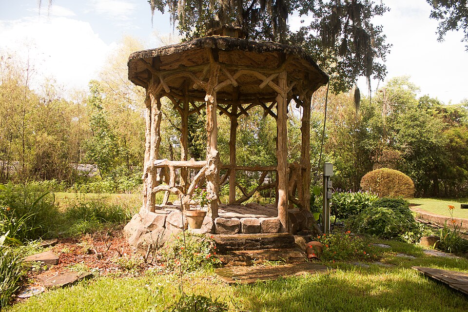
Listed on the National Register of Historic Places in 2004.
One of 12 National Register listings published here for Brazoria County · listed in 2004 · category: Structure.
Sources: the case file at the National Archives · the National Register database, National Park Service
Regional context, not property-specific evidence. The federal wildfire occurrence database lists 34 fires within 5 miles of Gazebo for James Richard Marmion between 2008 and 2020, burning about 91 acres in total. 1 started naturally. 1 was recorded as arson. Distance is straight-line from the map coordinates, so a fire counted here may appear on a neighbouring settlement's page as well.
| Reported cause | Fires |
|---|---|
| Debris and open burning | 29 |
| Missing data/not specified/undetermined | 2 |
| Recreation and ceremony | 1 |
| Arson/incendiarism | 1 |
| Natural | 1 |
The most recent of them, most recent first, with the day each was reported and the service that recorded it.
| Date | Cause | Size | Reported by | Name on the report |
|---|---|---|---|---|
| 7 September 2009 | Debris and open burning | 2.0 acres | Texas A & M Forest Service | CR 347 |
| 5 September 2009 | Debris and open burning | 2.0 acres | Texas A & M Forest Service | GST. PAUL |
| 28 September 2009 | Debris and open burning | 2.0 acres | Texas A & M Forest Service | GST. PAUL |
| 28 August 2009 | Debris and open burning | 5.0 acres | Texas A & M Forest Service | CR 244 |
| 31 July 2009 | Debris and open burning | 2.0 acres | Texas A & M Forest Service | CR 244 |
| 17 July 2009 | Debris and open burning | 2.0 acres | Texas A & M Forest Service | PAN AMERICA |
| 10 July 2009 | Debris and open burning | 2.0 acres | Texas A & M Forest Service | CR 244F |
| 24 June 2009 | Debris and open burning | 2.0 acres | Texas A & M Forest Service | CR 586 |
Regional context, not property-specific evidence. The federal mineral resources record lists 1 working within 5 miles of Gazebo for James Richard Marmion: 1 producer. All of them still produce. What was taken out: Sand and Gravel, Construction. Distance is straight-line from the map coordinates, so a quarry counted here may appear on a neighbouring settlement's page as well.
| Where | Site | Commodity | Status | Recorded |
|---|---|---|---|---|
| Pand W Materials Co. | Sand and Gravel, Construction | Producer | Sand |
Regional context, not property-specific evidence. The National Weather Service names Sweeny, the town this property stands in, in 11 storm reports between 1993 and 2021: 4 flash flood, 3 hail, 3 thunderstorm wind, 1 tornado. No death or injury is recorded in these reports. Each account below is quoted exactly as the forecast office filed it, from the NOAA Storm Events Database, and each date opens the federal record of that event.
| When | Event | Place named | Harm | What the report says |
|---|---|---|---|---|
| July 2010 | Flash Flood | Sweeny | $500,000 | Heavy rainfall caused flooding of 30 to 35 homes in the town of Sweeny. |
| September 2002 | Flash Flood | Sweeny | $250,000 | Waist deep water and flooding in Sweeny. |
| February 2017 | Tornado (EF0) | Sweeny | $100,000 | This EF-0 tornado touched down along CR 321 and then dissipated near the intersection of FM 524 and CR 321. Damage was mainly to trees and power lines. Estimated peak winds were 75 mph. |
| August 2002 | Hail | Sweeny | $10,000 | Dime size hail. |
| June 2004 | Hail | Sweeny | $10,000 | no account filed |
| May 2021 | Flash Flood | Sweeny | $5,000 | Vehicles were flooded in Sweeny due to heavy rain. |
| June 2004 | Flash Flood | Sweeny | $5,000 | Roads flooded in and around Sweeny. |
| June 2002 | Thunderstorm Wind | Sweeny | $5,000 | Trees blown down. |
| May 1993 | Hail | Sweeny | $5,000 | Brazoria County Deputy Sheriff reported nickel-size hail in Sweeny. |
| March 2018 | Thunderstorm Wind | Sweeny | - | There was some wind damage around Sweeny. |
| April 2015 | Thunderstorm Wind | Sweeny | - | Trees and power lines were reported downed around town. |
No historic map-sheet match is published for this property yet. That does not mean no map exists. This record needs a coordinate-quality review before it can be joined to a sheet boundary. Browse the county's mapped places while that work is pending.
Other National Register properties close enough to walk or drive between, ordered by distance from this one. Both positions come from the same geocoding pass that matched these properties to their map sheets.
| Photograph | Property | Distance | Listed |
|---|---|---|---|
 | Palapa Table for James Richard Marmion | 0.2 miles | 2004 |
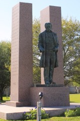 | Henry Smith Statue | 4.5 miles | 2018 |
 | Brazoria Bridge | 5.3 miles | 1991 |
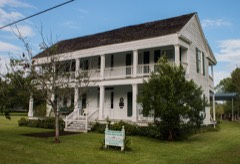 | Ammon Underwood House | 6.8 miles | 1976 |
| East Columbia Historic District | 7.0 miles | 1991 | |
| John McCroskey Cabin | 7.4 miles | 1975 |
| National Archives record | The nomination case file for reference 04001173 in Record Group 79. |
| Brazoria County | All 12 listed properties in this county. |