 Block
BlockFrom the record
One of 12 National Register listings published here for Brazoria County · listed in 1991 · category: Structure.
Sources: the case file at the National Archives · the National Register database, National Park Service
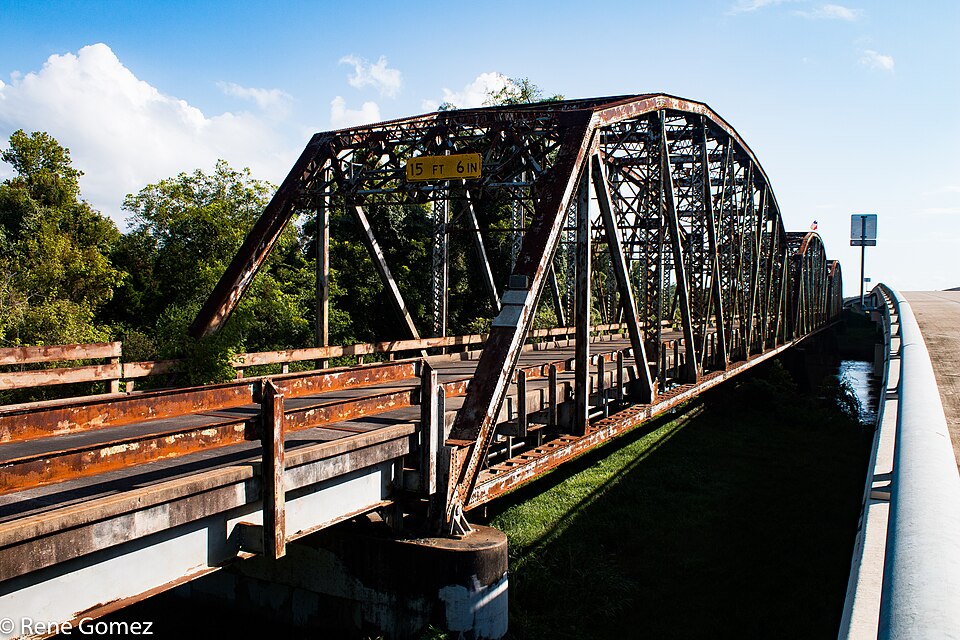
Listed on the National Register of Historic Places in 1991.
One of 12 National Register listings published here for Brazoria County · listed in 1991 · category: Structure.
Sources: the case file at the National Archives · the National Register database, National Park Service
Regional context, not property-specific evidence. The federal wildfire occurrence database lists 19 fires within 5 miles of Brazoria Bridge between 2008 and 2009, burning about 42 acres in total. None started naturally. None was recorded as arson. Distance is straight-line from the map coordinates, so a fire counted here may appear on a neighbouring settlement's page as well.
| Reported cause | Fires |
|---|---|
| Debris and open burning | 16 |
| Missing data/not specified/undetermined | 2 |
| Recreation and ceremony | 1 |
The most recent of them, most recent first, with the day each was reported and the service that recorded it.
| Date | Cause | Size | Reported by | Name on the report |
|---|---|---|---|---|
| 7 September 2009 | Debris and open burning | 2.0 acres | Texas A & M Forest Service | CR 347 |
| 5 September 2009 | Debris and open burning | 2.0 acres | Texas A & M Forest Service | GST. PAUL |
| 28 September 2009 | Debris and open burning | 2.0 acres | Texas A & M Forest Service | GST. PAUL |
| 28 August 2009 | Debris and open burning | 5.0 acres | Texas A & M Forest Service | CR 244 |
| 4 July 2009 | Debris and open burning | 2.0 acres | Texas A & M Forest Service | CR 310 |
| 24 June 2009 | Debris and open burning | 2.0 acres | Texas A & M Forest Service | CR 586 |
| 8 May 2009 | Debris and open burning | 2.0 acres | Texas A & M Forest Service | CR 347 |
| 21 April 2009 | Debris and open burning | 2.0 acres | Texas A & M Forest Service | CR 342 |
Regional context, not property-specific evidence. The federal mineral resources record lists 5 workings within 5 miles of Brazoria Bridge: 4 producers, 1 past producer. 4 still produce. What was taken out: Sand and Gravel, Construction, Sulfur, Halite, Limestone, Ultra Pure. Distance is straight-line from the map coordinates, so a quarry counted here may appear on a neighbouring settlement's page as well.
| Where | Site | Commodity | Status | Recorded |
|---|---|---|---|---|
| Clemens Dome Mine | Sulfur, Halite, Limestone, Ultra Pure | Past Producer | 1937, 1960 | |
| Miller Sand Pits | Sand and Gravel, Construction | Producer | ||
| Moller Pit | Sand and Gravel, Construction | Producer | ||
| Riggs Oak Sand Pit | Sand and Gravel, Construction | Producer | ||
| Riggs Oaks Sand Pit | Sand and Gravel, Construction | Producer | Sand |
Regional context, not property-specific evidence. The National Weather Service names Brazoria, the town this property stands in, in 26 storm reports between 1997 and 2022: 11 thunderstorm wind, 6 hail, 4 flash flood, 4 tornado. The reports record 1 injury. Each account below is quoted exactly as the forecast office filed it, from the NOAA Storm Events Database, and each date opens the federal record of that event.
| When | Event | Place named | Harm | What the report says |
|---|---|---|---|---|
| November 2003 | Tornado (F0) | Brazoria | 1 hurt, $75,000 | Tornado touch down in downtown Brazoria. Roof damage to several buildings along Highway 36 with tree damage in Old Town Brazoria. A semi-trailer was lifted and over-turned on its side at intersection of Road 332 and Highway 36. |
| October 2006 | Flash Flood | Brazoria | $500,000 | Approximately 115 homes flooded in several locations around the county including Pearland. Several roads flooded including County Road 5995 near Bastrop Bayou, Highway 36 and County Road 304 near Jones Creek, and near County Road 769B. |
| March 2007 | Hail | Brazoria | $200,000 | Residence damaged by near racqetball-size hail. Damage to home's front windows and screens with damage to 2 vehicles in yard. Roof damage to a city facility. 43 vehicle windshields were shattered with back windshield damage to 3 other vehicles at a local automotive dealership. Damage reported to two other businesses in the town of Brazoria with reports of damage to a few residential homes. |
| December 2001 | Tornado (F1) | Brazoria | $200,000 | An F1 Tornado touched down 5 miles southwest of Brazoria. Several homes in the Lazy Oak Ranch Subdivision on CR 461A had roof damage. A machine shop on CR 461 sustained heavy damage, along with the cars and boats in its parking lot. There were no injuries. Numerous trees were down from the San Bernard River to the Lazy Oak subdivision. Reported by Emergency Management. |
| December 2001 | Tornado (F0) | Brazoria | $200,000 | An F0 Tornado touched down in the city of Brazoria. There was roof and structural damage to homes and businesses, in a 10 block area, along TX Highway 36 in Brazoria. A 175 foot internet tower was blown down, signs were bent over, and minor roof damage to Brazoria Elementary school. No injuries. Reported by Emergency Management |
| July 1999 | Thunderstorm Wind | Brazoria | $100,000 | Canopy blown onto several cars at car dealership and three large trees blown onto houses by strong winds. |
| June 2010 | Thunderstorm Wind | Brazoria | $80,000 | A metal barn was destroyed, with the loss of a roof to another barn, near the intersection of County Road 463 and FM 521 southwest of Brazoria. |
| April 2015 | Thunderstorm Wind | Brazoria | $75,000 | Thunderstorm winds downed a tree and destroyed much of a two story house. A tree also fell on the American Legion Pavilion. |
| July 1997 | Hail | Brazoria | $50,000 | 15 minutes of dime size hail and high wind in Brazoria. 5 houses with roof damage and many downtown businesses had broken windows from hail and flying debris. At least 1 car totalled because tree fell on it. |
| December 1999 | Hail | Brazoria | $25,000 | Hail covering the ground. |
| March 2022 | Thunderstorm Wind | Old Brazoria | $20,000 | Straight-line winds produced building damage to businesses near the intersection of College Drive and Highway 288 near Clute. A building supply center lost its roof from one of its open lumber yard buildings. The roof blew off and impacted a neighboring convenience store. |
| April 2002 | Hail | Brazoria | $10,000 | Sheriff reported quarter sized Hail at CR 521 in Brazoria. |
| April 2002 | Thunderstorm Wind | Brazoria | $10,000 | Sheriff reported large trees knocked down in Brazoria and Sweeney. |
| February 2008 | Thunderstorm Wind | Brazoria | $8,000 | Thunderstorm winds downed trees around the town of Brazoria and caused residential roof damage south of Angleton. There was also minor hanger damage reported at the Brazoria County Airport. |
| February 2011 | Thunderstorm Wind | Brazoria | $5,000 | Numerous trees were downed across Brazoria County. |
| August 2001 | Tornado (F0) | Brazoria | $5,000 | Newspaper reported tornado touched down 2.5 miles southeast of Wild Peach Village. |
| November 1997 | Hail | Brazoria | $5,000 | 3/4" hail at HWY 36 & CR 310. |
| April 1997 | Thunderstorm Wind | Brazoria | $5,000 | no account filed |
| October 1998 | Flash Flood | Brazoria | $3,000 | Minor street flooding. |
| May 2002 | Thunderstorm Wind | Brazoria | $2,000 | Trees blown down along CR 519 near the San Bernard River. |
| March 2018 | Thunderstorm Wind | Brazoria | $1,000 | Thunderstorm winds caused some carport and fencing damage. |
| January 2015 | Flash Flood | Brazoria | $1,000 | The intersection of CR 353 and CR 354 between West Columbia and Brazoria was barricaded. |
| April 2012 | Hail | Brazoria | $1,000 | Golfball sized hail reported by television viewers in Brazoria. |
| March 2019 | Funnel Cloud | Brazoria | - | A late afternoon funnel cloud was sighted. |
| August 2017 | Flash Flood | Brazoria | - | Parts of SH 36 and FM 521 around the town of Brazoria were closed due to flooding.||Major record flooding of the Brazos, San Bernard and Oyster Creek caused the flooding of hundreds to thousands of vicinity homes, vehicles and businesses. Numerous Roads and homes were inundated with flood waters on east side of Oyster Creek including the Columbia Lakes, Mallard Lakes, Great Lakes, Riverside Estates and Bar X subdivisions as well as homes along CR 39. Other county roads that became impassable due to high flood waters include, but are not limited to, FM 1462, Highways 35 and 90, FM 950, CR 25, 380A, CR 42 and FM 521. The Phillips refinery outside of the town of Sweeny took on water from the west near Little Linville Bayou. Hanson Riverside County Park along the San Bernard River southwest of West Columbia was inundated and water over-topped the Phillips Terminal. |
| May 2016 | Thunderstorm Wind | Brazoria | - | Severe thunderstorm winds downed trees and damaged power lines near the intersection of County Road 3467 and County Road 654B. |
No historic map-sheet match is published for this property yet. That does not mean no map exists. This record needs a coordinate-quality review before it can be joined to a sheet boundary. Browse the county's mapped places while that work is pending.
Other National Register properties close enough to walk or drive between, ordered by distance from this one. Both positions come from the same geocoding pass that matched these properties to their map sheets.
| Photograph | Property | Distance | Listed |
|---|---|---|---|
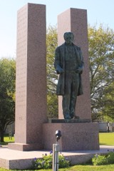 | Henry Smith Statue | 0.9 miles | 2018 |
 | Gazebo for James Richard Marmion | 5.3 miles | 2004 |
 | Palapa Table for James Richard Marmion | 5.5 miles | 2004 |
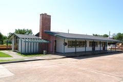 | Alden B. Dow Office and Lake Jackson City Hall | 6.6 miles | 2010 |
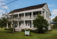 | Ammon Underwood House | 6.9 miles | 1976 |
| East Columbia Historic District | 7.0 miles | 1991 |
| National Archives record | The nomination case file for reference 91000783 in Record Group 79. |
| Brazoria County | All 12 listed properties in this county. |